Earth:Mount Iō (Iōjima)
From HandWiki
Short description: Active lava dome in Iojima, Kagoshima, Japan
| Mount Iō | |
|---|---|
| 硫黄岳 | |
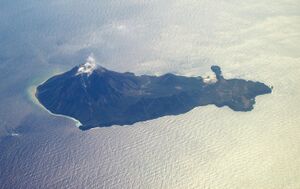
 Aerial view of Iōjima with Mount Iō steaming.(February 2008) | |
| Highest point | |
| Elevation | 703.7 m (2,309 ft) [1] |
| Listing | List of mountains and hills of Japan by height |
| Coordinates | [ ⚑ ] : 30°47′35″N 130°18′19″E / 30.79306°N 130.30528°E [1] |
| Naming | |
| English translation | Sulphur Mountain |
| Language of name | Japanese |
| Geography | |
| Location | Iōjima, Kagoshima Prefecture, Japan |
| Parent range | Kikai Caldera |
| Topo map | Geographical Survey Institute, 25000:1 薩摩硫黄島, 50000:1 開聞岳 |
| Geology | |
| Age of rock | Holocene |
| Mountain type | Stratovolcano |
| Volcanic arc/belt | Ryukyu arc |
| Last eruption | June 2013 |
Mount Iō (硫黄岳 Iō-dake) also Mount Iwo is an active rhyolitic lava dome on Iōjima in Kagoshima Prefecture, Japan . It sits within the borders of the town of Mishima.
The mountain is made up of non-alkali felsic rock and pyroclasitic flows.[2]
References
- ↑ Jump up to: 1.0 1.1 Geographical Survey Institute map 25000:1 薩摩硫黄島, last access 9 January 2009
- ↑ "Kyushu". Seamless Digital Geographical Map of Japan. Geological Survey of Japan AIST. 2007. http://riodb02.ibase.aist.go.jp/db084/kihon/kyushu_e.xml. Retrieved 2009-01-13.
- VolcanoWorld - Kikai, Kyūshū, Japan
- S. Hamasaki, Volcanic-related alteration and geochemistry of Iwodake volcano, Satsuma-Iwojima, Kyushu, SW Japan, Earth Planets Space, pp 217–229, 2002, Tsukuba, Research Center for Deep Geological Environments, Geological Survey of Japan, AIST,
External links
- Satsuma-Iojima - Japan Meteorological Agency (in Japanese)
- "Satsuma-Iojima: National catalogue of the active volcanoes in Japan". http://www.data.jma.go.jp/svd/vois/data/tokyo/STOCK/souran_eng/volcanoes/093_satsuma-iojima.pdf. - Japan Meteorological Agency
- Satsuma-iojima - Geological Survey of Japan
- Kikai - Geological Survey of Japan
- "Kikai". Smithsonian Institution. https://volcano.si.edu/volcano.cfm?vn=282060.
 |


