Earth:Mount Seguam
From HandWiki
| Mount Seguam | |
|---|---|
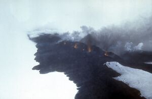
 Incandescent lava fountaining from a fissure eruption near Pyre Peak on Seguam Island. | |
| Highest point | |
| Elevation | 3,458 ft (1,054 m) |
| Coordinates | [ ⚑ ] 52°18′54″N 172°30′37″W / 52.315°N 172.51028°W |
| Geography | |
| Location | Seguam Island, Alaska, U.S. |
| Parent range | Aleutian Range |
| Topo map | USGS Umnak A-2 |
| Geology | |
| Mountain type | Stratovolcano |
| Volcanic arc/belt | Aleutian Arc |
| Last eruption | 1993 |
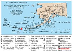
Mount Seguam is an active stratovolcano on Seguam Island in the Aleutian Islands of Alaska.

Sources
- "Seguam". Smithsonian Institution. https://volcano.si.edu/volcano.cfm?vnum=1101-18-.
- Volcanoes of the Alaska Peninsula and Aleutian Islands-Selected Photographs
- Alaska Volcano Observatory
