Earth:Mount Wright (Alaska)
From HandWiki
| Mount Wright | |
|---|---|
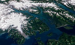
 Landsat map of Glacier Bay (Mount Wright) | |
| Highest point | |
| Elevation | 5,054 feet (1,540 m)[1] |
| Prominence | 1,850 feet (560 m) [2] |
| Coordinates | [ ⚑ ] : 58°47′52″N 136°01′38″W / 58.7976627°N 136.0271834°W |
| Geography | |
| Location | Glacier Bay National Park and Preserve, Alaska, United States |
| Topo map | USGS Mount Wright |
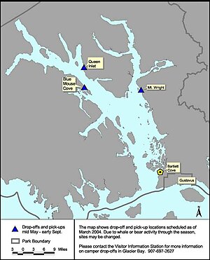
Mount Wright is a mountain located in the eastern Alaskan panhandle, on the east side of Muir Inlet, just north of Glacier Bay within Glacier Bay National Park and Preserve.
Location
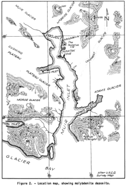
Mount Wright is south of Adams Inlet, Dirt Gulch, and Dirt Glacier, to the east of Garforth Island in Muir Inlet, west of White Glacier, and the Chilkat Range[3] and 52 miles (84 km) northwest of Hoonah, Saint Elias Mountains.
History
Mount Wright was named by Dr. Harry Fielding Reid in 1891 after George Frederick Wright who spent some in the Glacier Bay area in 1886. Forty-three miles to the west is another mountain also called Mount Wright.[4]
Fauna
The area has a high population of mountain goats.[5]
References
- ↑ "Dirt Glacier". Alaska Guide. https://alaska.guide/Glacier/Dirt-Glacier. Retrieved 2019-08-07.
- ↑ "Mount Wright, Alaska". Peakbagger.com. https://www.peakbagger.com/peak.aspx?pid=633. Retrieved 2019-08-07.
- ↑ "Dirt Glacier". Mapcarta. https://mapcarta.com/24037192. Retrieved 2019-08-07.
- ↑ "Feature Detail Report for: Mount Wright". GNIS. https://geonames.usgs.gov/apex/f?p=138:3:0::NO::P3_FID,P3_TITLE:1415853,Mount%20Wright. Retrieved 2019-08-07.
- ↑ DuFresne, Jim (1987). Glacier Bay National Park: A Backcountry Guide to the Glaciers and Beyond. The Mountaineers Books. p. 61. ISBN 9780898861327. https://books.google.com/books?id=N_iaTD89NdQC&printsec=frontcover&dq=Glacier+Bay+National+Park:+A+Backcountry+Guide+to+the+Glaciers+and+Beyond&hl=en&sa=X&ved=2ahUKEwjH6Kv_2PDjAhUPD60KHcCKAH4Q6AEwAHoECAUQAg#v=onepage&q=Glacier%20Bay%20National%20Park%3A%20A%20Backcountry%20Guide%20to%20the%20Glaciers%20and%20Beyond&f=false. Retrieved 2019-08-07.


