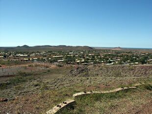
Earth:Wickham, Western Australia
| Wickham Western Australia | |||||||||
|---|---|---|---|---|---|---|---|---|---|
 Wickham townsite | |||||||||
| Script error: No such module "Australian place map". | |||||||||
| Coordinates | [ ⚑ ] : 20°40′30″S 117°08′25″E / 20.675°S 117.14028°E | ||||||||
| Population | 2,295 (Template:CensusAU)[1] | ||||||||
| Established | 1970 | ||||||||
| Postcode(s) | 6720 | ||||||||
| Location | 33 km (21 mi) from Karratha | ||||||||
| LGA(s) | City of Karratha | ||||||||
| State electorate(s) | North West | ||||||||
| Federal Division(s) | Durack | ||||||||
| |||||||||
Wickham is a town located 1,572 km north of Perth and 13 km north of Roebourne in the Pilbara region of Western Australia. In 2016 Wickham had a population of 2,295 people. Aboriginal people made up 17.2% of the population, five times the state average.[1]
History
Wickham was established in 1970 by Cliffs Robe River Iron Associates (Robe) and named after John Clements Wickham, the captain of HMS Beagle, who surveyed the north-west coast in 1840.[2]
The town's first permanent buildings were completed in 1970 by Robe to support its iron-ore mine at Pannawonica, and pelletising plant and shiploading at Cape Lambert. The majority of the residences and facilities in town are owned by Rio Tinto. Wickham was originally a closed company town but from 1980 has been jointly administered by Robe and the Shire of Roebourne.[3] In August 2000 Rio Tinto acquired a majority interest in the Robe River Iron Associates joint venture and in 2012 established a new Wickham South subdivision that included 212 new dwellings, 25 residential lots, and 198 new FIFO accommodation units.[3]
References
- ↑ 1.0 1.1 Australian Bureau of Statistics (27 June 2017). "Wickham (State Suburb)". 2016 Census QuickStats. http://www.censusdata.abs.gov.au/census_services/getproduct/census/2016/quickstat/SSC51585.
- ↑ Reay, Justin. "Voyage of the Beagle to Western Australia 1837-43 and her commanders’ knowledge of two VOC wrecks". Department of Maritime Archaeology, Western Australian Maritime Museum. http://museum.wa.gov.au/maritime-archaeology-db/sites/default/files/no._314_reay_report_of_the_beagle_.pdf. Retrieved 5 May 2019.
- ↑ 3.0 3.1 Latimer, Cole (18 April 2012). "Rio announces massive Wickham expansion". Australian Mining. https://www.australianmining.com.au/news/rio-announces-massive-wickham-expansion/. Retrieved 5 May 2019.

