File:Hungary topographic map.jpg
From HandWiki
Size of this preview: 800 × 549 pixels. Other resolutions: 640 × 439 pixels | 912 × 626 pixels.
Original file (912 × 626 pixels, file size: 75 KB, MIME type: image/jpeg)
Summary
| Description |
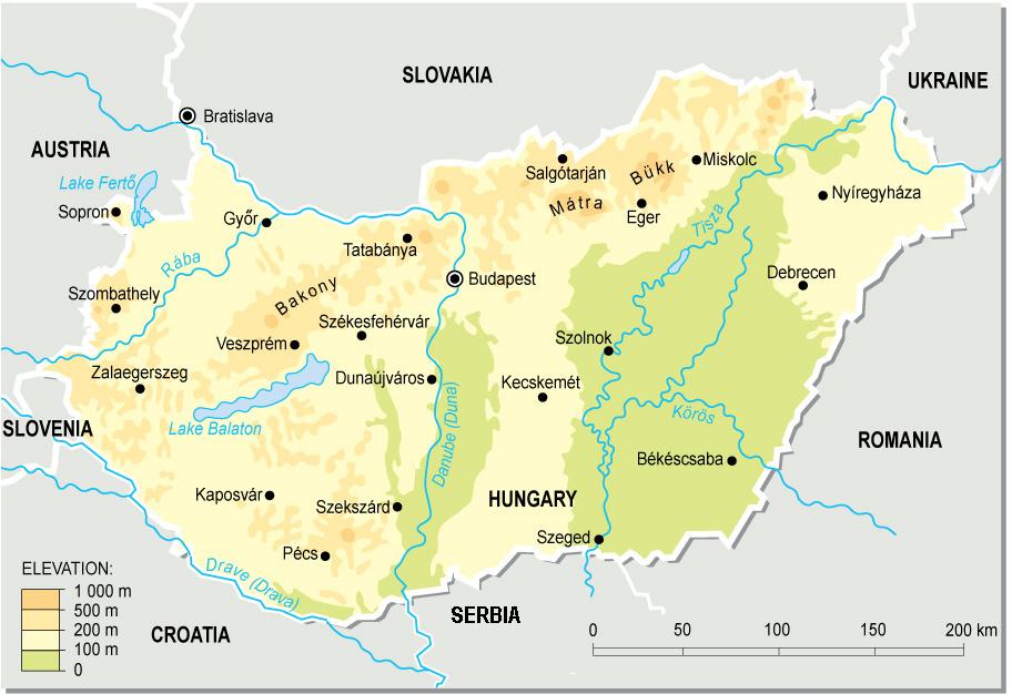
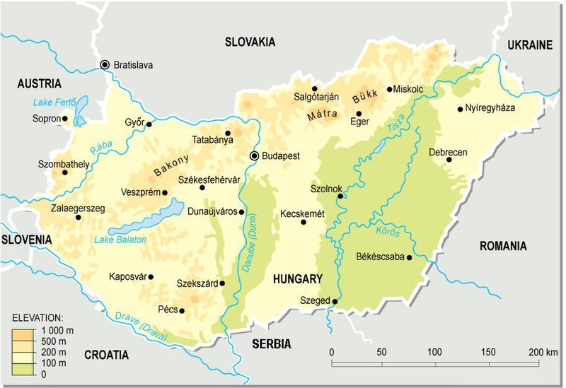
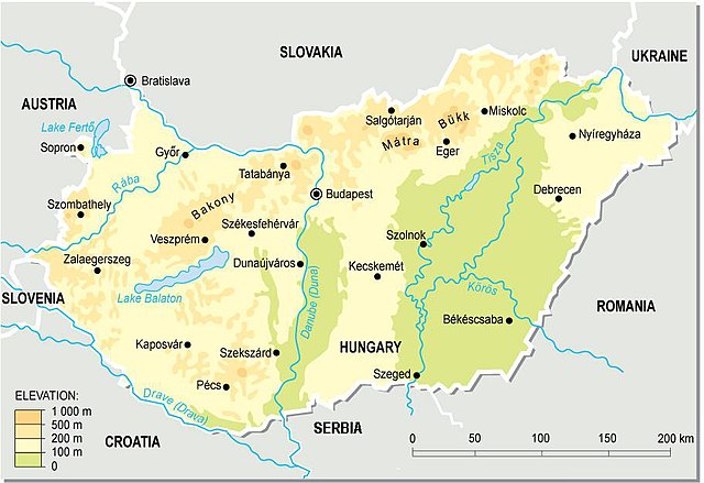
English: Topographic map of Hungary.
Deutsch: Topografische Karte Ungarns. |
| Date | |
| Source | Own work (from a PD map collection. Mistakes fixed) |
| Author | Cserlajos |
| Other versions |
|


|
This map has been uploaded by Electionworld from en.wikipedia.org to enable the |


Licensing
| This work has been released into the public domain by its author, Cserlajos. This applies worldwide. In some countries this may not be legally possible; if so: |
File history
Click on a date/time to view the file as it appeared at that time.
| Date/Time | Thumbnail | Dimensions | User | Comment | |
|---|---|---|---|---|---|
| current | 18:51, 23 December 2006 | | 912 × 626 (75 KB) | imagescommonswiki>Electionworld | {{ew|en|Cserlajos}} == Summary == From a pd map collection. Mistakes fixed by User:cserlajos. == Licensing == {{no rights reserved}} |
File usage
The following file is a duplicate of this file (more details):
- File:Hungary topographic map.jpg from Wikimedia Commons
The following 2 pages use this file:

