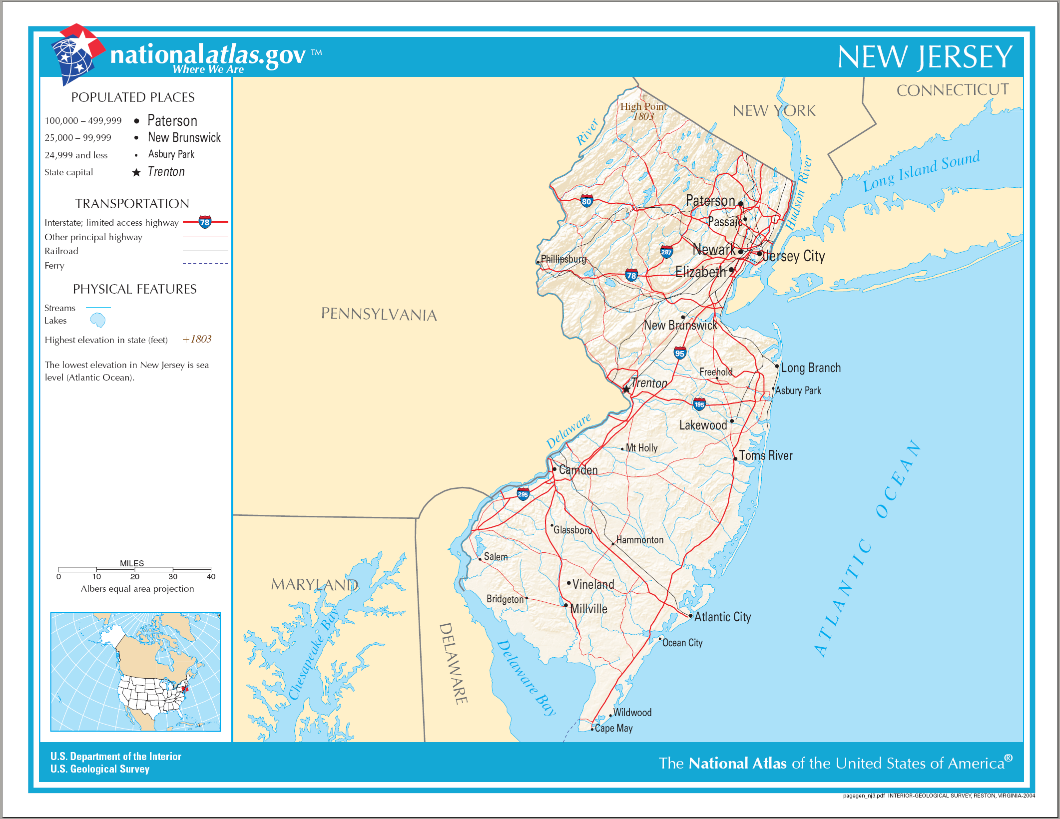
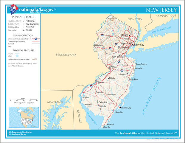
File:Map of New Jersey NA.png
From HandWiki
Size of this preview: 776 × 600 pixels. Other resolutions: 621 × 480 pixels | 2,122 × 1,640 pixels.
Original file (2,122 × 1,640 pixels, file size: 1.2 MB, MIME type: image/png)
Summary
| Description |
English: Map of New Jersey. |
| Date | |
| Source | National Atlas |
| Author |
Licensing
This map was obtained from an edition of the National Atlas of the United States. Like almost all works of the U.S. federal government, works from the National Atlas are in the public domain in the United States.
Online access: NationalAtlas.gov | 1970 print edition: Library of Congress, Perry-Castañeda Library
|
File history
Click on a date/time to view the file as it appeared at that time.
| Date/Time | Thumbnail | Dimensions | User | Comment | |
|---|---|---|---|---|---|
| current | 16:31, 14 August 2006 | | 2,122 × 1,640 (1.2 MB) | imagescommonswiki>Huebi~commonswiki | {{Information| |Description=Map of New Jersey |Source=[http://www.nationalatlas.gov National Atlas] }} Category:Maps of the United States Category:Maps of New Jersey {{PD-USGov-Atlas}} |
File usage
The following file is a duplicate of this file (more details):
- File:Map of New Jersey NA.png from Wikimedia Commons
The following page uses this file:

