History:Chebaki (Khakassia)
This article may require copy editing for more standard/idiomatic English. (April 2023) (Learn how and when to remove this template message) |
Template:Infobox Russian inhabited localityChebaki (Russian: Чебаки, Khakass: Чабах аалы, Çabax aalı) is a village in the Shirinsky District of Khakassia, Russian Federation.
Geography
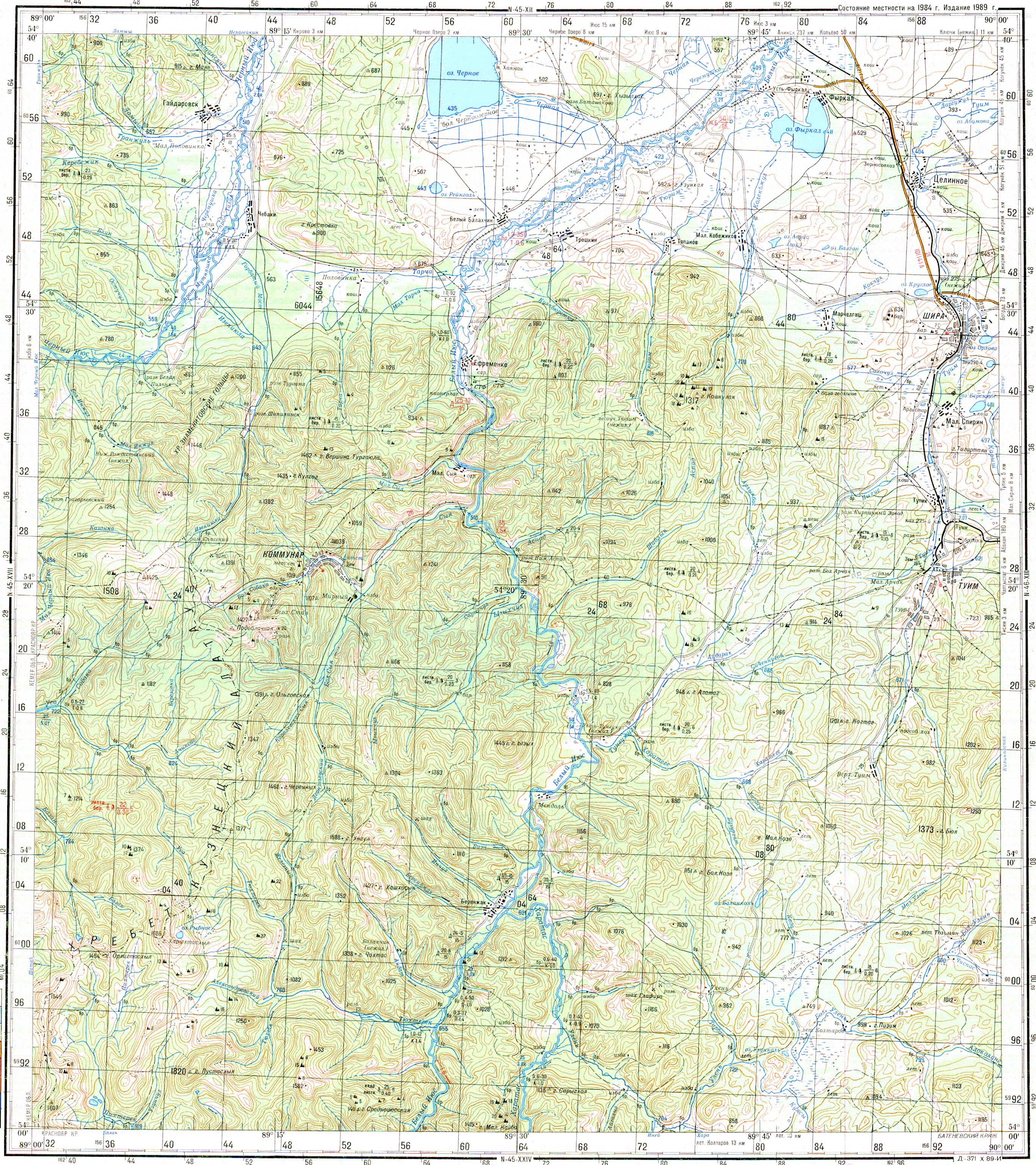
It is located on the banks of the Cherny Iyus river, 80 km northwest of the regional center of the village of Shira, as well as the railway station.
Nearby mountain Krestovka 912m, on the south nearest ridge Znamenitovskiye Gol'tsy 1446m, stream bed Tserkovnyy and freshwater lake Chernoye, lake Reyngol.[1]
The left bank of the Yenisei part of the Minusinsk basin,[2] belong to the geographic site of Yenisei Siberia.[3]
Surrounding relief is varied along with areas almost flat, both isolated hills and ridges of hills or spurs of the surrounding mountains with steep slopes, narrow valleys and intermountain depressions. The lowlands lie at an altitude of 300 m above sea level, with heights reaching 900 m. The climate is sharply continental.[3]
The following species, characteristic of the southern steppe regions, find here the northern limit of their habitat: Ardea cinerea, Nyroca ferina, Tadorna Tadorna, Recurvirostra avoceta, Totanus totanus, Sterna hirundo minussensis, Upupa epops, Pyrrhocorax Pyrrhocorax, Otocoris brandti, Otocoris brandti Montana, Calandrella brachydactyla, Locustrella naevia mongolica.[3]
From among the species of adjacent Mongolia, Cygopsis cygnoides penetrate here. Otis Dybowskii, Emberiza godlewskii, perdix daureca.[3]
Acrocephlus ogricola comes here from the west from neighboring Altai Phylloscopus tristis fulvescens.[3]
Toponym and etymology
The village name comes from the name of the khakas Chebak Serenev of Chebakinsky ulus / Chebakevsky ulus / Chebak aal, founded in 1790.[4][5][6][7][8][9][10]
Chebak, or Siberian roach (lat. Rutilus rutilus lacustris) is a subspecies of roach, a ray-finned fish from the carp family, common in Siberia and the Urals.[12][13][14]
A chebak is a fur hat with earmuffs, ties, and nape.[12][15] It been known since the 18th century in the Yenisei and Tobolsk provinces[12][13] as winter headdress worn by married women. It was a spherical hat with headphones and a long back blade, called the tail. (Teleut) čаbаk is a tall women's hat.
Chebak kind of scraper, in mining.[12]
In 1893 name of the settlement the village of Pokrovskoe (Chebaki),[16] Yenisei province, Achinsk district, Kizyl administration. It was named Pokrovskoe after Pokrova Bogoroditsy church which was built at the expense of the gold miner Z. M. Tsybulsky (1867, nowadays not preserved).[17]
In reports for 1893[18][19] orthodox priest Matvey Tyzhnov from Pokrovskoe (Chebaki) of the Achinsk district of the Yenisei province mentioned of sacred object, the embodiment of the spirit of fire, Template:Lang-kjh and the rituals of their veneration in connection of shaman tradition and spiritual life of the Khakass.[20][21][22] Also Template:Lang-kjh,[23] like in Template:Lang-kjh[24][25] and Template:Lang-kjh,[26] Template:Lang-kjh, Template:Lang-kjh.[27]
History
The territory belonged to the Siberia Governorate (until 1779), the Kolyvan Oblast (1779 - 1783), the Kolyvan Governorate (1783 - 1796), the Tobolsk Governorate (1796 - 1804), the Tomsk Governorate (1804 - 1822), Achinsk-Minusinsk Mining Okrug[28][29][30] (Minusinsk Okrug 1822-1898, Minusinsk Uezd 1898-1925) of Yeniseysk Governorate (1822 - 1925).
Founded in the 19th century, Chebaki was part of the Yeniseysk Governorate (1822 -1925), as an establishment of gold miners. It was the residence of the gold miners Z. M. Tsibulsky and his cousin-nephew and heir K. I. Ivanitsky.[13][31][32][33][34]
In 1867 Pokrova Bogoroditsy church became part of orthodox parishes of the Yenisei Governorate, Achinsk uezd, Uzhur volost.[35][36][37][17][38][39]
The parish was formed on the territory of the Kizyl Inorodtsy volost of the Achinsk uezd. It included 38 uluses.[13]
On 24 January 1888, a school was opened at the Pokrova Bogoroditsy church.[13][40]
The Brotherhood at the Krasnoyarsk Cathedral in the Name of the Nativity of the Blessed Virgin Mary from 1894[41][42] began to supply the libraries of church parochial schools with books for out-of-class reading.[38] In missionary reports of that time, the local population was described as "inorodtsy"[43] and their customs or superstitions and their rituals and believes were different.[38][39][44][20]
For the literate population, readings with light paintings in the parish church schools of the diocese were arranged (2 sciopticons and 60 paintings in each district of the diocese).[clarification needed] In 1897, a total of 10 sciopticons (magic lanterns) and 600 paintings on glass were ordered from the Moscow manufacturer Swiss citizen Theodor Schwabe, a physico-optical mechanic. For the timely exchange of pictures between schools of neighboring districts, a timetable for the movement of the sciopticons (magic lanterns) and a light pictures were published in the yearly gazette Eparkhalnye Vedomosty.[38]
In the Minusinsk district[45][46] in the Chebakovsky-Pokrovsky parish with a non-Russian population on 1 August 1897, a seminary student Pavel Sukhovsky was ordained.[38] Only 17 boys and 1 girl, of whom 10 were non-Russian, studied at the Pokrovsky parish school, while more kinds were attending school; for a total adult parish population of 2288 people in 1897, it was quite a small amount.
In 1912[47] a one-class ministerial school opened and in 1916 school already enrolled 80 boys and 40 girls, the school was in excellent condition and respected by the population.
In 1916[48] in the description of the Chebakovsky-Pokrovsky parish:[13][39]
All this area, it must be said, is one of the richest areas of the Achinsk district: in the mountains, gold mines, valleys - give excellent harvests of bread and herbs, the surrounding forests abound with animals, and the river and lakes - with fish. This is one of the richest parishes of the Yenisei diocese. For the beauty of nature and healthy terrain, Chebaki are called "Siberian Switzerland".
From 1924 - 1933 the village of Chebaki is the administrative center of the Chebakovsky District, included 24 village and town councils.[13]
In the spring of 1924, a reading room was opened in the village of Chebaki in the club's premises. The club included a political club, drama club, music club, and club for the study of the charter of the VSKSM. A paramedical station in Chebaki had two employees, a paramedic and a midwife, provided only outpatient care. There were no medicines in the first-aid post; there was only one damaged thermometer and two old tweezers.[13]
In 1926[49][50][51][52][53][54][55] Chebaki near the Ivanovka River (probably a tributary stream of Black Iyus River) already there is a school, a district executive committee, a credit partnership, a shop, a hospital, a library.[13]
In 1933,[56][57] the center of the Chebaki District of the West Siberian Krai was moved to the village of Shira, Russia.
Population
The earliest information about the village was found in the document of 1864, in Lists of settlements of the Achinsk district, plot 2 N295 settlement - ulus (state) Chebakinsky (Chebak aly). Distance from the district town of Achinsk 240 versts. Number of households 31. The number of inhabitants 114 male, 98 female.[13][58]
| 1864 | 1893 | 1901 | 1907 | 1911 | 1917 | 1925 | 1926 | 1924-1933 | 2002 | 2004 | 2010 | 2015 |
|---|---|---|---|---|---|---|---|---|---|---|---|---|
| ↗204[13][58] | ↗417[13][59] | ↗498[13][60] | ↗681[13][61] | ↗858[13][62] | ↗1238[13][63] | ↗1185[13] | ↗1372[13][64] | ↗1661[13] | ↘95 | ↘78 | ↘61 | ↘45[13] |
Many Chebaki residents fought and died during the Fist World War 1914-1918, Russian Civil War 1918-1921,[13][65] Repressions,[13][66] Second World War 1941-1945.[13]
In the village of Chebaki there is the largest mass grave, more than 170 people, deceased on the Eastern Front of the Russian Civil War by Kolchac Army or policemen in the taiga or on the roads and buried where they died, later reburied in a mass grave in the rural square of the village of Chebaki in 1921. There are 75 miners of the Kommunar goldmine (former Bogomdarovanny goldmine) in a mass grave. On the first obelisks was the text "To the fighters who fell for the cause of the revolution of 1917-1920", later text on obelisk "Memorial to Civil War Heroes".[13]
In 2004 the number of households was 34, the population was 78 people, including Russians, Khakasses (30%) etc.
Notable natives and people
- Tsibulsky Zakhary Matveyevich merchant of the first guild, gold miner, philanthropist. Donated 200 thousand rubles to complete the cathedral in Tomsk, and 200 thousand rubles for the Imperial Tomsk University, the first university in Siberia, under construction in Tomsk at that time.
Founder of the sanatorium business in the Yenisei province in 1873, he came up with the idea to organize a resort at nearby Lake Shira, after he experienced the healing properties of the salt lake and then made an attempt to study them. Tsibulsky build his summer residence at Chebaki,[67] later the house became the property of Ivanitsky:
In the summer, he usually lived in his luxurious dacha, built not far from the taiga foreign village of Chebaki. At this dacha, its owner built a rather spacious church, where spiritual parables and a choir of singers were kept. The dacha itself was a large manor's house, with a spacious dance hall, a billiard room and all the manor's amenities. The house consisted of a fairly decent orchestra of musicians. On the dacha's estate there was a beautiful garden with greenhouses, in which several perfectly ripe oranges were grown by Christmas. On Christmas holidays, the Tsybulskys usually came from Tomsk to Chebaki, to their dacha; and then these oranges grown in greenhouses were then served at the table, the owners treated themselves, and treated guests who came to the Tsybulskys on Christmas visits. According to clerical reports, the maintenance of Tsybulsky's dacha cost him 40 thousand rubles annually. This dacha also served as the gold-mining residence of Tsybulsky, who had a number of mines in the Achinsk-Minusinsk region.
- Ivanitsky K. I. the gold miner. After the death of Tsybulsky, his affairs and property passed to I.M. Ivanitsky, and after the death of the latter - to his son Konstantin Ivanovich, who thus became the owner of a large hereditary property. The Russian revolution forced K.I. Ivanitsky to flee to Manchuria, to Harbin:[67]
When he left his gold-mining residence in Chebaki, he buried about 6 poods of gold in the ground. The place where the gold was hidden was 20 versts from Chebakov; Some Soviet agents in Harbin persuaded the Ivanitskys to hand over the gold they had hidden to the Soviet government. (it seems that this happened in 1930, I don't remember the exact date). There, on instructions, the gold was dug up and handed over to representatives of the Soviet authorities. This operation gave the Ivanitsky such financial results: half the price agreed namely 50 thousand yen, and the second half was paid in Tomsk to Ivanitsky's sisters.
- Zertsalov, Gennady Ivanovich (1940-2021) Soviet party leader, first secretary of the Kazan City Committee of the CPSU, chairman of the Kazan City Council of People's Deputies (1990-1991).
Economy
In 1917 in data description it was mentioned about presence of consumer society in village, also of livestock in the village: horses 737, working horses 571, foals up to a year 76; cattle 999, dairy cows 448, calves up to a year 258; sheep and goats 1080, pigs and piglets 104. Number of farms without arable land 107. Under crops 281.5 acres. Winter rye 11 dessiatin; Jaritsy (spring wheat or spring rye) 64 dessiatin. Oats 78.4 dessiatin. All other cultures 70.2 dessiatin. Convertible husbandry area 63.1 dessiatin. The area of meadow or hay lots is 1430 dessiatin.
USSR period[68][69][70][71][72][73][74][75]
Russia period[76][77][78][79] now only the Berendey farm and the Praskovya Wellness Phytocentre are operating.

Attractions
- The house of Ivanitsky, a two-story mansion with a tower-balcony and a spire was built in the second half of the 19th century from good age-old larches. The mansion is decorated with carved platbands, openwork belts and cornices between floors. The house has been preserved; it was a school, then an orphanage, and recently, after a small internal reconstruction, the children's tourist recreation camp was located in the mansion.[13] Nowadays the house of Ivanitsky is recognized as a valuable architectural monument of Khakassia of federal significance.
- In 1978 Gorky Film Studio produced historical film (Estern) "The end of the taiga Emperor" (Director Vladimir Sarukhanov, Screenplay Boris Kamov and Pavel Lungin) about the 1920s RSFSR and Russian Civil War on territory of Siberia, in Pokrovskoe (Chebaki) and Khakassia. The film reproduces one of the little-known pages of the biography of Arkady Golikov[80] (future writer Arkady Gaidar and grandfather of Yegor Gaidar) and cossacks under Ataman Solovyov.[81][82]
- Nearby attraction an ancient fortress Chebaki fortress Sve-Takh.
References
- ↑ Old Soviet Map
- ↑ Schwartz, Ludwig; Tsvetkov, Yakov (1864). "Proceedings of the Siberian Expedition of the Imperial Russian Geographical Society. Mathematical department. A detailed report on the results of research by the Mathematical Department of the Siberian Expedition of Imp. Russian Geographical Society" (in ru). St. Petersburg. https://elib.rgo.ru/handle/123456789/213107.
- ↑ 3.0 3.1 3.2 3.3 3.4 Tugarinov, A. Ya. (1927) (in ru). Birds of Yenisei Siberia: list and distribution. (Volume 1 №1 ed.). Krasnoyarsk. pp. 22, 24. https://search.rsl.ru/ru/record/01008035335.
- ↑ Zhevlov, M.A. (1984). Toponymy of the Khakass-Minusinsk basin (linguistic analysis). Thesis (candidate of philological sciences 10.02.06 thesis) (in русский). Alma-Ata.
- ↑ "Map of Altai 1750". http://www.etomesto.ru/map-barnaul_1734/.
- ↑ "Map of the Kuzneck district of the Tobolsk province atlas 1798". http://www.etomesto.ru/map-kemerovo_kuzneckiy-uezd-1798/.
- ↑ "Map of the Tobolsk and Tomsk provinces from the atlas of the Russian Empire for gymnasiums". 1807. http://www.etomesto.ru/map-tomsk_atlas-1807/.
- ↑ "Detailed map of the Kolyvano-Voskresenskaya mountain region". 1816. http://www.etomesto.ru/map-barnaul_kolyvan-1816/.
- ↑ "Geographical atlas of the Russian Empire by Pyadyshev". 1820. http://www.etomesto.ru/map-atlas_pyadyshev/.
- ↑ "General map of Western Siberia by Military Topographic Depot 1848". http://www.etomesto.ru/map-atlas_zapadnaya-sibir-1848/.
- ↑ Патачаков, К. М. (2013) (in ru). Культура и быт хакасов в свете исторических связей с русским народом (XVIII XIX вв.). Рипол Классик. p. 19. ISBN 978-5-458-27150-9. https://books.google.com/books?id=ihD7AgAAQBAJ&q=https://books.google.com/books?id=ihD7AgAAQBAJ&q=Караблеков+улус.
- ↑ 12.0 12.1 12.2 12.3 "ТСД2/Чебак — Викитека" (in ru). https://ru.wikisource.org/wiki/%D0%A2%D0%A1%D0%942/%D0%A7%D0%B5%D0%B1%D0%B0%D0%BA.
- ↑ 13.00 13.01 13.02 13.03 13.04 13.05 13.06 13.07 13.08 13.09 13.10 13.11 13.12 13.13 13.14 13.15 13.16 13.17 13.18 13.19 13.20 13.21 13.22 13.23 13.24 "Республика Хакасия Ширинский район деревня Чебаки" (in Russian). https://uistoka.ru/chebaki/istoriya.
- ↑ "ЭСБЕ/Чабак — Викитека" (in ru). https://ru.wikisource.org/wiki/%D0%AD%D0%A1%D0%91%D0%95/%D0%A7%D0%B0%D0%B1%D0%B0%D0%BA.
- ↑ Sosnina, N. N. (1998). Russkiĭ tradit︠s︡ionnyĭ kosti︠u︡m : illi︠u︡strirovannai︠a︡ ėnt︠s︡iklopedii︠a︡. I. I. Shangina, И. И Шангина. Sankt-Peterburg. ISBN 5-210-01501-7. OCLC 39887290. https://www.worldcat.org/oclc/39887290.
- ↑ Russia (1914) (in ru). Ustav gornyĭ (t. VII Sv. Zak. po izdanīi͡u 1912 g.): s razʺi͡asnenīi͡ami, t͡sirkuli͡arami, instrukt͡sīi͡ami, ri͡eshenīi͡ami .... Tip. I. Fleĭtmana. https://books.google.com/books?id=yRYzAQAAMAAJ&dq=Чебаки&pg=PA963.
- ↑ 17.0 17.1 Samoilova, G.S. (2020). "KHAKASIA". https://bigenc.ru/geography/text/5454659.
- ↑ "Map of Minusinsk district of Yenisei province, 1893". http://www.etomesto.ru/map-krasnoyarsk_minusinskiy-okrug-1893/.
- ↑ "Map of the provinces and regions of the Russian Empire along the Siberian Railway in 1893". http://www.etomesto.ru/map-atlas_1893/.
- ↑ 20.0 20.1 Yakovlev, E.K. (1900) (in ru). An ethnographic review of the foreign population of the Southern Yenisei Valley and an explanatory catalog of the Ethnographic Department of the Museum Minusinsk (Issue 4 ed.). Minusinsk: at the expense of V.A. Danilova. https://search.rsl.ru/ru/record/01003694986.
- ↑ Burnakov, V. A. (2020) (in ru). Fetishes of tos in the traditional worldview of Khakass (end of the 19th - the middle of the 20th century). Novosibirsk: Publishing house IAET SO RAN. pp. 50, 183. ISBN 978-5-7803-0306-0. https://search.rsl.ru/ru/record/07000442116.
- ↑ Burnakov, Venariy A. (2016). "ЧАЛБАХ ТӦС – ВОПЛОЩЕНИЕ ДУХА ОГНЯ В ТРАДИЦИОННОЙ РИТУАЛЬНОЙ ПРАКТИКЕ ХАКАСОВ (КОНЕЦ XIX – СЕРЕДИНА XX в.)". Гуманитарные науки в Сибири (том 23, № 2). https://www.academia.edu/30177663.
- ↑ Butanaev, V.. "Семейно-родовые фетиши тюрок Хонгорая". https://cyberleninka.ru/article/n/semeyno-rodovye-fetishi-tyurok-hongoraya/viewer.
- ↑ Narody i kulʹtury Južnoj Sibiri i sopredelʹnych territorij materialy meždunarodnoj naučnoj konferencii [... 24 - 26 sentjabrja 2014 g.]. V. Tugužekova, Literatury i Istorii Chakasskij Naučno-Issledovatel'skij Institut Jazyka. Abakan: Chakasskoe knižnoe izdat. 2014. ISBN 978-5-7091-0706-9. OCLC 1074741563. https://www.worldcat.org/oclc/1074741563.
- ↑ Научное наследие Н.Ф .Катанова и современное востоковедение. Материалы международной научной конференции, посвященной 140-летию со дня рождения Н.Ф.Катанова. - Абакан: Изд-во Хакасского государственного университета им. Н.Ф. Катанова. Abakan: Publishing House of the Khakass State University named after N.F. Katanov. 2003. https://nbdrx.ru/pdf/Karpov/karpov19.pdf.
- ↑ "Республика Хакасия — города и районы, экскурсии, заповедники, парки Республики Хакасия" (in ru). https://tonkosti.ru/Республика_Хакасия.
- ↑ "Grammatical dictionary of Khakassian stems : "чалбах" Query result". https://starling.rinet.ru/cgi-bin/response.cgi?root=khakas&morpho=0&basename=khakas%5Chrs_new3&first=1&off=&text_field1=&method_field1=substring&ic_field1=on&text_word=%D1%87%D0%B0%D0%BB%D0%B1%D0%B0%D1%85&method_word=substring&ic_word=on&text_headword=&method_headword=substring&ic_headword=on&text_alternat=&method_alternat=substring&ic_alternat=on&text_alternaten=&method_alternaten=substring&ic_alternaten=on&text_form=&method_form=substring&ic_form=on&text_deriv=&method_deriv=substring&ic_deriv=on&text_derivgloss=&method_derivgloss=substring&ic_derivgloss=on&text_semgloss=&method_semgloss=substring&ic_semgloss=on&text_part=&method_part=substring&ic_part=on&text_rest=&method_rest=substring&ic_rest=on&text_any=&method_any=substring&sort=field1&ic_any=on.
- ↑ Описания к картам золотых приисков Сибири и Урала. Енисейская губерния. Ачинско-Минусинский горный округ (Минусинский округ). Комис. для собрания и разработки сведений о сиб. золотопромышленности и для сост. программы исслед. золотоносных районов. Санкт-Петербург. Тип. Е. Евдокимова. 1899., St. Petersburg.: Type. E. Evdokimova, 1899, https://commons.wikimedia.org/wiki/File:Описания_к_картам_золотых_приисков_Сибири_и_Урала._Енисейская_губерния._Ачинско-Минусинский_горный_округ._(1899).pdf, retrieved 2022-10-07
- ↑ Tomsk State University (1899). Описания к картам золотых приисков Сибири и Урала. Енисейская губерния. Ачинско-Минусинский горный округ (Минусинский округ) : листы I-VII и клапаны к л. IV и л. VI. https://vital.lib.tsu.ru/vital/access/manager/Repository/vtls:000421043.
- ↑ "Map of the Russian Empire showing the regions of the precious metals.". 1890. https://www.loc.gov/item/99446180/.
- ↑ "Map of the southern part of the Yenisei province of 1855". http://www.etomesto.ru/map-krasnoyarsk_eniseyskaya-gub-ug-1855/.
- ↑ "Map of the Achinsk area of the Yenisei province, 1859". http://www.etomesto.ru/map-krasnoyarsk_achinskiy-okrug-1859/.
- ↑ "General map of Western Siberia by Military Topographic Depot 1862". http://www.etomesto.ru/map-atlas_zapadnaya-sibir/.
- ↑ "Petrographic map of the Minusinsk area, 1864". http://www.etomesto.ru/map-krasnoyarsk_minusinskiy-okrug-1864/.
- ↑ "Map of the Eniseysk province from the atlas of the Russian Empire by Ilyn". 1871. http://www.etomesto.ru/map-krasnoyarsk_eniseyskaya-gub-1871/.
- ↑ "Hypsometric map of Minusinsk, Krasnoyarsk, and parts of the Kansk districts". 1873. http://www.etomesto.ru/map-krasnoyarsk_minusinsk-1873/.
- ↑ "Map of the southern half of Eastern Siberia". http://www.etomesto.ru/map-atlas_vostochnaya-sibir/.
- ↑ 38.0 38.1 38.2 38.3 38.4 (in ru) Orthodox missionary society. Yenisei Diocesan Committee. Report of the Yenisei Diocesan Committee of the Orthodox Missionary Society 1894-1897. For 1897.. Krasnoyarsk: Printing house of the Yenisei provincial administration. 1898. https://search.rsl.ru/ru/record/02000000836.
- ↑ 39.0 39.1 39.2 (in ru) A brief description of the parishes of the Yenisei diocese. On the history of the Yenisei diocese (Edition of the Yenisei Church-Historical-Archaeological Society. Issue 1 ed.). Krasnoyarsk: El.-type. Eparch. Bratsva. 1916. pp. 121-122 (original) 61-62 (digital). https://search.rsl.ru/ru/record/01009410963.
- ↑ "Map of the journey of the sovereign heir to the Tsarevich to the Far East. Section from Chita to Uralsk.". 1891. http://www.etomesto.ru/map-atlas_cesarevich_1/.
- ↑ "Map of the southern border strip of Asian Russia". 1895. http://www.etomesto.ru/map-atlas_ug-pogran/.
- ↑ "Map of the Asiatic Russia of 1895 by Koversky". http://www.etomesto.ru/map-atlas_1895-koverskiy/.
- ↑ Е.п, Мамышева (2018). "Переселенцы и инородческое население в Енисейской губернии во второй половине XIX – начале XX вв. (на материалах Минусинского и Ачинского округов): проблема взаимоотношений". Genesis: исторические исследования (11): 101–107. doi:10.25136/2409-868X.2018.11.28138. ISSN 2409-868X. http://nbpublish.com/library_read_article.php?id=28138.
- ↑ "History of civilizations of Central Asia, v. 6: Towards the contemporary period: from the mid-nineteenth to the end of the twentieth century". 2005. p. 320. https://unesdoc.unesco.org/ark:/48223/pf0000141275.
- ↑ "Geological map of Eastern Siberia by Reutovsky". 1905. http://www.etomesto.ru/map-atlas_1905-ostsibir-reutovskiy/.
- ↑ "Map of the routes of communication of Asian Russia, 1911". http://www.etomesto.ru/map-atlas_dorogi-1911/.
- ↑ "The Tomsk province. Atlas of Asian Russia.". 1914. http://www.etomesto.ru/map-tomsk_asia1914/.
- ↑ "Military-road map of Asian Russia, 1919". http://www.etomesto.ru/map-atlas_voenno-dor-asia/.
- ↑ "Map of the Khakassk area, 1926". http://www.etomesto.ru/map-hakasiya_okrug-1926/.
- ↑ "1928 Map of the Yenisei Region". http://www.etomesto.ru/map-krasnoyarsk_prieniseyskiy-kray-1928/.
- ↑ "Map of the Siberian territory, 1929". http://www.etomesto.ru/map-atlas_1929-sibkray/.
- ↑ "Mineral resources map of the Minysinsk-Eniseysk district, 1930". http://www.etomesto.ru/map-krasnoyarsk_1930-minusinsk-eniseysk/.
- ↑ "Map of the West Siberian Region by Gurinovich". 1931. http://www.etomesto.ru/map-atlas_zapsib-kray/.
- ↑ "Map of the Kuznetsk Basin (Kuzbass) in 1932". http://www.etomesto.ru/map-kemerovo_1932-kuzbass/.
- ↑ "Schematic map of Zapsib District administrative districts". http://www.etomesto.ru/map-novosibirsk_1932-zapsibkray/.
- ↑ "Map of the Khakassia Autonomous Region,1934". http://www.etomesto.ru/map-hakasiya_ao-1934/.
- ↑ "Krasnoyarsk territory - Great Soviet Atlas of the World". 1939. http://www.etomesto.ru/map-krasnoyarsk_bsam/.
- ↑ 58.0 58.1 List of populated places of the Yenisei province according to the data of 1859. St. Petersburg 1864
- ↑ Statistics of the Russian Empire of the 19th century. Volosts and settlements in 1893. Issues 10 and 11. Tobolsk and Yenisei provinces. Publication of the Central Statistical Committee of the Ministry of Internal Affairs.
- ↑ List of settlements of the Yenisei province 1901.Yenisei province, Achinsk district, Kizylskoy Foreign council, Chebakevsky ulus.
- ↑ List of settlements of the Yenisei province 1907. Yenisei Governorate, Achinsk Uyezd, Kizyl Foreign Council. Chebakovsky ulus or Pokrovskoe
- ↑ List of settlements of the Yenisei province 1911.Yenisei province, Achinsk district, Kizyl volost, Village No.220 Chebakovsky ulus (Chebaki) (village Pokrovskoe)
- ↑ Lists of settlements of the Yenisei province. Compiled according to the All-Russian agricultural and urban census of 1917 and other studies of 1916-1919. Yenisei province, Achinsk district, Kizyl volost. Village No.195 Chebaka (Pokrovskoye)
- ↑ Lists of populated places of the Khakassky district of the Chebakovsky district for 1926. Village No. 663 Chebaki near the Ivanovka River
- ↑ Tarasov, M.G. (2011) (in ru). Yenisei Cossacks during the Revolution and the Civil War 1917-1922. Moscow: Flinta Nauka. ISBN 978-5-02-037692-2. https://search.rsl.ru/ru/record/01005031200.
- ↑ "Списки жертв". https://base.memo.ru/person/list?params=H4sIAAAAAAAAA6tWSsosKskoyElMTlWyUoopNTAxMgeRxqZg0hBMGoDJRDBpoVQLAPM5dqc1AAAA.
- ↑ 67.0 67.1 Kulaev, IV (2006) (in Russian). Under a Lucky Star. Notes of a Russian businessman. 1875–1930. Moscow: Centerpolygraph. https://statehistory.ru/books/Pod-schastlivoy-zvezdoy--Zapiski-russkogo-predprinimatelya--1875-1930/.
- ↑ "USSR map of 1946". http://www.etomesto.ru/map-atlas_ussr-1946/.
- ↑ "Atlas of the USSR 1947 online". http://www.etomesto.ru/map-atlas_sssr-1947/.
- ↑ "International millionth map of the world. Territory of the USSR". 1964. http://www.etomesto.ru/map-atlas_1000000/.
- ↑ "USSR map 1970". http://www.etomesto.ru/map-atlas_ussr-1970/.
- ↑ "Karta Mira 1: 2500000. Territory of the USSR". http://www.etomesto.ru/map-atlas_karta-mira/.
- ↑ "Topographic map of the Soviet Union and Europe". http://www.etomesto.ru/map-atlas_topo-5km/.
- ↑ "N-45 Soviet Maps 1:200000". http://www.etomesto.ru/map-genshtab_n-45/.
- ↑ "Map 10 km. Western Siberia". http://www.etomesto.ru/map-atlas_topo-10km-sibir/.
- ↑ "1999 Map of Russia and Neighboring Countries". http://www.etomesto.ru/map-atlas_russia-1999/.
- ↑ "Topographic map of Western Siberia". http://www.etomesto.ru/map-atlas_topo-russia-west-sibir/.
- ↑ "Detailed map". 2016. http://www.etomesto.ru/map-atlas_blank/.
- ↑ "Map with regions and cities". 2022. http://www.etomesto.ru/map-index/.
- ↑ Kamov, Boris (2022-01-29) (in ru). Leap into the unknown. Litres. ISBN 978-5-04-147997-8. https://books.google.com/books?id=Dm-ADwAAQBAJ&dq=Черный+Июс&pg=PT95.
- ↑ Sarukhanov, Vladimir, Konets imperatora taygi, Kinostudiya imeni M. Gorkogo, https://www.imdb.com/title/tt0314284/, retrieved 2022-05-16
- ↑ "Солоухин В.А. "Соленое озеро"". http://www.rus-sky.com/gosudarstvo/solouhin/slt_lake.htm.
General references
- Decree of the Presidium of the Central Executive Committee of the USSR of 06/07/1933. "On the renaming of the districts of the same name and regional centers of the West Siberian Territory"
- Monuments of history and culture of the Russian Federation. Archived on September 7, 2014., ITAR-TASS-SIBERIA (inaccessible link - history).
- Encyclopedia of the Republic of Khakassia: [in 2 volumes] / Government of the Rep. Khakassia; [scientific-ed. advice: V. A. Kuzmin (prev.) and others]. - Krasnoyarsk: Polikor, 2008. Vol. 2: [O - I]. 320 p. : illus. S. 268 ISBN 978-5-91502-008-4
| Wikivoyage has a travel guide for Khakassia - Chebaki. |
 |  |

