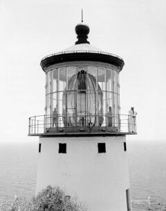
Physics:Hyperradiant Fresnel lens
Hyper-radial or hyperradiant Fresnel lenses are Fresnel lenses used in lighthouses. They are larger than "first-order" lenses, having a focal length (radius) of 1330 mm (52.36 inches). The idea was mentioned by Thomas Stevenson in 1869[1] and first proposed by John Richardson Wigham in 1872, and again proposed by Thomas Stevenson in 1885 (infringing Wigham's patent).[2]
The hyper-radial lens was made in 1885 by the F. Barbier Company in Paris as a test lens for the lighthouse illumination trials then going on at the South Foreland Lighthouse in the United Kingdom (UK). Chance Brothers Glass Company made their first hyper-radial lens in 1887 in the UK.[1]
These lenses were originally named biform, and later triform and quadriform lenses, by Wigham. Thomas Stevenson used the term hyperradiant lens, and later they were renamed the hyper-radial lens by James Kenward of the Chance Brothers Glass Company.
The hyper-radial Fresnel lenses were the largest ever put into use and were installed in about two dozen major "landfall" beacons around the world. The recipients include Makapu'u Point lighthouse on Oahu Island in Hawaii, Cabo de São Vicente in Portugal, Manora Point in Karachi, Pakistan , the Bishop Rock off the coast of Cornwall (in the UK), Cabo de Santa Marta in Brazil , and Cape Race, Newfoundland.[1] By the 1920s, high-intensity lamp technology had rendered lenses of this size obsolete.
Lighthouses
Template:Geogroup Hyperradiant optics were installed in thirty-one lighthouses around the world. A large proportion were destined for lights around Great Britain and Ireland, with another four used at sites around Sri Lanka. Despite the improvements in lighting technology, a number are still in use today. Others are in museums, either on display or in storage. The remainder have been broken up or lost.[1][3][4]
| Name | Image | Location Coordinates |
Country | Company | Date | Notes |
|---|---|---|---|---|---|---|
| Barberyn |  |
Barberyn [ ⚑ ] 6°27′49″N 79°58′06″E / 6.4635°N 79.9683°E |
Sri Lanka | Chance | 1888 | The optic gave a flash of white light every minute.[5][1] |
| Bazaruto | 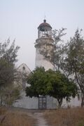 |
Bazaruto Island [ ⚑ ] 21°31′58″S 35°29′10″E / 21.5327°S 35.4861°E |
Mozambique | Barbier et al. | 1913 | Still in situ, but badly damaged.[1] |
| Beiyushan | 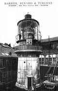 |
Yushan Islands [ ⚑ ] 28°53′03″N 122°15′38″E / 28.8842°N 122.2605°E |
China | Barbier et al. | 1895 | Made up of four panels, "each lens panel has two partial bull's-eyes giving a double group-flashing characteristic". It is not in the lantern room anymore, the fate of the optic is not known.[1] |
| Bell Rock | 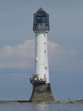 |
Inchcape [ ⚑ ] 56°26′03″N 2°23′14″W / 56.4342°N 2.3873°W |
United Kingdom | Henry Lepaute | 1902 | Lens removed in 1964. Made up of two panels, one panel is in the Signal Tower Museum, Arbroath. The location of the other panel is unknown.[1] |
| Berlenga |  |
Berlengas [ ⚑ ] 39°24′48″N 9°30′30″W / 39.4133°N 9.5083°W |
Portugal | Barbier et al. | 1897 | Made up of three panels, it was taken out of the tower in 1985. Two of the panels went to the Lighthouse Directorate Museum in Lisbon, one is on display the other stored but damaged. The third was taken to the museum in the Santa Marta Lighthouse, Cascais.[1] |
| Bishop Rock |  |
Isle of Scilly [ ⚑ ] 49°52′22″N 6°26′45″W / 49.8729°N 6.4457°W |
United Kingdom | Chance | 1887 | Following automation in 1992 the bi-form lens was split, the lower tier remains in use, the upper tier is on display in the National Maritime Museum Cornwall.[1] |
| Buchan Ness | 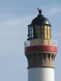 |
Boddam, Aberdeenshire [ ⚑ ] 57°28′13″N 1°46′28″W / 57.4704°N 1.7745°W |
United Kingdom | Chance | 1910 | A combined first order and hyper-radial optic, taken out in 1978 now stored at the Museum of Scottish Lighthouses.[1][3] |
| Bull Rock |  |
Dursey Island [ ⚑ ] 51°35′31″N 10°18′04″W / 51.5920°N 10.3010°W |
Ireland | Barbier et al. | 1888 | Bi-form lens was removed in 1991 by the Commissioners of Irish Lights.[1] |
| Cabo de São Vicente | 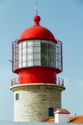 |
Cape St. Vincent [ ⚑ ] 37°01′23″N 8°59′46″W / 37.0231°N 8.9961°W |
Portugal | Barbier et al. | 1906 | Still in situ and in use.[1] |
| Cap d'Antifer | 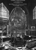 |
La Poterie-Cap-d'Antifer [ ⚑ ] 49°41′01″N 0°09′55″E / 49.6835°N 0.1654°E |
France | Barbier et al. | 1894 | Made up of six bullseye panels. It was lost when German soldiers demolished the entire lighthouse at the end of Occupation of France in August 1944.[1] |
| Cape Race |  |
Cape Race [ ⚑ ] 46°39′31″N 53°04′26″W / 46.6587°N 53.0738°W |
Canada | Chance | 1907 | Still in situ and in use.[1] |
| Dondra Head |  |
Dondra Head [ ⚑ ] 5°55′17″N 80°35′39″E / 5.9213°N 80.5941°E |
Sri Lanka | Chance | 1888 | The optic gave a flash of white light every twenty seconds.[5][1] |
| Fair Isle North |  |
Fair Isle [ ⚑ ] 59°33′08″N 1°36′35″W / 59.5521°N 1.6098°W |
United Kingdom | Barbier et al. | 1892 | Made up four panels, it was taken from the lighthouse in 1980, current location is not known.[1] |
| Flannan Isles | 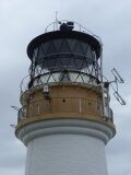 |
Flannan Isle [ ⚑ ] 58°17′17″N 7°35′16″W / 58.2881°N 7.5879°W |
United Kingdom | Henry Lepaute | 1899 | Made up of two panels, in a clamshell configuration. Broken up in 1971, a fragment of one of the prisms is on display in the Museum of Scottish Lighthouses.[4][1] |
| Great Basses Reef | 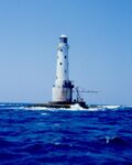 |
Southern Province [ ⚑ ] 6°10′56″N 81°28′59″E / 6.1821°N 81.4830°E |
Sri Lanka | Chance | 1888 | Broken up in the 1960s.[1] |
| Hyskeir |  |
Hyskeir [ ⚑ ] 56°58′10″N 6°40′49″W / 56.9694°N 6.6804°W |
United Kingdom | Chance | 1904 | Still in situ and in use.[1] |
| Kinnaird Head |  |
Kinnaird Head [ ⚑ ] 57°41′52″N 2°00′14″W / 57.6977°N 2.0039°W |
United Kingdom | Chance | 1902 | Still in situ in the original tower which is now part of the Museum of Scottish Lighthouses, which has been superseded by a modern lighthouse.[1] |
| Little Basses Reef | 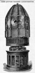 |
Southern Province [ ⚑ ] 6°24′26″N 81°43′49″E / 6.4073°N 81.7302°E |
Sri Lanka | Chance | 1888 | Broken up in the 1960s.[1] |
| Makapuu Point |  |
Oahu [ ⚑ ] 21°18′36″N 157°38′59″W / 21.3099°N 157.6497°W |
United States | Barbier et al. | 1887 | Still in situ and in use.[1] |
| Manora Point | 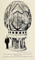 |
Manora [ ⚑ ] 24°47′38″N 66°58′39″E / 24.7939°N 66.9775°E |
Pakistan | Chance | 1908 | Made up of four bullseye panels, it is still in situ and in use.[1] |
| Mew Island |  |
Copeland Islands [ ⚑ ] 54°41′55″N 5°30′49″W / 54.6986°N 5.5136°W |
United Kingdom | Barbier et al. | 1928 | The original 1887 Tory Island tri-form lens was re-engineered to create a bi-form lens. Taken out in 2014, it was renovated and has been relocated to the Titanic Quarter in Belfast as a tourist attraction known as the Great Light.[1] |
| Nólsoy |  |
Nólsoy [ ⚑ ] 61°57′26″N 6°36′53″W / 61.9573°N 6.6146°W |
Faroe Islands | Barbier et al. | 1893 | Still in situ and in use.[1] |
| Orfordness | 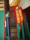 |
Orford Ness [ ⚑ ] 52°05′02″N 1°34′27″E / 52.0839°N 1.5742°E |
United Kingdom | Chance | 1909 | Two secondary sector light panels, removed in 2014, as the tower is endangered by coastal erosion.[1] |
| Pakri |  |
Pakri Peninsula [ ⚑ ] 59°23′15″N 24°02′16″E / 59.3874°N 24.0377°E |
Estonia | Barbier et al. | 1889 | The lighthouse was badly damaged and the lens was lost in 1941 during World War II.[1] |
| Pladda |  |
Pladda [ ⚑ ] 55°25′30″N 5°07′06″W / 55.4251°N 5.1184°W |
United Kingdom | Chance | 1901 | Made up of three bullseye panels, it was taken out of the tower, but its location is unknown. Reportedly moved to the Arran Heritage Museum.[1] |
| Round Island |  |
Isles of Scilly [ ⚑ ] 49°58′44″N 6°19′23″W / 49.9790°N 6.3231°W |
United Kingdom | Chance | 1888 | Bi-form, each tier made up of six panels. Removed in 1966, location not known.[1] |
| Rua Reidh |  |
Wester Ross [ ⚑ ] 57°51′32″N 5°48′42″W / 57.8588°N 5.8117°W |
United Kingdom | Chance | 1909 | Made up of six panels. Removed in 1985, on display at Gairloch Heritage Museum.[1] |
| Santa Marta |  |
Laguna [ ⚑ ] 28°36′12″S 48°48′48″W / 28.6033°S 48.8133°W |
Brazil | Barbier et al. | 1891 | Still in situ and in use.[1] |
| Spurn Point |  |
Spurn [ ⚑ ] 53°34′44″N 0°07′06″E / 53.5789°N 0.1183°E |
United Kingdom | Chance | 1895 | Location not known.[1] Made up of six lens panels it was removed in 1957 when the lighthouse was automated. |
| Sule Skerry |  |
Sule Skerry [ ⚑ ] 59°05′05″N 4°24′26″W / 59.0847°N 4.4073°W |
United Kingdom | Barbier et al. | 1895 | Removed in 1977, now stored at the National Museum of Scotland.[1] |
| Tory Island |  |
Tory Island [ ⚑ ] 55°16′23″N 8°14′56″W / 55.2730°N 8.2490°W |
Ireland | Chance | 1887 | Original 1887 tri-form was re-engineered by dividing up the bullseye panels, and creating a new bi-form optic for use at Mew Island in 1928. The second set of panels were used to create a second bi-form optic that is still in situ and in use.[1] |
References
- ↑ 1.00 1.01 1.02 1.03 1.04 1.05 1.06 1.07 1.08 1.09 1.10 1.11 1.12 1.13 1.14 1.15 1.16 1.17 1.18 1.19 1.20 1.21 1.22 1.23 1.24 1.25 1.26 1.27 1.28 1.29 1.30 1.31 1.32 1.33 1.34 "Hyper-Radial Lenses". United States Lighthouse Society. http://uslhs.org/hyper-radial-lenses. Retrieved 2 February 2016.
- ↑ "John Richardson Wigham 1829–1906". BEAM (Commissioners of Irish Lights) 35: 21–22. 2006. Archived from the original on 12 March 2012. https://web.archive.org/web/20120312014229/http://www.commissionersofirishlights.com/media/35546/Beam_2006.PDF.
- ↑ 3.0 3.1 "Bullseye lens part from Buchan Ness Lighthouse". goindustrial.co.uk. https://www.goindustrial.co.uk/collections/collection/bullseye-lens-part-from-buchan-ness-lighthouse. Retrieved 12 July 2020.
- ↑ 4.0 4.1 "Part of a prism from Flannan Isle". goindustrial.co.uk. https://www.goindustrial.co.uk/collections/lighthouses-museum/collection/prism-flannan-isle. Retrieved 12 July 2020.
- ↑ 5.0 5.1 "Notice to Mariners". The London Gazette. 17 September 1889. https://www.thegazette.co.uk/London/issue/25975/page/4995/data.pdf. Retrieved 12 July 2020.
External links
 |
