Place:Guelmim
Guelmim Agʷelmim / ⴰⴳⵯⵍⵎⵉⵎ ڭلميم | |
|---|---|
| Coordinates: [ ⚑ ] 28°59′N 10°04′W / 28.983°N 10.067°W | |
| Country | |
| Region | Guelmim-Oued Noun |
| Province | Guelmim |
| Population (2014)[1] | |
| • Total | 118,318 |
| Time zone | UTC+1 (CET) |
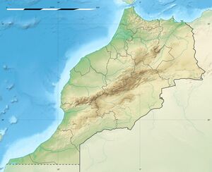
Guelmim (in Berber languages: Agʷelmim, ⴰⴳⵯⵍⵎⵉⵎ, in Arabic: ڭلميم, also spelled in European sources: Glaimim, Goulimine or Guelmin), is a city in southern Morocco, often called Gateway to the Desert. It is the capital of the Guelmim-Assif Noun region which includes southern Morocco (south of the Souss-Massa region) and the northeastern corner of Western Sahara. The population of the city was 187,808 as of the 2014 Moroccan census,[1] making it the largest city in the region. The N1 and N12 highways cross at Guelmim and link it to the nearby region of Souss-Massa.
Guelmim is located just north of Asrir, which was the site of an important trade-route city and the capital of the Saharan Berber tribes.
It is home to a camel market.
Most of the inhabitants speak either the Tachelhit language or the Hassaniya dialect of Berbers, as it is part of the Sahrawi-inhabited southern region of Morocco.
Climate
Guelmim has a hot desert climate (Köppen climate classification BWh). Script error: No such module "weather box".
See also
- Beni Ḥassān
- Noun River
- Maqil
- Tekna
References
- ↑ 1.0 1.1 "POPULATION LÉGALE DES RÉGIONS, PROVINCES, PRÉFECTURES, MUNICIPALITÉS, ARRONDISSEMENTS ET COMMUNES DU ROYAUME D’APRÈS LES RÉSULTATS DU RGPH 2014" (in ar, fr). High Commission for Planning, Morocco. 8 April 2015. http://rgph2014.hcp.ma/file/166326/.
- ↑ "Guelmim Climate Normals 1991–2020". World Meteorological Organization Climatological Standard Normals (1991–2020). National Oceanic and Atmospheric Administration. https://www.nodc.noaa.gov/archive/arc0216/0253808/1.1/data/0-data/Region-1-WMO-Normals-9120/Morocco/CSV/GUELMIM_60280.csv.
External links
[ ⚑ ] 28°59′N 10°04′W / 28.983°N 10.067°W
 |
