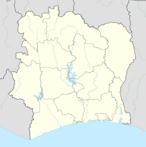
Place:Séguéla
From HandWiki
Séguéla | |
|---|---|
Town, Sub-prefecture, and commune | |
| Coordinates: [ ⚑ ] : 7°58′N 6°40′W / 7.967°N 6.667°W | |
| Country | |
| District | Woroba |
| Region | Worodougou |
| Department | Séguéla |
| Area | |
| • Total | 821 km2 (317 sq mi) |
| Population (2021 census)[2] | |
| • Total | 103,980 |
| • Density | 130/km2 (330/sq mi) |
| • Town | 46,189[1] |
| (2014 census) | |
| Time zone | UTC+0 (GMT) |
Séguéla is a town in western Ivory Coast. It is the seat of both the Woroba District and the Worodougou Region. It is also a commune and the seat of and a sub-prefecture of Séguéla Department.
Séguéla is served by Séguéla Airport. In 2021, the population of the sub-prefecture of Séguéla was 103,905.[2]
Villages
The forty two villages of the sub-prefecture of Séguéla and their population in 2014 are:[3]
References
- ↑ Citypopulation.de Population of cities & localities in Ivory Coast
- ↑ 2.0 2.1 Citypopulation.de Population of the regions and sub-prefectures of Ivory Coast
- ↑ "RGPH 2014, Répertoire des localités, Région Worodougou". http://www.ins.ci/n/documents/rgph/WORODOUGOU.pdf. Retrieved 5 August 2019.
 |


