Place:Tala, Egypt
From HandWiki
Tala تلا | |
|---|---|
city | |
 | |
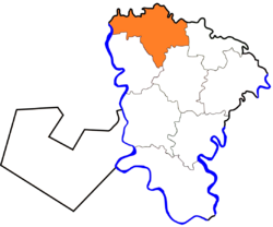
 Location in Monufia Governorate | |
Location in Egypt | |
| Coordinates: [ ⚑ ] : 30°40′48″N 30°56′38″E / 30.680108°N 30.943758°E | |
| Country | |
| Governorate | Monufia |
| Area | |
| • Total | 188.3 km2 (72.7 sq mi) |
| Population (2021)[1] | |
| • Total | 413,839 |
| • Density | 2,200/km2 (5,700/sq mi) |
| Time zone | UTC+2 (EST) |
| Climate | BWh |
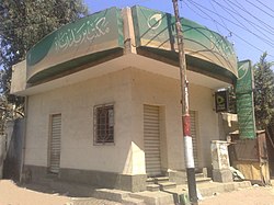
Tala, sometimes also transliterated Talla[2] (Arabic: تلا, from Coptic: ⲧⲁⲗⲁⲛⲁⲩ[3]), is a city in the northern part of Monufia Governorate, Egypt.[4]
The 1885 Census of Egypt recorded Tala as a city in its own district in Monufia Governorate; at that time, the population of the city was 9,653 (4,784 men and 4,869 women).[5] The village of Kafr Zarqan accounts for over 1,500 of these residents, according to the 2006 census.[6]
See also
- List of cities and towns in Egypt
- Kafr Zarqan
References
- ↑ 1.0 1.1 "Talā (Markaz, Egypt) - Population Statistics, Charts, Map and Location". https://www.citypopulation.de/en/egypt/admin/al_min%C5%ABfiyah/1704__tal%C4%81/.
- ↑ "Talla, Egypt - Geographical Names, map, geographic coordinates". https://geographic.org/geographic_names/name.php?uni=-474019&fid=1595&c=egypt.
- ↑ Daressy, George. Les grandes villes d'Égypte a l'époque copte. Presses Universitaires de France.
- ↑ "Tala". http://www.monofeya.gov.eg/HaykalTanzemy/cities/tala/default.aspx.
- ↑ Egypt min. of finance, census dept (1885). Recensement général de l'Égypte. p. 302. https://books.google.com/books?id=OpQNAAAAQAAJ. Retrieved 21 June 2020.
- ↑ "الجهاز المركزى للتعبئة العامة والاحصاء". http://www.msrintranet.capmas.gov.eg/.
