Earth:Mount Bursey
| Mount Bursey | |
|---|---|
| Highest point | |
| Elevation | 2,780 m (9,120 ft) |
| Coordinates | [ ⚑ ] : 76°01′S 132°38′W / 76.017°S 132.633°W |
| Geography | |
| Location | Marie Byrd Land, Antarctica |
| Parent range | Flood Range |
| Geology | |
| Mountain type | Shield volcano |
| Volcanic field | Marie Byrd Land Volcanic Province |
| Last eruption | Unknown |
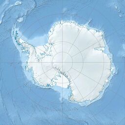
Mount Bursey is a broad, ice-covered mountain, 2,780 metres (9,120 ft) high, which forms the eastern end of the Flood Range in Marie Byrd Land, Antarctica.
It was discovered by members of the United States Antarctic Service (USAS) on aerial flights in 1940, and named for Jacob Bursey, member of the Byrd Antarctic Expedition (1928–30) and dog-driver with the USAS party which sledged to the west end of the Flood Range in December 1940.[1]
Volcanism
Mount Bursey consists of two coalescing shield volcanoes, namely Hutt Peak and Koerner Bluff. Each shield contains a 4–5 km (2.5–3.1 mi) diameter caldera at its summit. Potassium–argon dating has indicated both shields formed during the Miocene epoch, with volcanism at Hutt Peak occurring as recently as 0.49 million years ago.[2]
Starbuck Crater is a volcanic cone on the mountain.
Named features
Several features of Mount Bursey have been named by various groups of surveyors and explorers.
Along the mountain's northwest margin lies Koerner Bluff, a bare rock bluff.[3] Below Koener Bluff, about one mile (1.6 km) to the north, sits Syrstad Rock, a rock outcrop.[4]
Both features were first mapped by the United States Geological Survey (USGS) from surveys and U.S. Navy air photos collected from 1959 to 1965, and were named by the Advisory Committee on Antarctic Names (US-ACAN). Koerner Bluff was named for Roy M. Koerner, a United States Antarctic Research Program (USARP) glaciologist with the Byrd Station Traverse, 1962–63.[3] Syrstad Rock was named for Erik Syrstad, ionospheric physicist at South Pole Station, 1970.[4]
See also
- List of volcanoes in Antarctica
References
- ↑ "Mount Bursey". United States Geological Survey. https://geonames.usgs.gov/apex/f?p=gnispq:5:::NO::P5_ANTAR_ID:2193.
- ↑ "Mount Bursey". Smithsonian Institution. https://volcano.si.edu/volcano.cfm?vnum=390820.
- ↑ 3.0 3.1 "Koerner Bluff". United States Geological Survey. https://geonames.usgs.gov/apex/f?p=gnispq:5:::NO::P5_ANTAR_ID:8102.
- ↑ 4.0 4.1 "Syrstad Rock". United States Geological Survey. https://geonames.usgs.gov/apex/f?p=gnispq:5:::NO::P5_ANTAR_ID:14942.
![]() This article incorporates public domain material from websites or documents of the United States Geological Survey.
This article incorporates public domain material from websites or documents of the United States Geological Survey.
 |


