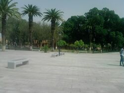
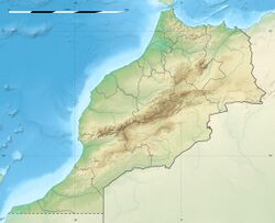
Place:El Kelaa des Sraghna
El Kelaa des Sraghna | |
|---|---|
 | |
| Coordinates: [ ⚑ ] 32°2′53″N 7°24′30″W / 32.04806°N 7.40833°W | |
| Country | |
| Region | Marrakesh-Safi |
| Province | El Kelaa des Sraghna |
| Elevation | 400 m (1,300 ft) |
| Population (2014)[1] | |
| • Total | 95,224 |
| Time zone | UTC+0 (WET) |
| • Summer (DST) | UTC+1 (WEST) |
El Kelaa des Sraghna (Berber: ⵇⵍⵄⵜ ⵙⵔⴰⵖⵏⵙ, Arabic: قلعة السراغنة, sometimes spelled El Kelaa des Srarhna) is a town in central Morocco. The economy of the town is mostly based on agriculture, the growing of olive trees being predominant.
History
According to some historical references, the Alaouite Sultan Moulay Ismail established the city, Kelaat Sraghnas in the 17th century. The Sultan had aimed to found citadels and Quasbas to control the movements of mountainous tribes. Other references state that the existence of the city refers to the period of the Almoravids. According to other sources, the city was known as the Arabs designations such as "Gaynou" Lagrare, and it was founded by the Almoravids like a project to monitor the road between Fes and Marrakesh, to populate the area and fight against Berghouata’s heresy. Nevertheless, some manuscripts cite evidence that Saadian Dynasty founded the city in the late of sixteenth century and it was known as designation "Kelaat Lagrare".
Climate
El Kelaa des Sraghna has a hot semi-arid climate (Köppen climate classification BSh).
Script error: No such module "weather box".
References
- ↑ "POPULATION LÉGALE DES RÉGIONS, PROVINCES, PRÉFECTURES, MUNICIPALITÉS, ARRONDISSEMENTS ET COMMUNES DU ROYAUME D'APRÈS LES RÉSULTATS DU RGPH 2014" (in ar, fr). High Commission for Planning, Morocco. 8 April 2015. http://rgph2014.hcp.ma/file/166326/.
- ↑ "Weatherbase: Historical Weather for El Kelaa des Srarhna, Morocco". Weatherbase. 2011. http://www.weatherbase.com/weather/weather.php3?s=140206&refer=wikipedia. Retrieved on November 24, 2011.


