Place:Kafir-kala (Tajikistan)
From HandWiki
Short description: Archaeological site in Tajikistan
Kafir-kala
(Tajikistan)
(Tajikistan)
Ruins of citadel of Kafir-kala.
Lua error in Module:Location_map at line 522: Unable to find the specified location map definition: "Module:Location map/data/Bactria" does not exist.
[ ⚑ ] 37°35′20″N 68°38′47″E / 37.588861°N 68.646444°E Kafir-kala ("Fortress of the infidels") is an ancient fortress in the Vakhsh valley in Tajikistan.[1]
Fortress and Buddhist temple
It consists in a rectangular town surrounded by a wall with towers (360x360 meters), surrounded by a large ditch, and has one citadel (360x360 meters) in one corner, also surrounded by a wall. The citadel (70x70 meters) contained the palace of the rulers.[1]
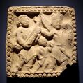
A Buddhist temple was found in the palace complex of the fortress as well as a Buddhist Vihara with Buddhist paintings, belonging to the "Tokharistan school of art".[1][2] Inscriptions with apparently Buddhist content have also been found.[3]
Artefacts
Sources
- LITVINSKY, BORIS; SOLOV'EV, VIKTOR (1990). "The Architecture and Art of Kafyr Kala (Early Medieval Tokharistan)". Bulletin of the Asia Institute 4: 61–75. ISSN 0890-4464. https://www.jstor.org/stable/pdf/24048351.pdf.
References
- ↑ 1.0 1.1 1.2 Dani, Ahmad Hasan; Litvinsky, B. A. (January 1996) (in en). History of Civilizations of Central Asia: The crossroads of civilizations, A.D. 250 to 750. UNESCO. p. 150. ISBN 978-92-3-103211-0. https://books.google.com/books?id=883OZBe2sMYC&pg=PA150.
- ↑ UNESCO Collection of History of Civilizations of Central Asia : Online chapter. http://unesco.culture.free.fr/asia-new/html_eng/chapitre316/chapitre5.htm.
- ↑ "A fragment of birchbark manuscript bearing a text of apparently Buddhist content has been found at Kafyr-kala in the Vakhsh valley." in Dani, Ahmad Hasan (1999) (in en). History of Civilizations of Central Asia: The crossroads of civilizations: A.D. 250 to 750. Motilal Banarsidass Publ.. p. 387. ISBN 978-81-208-1540-7. https://books.google.com/books?id=FcKtIPVQ6REC&pg=PA387.
 |


