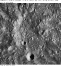
Astronomy:Marco Polo (crater)
 | |
| Diameter | 28 × 21 km |
|---|---|
| Depth | 1.1 km |
| Colongitude | 2° at sunrise |
Marco Polo is a lunar impact crater that is located in the rugged foothills to the south of the Montes Apenninus mountain range. It was named after Italian explorer Marco Polo.[1] It lies just 20 kilometers to the west of the Mare Vaporum, but is otherwise located in an undistinguished region of terrain with no notable craters nearby.
This crater is elongated to the south-southeast, with a very eroded outer rim. The southern part of the rim is nearly nonexistent, and there is a narrow cleft at the northern end of the crater. Portions of the rim still remain along the western and northeastern sides, but appear as little more than curved ridges. The interior has little detail of interest apart from a tiny craterlet along the southwest inner wall.
Satellite craters
By convention these features are identified on lunar maps by placing the letter on the side of the crater midpoint that is closest to Marco Polo.
| Marco Polo | Latitude | Longitude | Diameter |
|---|---|---|---|
| A | 14.9° N | 2.0° W | 7 km |
| B | 17.2° N | 1.9° W | 7 km |
| C | 14.0° N | 5.0° W | 7 km |
| D | 15.0° N | 3.7° W | 6 km |
| F | 15.7° N | 4.5° W | 4 km |
| G | 16.7° N | 1.9° W | 5 km |
| H | 17.8° N | 1.7° W | 6 km |
| J | 17.9° N | 1.2° W | 5 km |
| K | 18.2° N | 1.4° W | 10 km |
| L | 14.8° N | 5.0° W | 19 km |
| M | 17.6° N | 1.1° W | 37 km |
| P | 16.9° N | 0.2° W | 31 km |
| S | 17.8° N | 0.0° E | 21 km |
| T | 13.6° N | 1.0° W | 3 km |
References
- ↑ "Marco Polo (crater)". Gazetteer of Planetary Nomenclature. USGS Astrogeology Research Program.
- Andersson, L. E.; Whitaker, E. A. (1982). NASA Catalogue of Lunar Nomenclature. NASA RP-1097.
- Bussey, B.; Spudis, P. (2004). The Clementine Atlas of the Moon. New York: Cambridge University Press. ISBN 978-0-521-81528-4.
- Cocks, Elijah E.; Cocks, Josiah C. (1995). Who's Who on the Moon: A Biographical Dictionary of Lunar Nomenclature. Tudor Publishers. ISBN 978-0-936389-27-1. https://archive.org/details/isbn_9780936389271.
- McDowell, Jonathan (July 15, 2007). "Lunar Nomenclature". Jonathan's Space Report. http://host.planet4589.org/astro/lunar/.
- Menzel, D. H.; Minnaert, M.; Levin, B.; Dollfus, A.; Bell, B. (1971). "Report on Lunar Nomenclature by the Working Group of Commission 17 of the IAU". Space Science Reviews 12 (2): 136–186. doi:10.1007/BF00171763. Bibcode: 1971SSRv...12..136M.
- Moore, Patrick (2001). On the Moon. Sterling Publishing Co.. ISBN 978-0-304-35469-6. https://archive.org/details/patrickmooreonmo00patr.
- Price, Fred W. (1988). The Moon Observer's Handbook. Cambridge University Press. ISBN 978-0-521-33500-3.
- Rükl, Antonín (1990). Atlas of the Moon. Kalmbach Books. ISBN 978-0-913135-17-4.
- Webb, Rev. T. W. (1962). Celestial Objects for Common Telescopes (6th revised ed.). Dover. ISBN 978-0-486-20917-3. https://archive.org/details/celestialobjects00webb.
- Whitaker, Ewen A. (1999). Mapping and Naming the Moon. Cambridge University Press. ISBN 978-0-521-62248-6.
- Wlasuk, Peter T. (2000). Observing the Moon. Springer. ISBN 978-1-85233-193-1.
External links
 |

