Earth:Tourmaline Plateau
From HandWiki
Revision as of 09:07, 5 August 2021 by imported>PolicyEnforcerIA (attribution)
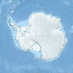
Tourmaline Plateau in Antarctica
Tourmaline Plateau ( [ ⚑ ] : 74°10′S 163°27′E / 74.167°S 163.45°E) is an ice-covered plateau in the central part of the Deep Freeze Range, bounded by the Howard Peaks and the peaks and ridges which trend north-south from Mount Levick, in Victoria Land. It was so named by the Northern Party of the New Zealand Geological Survey Antarctic Expedition (NZGSAE), 1965–66, because of the quantities of tourmaline-granite found there.
![]() This article incorporates public domain material from the United States Geological Survey document "Tourmaline Plateau" (content from the Geographic Names Information System).
This article incorporates public domain material from the United States Geological Survey document "Tourmaline Plateau" (content from the Geographic Names Information System).
This article does not cite any external source. HandWiki requires at least one external source. See citing external sources. (2021) (Learn how and when to remove this template message) |
 |


