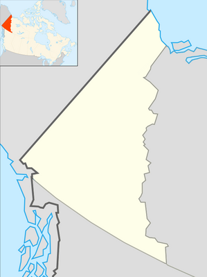
Module:Location map/data/Canada Yukon
From HandWiki
< Module:Location map
Revision as of 13:17, 11 March 2018 by imported>Plastikspork (Protected "Module:Location map/data/Canada Yukon" ([Edit=Require autoconfirmed or confirmed access] (indefinite) [Move=Require autoconfirmed or confirmed access] (indefinite)))
| name | Yukon | ||
|---|---|---|---|
| x | (0.43865313653137 + (1 - ($1- 63.31) * (0.034717103369757 + 0.000003525145 * ($1- 63.31) * ($1- 63.31))) * ($2+ 94.94) * ( 0.0089116793548638 - 0.000000361163 * ($2 + 94.94) * ($2 + 94.94))) * 506.3291139 | ||
| y | (-0.14714022140221 + (1 - ($1- 63.31) * (0.034717103369757 + 0.000003525145 * ($1 - 63.31) * ($1 - 63.31))) * ( 0.57149446494465 - 0.000069482763 * ($2 + 94.94) * ($2 + 94.94))) * 380.1347332 - 66.73003802 | ||
| image | Location map Yukon 2.png
| ||

| |||
Module:Location map/data/Canada Yukon is a location map definition used to overlay markers and labels on an equirectangular projection map of Yukon. The markers are placed by latitude and longitude coordinates on the default map or a similar map image.
Usage
These definitions are used by the following templates when invoked with parameter "Canada Yukon":
{{Location map|Canada Yukon |...}}{{Location map many|Canada Yukon |...}}{{Location map+|Canada Yukon |...}}{{Location map~|Canada Yukon |...}}
Map definition
name = Yukon- Name used in the default map caption
image = Location map Yukon 2.png- The default map image, without "Image:" or "File:"
x = (0.43865313653137 + (1 - ($1- 63.31) * (0.034717103369757 + 0.000003525145 * ($1- 63.31) * ($1- 63.31))) * ($2+ 94.94) * ( 0.0089116793548638 - 0.000000361163 * ($2 + 94.94) * ($2 + 94.94))) * 506.3291139- An expression to calculate a location on the map via its longitude; evaluates as 0 along the left edge and 100 along the right edge
y = (-0.14714022140221 + (1 - ($1- 63.31) * (0.034717103369757 + 0.000003525145 * ($1 - 63.31) * ($1 - 63.31))) * ( 0.57149446494465 - 0.000069482763 * ($2 + 94.94) * ($2 + 94.94))) * 380.1347332 - 66.73003802- An expression to calculate a location on the map via its latitude; evaluates as 0 along the top edge and 100 along the bottom edge
See also
Location map templates
- Template:Location map, to display one mark and label using latitude and longitude
- Template:Location map many, to display up to nine marks and labels
- Template:Location map+, to display an unlimited number of marks and labels
Creating new map definitions
return {
	 name = 'Yukon',
	 x = '(0.43865313653137 + (1 - ($1- 63.31) * (0.034717103369757 + 0.000003525145 * ($1- 63.31) * ($1- 63.31))) * ($2+ 94.94) * ( 0.0089116793548638 - 0.000000361163 * ($2 + 94.94) * ($2 + 94.94))) * 506.3291139',
	 y = '(-0.14714022140221 + (1  - ($1- 63.31) * (0.034717103369757 + 0.000003525145 * ($1 - 63.31) * ($1 - 63.31))) * ( 0.57149446494465 - 0.000069482763 * ($2 + 94.94) * ($2 + 94.94))) * 380.1347332 - 66.73003802',
	 image = 'Location map Yukon 2.png'
}
