Earth:Varignon frame
From HandWiki
Revision as of 12:39, 10 August 2021 by imported>PolicyEnforcerIA (attribution)
This article needs additional citations for verification. (May 2015) (Learn how and when to remove this template message) |
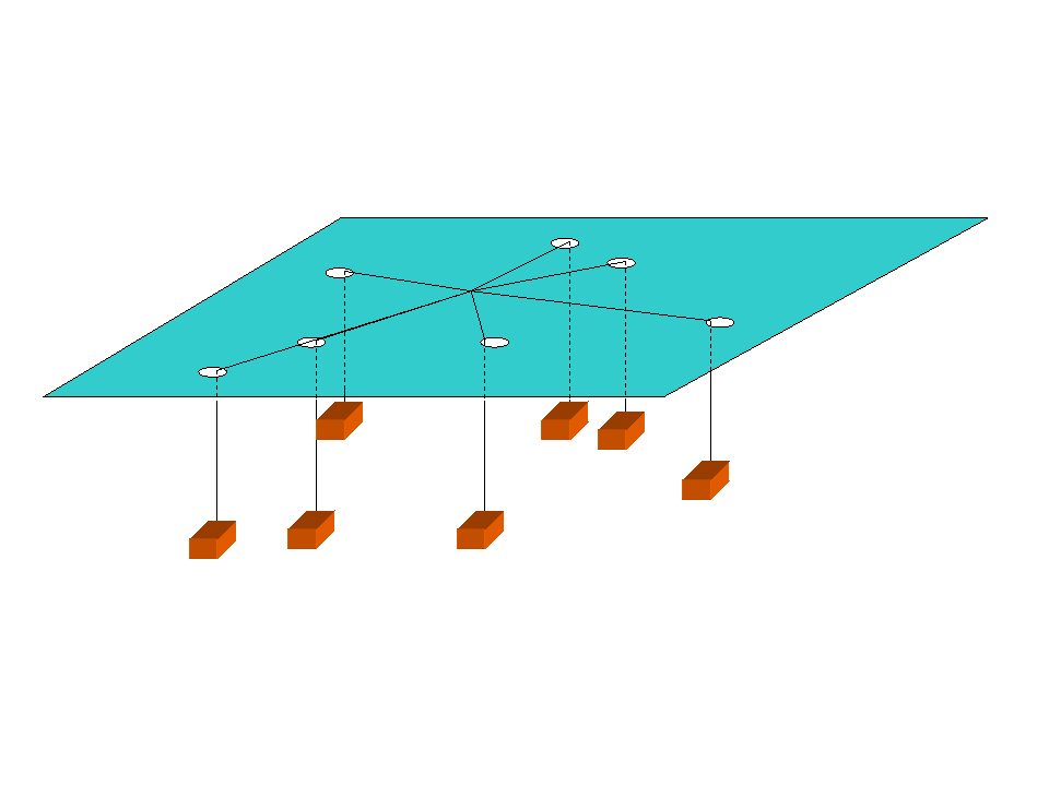
A Varignon frame is a system of weights and pulleys used by geographers to help determine optimum location. For example, the weights might represent the relative cost of transporting particular goods to or from particular locations, to help a firm decide the most cost effective site to locate a prospective production facility.
In this drawing of a Varignon frame, the weights are represented as orange cubes. The blue plane could be a map, and the point where all the "strings" meet would indicate the optimum location where the sum of the weights times the distances from this point to the holes (facility locations) is minimum.
This article uses only URLs for external sources. (2021) (Learn how and when to remove this template message) |
This article does not cite any external source. HandWiki requires at least one external source. See citing external sources. (2021) (Learn how and when to remove this template message) |
 |  |

