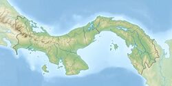
Earth:Caimito Formation
From HandWiki
| Caimito Formation Stratigraphic range: Late Oligocene-Early Miocene | |
|---|---|
| Type | Formation |
| Underlies | Alajuela & Gatún Formations |
| Overlies | Bohío, Caraba & Gatuncillo Formations, Cretaceous basement |
| Lithology | |
| Primary | Marl |
| Other | Siltstone, sandstone, conglomerate |
| Location | |
| Coordinates | [ ⚑ ] : 9°12′N 79°48′W / 9.2°N 79.8°W |
| Paleocoordinates | [ ⚑ ] 7°42′N 77°30′W / 7.7°N 77.5°W |
| Region | Panamá Province |
| Country | |
| Extent | Panama Basin |
| Type section | |
| Named for | Caimito Junction of Panama Railroad |
| Named by | MacDonald |
| Year defined | 1913 |
The Caimito Formation (Tcm)[1] is a geologic formation in Panama. The marls, sandstones and conglomerates preserve bivalve and gastropod fossils dating back to the Late Oligocene to Early Miocene period.[2] The name Caimito was proposed by MacDonald in 1913, named after the Caimito junction in the Panama Railroad during the construction of the Panama Canal.[3]
See also
- List of fossiliferous stratigraphic units in Panama
References
- ↑ Geologic Map, 1980
- ↑ Caimito Formation at Fossilworks.org
- ↑ Woodring, 1957, p.28
Bibliography
- Stewart, R.H.; J.L. Stewart, and W.P. Woodring. 1980. Geologic Map of the Panama Canal and Vicinity, 1. USGS. Accessed 2019-02-09.
- Woodring, W.P. 1957. Geology and Paleontology of Canal Zone and Adjoining Parts of Panama - 306A Geology and description of Tertiary mollusks (Gastropods: Trochidae to Turritellidae), 1–186. USGS. Accessed 2019-02-09.
 |

