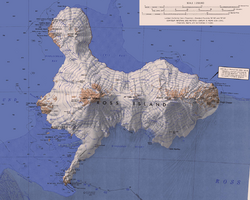
Earth:Cinder Hill
From HandWiki
Short description: Mountain in Ross Dependency, Antarctica
Cinder Hill ( [ ⚑ ] : 77°16′S 166°25′E / 77.267°S 166.417°E) is a prominent dissected volcano, 305 metres (1,000 ft) high, consisting of layers of red basalt scoria and cinders and abundant olivine nodules, standing between Harrison Stream and Wilson Stream on the ice-free lower west slopes of Mount Bird, Ross Island. It was mapped and descriptively named by the New Zealand Geological Survey Antarctic Expedition, 1958–59.
References
 This article incorporates public domain material from the United States Geological Survey document "Cinder Hill" (content from the Geographic Names Information System).


