Earth:Iranian Plate
From HandWiki
Short description: Small tectonic plate including Iran and Afghanistan, and parts of Iraq and Pakistan

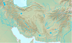
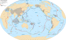
The Iranian Plate is a small tectonic plate thought to underlie the Persian plateau, covering the modern-day countries of Iran and Afghanistan, and parts of Iraq and Pakistan . It is compressed between the Arabian Plate to the southwest, the Eurasian Plate to the north, and the Indian Plate to the southeast. This compression is likely a cause for the very mountainous terrain of the area including the Alborz and Zagros Mountains.
References
- William Bayne Fisher: The Middle East: a Physical, Social, and Regional Geography. Routledge 1978, ISBN 978-0-416-71520-0, p. 15–16

