Earth:Māhukona
| Māhukona | |
|---|---|
Lua error in Module:Location_map at line 522: Unable to find the specified location map definition: "Module:Location map/data/Hawaii" does not exist.
| |
| Highest point | |
| Elevation | −3,770 feet (−1,149 m) |
| Coordinates | [ ⚑ ] : 20°01′N 156°01′W / 20.017°N 156.017°W |
| Geography | |
| Location | Hawaii, US |
| Parent range | Hawaiian Islands |
| Topo map | USGS Kamuela |
| Geology | |
| Mountain type | Shield volcano, Hotspot volcano |
| Volcanic arc/belt | Hawaiian-Emperor seamount chain |
| Last eruption | About 470,000 BP |
Māhukona is a submerged shield volcano on the northwestern flank of the Island of Hawaiʻi. A drowned coral reef at about 3,770 feet (-1,150 m) below sea level and a major break in slope at about 4,400 feet (-1,340 m) below sea level represent old shorelines.
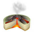
A roughly circular caldera marks its summit. A prominent rift zone extends to the west. A second rift zone probably extended to the east but has been buried by younger volcanoes.
The main shield-building stage of volcanism ended about 470,000 years ago. The summit of the shield volcano was once 800 feet (250 m) above sea level, but subsided below sea level between 435,000 and 365,000 years ago.[1]
Māhukona is the oldest volcano to build Hawaiʻi island, older than Kohala and Mauna Kea.[2]
The Monterey Bay Aquarium Research Institute investigated the area with a remotely controlled submarine in 2001.[3]
It was named for the area known as Māhukona, on the shore to the northeast.[4]
References
- ↑ "Mahukona, Hawaii". Volcano World. Oregon State University. http://volcano.oregonstate.edu/vwdocs/volc_images/north_america/hawaii/mahukona.html. attributed to:
David A. Clague; James G. Moore (April 1991). "Geology and Petrology of Mahukona Volcano". Bulletin of Volcanology 53 (3): 159–172. doi:10.1007/BF00301227. Bibcode: 1991BVol...53..159C. https://zenodo.org/record/1232423. - ↑ "Volcanoes of the Big Island". Volcano Watch. Hawaiian Volcano Observatory. September 15, 1995. http://hvo.wr.usgs.gov/volcanowatch/1995/95_09_15.html.
- ↑ "Hawaii Cruise: March 13, 2001 to June 2, 2001". Monterey Bay Aquarium Research Institute. http://www.mbari.org/expeditions/Hawaii/history&purpose.htm.
- ↑ U.S. Geological Survey Geographic Names Information System: Māhukona
Further reading
- David A. Clague; Andrew T. Calvert (July 2009). "Postshield stage transitional volcanism on Mahukona Volcano, Hawaii". Bulletin of Volcanology 71 (5): 533–539. doi:10.1007/s00445-008-0240-z. Bibcode: 2009BVol...71..533C.
External links
 |  |

