Earth:Mount Manengouba
From HandWiki
Short description: Volcano in Cameroon
| Mount Manengouba | |
|---|---|
 Mount Manengouba Location in Cameroon | |
| Highest point | |
| Elevation | 2,396 m (7,861 ft) [1] |
| Prominence | 1,433 m (4,701 ft) |
| Listing | Ribu |
| Coordinates | [ ⚑ ] : 5°01′48″N 9°49′48″E / 5.03°N 9.83°E |
| Geography | |
| Location | Cameroon |
| Parent range | Cameroon line |
| Geology | |
| Age of rock | Pleistocene |
| Mountain type | Shield volcano, stratovolcano |
Mount Muanenguba (also spelled Manenguba or Mwanenguba) is a volcano in the Southwest Province of Cameroon.[2] The Manenguba shrew and endemic vegetal species are native to the mountain. The area is featured in the documentary The Mists of Mwanenguba with botanist Martin Cheek.[3]
Geology
The volcano is a Pleistocene shield volcano. It is topped by the Eboga stratovolcano.[4]
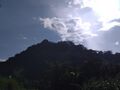
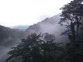
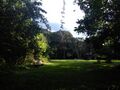
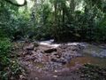
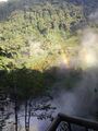
Gallery
- Mount Mwanenguba
-
-
-
-
-
-
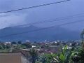 Mount Manengouba from Nkongsamba


References
- ↑ "World Ribus – West Africa Mountains". 17 March 2022. https://worldribus.org/west-africa-mountains/.
- ↑ "Manengouba". Smithsonian Institution. https://volcano.si.edu/volcano.cfm?vn=224020.
- ↑ "Oasis TV". Archived from the original on November 27, 2010. https://web.archive.org/web/20101127021332/http://oasishd.ca/index.php?option=com_content&view=article&id=41:art-themistsofmwanenguba&catid=23:catt&Itemid=3. Retrieved August 8, 2010.
- ↑ "Global Volcanism Program | Manengouba". https://volcano.si.edu/volcano.cfm?vn=224020.
External links
 |  |
