Earth:Pilot crater
From HandWiki
Short description: Crater lake in Canada
| Pilot Lake | |
|---|---|
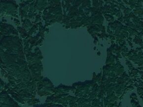
 Satellite image (Landsat) | |
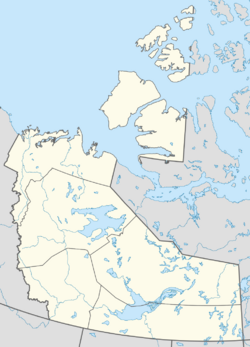
| Location | Northwest Territories |
| Coordinates | [ ⚑ ] 60°17′N 111°0′W / 60.283°N 111°W |
| Type | Impact crater lake |
| Basin countries | Canada |
| Surface area | 43 km2 (17 sq mi) |
| Max. depth | 90 m (300 ft) |
| Surface elevation | 255 m (837 ft) |
| Islands | 9 |
Pilot crater is an impact crater in the Northwest Territories, Canada, just north of the Alberta border and near Fort Smith 54 km (34 mi). It is 6 km (3.7 mi) in diameter and the age is estimated to be 445 ± 2 million years (Upper Ordovician).[1]
The crater contains Pilot Lake, a pristine fresh-water lake that covers 43 km2 (17 sq mi) and is 90 m (300 ft) deep. Lake trout, northern pike, whitefish, and pickerel are plentiful, supporting a summer market for recreational fishing.[2]
References
- ↑ "Pilot". Earth Impact Database. Planetary and Space Science Centre University of New Brunswick Fredericton. http://www.passc.net/EarthImpactDatabase/New%20website_05-2018/Pilot.html. Retrieved 2009-08-19.
- ↑ "Pilot Lake Cabins – Fly-In Fishing". Archived from the original on 2006-12-05. https://web.archive.org/web/20061205051814/http://pilotlake.ca/. Retrieved 2007-01-14.
External links
[ ⚑ ] 60°17′N 111°0′W / 60.283°N 111°W
 |


