Place:Khorramabad
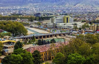
Khorramabad (Persian: خرمآباد; fa)[lower-alpha 1] is a city in the Central District of Khorramabad County, Lorestan province, Iran, serving as capital of the province, the county, and the district.[2] Situated in a scenic valley surrounded by mountains, the city lies approximately 100 kilometers (about 62 miles) east of the Iraqi border.[3][4][5]
History
Prehistoric sites
The Khorramabad Valley, a UNESCO World Heritage Site, contains evidences from the Middle to Upper Palaeolithic periods with remains of Mousterian and Baradostian cultures.[6]
Hazaraspids
The founder of the Hazaraspid dynasty was Abu Tahir ibn Muhammad, a descendant of the Shabankara chieftain Fadluya. Fadluya was initially a commander of the Salghurids of Fars and was appointed governor of Kuhgiluya,[7] but eventually gained independence in Lorestan and extended his realm as far as Isfahan.
Safavid era
During the Safavid era, Khorramabad was the administrative center of Lorestan province.
In the wake of the demise of the Safavids, after the signing of the Treaty of Constantinople (1724) with Imperial Russia, the Ottoman Turks conquered Khorramabad on the 6 September 1725.[8]
Demographics
Language
The city population is predominantly Lur and the largest Luri-speaking city in the country.[9][10]
The linguistic composition of the city:[11]
Population
At the time of the 2006 National Census, the city's population was 328,544 in 75,945 households.[12] The following census in 2011 counted 348,216 people in 94,747 households.[13] The 2016 census measured the population of the city as 373,416 people in 109,231 households.[14]
Geography
Location
Khorramabad is in the Zagros Mountains. Khorramabad Airport is 3 km south of the city proper.[15]
Climate
Khorramabad has a mild and semi-humid Mediterranean climate with high amounts of rainfall during spring and winter. It is the sixth cities in Iran having high level of annual rainfall.
Khorramabad has what is classed under the Köppen climate classification as a Hot-summer Mediterranean climate (Csa) climate. Its elevation is 1147.8 above sea level. Average annual precipitation is 511.06 and its average annual temperature is 17.21 Celsius.
Highest recorded temperature: 47.0 °C (116.6 °F) on 14 August 1960 and 23 July 1961[16]
Lowest recorded temperature: −14.6 °C (5.7 °F) on 25 January 1990.[17]
Script error: No such module "weather box".
Historical monuments

Brick minaret
The Brick Minaret is a cylindrical brick tower from the Seljuk and Buyid eras located inside the ancient city of Shapur khast, south of Khorramabad.
This minaret is a combination of the Indian Stupa, commemorative columns, and the central Asian tradition of tower building for defensive and communication purposes.[19]
Sahpuri Bridge
Shapuri Bridge dates back to the Sasanian era and is registered on the list of National Monuments.
Attractions
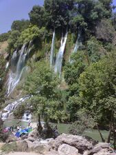
Khorramabad is a major tourist destination and possesses several attractions, such as five Paleolithic cave-dwelling sites[20] which were recognised in 2025 as World Heritage Sites by UNESCO.[21]
Colleges and universities

- Islamic Azad University of Khorram Abad
- Lorestan University[22]
- Lorestan University of Medical Sciences[23]
- Madanni Technical College[24]
Sister cities and twin towns
| Country | City | State / Province / Region / Governorate | Date | ||||
|---|---|---|---|---|---|---|---|
| Turkey | Afyonkarahisar | Afyonkarahisar Province | 2015[25] | ||||
| Japan | Yamagata | Yamagata Prefecture | October 2013[26] | December 2020[27] | |||
Photo gallery
-
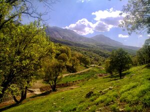 Nojian oak forest, Khorramabad County
 -
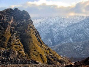 Makhmalkuh Khorramabad County
 -
 Shapur Khast castle
 -
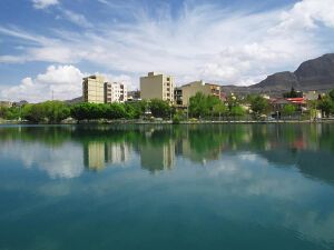 Keeyow Lake, Khorramabad
 -
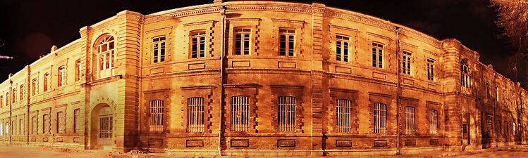 Sarbaz khaneh building
 -
 Building in Khorramabad
 -
 Bisheh waterfall, Khorramabad County
 -
 Khorramabad


See also
- List of World Heritage Sites in Iran
- Khaydalu
Notes
- ↑ Northern Luri: خۉرمۊه, also romanized as Khoramabad, Khorram Abad, Khorramābād, and Xorramâbâd; also known as Khur Ramābād, Khurramabad, and Xurremabad[1]
References
- ↑ Khorramabad can be found at GEOnet Names Server, at this link, by opening the Advanced Search box, entering "-3071194" in the "Unique Feature Id" form, and clicking on "Search Database".
- ↑ (in fa) Approval of the organization and chain of citizenship of the elements and units of the country divisions of Lorestan province, centered in the city of Khorramabad (Report). Ministry of the Interior, Political and Defense Commission of the Government Board. c. 2024. Proposal 3233.1.5.53; Letter 907-93808; Notification 82816/T121K. https://lamtakam.com/law/council_of_ministers/113030. Retrieved 19 January 2024.
- ↑ "Khorramābād | Persian City, Lorestan Province | Britannica". https://www.britannica.com/place/Khorramabad.
- ↑ "'Born on the Wrong Side of the Border'". 28 January 2021. https://arablit.org/2021/01/28/born-on-the-wrong-side-of-the-border/.
- ↑ "MEED | Norway's DNO to study Iran's Changuleh oilfield". https://www.meed.com/norways-dno-to-study-irans-changuleh-oilfield/.
- ↑ "Prehistoric Sites of the Khorramabad Valley - UNESCO World Heritage Centre". https://whc.unesco.org/en/list/1744.
- ↑ B. Spuller,Atabakan-e Lorestan , Encyclopædia Iranica.
- ↑ Somel, Selcuk Aksin (2003). Historical Dictionary of the Ottoman Empire. Scarecrow Press. p. xlvi. ISBN 978-0810866065. https://books.google.com/books?id=jGZQL41tg_oC&q=ottomans+khoy&pg=RA1-PR46.
- ↑ Anonby, Erik John "Update on Luri: How many languages" JRAS (Journal of the Royal Asiatic Society) Series 3 13(2): pp. 171–197, p.183, doi:10.1017/S1356186303003067
- ↑ "Khorramabad is the largest city of Lurs" (in fa). Yafte news agancy. 18 April 2018. http://yaftenews.ir/news/other/22438-khademi9701.html.
- ↑ "Language distribution: individual languages and language families". http://iranatlas.net/index.html?module=module.language-distribution.single_language#eyJ0IjoieCIsImkiOiJiNjBjOGY3OGMwYjI5MTAwYThhZjliNWVhNGYxNTQzZSIsInMiOjE2OTQ4MTAwMTI0NjB9.
- ↑ (in fa) (Excel) Census of the Islamic Republic of Iran, 1385 (2006): Lorestan Province (Report). The Statistical Center of Iran. http://www.amar.org.ir/DesktopModules/FTPManager/upload/upload2360/newjkh/newjkh/15.xls. Retrieved 25 September 2022.
- ↑ (in fa) (Excel) Census of the Islamic Republic of Iran, 1390 (2011): Lorestan Province (Report). The Statistical Center of Iran. https://irandataportal.syr.edu/wp-content/uploads/Lorestan.xls. Retrieved 19 December 2022.
- ↑ (in fa) (Excel) Census of the Islamic Republic of Iran, 1395 (2016): Lorestan Province (Report). The Statistical Center of Iran. https://www.amar.org.ir/Portals/0/census/1395/results/abadi/CN95_HouseholdPopulationVillage_15.xlsx. Retrieved 19 December 2022.
- ↑ "Lorestan Province" (in fa). Lorestan council of dispute resolution. https://shoralr.eadl.ir/%D9%85%D8%B9%D8%B1%D9%81%D9%8A-%D8%A7%D8%B3%D8%AA%D8%A7%D9%86.
- ↑ "Form 7: Temperature records highest in C. Station: Khorramabad(40782)" (asp). IRIMO. http://www.chaharmahalmet.ir/stat/archive/iran/lor/KHORAMAB/7.asp.
- ↑ "Form 6: Temperature records lowest in C. Station: Khorramabad(40782)" (asp). IRIMO. http://www.chaharmahalmet.ir/stat/archive/iran/lor/KHORAMAB/6.asp.
- ↑ "World Meteorological Organization Climate Normals for 1991-2020: Khorramabad" (CSV). NOAA. https://www.nodc.noaa.gov/archive/arc0216/0253808/2.2/data/0-data/Region-2-WMO-Normals-9120/Iran/CSV/Khorramabad_40782.csv. "Parameter 71: No. of days with rain/drizzle, Parameter 46:No. of days with rain showers"
- ↑ Hutt, Anthony Max. (1974). The development of the Minaret in Iran under the Saljügs. A thesis presented for the degree of M. Phil. at London University.. OCLC 46455166.
- ↑ Baumler, Mark F. and Speth, John D. (1993) "A Middle Paleolithic Assemblage from Kunji Cave, Iran" pp. 1–74 In Olszewski, Deborah and Dibble, Harold Lewis (editors) (1993) The Paleolithic prehistory of the Zagros-Taurus The University Museum of Archaeology and Anthropology, University of Pennsylvania, Philadelphia, Pennsylvania, ISBN 978-0-924171-24-6
- ↑ "Milestone recognition marks Iran's first Paleolithic World Heritage site". Tehran Times. July 12, 2025. https://www.tehrantimes.com/news/515476/Milestone-recognition-marks-Iran-s-first-Paleolithic-World-Heritage.
- ↑ "Lorestan University" homepage, in English". http://www.lu.ac.ir/English/English.htm.
- ↑ "Lorestan University of Medical Sciences homepage". Lums.ac.ir. http://www.lums.ac.ir/.
- ↑ "afpkh.ir". afpkh.ir. http://www.afpkh.ir/.
- ↑ "خطا | خبرگزاری فارس". http://www.farsnews.ir/newstext.php?nn%3D1393102700105.
- ↑ "راهنمای ثبت شرکت در خرم آباد". https://sabt-ag.ir/%D8%AB%D8%A8%D8%AA-%D8%B4%D8%B1%DA%A9%D8%AA-%D8%AF%D8%B1-%D8%AE%D8%B1%D9%85-%D8%A2%D8%A8%D8%A7%D8%AF/.
- ↑ "Shahin Souri". https://shahin-soori.ir/.
External links
 |  |

