Software:Archimedes Geo3D
From HandWiki
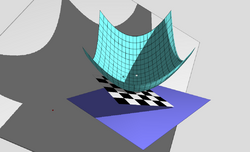
Archimedes Geo3D is a software package for dynamic geometry in three dimensions. It was released in Germany in March 2006 and won a German government award for outstanding educational software in 2007 [1].

Advanced features
Archimedes Geo3D can trace the movement of points, lines, segments, and circles and generate locus lines and surfaces. Arbitrary objects can be intersected with lines, locus lines, and planes.
References
- "digita Förderpreis Archimedes Geo3D". Archived from the original on 14 November 2007. https://web.archive.org/web/20071114222846/http://www.digita.de/2007/foerder.htm. Retrieved 2007-11-08.
- "Dynamische Raumgeometrie". mathematik lehren 144: 60. October 2007.
External links
- Archimedes Geo3D home page
- Building a projection in Archimedes Geo3D
- Building a double cone in Archimedes Geo3D
 |
