Astronomy:Fermat (crater)
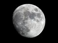
 Lunar Orbiter 4 image | |
| Diameter | 37.77 km |
|---|---|
| Depth | 2.0 km |
| Colongitude | 20° at sunrise |

Fermat is a lunar impact crater located to the west of the Rupes Altai escarpment. To the west-southwest is the larger crater Sacrobosco, and to the southwest is the irregular Pons. It is 39 kilometers in diameter and two kilometers deep.[1]
The rim of Fermat is worn and somewhat irregular, but still possesses an outer rampart. The north rim is indented by a double crater formation that includes Fermat A. The floor is relatively flat and does not have a central rise.[2] The crater is from the Pre-Imbrian period, 4.55 to 3.85 billion years ago.[1]
It is named for 17th century France mathematician Pierre de Fermat.[3][1]
Satellite craters
By convention these features are identified on lunar maps by placing the letter on the side of the crater midpoint that is closest to Fermat.[4]
| Fermat | Coordinates | Diameter |
|---|---|---|
| A | [ ⚑ ] 21°48′S 19°36′E / 21.8°S 19.6°E | 17 km |
| B | [ ⚑ ] 23°00′S 21°06′E / 23.0°S 21.1°E | 11 km |
| C | [ ⚑ ] 21°00′S 18°30′E / 21.0°S 18.5°E | 14 km |
| D | [ ⚑ ] 20°06′S 18°00′E / 20.1°S 18.0°E | 13 km |
| E | [ ⚑ ] 19°54′S 19°54′E / 19.9°S 19.9°E | 7 km |
| F | [ ⚑ ] 22°06′S 20°12′E / 22.1°S 20.2°E | 5 km |
| G | [ ⚑ ] 19°24′S 20°00′E / 19.4°S 20.0°E | 7 km |
| H | [ ⚑ ] 23°06′S 20°42′E / 23.1°S 20.7°E | 5 km |
| P | [ ⚑ ] 23°36′S 19°18′E / 23.6°S 19.3°E | 37 km |
References
- ↑ 1.0 1.1 1.2 Autostar Suite Astronomer Edition. CD-ROM. Meade, April 2006.
- ↑ Atlas of the Moon. Kalmbach Books. 1990. ISBN 0-913135-17-8.
- ↑ "Fermat (crater)". Gazetteer of Planetary Nomenclature. USGS Astrogeology Research Program.
- ↑ Bussey, B.; Spudis, P. (2004). The Clementine Atlas of the Moon. New York: Cambridge University Press. ISBN 0-521-81528-2.
External links
 |  |
