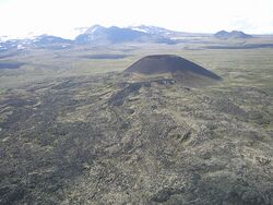
Earth:Mount Edziza volcanic complex
| Mount Edziza volcanic complex | |
|---|---|
| Mount Edziza–Spectrum Range complex | |
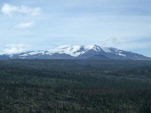 Mount Edziza with Eve Cone in the distant foreground | |
| Highest point | |
| Peak | Mount Edziza[1] |
| Elevation | 2,786 m (9,140 ft) [1] |
| Coordinates | [ ⚑ ] : 57°42′55″N 130°38′04″W / 57.71528°N 130.63444°W [2] |
| Dimensions | |
| Length | 75 km (47 mi) [3] |
| Width | 20 km (12 mi) [3] |
| Area | 1,000 km2 (390 sq mi) [1] |
| Volume | 670 km3 (160 cu mi) [4] |
| Geography | |
| Province | British Columbia[5] |
| District | Cassiar Land District[2] |
| Protected area | Mount Edziza Provincial Park[6] |
| Parent range | Tahltan Highland[7] |
| Topo map | NTS Script error: No such module "Canada NTS".[8] NTS Script error: No such module "Canada NTS".[2] NTS Script error: No such module "Canada NTS".[9] |
| Geology | |
| Formed by | Shield volcanoes, stratovolcanoes, subglacial volcanoes, lava domes, cinder cones, calderas[1][10] |
| Age of rock | Less than 12,000,000 years old[11] |
| Volcanic region | Northern Cordilleran Province[12] |
| Last eruption | Unknown[13] |
The Mount Edziza volcanic complex (/ədˈzaɪzə/; abbreviated MEVC) is a linear group of volcanoes and associated lava flows in northwestern British Columbia, Canada. Located on the Tahltan Highland, it is 40 kilometres (25 miles) southeast of Telegraph Creek and 85 kilometres (53 miles) southwest of Dease Lake. The complex encompasses a broad, steep-sided lava plateau that extends over 1,000 square kilometres (390 square miles). Its highest summit is 2,786 metres (9,140 feet) above sea level, making the MEVC the highest of four large complexes in an extensive north–south trending volcanic region. An ice cap obscures the highest summit which is characterized by several outlet glaciers stretching out to lower altitudes.
The MEVC consists of several types of volcanoes, including stratovolcanoes, shield volcanoes, cinder cones and lava domes. These volcanoes have formed over the last 12 million years during five cycles of magmatic activity which spanned Earth's four most recent geologic epochs. Volcanic eruptions during these magmatic cycles issued a wide variety of volcanic rocks that comprise 13 geological formations. The most recent eruptions took place in the last 11,000 years but many of them remain undated. Current activity occurs exclusively in the form of hot springs. Future eruptions are likely to impact local streams and cause wildfires.
Several streams surround the MEVC, many of which drain the flanks of the volcanic complex. This includes the Little Iskut River along the southeastern flank, Kakiddi Creek along the northeastern flank, the Klastline River along the northern flank and Mess Creek along the western flank. The valleys of these streams contain several species of trees, including pine, aspen and spruce. A wide variety of animal species inhabit the area. This includes birds, rodents, bears, sheep, goats, moose and caribou. Warm summers and cold, snowy winters characterize the climate at the MEVC; snow and ice remain on the highest volcanoes year-round.
Indigenous peoples have lived adjacent to the MEVC for thousands of years. The local Tahltan people used volcanic glass from the MEVC to make tools and weaponry in prehistoric times. Intermittent geological work has been carried out at the volcanic complex since the 1950s, the most detailed studies having been conducted in the 1960s. A large provincial park dominates the MEVC which can only be accessed by aircraft or by a network of trails.
Geography
Location
The Mount Edziza volcanic complex is situated within the Southern Boreal Plateau Ecosection. This ecosection consists of several upland summits, as well as wide river valleys and deeply incised plateaus.[14] It is one of seven ecosections comprising the Boreal Mountains and Plateaus Ecoregion.[15] This large ecological region of northwestern British Columbia encompasses high plateaus and rugged mountains with intervening lowlands. Boreal forests of black and white spruce occur in the lowlands and valley bottoms of this ecoregion whereas birch, spruce and willow form forests on the mid-slopes. Extensive alpine altai fescue covers the upper slopes but barren rock is abundant at higher elevations.[16]
The MEVC dominates the eastern edge of the Tahltan Highland. This is a southeast-trending upland area extending along the western side of the Stikine Plateau. It lies between the Taku River in the north, the Boundary Ranges in the west and the head of the Iskut River in the east. The width of the Tahltan Highland varies from about 8 kilometres (5.0 miles) in the north to about 48 kilometres (30 miles) in the south where the Stikine River crosses the highland.[17]
Lakes
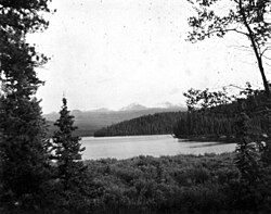
Several named lakes are present on and adjacent to the MEVC.[18] The eastern side of the MEVC is flanked by Kakiddi Lake, Mowchilla Lake, Mowdade Lake and Nuttlude Lake, all of which lie inside Kakiddi Valley.[19] With the exception of Mowdade Lake, all three lakes drain north into the Klastline River.[6] Buckley Lake is the main lake bordering the northern side of the MEVC while Mess Lake is the main lake bordering the western side of the MEVC.[18] Southeast of the MEVC is 180 Lake, so-named because it is large enough for the Cessna 180 Skywagon to safely operate.[20] The southern end of the MEVC is flanked by Arctic Lake which gets its name from the surrounding barren and treeless landscape.[18][21]
Two small lakes are named on the southern portion of the MEVC.[22] At the head of the Little Iskut River is Little Ball Lake, also called Kounugu Lake after the guardian of fresh water in Tahltan folklore.[20][23] It lies immediately south of Kounugu Mountain in the Spectrum Range and east of Ball Creek.[22] Little Arctic Lake lies northeast of Arctic Lake near the northeastern flank of Wetalth Ridge.[24][25]
Drainage
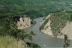
The MEVC is drained on all sides by streams within the Stikine River watershed.[7][26] To the west, Mess Creek flows north along the Mess Creek Escarpment inside a broad valley paralleling the MEVC.[19] It then flows northwest into the Stikine River near the community of Telegraph Creek.[27] Several short tributaries of Mess Creek drain the western half of the MEVC where they have cut steep-sided canyons into the volcanic plateau.[26] This includes Crayke Creek which flows to the southwest,[7][28] Elwyn Creek which flows to the west,[7][29] Kitsu Creek which flows to the northwest,[30][31] Raspberry Creek which flows to the northwest,[7][32] Tadekho Creek which flows to the northwest[7][33] and Taweh Creek which flows to the northwest.[7][34] Many of these Mess Creek tributaries also contain tributaries. The only named tributary of Elwyn Creek is Kadeya Creek which flows northwest from Mount Edziza.[7] Kitsu Creek contains one named tributary, Nagha Creek, which flows northwest from the Spectrum Range.[7][35] Walkout Creek is the only named tributary of Raspberry Creek.[7] It flows west in a canyon west of the Armadillo Highlands and also contains only one named tributary, Flyin Creek, which flows northwest from near the west side of Cache Hill.[7][36][37] The only named tributary of Taweh Creek is Sezill Creek which flows northwest in a canyon southwest of Mount Edziza.[7][38]
To the east, the MEVC overlooks a drainage divide that lies in a broad hummocky lowland.[26] Its upper eastern half is drained by tributaries of Kakiddi Creek.[7][26] This includes Nido Creek, Tenchen Creek and Tennaya Creek which flow to the northeast from the eastern side of Mount Edziza,[7][39][40][41] Shaman Creek and Sorcery Creek which flow to the east and north from near Kaia Bluff[7][42][43] and Tsecha Creek which flows to the northeast from near Williams Cone.[7][44] Shaman Creek contains one named tributary, Chakima Creek, which flows to the east and north.[7][45] The rapidly eroding headwalls and steep spurs on the eastern side of the MEVC have deposited glacial and landslide debris into these tributaries. Transportion of this debris into Kakiddi Valley has produced several large alluvial fans behind which Kakiddi Lake, Mowchilla Lake, Mowdade Lake and Nuttlude Lake have formed.[26]
The lower eastern half and south end of the MEVC are drained by tributaries of the Iskut River.[7][26] This includes Ball Creek which flows to the south from the southeastern side of the Spectrum Range,[7][46] More Creek which flows to the southeast from the southern end of the Arctic Lake Plateau[7][47] and the Little Iskut River which flows to the southeast from the southeastern side of the Spectrum Range.[7][48] The only named tributary of Ball Creek is Chachani Creek which flows to the southeast from the eastern end of the Arctic Lake Plateau.[7][49] Tributaries of the Little Iskut River include Stewbomb Creek, which flows eastwards from the eastern side of the Spectrum Range, and Bourgeaux Creek which flows to the east from Raspberry Pass.[7][50][51] The only named tributary of Stewbomb Creek is Artifact Creek which flows to the southeast between Artifact Ridge and Obsidian Ridge.[7][52] Bourgeaux Creek contains one named tributary, Gerlib Creek, which flows southwards from between Tadeda Peak and Armadillo Peak.[7][53] Several small, unnamed streams drain the youthful northern side of the MEVC.[7][26] They flow north into the Klastline River and contain shallowly incised channels.[26]
Climate
The climate at the MEVC is characterized by warm summers and cold, snowy winters; Mount Edziza itself is covered by snow year-round. Temperatures are warmest in mid-summer during the day when they may hit the 30 degrees Celsius (86 degrees Fahrenheit) range. However, temperatures can drop below freezing during summer nights, making snow or freezing rain a possibility at any time of the year.[6] The closest weather stations to the MEVC are located at Telegraph Creek and Dease Lake, which lie about 40 kilometres (25 miles) to the northwest and 85 kilometres (53 miles) to the northeast, respectively.[54]
Meteorological data from the Telegraph Creek and Dease Lake weather stations suggest that the MEVC area has a temperature gradient of around −1.5 degrees Celsius (29.3 degrees Fahrenheit) per 1,000-metre (3,300-foot) increase in elevation. The data also suggest that precipitation likely increases with altitude. At Mess Creek, the mean annual temperature is probably around −1 degree Celsius (30 degrees Fahrenheit) while the annual precipitation likely amounts to 400 millimetres (16 inches) of snow and rain. The mean annual temperature at an elevation of 1,390 metres (4,560 feet) is likely about −1 to −5 degrees Celsius (30 to 23 degrees Fahrenheit) where annual precipitation amounts to approximately 400 to 500 millimetres (16 to 20 inches).[54]
Animals and plants
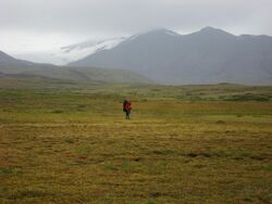
The MEVC is situated in an area with abundant wildlife. This wildlife includes moose, Osborn caribou, mountain goats, stone sheep, black bears, grizzly bears, wolves, Arctic ground squirrels and several species of birds. Arctic ground squirrels are abundant above the timberline where grizzly bears are occasionally seen. The alpine and subalpine zones between Mount Edziza and the western escarpment contain small herds of Osborn caribou. The western escarpment, the Spectrum Range and the eastern, western and southern flanks of Mount Edziza contain mountain goats and stone sheep. Birds such as scaup, owls, goldeneye, grebes, gyrfalcons, white-winged scoters, ravens, grouse and ptarmigans are present at the MEVC.[6]
The area between Buckley Lake and Telegraph Creek contains peat meadows, shrub fields and wet grasslands. It is characterized by long, severe winters with short growing seasons and deeply frozen soils. The Mess Creek, Kakiddi and Klastline valleys are intermixed with white spruce, trembling aspen and lodgepole pine, the latter two of which occur in drier areas. Balsam poplar grows on delta soils and near lakes and creeks. The MEVC plateau is characterized by alpine and subalpine vegetation zones.[6]
Glaciation
The MEVC has been extensively modified by local and regional glaciation as evidenced by the existence of drumlins and glacial striations, which record north-northwest ice movement across the western volcanic plateau.[55] Evidence of ice stagnation is present in the form of outflow channels, eskers, kames, kettles and morainal ridges on the northern side of the MEVC adjacent to Buckley Lake.[19] Deglaciation of unstable and oversteepened valley walls has caused several landslides, especially along the Mess Creek Escarpment. This instability is attributed to the low-yield strength of the highly fractured, poorly consolidated rocks comprising the MEVC.[56]
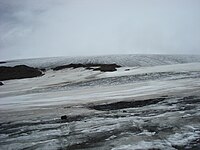
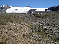
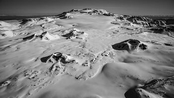
Most peaks greater than 2,130 metres (6,990 feet) in elevation contain glaciers.[56] Small separate glaciers are largely restricted to the southern half of the MEVC where they occur in the Spectrum Range, on Armadillo Peak and elsewhere.[57] In contrast, Mount Edziza and Ice Peak are obscured by a relatively large ice cap that covers an area of 70 square kilometres (27 square miles). The western side of this ice cap is drained by many outlet glaciers that spread in broad lobes onto the Big Raven Plateau.[58] Distributary glaciers extending from the eastern side of the ice cap drape down steep slopes to form broken icefalls.[59]
Five named glaciers are situated at the northern and southern ends of the MEVC.[7] Idiji Glacier lies southeast of Mount Edziza on the eastern side of the MEVC.[7][60] At the head of Nagha Creek in the western portion of the Spectrum Range is Nagha Glacier.[7][61] Tenchen Glacier is a debris-covered glacier on the eastern side of Mount Edziza at the head of Tenchen Creek.[7][62] The debris covering Tenchen Glacier originates from landslides of the steep headwall and neighbouring spurs.[62] South of Mount Edziza lies Tencho Glacier, the largest glacier of the MEVC.[63] Tennaya Glacier lies at the head of Tennaya Creek on the southeastern side of Mount Edziza.[7][64]
Geology
Background
The MEVC is part of the Northern Cordilleran Volcanic Province (NCVP).[12] This is a broad area of shield volcanoes, lava domes, cinder cones and stratovolcanoes extending from northwestern British Columbia northwards through Yukon into easternmost Alaska.[65] The dominant rocks comprising these volcanoes are alkali basalts and hawaiites but nephelinite, basanite and peralkaline[lower-alpha 1] phonolite, trachyte and comendite are locally abundant. These rocks were deposited by volcanic eruptions from 20 million years ago to as recently as a few hundred years ago. The cause of volcanic activity in the Northern Cordilleran Volcanic Province is thought to be due to rifting of the North American Cordillera driven by changes in relative plate motion between the North American and Pacific plates.[67]
The MEVC is part of the Stikine Subprovince of the NCVP. This subprovince, confined to the Stikine region of northwestern British Columbia, includes three other volcanic complexes: Heart Peaks, Hoodoo Mountain and Level Mountain. All four complexes differ petrologically and/or volumetrically from the rest of the NCVP. Heart Peaks, Level Mountain and the MEVC are the largest NCVP centres by volume, the latter two having experienced volcanism for a much longer timespan than any other NCVP centre. Level Mountain, Hoodoo Mountain and the MEVC are the only NCVP centres that contain volcanic rocks of both mafic[lower-alpha 2] and intermediate to felsic[lower-alpha 3] composition.[69] The highest of the four complexes is the MEVC at 2,786 metres (9,140 feet), followed by Level Mountain at 2,164 metres (7,100 feet), Heart Peaks at 2,012 metres (6,601 feet) and Hoodoo Mountain at 1,850 metres (6,070 feet).[1][70][71][72]
Structure
A bimodal population of volcanic rocks characterizes the MEVC.[10] The most voluminous rocks are mafic alkali basalts and hawaiites, which comprise about 60% of the volcanic complex.[73] MEVC hawaiites are thought to have formed as a result of partial fractional crystallization and the accumulation of feldspar inside rising columns of mantle-derived alkali basalt.[74] Felsic peralkaline rocks such as trachyte, comendite and pantellerite form about 40% of the MEVC.[73][75] They are product of prolonged fractional crystallization of mantle-derived basalt in magma chambers and mainly comprise lava domes and central volcanoes.[74][75] Volcanic rocks of intermediate composition such as benmoreite, trachybasalt, mugearite and tristanite are present in relatively small volumes. They are the result of alkali basalt having pooled in large magma chambers on a shorter timespan.[74] Underlying the MEVC rocks is the Stikinia terrane, a Paleozoic and Mesozoic suite of volcanic and sedimentary rocks that accreted to the continental margin of North America during the Jurassic.[76][77] Rocks of Paleozoic age underlie the western and southern portions of the MEVC. This includes limestone, bedded tuff and volcanic rocks of intermediate composition. Mesozoic rocks underlie most of the MEVC and include andesite, basaltic andesite, volcanic sandstone, siltstone, shale, greywacke, limestone and chert.[78] The volcanic and sedimentary rocks comprising Stikinia are remnants of a former island arc.[79]
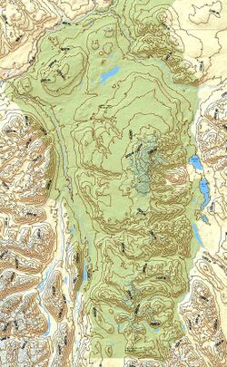
The MEVC has a volume of 670 cubic kilometres (160 cubic miles) and an area of 1,000 square kilometres (390 square miles), making it the second largest eruptive centre in the NCVP after Level Mountain.[80] It comprises a broad, steep-sided, intermontane plateau that rises from a base elevation of 760 metres (2,500 feet).[1][54][81] Its sides tower 760 metres (2,500 feet) above adjacent valleys that serve as drainageways for several streams.[26][54] The edges of the plateau have been deeply incised by creeks that flow eastward and westward into Mess Creek, Kakiddi Creek and the Iskut River.[54] A northerly-trending, elliptical, composite shield volcano consisting of multiple flat-lying lava flows forms the plateau.[1] The MEVC has many geomorphological similarities to the Eyjafjallajökull volcano in Iceland. This includes its overall elongated structure, its flanking basaltic lava fields and its similar-sized summit ice cap dominated by silica-rich volcanic rocks.[82] The elongated structure of the MEVC is 75 kilometres (47 miles) long and 20 kilometres (12 miles) wide.[3] It is surrounded on the east by the Skeena Mountains and the Klastline Plateau while to the west it is flanked by the Coast Mountains.[83]
The MEVC lies on the eastern shoulder of Mess Creek valley. This is a long and narrow graben-like depression possibly linked to volcanism at the volcanic complex. The eastern edge of the valley is bounded by north-trending vertical faults, one of which has been traced for more than 24 kilometres (15 miles). This fault shows signs of having been active contemporaneously with volcanism at the MEVC. It has vertically displaced Holocene basalt flows of the MEVC by 15 to 20 metres (50 to 70 feet) and older MEVC basalt flows by 91 to 122 metres (299 to 400 feet), such that the western side of the fault has been downthrown. The downthrowing of this fault during the Holocene may have been due to the draining of magma chambers following eruptions at the MEVC.[84] The existence of peralkaline rocks at the MEVC and the presence of normal faults along Mess Creek valley support the conclusion that the MEVC lies in an area of continental rifting.[84][85]
Subfeatures
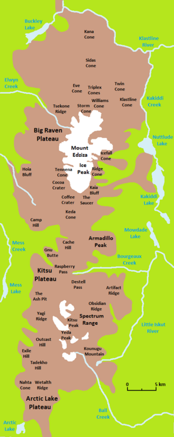
Four central volcanoes dominate the MEVC, each of which contains the remains of a caldera or crater. The highest, youngest and northernmost central volcano is Mount Edziza with an elevation of 2,786 metres (9,140 feet).[1] It is a large ice-covered stratovolcano rising well above the general level of the Tahltan Highland.[1][2][17] The southern flank of Mount Edziza overlaps with Ice Peak, the second oldest central volcano.[1] It is a composite stratovolcano that has been reduced to a steep-walled pyramidal peak with active cirques on all of its sides.[1][18] The southernmost and third oldest central volcano is the Spectrum Range.[1] It has an elevation of 2,430 metres (7,970 feet) and consists of a nearly circular, more than 10-kilometre-wide (6.2-mile) dome with a thickness of up to 650 metres (2,130 feet).[1][13][86] Armadillo Peak between Ice Peak and the Spectrum Range is the oldest of the four MEVC central volcanoes. It represents the eroded remains of a small caldera whose 2,194-metre (7,198-foot) summit is capped by a 180-metre-thick (590-foot) sequence of ponded lava flows.[1] Various stages of erosion have modified these central volcanoes. In some cases, only a few small remnants of their original surface remain.[18] The degree of erosion becomes less pronounced on those that have more recently formed.[26]
Several small cinder cones with reliefs of up to 460 metres (1,500 feet) dot the plateau surface.[54][81] They differ from the central volcanoes in that they are much smaller in size and they are mainly of mafic composition. A large percentage of these cones occur in three lava fields.[87] The Desolation Lava Field on the northern slope of Mount Edziza contains 10 cinder cones, namely Eve Cone, Storm Cone, Moraine Cone, Williams Cone, Sleet Cone, Twin Cone, Sidas Cone and the three Triplex Cones.[88] Four named cones occur in the Snowshoe Lava Field on the southwestern flank of Ice Peak: Tennena Cone, Coffee Crater, Cocoa Crater and The Saucer. The Ash Pit is the only named cinder cone in the Mess Lake Lava Field which lies at the south-central end of the MEVC.[87] Isolated cinder cones include Icefall Cone and Ridge Cone on the eastern slope of Mount Edziza, Nahta Cone at the extreme southern end of the MEVC, Kana Cone on the extreme northern flank of the MEVC and two unnamed cones in Walkout Creek valley.[89]
The MEVC contains three named subplateaus, the largest and northernmost of which is the Big Raven Plateau.[18] Its dominant feature is Mount Edziza which rises from within the middle of the plateau.[2] Two lava fields are present on the Big Raven Plateau. The Desolation Lava Field at the northern end of the plateau covers more than 150 square kilometres (58 square miles), making it the largest of the two lava fields.[90] The smaller of the two lava fields is the Snowshoe Lava Field which covers about 40 square kilometres (15 square miles) at the southern end of the Big Raven Plateau.[91] At the northwestern end of the Spectrum Range is the Kitsu Plateau.[18] Its dominant feature is the smaller Mess Lake Lava Field which covers around 18 square kilometres (6.9 square miles).[92] The Arctic Lake Plateau is the southernmost of the three MEVC subplateaus.[18] It consists of a nearly flat upland containing volcanic features such as Outcast Hill, Tadekho Hill, Wetalth Ridge, Nahta Cone, Source Hill, Thaw Hill and Exile Hill.[93]
The MEVC contains two named mountain passes.[94] Destell Pass is a narrow rock cleft northwest of Artifact Ridge that provides access between the broad upland valleys of Artifact Creek and Raspberry Creek.[95][96] Between the heads of Bourgeaux Creek and Raspberry Creek is Raspberry Pass, a broad east–west valley in the middle of the MEVC.[97][98] It separates the Spectrum Range in the south from the Mount Edziza area in the north.[6][18]
In the north fork of Tenchen Creek is Cinder Cliff, a 210-metre-high (690-foot) barrier of volcanic rocks.[99] Koosick Bluff and Ornostay Bluff are two bluffs just southwest of Mount Edziza near the head of Sezill Creek.[100][101][102] Northwest of Coffee Crater is Hoia Bluff, a prominent west-facing cliff.[103] Kaia Bluff is a steep-sided hill east of Coffee Crater.[104] On the northwestern side of Raspberry Pass is an isolated, flat-topped hill with steep sides called Gnu Butte.[105] The Mess Creek Escarpment is a long laterally continuous, often cliff-like feature forming the western edge of the MEVC.[18][106] It runs along the eastern side of Mess Creek and exposes thick, flat-lying lava flows.[106][107]
Subdivisions
The MEVC was originally subdivided into 15 geological formations, two of which are no longer used:[108][109][110]
| Current | |||
|---|---|---|---|
| Name | Lithology | Volcanology | |
| Big Raven Formation[90] | Alkali basalt, hawaiite, trachyte[90] | Volcanic cones, lava flows, air-fall tephra[90] | |
| Kakiddi Formation[111] | Trachyte[112] | Lava flows, pyroclastic rocks[111] | |
| Klastline Formation[113] | Alkali basalt[112] | Volcanic cones, lava flows[114] | |
| Arctic Lake Formation[115] | Alkali basalt[112] | Volcanic cones, subglacial volcanoes, lava flows[93] | |
| Edziza Formation[116] | Trachyte[112] | Stratovolcano, lava domes, lava flows[116] | |
| Pillow Ridge Formation[117] | Alkali basalt[112] | Subglacial volcanoes[118] | |
| Ice Peak Formation[119] | Alkali basalt, hawaiite, mugearite, benmoreite, trachyte[112] | Volcanic cones, shield volcanoes, lava domes[120] | |
| Pyramid Formation[121] | Trachyte, comendite, pantellerite[112] | Lava domes, lava flows[121] | |
| Spectrum Formation[86] | Trachyte, comendite, rhyolite[112] | Lava dome[86] | |
| Nido Formation[122] | Alkali basalt, hawaiite[112] | Shield volcanoes, lava flows[123] | |
| Armadillo Formation[124] | Alkali basalt, comendite, trachyte[112] | Caldera, lava domes, lava flows[124] | |
| Little Iskut Formation[125] | Trachybasalt[112] | Shield volcano, lava flows[125] | |
| Raspberry Formation[126] | Alkali basalt, hawaiite[112] | Shield volcano, lava flows[126] | |
| Former | |||
| Name | Lithology | Notes | |
| Sheep Track Formation[127] | Trachyte[112] | Reassigned as a member of the Big Raven Formation.[128] | |
| Kounugu Formation[129] | Alkali basalt, hawaiite[110] | Reassigned as a member of the Nido Formation.[130] | |
Volcanism
The MEVC is a highly active volcanic system with a nearly continuous record of activity dating from the Miocene.[131][132] It is the second most long-lived eruptive centre in the NCVP after Level Mountain, having started erupting at least 7.4 million years ago.[4][133] Five cycles of magmatic activity created the MEVC; one in the Miocene, one in the Plio-Pleistocene, two in the Pleistocene and one in the Holocene.[112][134] Each magmatic cycle began with the effusion of alkali basalt and culminated with the eruption of felsic magma.[10] The eruption sequence and style of the MEVC, along with its chemistry, mineralogy and isotopic composition, is similar to continental peralkaline volcanism at the Rainbow Range of central British Columbia, the Afar Depression of East Africa and parts of the Great Basin of the western United States.[135]
Eruptions have occurred subaqueously, subglacially and subaerially throughout the long eruptive history of the MEVC.[136] Interactions between ice and volcanism are well-documented at the volcanic complex. Out of the 13 geological formations comprising the MEVC, seven of them contain evidence of having been associated with ice. This includes the Pyramid, Ice Peak, Pillow Ridge, Edziza, Arctic Lake, Klastline and Big Raven formations which have all formed within the last two million years.[73] Volcano-ice interactions at these formations is represented by pillow lava, tuff breccia, hyaloclastite, glacial till interbedded with lava flows, and massive lava with well-developed slender columnar joints.[1][73] The MEVC has been scoured by regional glaciations at least twice throughout its eruptive history, as well as several lesser advances of local alpine glaciers.[1][10]
Potassium–argon dating of the MEVC has yielded ages ranging from 11.4 to 0.28 million years old.[11] Most of these ages are consistent with the general volcanic stratigraphy, though some of them are anomalously old and most likely result from contamination of lava with older rocks of the underlying Stikinia terrane.[137] Several geologically recent eruptions at the MEVC have not been quantitatively dated. Instead, a Holocene age is inferred because their eruptive products do not show evidence of having been glaciated by the Cordilleran Ice Sheet, which retreated from the area about 11,000 years ago. Therefore, many of these inferred Holocene eruptions may have occurred as early as the time of glacial retreat. An eruption recurrence interval of 379 years has been calculated for the MEVC by dividing 11,000 years by the number of demonstrable Holocene eruptions, of which there are at least 29 of them.[138] This would make the MEVC the most active eruptive centre in Canada throughout the Holocene.[139] It is also one of the most widespread areas of recent volcanism in Canada.[140]
Present day status
The MEVC is volcanically dormant but it still remains hydrothermally active.[141][142] Four hot spring areas are found along the western flank of the MEVC at Mess Lake, Mess Creek, Elwyn Creek and Sezill Creek, the latter three of which have recorded water temperatures of 42.5 degrees Celsius (108.5 degrees Fahrenheit), 36 degrees Celsius (97 degrees Fahrenheit) and 46 degrees Celsius (115 degrees Fahrenheit), respectively.[140][141] Discharge at the Sezill Creek, Elwyn Creek and Mess Lake hot springs may be linked to shallow hydrothermal systems driven by residual magmatic heat as they are adjacent to recently active eruptive centres. In contrast, the Mess Creek Hot Springs may be discharging from a deeply circulating hydraulic system along a major fault on the western side of Mess Creek valley.[141] Estimated subsurface temperatures, as derived from geothermometers, are 177 degrees Celsius (351 degrees Fahrenheit) based on silica concentrations and 227 degrees Celsius (441 degrees Fahrenheit) based on sodium-potassium-calcium ratios.[143] This makes the MEVC a potential high-temperature geothermal resource area but it does not warrant subsurface exploration due to its remote location.[143][144]
The Mess Lake Hot Springs are situated near the southeastern corner of Mess Lake.[141] They had a vigorous flow of warm water in 1965 but are now inactive, having dried up by 1983.[141][140] These springs lie at an elevation of 760 metres (2,490 feet) and have created massive deposits of tufa that cover more than 120 hectares (300 acres).[141][145] About 7 kilometres (4.3 miles) south of Mess Lake are the Mess Creek Hot Springs.[146] They are located on the western side of Mess Creek where they attain an elevation of 760 metres (2,490 feet).[145][146] The Elwyn Hot Springs occur along the banks of Elwyn Creek at an elevation of 1,440 metres (4,720 feet) where they have created thick tufa deposits.[141][147] Extending 0.5 kilometres (0.31 miles) along Sezill Creek are the Taweh Hot Springs which contain extensive tufa.[141] They occur at an elevation of 1,310 metres (4,300 feet) and emit thermal waters containing carbon dioxide.[141][147]
Hazards and monitoring
Natural Resources Canada considers the MEVC a high threat volcanic complex as it has the highest eruption rate in Canada.[148] However, its extremely remote location makes it less hazardous than volcanoes in southwestern British Columbia.[149] MEVC trachyte and rhyolite contain silica-rich compositions that are comparable to those associated with the most powerful eruptions around the world. Parts of northwestern Canada would be affected by an ash column if an explosive eruption were to happen at the MEVC.[140] Ash columns can drift for thousands of kilometres downwind and often become increasingly spread out over a larger area with increasing distance from an erupting vent.[150] An eruption under the summit ice cap would possibly produce floods or lahars that could travel into the Stikine or Iskut rivers.[82] Lava flows are also a potential hazard as they have formerly dammed the Klastline and Stikine rivers, the latter of which contains a major salmon fishery.[142][140] Another potential hazard at the MEVC is the ignition of wildfires by eruptions as the area contains vegetation.[6][140]
Like other volcanic complexes in Canada, the MEVC is not monitored closely enough by the Geological Survey of Canada to ascertain its activity level. The Canadian National Seismograph Network has been established to monitor earthquakes throughout Canada, but it is too far away to provide an accurate indication of activity under the complex. It may sense an increase in seismic activity if the MEVC becomes highly restless, but this may only provide a warning for a large eruption; the system might detect activity only once the complex has started erupting.[151] If the MEVC were to erupt, mechanisms exist to orchestrate relief efforts. The Interagency Volcanic Event Notification Plan was created to outline the notification procedure of some of the main agencies that would respond to an erupting volcano in Canada, an eruption close to the Canada–United States border or any eruption that would affect Canada.[152]
Human history
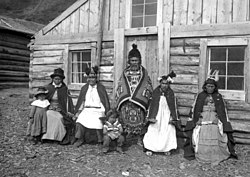
Indigenous peoples
The MEVC lies within the traditional territory of the Tahltan people which covers an area of more than 93,500 square kilometres (36,100 square miles).[153] In prehistoric times, the MEVC was a significant source of obsidian for the Tahltan people. It was used in the manufacturing of projectile points and cutting blades which were widely traded throughout the Pacific Northwest.[6] Obsidian from the MEVC has been recovered from archaeological sites in Alaska, Yukon, western Alberta and along the British Columbia Coast, making Edziza obsidian the most widely distributed obsidian in western North America. Edziza obsidian from the Hidden Falls archaeological site in Alaska has a date of 10,000 years. This suggests that the MEVC was being exploited as an obsidian source soon after ice sheets of the last glacial period retreated.[154]
The MEVC continues to be an important cultural resource for the Tahltan people. In 2021, Chad Norman Day, president of the Tahltan Central Government, said "Mount Edziza and the surrounding area has always been sacred to the Tahltan Nation. The obsidian from this portion of our territory provided us with weaponry, tools and trading goods that ensured our Tahltan people could thrive for thousands of years."[155]
Telegraphy
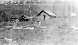
Along the western side of the MEVC and through its central portion at Raspberry Pass are the remains of the Yukon Telegraph Line.[6][83] This was a nearly 3,000-kilometre-long (1,900-mile) telegraphy system built by the Dominion Government Telegraph Service between 1897 and 1901 to send messages from Ashcroft, British Columbia in the south to Dawson City, Yukon in the north. A trail built to serve the line extended along much of its length and provided a route to the Yukon gold fields.[156]
Log cabins housing two men were built every 32 kilometres (20 miles) along the Yukon Telegraph Trail for maintenance.[6][156] One of these maintenance cabins existed at Raspberry Creek in the central portion of the MEVC.[157] The Yukon Telegraph Line and trail were maintained until 1936 when they were abandoned with the advent of radio communication.[156] Remnants of this telegraphy system include collapsed cabins, telegraph wire and a few telegraph poles.[6][156]
Naming
The MEVC is sometimes referred to as the Mount Edziza–Spectrum Range complex.[142][158] Stratigraphically, it has also been referred to as the Mount Edziza Group or the Edziza Group.[159][160] A number of explanations have been made regarding the origin of the name Edziza. A 1927 report by J. Davidson of the British Columbia Land Surveyors claims that Edziza means "sand" in the Tahltan language, referring to the deep volcanic ash deposits or pumiceous sand covering large portions of the Big Raven Plateau around Mount Edziza. Another explanation listed in the BC Parks brochure is that Edziza means "cinders" in the Tahltan language, although David Stevenson of University of Victoria's Anthropology Department advised in 1970 that the actual Tahltan word for sand or dust is "kutlves". A third explanation proposed by Canadian volcanologist Jack Souther is that Edziza is a corruption of Edzerza, the name of a local Tahltan family.[2]
Geological studies
The MEVC is one of the best-studied volcanic centres in the NCVP.[12] It was identified by the mapping program of Operation Stikine in 1956 along with Level Mountain, the Iskut-Unuk River Cones and many smaller volcanoes in the Canadian Cordillera. Their identification played a role in the closing of Canada's gap in the Ring of Fire because it allowed them to be added on the world volcanic map.[161] The mapping program of Operation Stikine, masterminded by Jack Souther, was carried out over the Stikine River area using a Bell helicopter.[161][162] Souther began detailed mapping of the MEVC in 1965 when he was given the job of working on the volcanic complex by the Geological Survey of Canada.[84][161]
A three-month period of earthquake monitoring was conducted at the MEVC in 1968 after geologists of the Geological Survey of Canada suggested that there may still be magma movement under the volcanic complex. About 20 microearthquakes potentially associated with the MEVC were recorded by seismographs installed at Buckley Lake and Nuttlude Lake. They had magnitudes of around 0.5 which typically occur in many areas throughout the Canadian Cordillera.[163]
By 1970, Souther and his assistant Maurice Lambert had established that episodic eruptions of alkali basalt and silicic peralkaline lavas had taken place at the MEVC over a timespan of at least 10 million years. They had also established that volcanism at the MEVC was accompanied by east–west extension and incipient rifting of Earth's crust.[161] During his last year of serious field work in 1992, Souther published an extensive bulletin on his work entitled The Late Cenozoic Mount Edziza Volcanic Complex, British Columbia which highlighted the importance and size of the MEVC.[140][161][164] The volcanic complex has since received very few geological studies.[165][166]
A three-year period of field studies conducted at the MEVC around 2007 focused on using volcano-ice interactions to constrain paleo-environmental conditions. The project was a collaboration between Ben Edwards of Dickinson College, Ian Skilling of the University of Pittsburgh, Barry Cameron of the University of Wisconsin–Milwaukee, Ian Spooner of Acadia University, J. Osborn of the University of Calgary, Kirstie Simpson of the Geological Survey of Canada and Bill McIntosh of the New Mexico Institute of Mining and Technology.[167]
Five students conducted studies at the MEVC in 2007. Among them were Chira Endress of Dickinson Collage who examined sediment under a trachytic lava flow of the Ice Peak Formation, Jeff Hungerford of the University of Pittsburgh who carried out fieldwork around Tennena Cone, Courtney Haynes of Dickinson Collage who examined the geometry of pillow lavas, Alex Floyd of Dickinson Collage who performed a detailed examination of pillow lavas possibly derived from Pillow Ridge, and Kristen LaMoreaux of the University of Pittsburgh who examined Ornostay Bluff, Triangle Dome and lava flows from Koosick Bluff.[167]
Protected areas
Much of the MEVC was designated as a provincial park in 1972 to showcase its geological and geothermal features.[6][54] A 101,171-hectare (250,000-acre) recreation area surrounding the 132,000-hectare (330,000-acre) park was also established in 1972.[168][169] In 1989, Mount Edziza Provincial Park roughly doubled in size when 96,770 hectares (239,100 acres) was annexed from the Mount Edziza Recreation Area.[169] In doing so, the recreation area was reduced in size to around 4,000 hectares (9,900 acres); it was eventually disestablished in 2003.[168] Mount Edziza Provincial Park now covers an area of 266,180 hectares (657,700 acres), making it one of the largest provincial parks in British Columbia.[6][170]
In 2021, an approximately 3,528-hectare (8,720-acre) conservation area called the Mount Edziza Conservancy was established northwest of Kakiddi Lake along the eastern border of Mount Edziza Provincial Park.[171] It was established in collaboration with Skeena Resources, BC Parks, the Tahltan Central Government and the Nature Conservancy of Canada after Skeena Resources returned their mineral tenures on the Spectrum property.[172] The name of this conservation area was changed to the Tenh Dẕetle Conservancy in 2022 to better reflect the culture, history and tradition of the Tahltan First Nation.[171][173]
Recreation
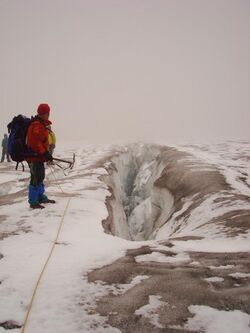
The MEVC offers many recreational activities, including mountain climbing, camping, fishing, hunting, horseback riding, wildlife viewing, photography, hiking and backpacking. Buckley Lake and Mowdade Lake on the northern and eastern sides of the MEVC contain campsites with fire rings, bear-proof metal food caches and backcountry-style toilets. It is advised by BC Parks to not gather wood for campfires within Mount Edziza Provincial Park to help maintain a healthy ecosystem community. The optimum time for backpacking is generally between July 1 and September 15 when weather conditions are the most suitable.[6]
Kakiddi Lake, Mowchilla Lake, Mowdade Lake, Nuttlude Lake and Buckley Lake are well populated with rainbow trout and offer fishing at the MEVC. A limited entry hunting authorization is required for the hunting of mountain goats, mountain sheep and caribou within Mount Edziza Provincial Park. Horseback riding at the MEVC requires a letter of authorization. The many cinder cones dotting the MEVC have designated climbing routes to prevent scarring on their delicate surfaces from foot traffic.[6]
A hiking trail dubbed the Buckley Lake to Mowdade Lake Route extends across the northern half of the MEVC.[22][174] It traverses south from Buckley Lake along Buckley Creek and gradually climbs onto the MEVC plateau where landmarks such as Eve Cone, Sidas Cone and Tsekone Ridge are visible along the route. Most of the Buckley Lake to Mowdade Lake Route is marked by a series of rock cairns from Tsekone Ridge onwards.[174]
The distance between Buckley Lake and Mowdade Lake is about 70 kilometres (43 miles) but the hiking length between these two lakes varies depending on the route taken. It can take a minimum of 7 days to hike the Buckley Lake to Mowdade Lake Route. The weather and climate can change extremely fast along this hiking trail.[174]
Accessibility
The MEVC lies in a remote location with no established road access.[83] The closest roads to the MEVC are the Stewart–Cassiar Highway to the east and the Telegraph Creek Road to the northwest, both of which extend within 40 kilometres (25 miles) of the volcanic complex.[1][22] Extending from these roads are horse trails that provide access to the MEVC.[83] From Telegraph Creek, the Buckley Lake Trail extends about 15 kilometres (9.3 miles) southeast along Mess Creek and Three Mile Lake. It then traverses about 15 kilometres (9.3 miles) northeast along Dagaichess Creek and Stinking Lake to the northeastern end of Buckley Lake where it meets with the Klastline River Trail and the Buckley Lake to Mowdade Lake Route.[22]
To the east, the roughly 50-kilometre-long (31-mile) Klastline River Trail begins at the community of Iskut on the Stewart–Cassiar Highway. It extends northwest and west along the Klastline River for much its length. The trail enters Mount Edziza Provincial Park at about 25 kilometres (16 miles) where Kakiddi Creek drains into the Klastline River. After entering Mount Edziza Provincial Park, the Klastline River Trail traverses northwest along the Klastline River for about 10 kilometres (6.2 miles) and then crosses the river north of the MEVC. From there, the Klastline River Trail traverses west for about 15 kilometres (9.3 miles) to the northeastern end of Buckley Lake where it meets with the Buckley Lake Trail and Buckley Lake to Mowdade Lake Route junction.[22]
From near the Eastman Creek Rest Area south of Kinaskan Lake on the Stewart–Cassiar Highway, the historic Yukon Telegraph Trail extends about 15 kilometres (9.3 miles) west to the Little Iskut River. From there, it enters Mount Edziza Provincial Park and continues another 15 kilometres (9.3 miles) west along Bourgeaux Creek into the central portion of the MEVC at Raspberry Pass. The Yukon Telegraph Trail then traverses about 10 kilometres (6.2 miles) northwest along Raspberry Creek into the broad valley of Mess Creek where it continues another 30 kilometres (19 miles) north along the western side of the MEVC. It conjoins with the Buckley Lake Trail near Matheson Creek.[22] Only short segments of the Yukon Telegraph Trail are still passible, having been mostly overgrown since maintenance of the trail ended in 1936.[83]
The MEVC can also be accessed by float plane or helicopter, both of which are available for charter at the communities of Iskut and Dease Lake.[83] Private aircraft are prohibited from landing on the Kitsu Plateau lava flows.[6] Kakiddi Lake, 180 Lake, Mess Lake, Arctic Lake, Nuttlude Lake, Mowdade Lake, Little Arctic Lake, Little Ball Lake, Mowchilla Lake and Buckley Lake are large enough to be used by float-equipped aircraft.[6][83] Landing on the latter four lakes with a private aircraft requires a letter of authorization from the BC Parks Stikine Senior Park Ranger.[6]
See also
- List of Northern Cordilleran volcanoes
- List of volcanoes in Canada
- Volcanism of Western Canada
Notes
- ↑ Peralkaline rocks are magmatic rocks that have a higher ratio of sodium and potassium to aluminum.[66]
- ↑ Mafic pertains to magmatic rocks that are relatively rich in iron and magnesium, relative to silicium.[68]
- ↑ Felsic pertains to magmatic rocks that are enriched in silicon, oxygen, aluminum, sodium and potassium.[68]
References
- ↑ 1.00 1.01 1.02 1.03 1.04 1.05 1.06 1.07 1.08 1.09 1.10 1.11 1.12 1.13 1.14 1.15 1.16 Wood, Charles A.; Kienle, Jürgen (2001). Volcanoes of North America: United States and Canada. Cambridge University Press. pp. 124, 125. ISBN 0-521-43811-X. https://books.google.com/books?id=eyDRib-FJh4C.
- ↑ 2.0 2.1 2.2 2.3 2.4 2.5 "Mount Edziza". BC Geographical Names. https://apps.gov.bc.ca/pub/bcgnws/names/2256.html.
- ↑ 3.0 3.1 3.2 Wojdak, Paul (1993). Evaluation of Mineral Potential for Mount Edziza Recreation Area (Report). Government of British Columbia. p. 1. https://propertyfile.gov.bc.ca/reports/PF831020.pdf. Retrieved 2023-05-03.
- ↑ 4.0 4.1 Edwards & Russell 2000, p. 1283.
- ↑ Cite error: Invalid
<ref>tag; no text was provided for refs namedWK - ↑ 6.00 6.01 6.02 6.03 6.04 6.05 6.06 6.07 6.08 6.09 6.10 6.11 6.12 6.13 6.14 6.15 6.16 6.17 "Mount Edziza Provincial Park". BC Parks. https://bcparks.ca/explore/parkpgs/mt_edziza/.
- ↑ 7.00 7.01 7.02 7.03 7.04 7.05 7.06 7.07 7.08 7.09 7.10 7.11 7.12 7.13 7.14 7.15 7.16 7.17 7.18 7.19 7.20 7.21 7.22 7.23 7.24 7.25 7.26 7.27 7.28 7.29 7.30 Telegraph Creek, Cassiar Land District, British Columbia (Topographic map) (3 ed.). 1:250,000. A502 (in English and français). Department of Energy, Mines and Resources. 1989. Archived from the original on 2021-05-02. Retrieved 2021-09-25.
- ↑ "Pillow Ridge". BC Geographical Names. https://apps.gov.bc.ca/pub/bcgnws/names/16786.html.
- ↑ "Spectrum Range". BC Geographical Names. https://apps.gov.bc.ca/pub/bcgnws/names/16447.html.
- ↑ 10.0 10.1 10.2 10.3 Souther 1992, p. 1.
- ↑ 11.0 11.1 Souther 1992, p. 28.
- ↑ 12.0 12.1 12.2 Edwards & Russell 2000, p. 1284.
- ↑ 13.0 13.1 "Spectrum Range: General Information". Smithsonian Institution. https://volcano.si.edu/volcano.cfm?vn=320070.
- ↑ Demarchi 2011, p. 146.
- ↑ Demarchi 2011, pp. 143–146.
- ↑ Demarchi 2011, pp. 143.
- ↑ 17.0 17.1 Holland, Stuart S. (1976). Landforms of British Columbia: A Physiographic Outline (Report). Government of British Columbia. pp. 49, 50. OCLC 601782234. http://cmscontent.nrs.gov.bc.ca/geoscience/PublicationCatalogue/Bulletin/BCGS_B048.pdf.
- ↑ 18.0 18.1 18.2 18.3 18.4 18.5 18.6 18.7 18.8 18.9 Souther 1992, p. 32.
- ↑ 19.0 19.1 19.2 Souther 1992, pp. 32, 33.
- ↑ 20.0 20.1 Souther 1992, p. 319.
- ↑ "Arctic Lake". BC Geographical Names. https://apps.gov.bc.ca/pub/bcgnws/names/9171.html.
- ↑ 22.0 22.1 22.2 22.3 22.4 22.5 22.6 Northern BC Backroad Mapbook. Mussio Ventures. 2018. pp. 88, 89, 96. ISBN 978-1-926806-87-7.
- ↑ "Little Ball Lake". BC Geographical Names. https://apps.gov.bc.ca/pub/bcgnws/names/39306.html.
- ↑ "Little Arctic Lake". BC Geographical Names. https://apps.gov.bc.ca/pub/bcgnws/names/2425.html.
- ↑ "Wetalth Ridge". Geographical Names Data Base. Natural Resources Canada. http://www4.rncan.gc.ca/search-place-names/unique.php?id=JBLMF&output=xml.
- ↑ 26.0 26.1 26.2 26.3 26.4 26.5 26.6 26.7 26.8 26.9 Souther 1992, p. 33.
- ↑ "Mess Creek". BC Geographical Names. https://apps.gov.bc.ca/pub/bcgnws/names/22550.html.
- ↑ "Crayke Creek". BC Geographical Names. https://apps.gov.bc.ca/pub/bcgnws/names/4820.html.
- ↑ "Elwyn Creek". BC Geographical Names. https://apps.gov.bc.ca/pub/bcgnws/names/9936.html.
- ↑ "Kitsu Creek". Geographical Names Data Base. Natural Resources Canada. http://www4.rncan.gc.ca/search-place-names/unique.php?id=JAIJN&output=xml.
- ↑ "Kitsu Creek". BC Geographical Names. https://apps.gov.bc.ca/pub/bcgnws/names/4622.html.
- ↑ "Raspberry Creek". BC Geographical Names. https://apps.gov.bc.ca/pub/bcgnws/names/23314.html.
- ↑ "Tadekho Creek". BC Geographical Names. https://apps.gov.bc.ca/pub/bcgnws/names/16745.html.
- ↑ "Taweh Creek". BC Geographical Names. https://apps.gov.bc.ca/pub/bcgnws/names/18502.html.
- ↑ "Nagha Creek". BC Geographical Names. https://apps.gov.bc.ca/pub/bcgnws/names/8993.html.
- ↑ "Walkout Creek". BC Geographical Names. https://apps.gov.bc.ca/pub/bcgnws/names/15905.html.
- ↑ "Flyin Creek". BC Geographical Names. https://apps.gov.bc.ca/pub/bcgnws/names/12946.html.
- ↑ "Sezill Creek". BC Geographical Names. https://apps.gov.bc.ca/pub/bcgnws/names/15312.html.
- ↑ "Nido Creek". BC Geographical Names. https://apps.gov.bc.ca/pub/bcgnws/names/14307.html.
- ↑ "Tenchen Creek". BC Geographical Names. https://apps.gov.bc.ca/pub/bcgnws/names/15008.html.
- ↑ "Tennaya Creek". BC Geographical Names. https://apps.gov.bc.ca/pub/bcgnws/names/15029.html.
- ↑ "Shaman Creek". BC Geographical Names. https://apps.gov.bc.ca/pub/bcgnws/names/15347.html.
- ↑ "Sorcery Creek". BC Geographical Names. https://apps.gov.bc.ca/pub/bcgnws/names/20640.html.
- ↑ "Tsecha Creek". BC Geographical Names. https://apps.gov.bc.ca/pub/bcgnws/names/23846.html.
- ↑ "Chakima Creek". BC Geographical Names. https://apps.gov.bc.ca/pub/bcgnws/names/4870.html.
- ↑ "Ball Creek". BC Geographical Names. https://apps.gov.bc.ca/pub/bcgnws/names/11045.html.
- ↑ "More Creek". BC Geographical Names. https://apps.gov.bc.ca/pub/bcgnws/names/7186.html.
- ↑ "Little Iskut River". BC Geographical Names. https://apps.gov.bc.ca/pub/bcgnws/names/2478.html.
- ↑ "Chachani Creek". BC Geographical Names. https://apps.gov.bc.ca/pub/bcgnws/names/3541.html.
- ↑ "Stewbomb Creek". BC Geographical Names. https://apps.gov.bc.ca/pub/bcgnws/names/7816.html.
- ↑ "Bourgeaux Creek". BC Geographical Names. https://apps.gov.bc.ca/pub/bcgnws/names/451.html.
- ↑ "Artifact Creek". BC Geographical Names. https://apps.gov.bc.ca/pub/bcgnws/names/9263.html.
- ↑ "Gerlib Creek". BC Geographical Names. https://apps.gov.bc.ca/pub/bcgnws/names/6058.html.
- ↑ 54.0 54.1 54.2 54.3 54.4 54.5 54.6 D.R. Piteau and Associates (1988). Geochemistry and Isotope Hydrogeology of the Mount Edziza and Mess Creek Geothermal Waters, British Columbia (Report). Open File 1732. Geological Survey of Canada. pp. 1, 3, 4. doi:10.4095/130715.
- ↑ Souther 1992, pp. 33, 36.
- ↑ 56.0 56.1 Souther 1992, p. 35.
- ↑ Souther 1992, pp. 35, 36.
- ↑ Souther 1992, pp. 32, 36.
- ↑ Souther 1992, p. 36.
- ↑ "Idiji Glacier". BC Geographical Names. https://apps.gov.bc.ca/pub/bcgnws/names/876.html.
- ↑ "Nagha Glacier". BC Geographical Names. https://apps.gov.bc.ca/pub/bcgnws/names/9046.html.
- ↑ 62.0 62.1 "Tenchen Glacier". BC Geographical Names. https://apps.gov.bc.ca/pub/bcgnws/names/15007.html.
- ↑ "Tencho Glacier". BC Geographical Names. https://apps.gov.bc.ca/pub/bcgnws/names/15009.html.
- ↑ "Tennaya Glacier". BC Geographical Names. https://apps.gov.bc.ca/pub/bcgnws/names/15031.html.
- ↑ Edwards & Russell 2000, pp. 1280, 1281, 1283, 1284.
- ↑ Imam, Naiyar (2003). Dictionary of Geology and Mineralogy. McGraw–Hill Companies. pp. 253, 390. ISBN 0-07-141044-9.
- ↑ Edwards & Russell 2000, p. 1280.
- ↑ 68.0 68.1 Pinti, Daniele (2011), "Mafic and Felsic", Springer Berlin Heidelberg, p. 938, doi:10.1007/978-3-642-11274-4_1893, ISBN 978-3-642-11271-3
- ↑ Edwards, Benjamin Ralph (1997). "1". Field, Kinetic, and Thermodynamic Studies of Magmatic Assimilation in the Northern Cordilleran Volcanic Province, Northwestern British Columbia (PhD). University of British Columbia. p. 6. doi:10.14288/1.0052728.
- ↑ "Level Mountain". Smithsonian Institution. https://volcano.si.edu/volcano.cfm?vn=320050.
- ↑ "Heart Peaks". Smithsonian Institution. https://volcano.si.edu/volcano.cfm?vn=320040.
- ↑ "Hoodoo Mountain". Smithsonian Institution. https://volcano.si.edu/volcano.cfm?vn=320080.
- ↑ 73.0 73.1 73.2 73.3 Smellie, John L.; Edwards, Benjamin R. (2016). Glaciovolcanism on Earth and Mars: Products, Processes and Palaeoenvironmental Significance. Cambridge University Press. pp. 42–44. ISBN 978-1-107-03739-7.
- ↑ 74.0 74.1 74.2 Cite error: Invalid
<ref>tag; no text was provided for refs namedLR - ↑ 75.0 75.1 Souther 1992, Preface.
- ↑ Edwards & Russell 2000, pp. 1281, 1287.
- ↑ Souther 1992, p. 39.
- ↑ Souther 1992, p. 41.
- ↑ Edwards & Russell 2000, p. 1281.
- ↑ Edwards & Russell 2000, pp. 1283, 1284.
- ↑ 81.0 81.1 Lakeman, Thomas R.; Clague, John J.; Menounos, Brian; Osborn, Gerald D.; Jensen, Britta J. L.; Froese, Duane G. (2008). "Holocene tephras in lake cores from northern British Columbia, Canada". Canadian Journal of Earth Sciences (NRC Research Press) 45 (8): 940. doi:10.1139/E08-035. ISSN 1480-3313.
- ↑ 82.0 82.1 Edwards, B. R. (2010). "Hazards associated with alkaline glaciovolcanism at Hoodoo Mountain and Mt. Edziza, western Canada: comparisons to the 2010 Eyjafjallajokull eruption". American Geophysical Union, Fall Meeting 2010. Bibcode: 2010AGUFMNH11B1132E.
- ↑ 83.0 83.1 83.2 83.3 83.4 83.5 83.6 Souther 1992, p. 31.
- ↑ 84.0 84.1 84.2 Souther, Jack Gordon (1966). Report of Activities, Part A: May to October, 1966 (Report). Geological Survey of Canada. pp. 89, 91. https://publications.gc.ca/collections/collection_2017/rncan-nrcan/M41-1-4-67-1A-eng.pdf. Retrieved 2023-05-15.
- ↑ Souther, J. G.; Symons, D. T. A. (1974). Stratigraphy and Paleomagnetism of Mount Edziza Volcanic Complex, Northwestern British Columbia (Report). Geological Survey of Canada. p. 1. https://emrlibrary.gov.yk.ca/gsc/papers/73-32.pdf. Retrieved 2023-05-18.
- ↑ 86.0 86.1 86.2 Souther 1992, p. 113.
- ↑ 87.0 87.1 Souther 1992, p. 214.
- ↑ Souther 1992, pp. 26, 214, 219.
- ↑ Souther 1992, pp. 214, 234.
- ↑ 90.0 90.1 90.2 90.3 Souther 1992, p. 213.
- ↑ Souther 1992, p. 228.
- ↑ Souther 1992, p. 235.
- ↑ 93.0 93.1 Souther 1992, pp. 22–24.
- ↑ Souther 1992, pp. 32, 318.
- ↑ Souther 1992, p. 318.
- ↑ "Destell Pass". BC Geographical Names. https://apps.gov.bc.ca/pub/bcgnws/names/14539.html.
- ↑ Souther 1992, p. 104.
- ↑ "Raspberry Pass". BC Geographical Names. https://apps.gov.bc.ca/pub/bcgnws/names/23319.html.
- ↑ Souther 1992, pp. 26, 226.
- ↑ Souther 1992, p. 155.
- ↑ "Ornostay Bluff". BC Geographical Names. https://apps.gov.bc.ca/pub/bcgnws/names/18770.html.
- ↑ "Koosick Bluff". BC Geographical Names. https://apps.gov.bc.ca/pub/bcgnws/names/6250.html.
- ↑ "Hoia Bluff". BC Geographical Names. https://apps.gov.bc.ca/pub/bcgnws/names/17404.html.
- ↑ "Kaia Bluff". BC Geographical Names. https://apps.gov.bc.ca/pub/bcgnws/names/2964.html.
- ↑ "Gnu Butte". BC Geographical Names. https://apps.gov.bc.ca/pub/bcgnws/names/2595.html.
- ↑ 106.0 106.1 "Mess Lake Escarpment". BC Geographical Names. https://apps.gov.bc.ca/pub/bcgnws/names/22549.html.
- ↑ Souther 1992, p. 49.
- ↑ Souther et al. 1984, pp. 342–347.
- ↑ "Sheep Track Formation". Lexicon of Canadian Geologic Units. Government of Canada. https://weblex.canada.ca/html/013000/GSCC00053013635.html.
- ↑ 110.0 110.1 "Kounugu Formation". Lexicon of Canadian Geologic Units. Government of Canada. https://weblex.canada.ca/html/007000/GSCC00053007795.html.
- ↑ 111.0 111.1 Souther 1992, p. 207.
- ↑ 112.00 112.01 112.02 112.03 112.04 112.05 112.06 112.07 112.08 112.09 112.10 112.11 112.12 112.13 Souther 1992, p. 267.
- ↑ Souther 1992, p. 191.
- ↑ Souther 1992, pp. 191, 195.
- ↑ Souther 1992, p. 199.
- ↑ 116.0 116.1 Souther 1992, p. 175.
- ↑ Souther 1992, p. 165.
- ↑ Souther 1992, pp. 19, 20.
- ↑ Souther 1992, p. 145.
- ↑ Souther 1992, pp. 18, 145.
- ↑ 121.0 121.1 Souther 1992, p. 129.
- ↑ Souther 1992, p. 93.
- ↑ "Nido Formation". Lexicon of Canadian Geologic Units. Government of Canada. https://weblex.canada.ca/html/010000/GSCC00053010765.html.
- ↑ 124.0 124.1 Souther 1992, p. 71.
- ↑ 125.0 125.1 Souther 1992, p. 61.
- ↑ 126.0 126.1 Souther 1992, p. 47.
- ↑ Souther et al. 1984, p. 347.
- ↑ "Sheep Track Member". Lexicon of Canadian Geologic Units. Government of Canada. https://weblex.canada.ca/html/017000/GSCC00053017290.html.
- ↑ Souther et al. 1984, p. 344.
- ↑ "Kounugu Member". Lexicon of Canadian Geologic Units. Government of Canada. https://weblex.canada.ca/html/017000/GSCC00053017289.html.
- ↑ Wilson & Kelman 2021, p. 34.
- ↑ Souther, J. G. (1976). "Geothermal Power, The Canadian Potential". Geoscience Canada (Geological Association of Canada) 3 (1): 17. ISSN 0315-0941.
- ↑ "Raspberry Formation". Lexicon of Canadian Geologic Units. Government of Canada. https://weblex.canada.ca/html/012000/GSCC00053012505.html.
- ↑ Wilson & Kelman 2021, p. 10.
- ↑ Souther et al. 1984, p. 349.
- ↑ Lamoreaux, K. A.; Skilling, I. P.; Endress, C.; Edwards, B.; Lloyd, A.; Hungerford, J. (2006). "Preliminary Studies of the Emplacement of Trachytic Lava Flows and Domes in an Ice- Contact Environment: Mount Edziza, British Columbia, Canada". American Geophysical Union, Fall Meeting 2006. Bibcode: 2006AGUFM.V53C1757L.
- ↑ Souther 1992, pp. 28, 39.
- ↑ Wilson & Kelman 2021, pp. 10, 16.
- ↑ Wilson & Kelman 2021, pp. 16, 33.
- ↑ 140.0 140.1 140.2 140.3 140.4 140.5 140.6 "Stikine volcanic belt: Mount Edziza". Catalogue of Canadian volcanoes. Natural Resources Canada. 2009-04-01. http://gsc.nrcan.gc.ca/volcanoes/cat/feature_edziza_e.php.
- ↑ 141.0 141.1 141.2 141.3 141.4 141.5 141.6 141.7 141.8 Souther 1992, p. 241.
- ↑ 142.0 142.1 142.2 Souther, J. G. (1981). Volcanic hazards in the Stikine region of northwestern British Columbia (Report). Open File 770. Geological Survey of Canada. p. 1. doi:10.4095/119198.
- ↑ 143.0 143.1 Fairbank, B. D.; Faulkner, R. L. (1992). Geothermal Resources of British Columbia (Map). 1:2,000,000. Open File 2526. Geological Survey of Canada. doi:10.4095/133397.
- ↑ Souther, Jack (1980). Proceedings of the Fourth Annual Geothermal Conference and Workshop (Report). Electric Power Research Institute. p. 7-53. https://www.osti.gov/servlets/purl/892253-GI5uNx/. Retrieved 2023-08-03.
- ↑ 145.0 145.1 "Spectrum Range: Synonyms & Subfeatures". Smithsonian Institution. https://volcano.si.edu/volcano.cfm?vn=320070.
- ↑ 146.0 146.1 Souther 1992, p. 242.
- ↑ 147.0 147.1 "Edziza: Synonyms & Subfeatures". Smithsonian Institution. https://volcano.si.edu/volcano.cfm?vn=320060.
- ↑ Wilson & Kelman 2021, p. 33.
- ↑ Wilson & Kelman 2021, pp. 29, 33.
- ↑ "Eruption column". United States Geological Survey. 2015-07-28. https://volcanoes.usgs.gov/vsc/glossary/eruption_column.html.
- ↑ "Monitoring volcanoes". Volcanoes of Canada. Natural Resources Canada. 2008-02-12. http://gsc.nrcan.gc.ca/volcanoes/mon_e.php.
- ↑ "Interagency Volcanic Event Notification Plan (IVENP)". Volcanoes of Canada. Natural Resources Canada. 2008-06-04. http://gsc.nrcan.gc.ca/volcanoes/ivenp_e.php.
- ↑ Markey, Sean; Halseth, Greg; Manson, Don (2012). Investing in Place: Economic Renewal in Northern British Columbia. University of British Columbia Press. p. 242. ISBN 978-0-7748-2293-0.
- ↑ "Archaeological Overview Assessment of the Cassiar-Iskut-Stikine LRMP". Government of British Columbia. 1998. pp. 44, 46. https://www.for.gov.bc.ca/ftp/archaeology/external/%21publish/web/raad/Cassiar%20FD%20AOA/Archaeological%20Overview%20Assessment%20of%20the%20Cassiar-Iskut-Stikine%20LRMP%20Vol%201.pdf.
- ↑ "Tahltan land to be protected in partnership with conservation organizations, industry and Province". Government of British Columbia. 2021. https://news.gov.bc.ca/releases/2021ENV0025-000657.
- ↑ 156.0 156.1 156.2 156.3 "Yukon Telegraph Trail". Canadian Register of Historic Places. https://www.historicplaces.ca/en/rep-reg/place-lieu.aspx?id=17944.
- ↑ Miller, Bill (2004). "The Early Years: Discontent and Description". Wires in the Wilderness: The Story of the Yukon Telegraph. Heritage House Publishing. p. 133. ISBN 978-1-894384-58-2.
- ↑ Souther, Jack G. (1976). "Geothermal Potential of Western Canada". Proceedings: Second United Nations Symposium on the Development and Use of Geothermal Resources. 1. Energy Research and Development Administration. p. 261. https://books.google.com/books?id=z8rc93g86sYC.
- ↑ VandenBygaart, A. J. (2011). "Regosolic soils of Canada: Genesis, distribution and classification". Canadian Journal of Soil Science (Canadian Science Publishing) 91 (5): 882. doi:10.4141/CJSS10021.
- ↑ "Stikinia Terrane, Canadian Cordillera". United States Geological Survey. https://pubs.usgs.gov/of/1999/of99-422/norpac/data/terranes/nor_pac/explanat/Columns/stikine.pdf.
- ↑ 161.0 161.1 161.2 161.3 161.4 "Acceptance of the 1995 Career Achievement Award by Jack Souther". Ash Fall (Geological Association of Canada): p. 3. 1996. https://www.vip-gac.ca/Ashfall/Ashfall_39.pdf.
- ↑ Brown, Derek A.; Gunning, Michael H.; Greig, Charles J. (1996). The Stikine Project: geology of western Telegraph Creek map area, northwestern British Columbia. British Columbia Geological Survey. p. 4. ISBN 0-7726-2502-6.
- ↑ Milne, W. G.; Smith, W. E. T.; Rogers, G. C. (1970). "Canadian seismicity and microearthquake research in Canada". Canadian Journal of Earth Sciences (National Research Council Canada) 7 (2): 598, 599. doi:10.1139/e70-060.
- ↑ "The Late Cenozoic Mount Edziza Volcanic Complex, British Columbia". Government of Canada. https://publications.gc.ca/site/eng/9.609683/publication.html.
- ↑ Wilson & Kelman 2021, p. 40.
- ↑ Hickson, Catherine; Mulder, Taimi (2003). "The Vulnerability of Canada to Volcanic Hazards". Natural Hazards (Kluwer Academic Publishers) 28 (2/3): 564. doi:10.1023/A:1022954829974.
- ↑ 167.0 167.1 "Fieldwork at Mount Edziza". Ash Fall (Geological Association of Canada): pp. 5, 6. 2007. http://vip-gac.ca/Ashfall/Ashfall64.pdf.
- ↑ 168.0 168.1 "Mount Edziza Recreation Area". BC Geographical Names. https://apps.gov.bc.ca/pub/bcgnws/names/36847.html.
- ↑ 169.0 169.1 "Mount Edziza Park". BC Geographical Names. https://apps.gov.bc.ca/pub/bcgnws/names/8172.html.
- ↑ "Edziza: Photo Gallery". Smithsonian Institution. https://volcano.si.edu/volcano.cfm?vn=320060.
- ↑ 171.0 171.1 "Tenh Dẕetle Conservancy". BC Geographical Names. https://apps.gov.bc.ca/pub/bcgnws/names/75619.html.
- ↑ "Condensed Interim Consolidated Financial Statements". Skeena Resources. 2021. p. 13. https://skeenaresources.com/site/assets/files/6251/ske_fs_q1_2021.pdf.
- ↑ "Conservancy renamed Ice Mountain, reflects Tahltan heritage". Government of British Columbia. 9 February 2022. https://news.gov.bc.ca/releases/2022ENV0012-000178.
- ↑ 174.0 174.1 174.2 "Mount Edziza Provincial Park". BC Parks. https://bcparks.ca/explore/parkpgs/mt_edziza/hikecamp.html.
Sources
- Demarchi, Dennis A. (2011). An Introduction to the Ecoregions of British Columbia. Government of British Columbia. pp. 143–147. OCLC 613357103.
- Edwards, Benjamin R.; Russell, James K. (2000). "Distribution, nature, and origin of Neogene–Quaternary magmatism in the northern Cordilleran volcanic province, Canada". Geological Society of America Bulletin (Geological Society of America) 112 (8): 1280, 1281, 1283, 1284, 1287. doi:10.1130/0016-7606(2000)112<1280:dnaoon>2.0.co;2. ISSN 0016-7606.
- Souther, J. G. (1992). The Late Cenozoic Mount Edziza Volcanic Complex, British Columbia. Geological Survey of Canada. pp. 1, 18, 19, 20, 22–24, 26, 28, 31–33, 35, 36, 39, 41, 47, 49, 61, 71, 93, 104, 113, 129, 145, 155, 165, 175, 191, 199, 207, 213, 214, 219, 224–226, 228, 234, 235, 241, 242, 267, 318, 319. doi:10.4095/133497. ISBN 0-660-14407-7.
- Souther, J. G.; Armstrong, R. L.; Harakal, J. (1984). "Chronology of the peralkaline, late Cenozoic Mount Edziza Volcanic Complex, northern British Columbia, Canada". Geological Society of America Bulletin (Geological Society of America) 95 (3): 342–347, 349. doi:10.1130/0016-7606(1984)95<337:COTPLC>2.0.CO;2.
- Wilson, Alexander M.; Kelman, Melanie C. (2021). Assessing the relative threats from Canadian volcanoes (Report). Open File 8790. Natural Resources Canada. pp. 10, 16, 29, 33, 34, 40. doi:10.4095/328950.
External links
- "Mt. Edziza, NW British Columbia, Canada". Oregon State University. 2000. http://volcano.oregonstate.edu/vwdocs/volc_images/north_america/canada/Final-Edziza.html.
- LaMoreaux, Kristen A. (2008). Recognizing Ice-Contact Trachyte-Phonolite Lavas at the Mount Edziza Volcanic Complex, British Columbia, Canada (PDF) (M.S.). University of Pittsburgh. Archived from the original (PDF) on 2022-09-29.
- Godfrey-Smith, Dorothy I. (1985). X-Ray Fluorescence Characterization of the Obsidian Flows From the Mount Edziza Volcanic Complex of British Columbia, Canada (PDF) (M.A.). Simon Fraser University. Archived from the original (PDF) on 2023-07-30.
 |

