Engineering:USA-309
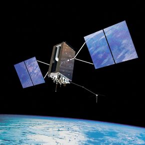
 Artist's rendering of GPS-III SV04 in orbit | |
| Names | Navstar 80 GPS-III SV04 Sacagawea |
|---|---|
| Mission type | Navigation |
| Operator | USSF |
| COSPAR ID | 2020-078A |
| SATCAT no. | 46826 |
| Mission duration | 15 years (planned) |
| Spacecraft properties | |
| Spacecraft | GPS-III SV04 |
| Spacecraft type | GPS Block III |
| Manufacturer | Lockheed Martin |
| Launch mass | 4331 kg |
| Power | watts |
| Start of mission | |
| Launch date | 5 November 2020, 23:24 UTC |
| Rocket | Falcon 9 B1062.1 |
| Launch site | Cape Canaveral Air Force Station , SLC-40 |
| Contractor | SpaceX |
| Orbital parameters | |
| Reference system | Geocentric orbit |
| Regime | Medium Earth orbit (Semi-synchronous orbit) |
| Perigee altitude | 20,181 km (12,540 mi) |
| Apogee altitude | 20,196 km (12,549 mi) |
| Inclination | 54.9° |
| Period | 718.0 minutes |
USA-309, also known as GPS-III SV04, NAVSTAR 80 or Sacagawea, is a United States navigation satellite which forms part of the Global Positioning System. It was the fourth GPS Block III satellite to be launched.[1]
Satellite
SV04 is the fourth GPS Block III satellite to be launched. Launch was pushed back several times due to delays with the earlier satellites.[2]
The spacecraft is built on the Lockheed Martin A2100 satellite bus, and weighs in at 4,331 kg (9,548 lb).[3]
Launch
USA-309 was launched by SpaceX on 5th of November 2020 at 23:24 UTC atop Falcon 9 booster B1062.[4] The launch took place from SLC-40 of the Cape Canaveral Air Force Station , and placed USA-309 directly into semi-synchronous orbit. About eight minutes after launch, Falcon 9 B1062 successfully landed on the droneship Of Course I Still Love You.[1]
Orbit
As of 2021, USA-309 was in a 54.9 degree inclination orbit with a perigee of 20,181 kilometers (12,540 mi) and an apogee of 20,198 km (12,550 mi).[5]
References
Note: This topic belongs to "Spaceflight " portal
- ↑ 1.0 1.1 Burghardt, Thomas (5 November 2020). "After month-long stand down, SpaceX launches fourth GPS III launch" (in en-US). https://www.nasaspaceflight.com/2020/11/spacex-line-launch-fourth-gps/.
- ↑ "SMC and SpaceX launch third GPS III satellite" (in en-US). 30 June 2020. https://www.gpsworld.com/smc-and-spacex-poised-for-third-gps-iii-falcon-9-launch/.
- ↑ "GPS Block III SV04 | Falcon 9" (in en-US). 4 November 2020. https://wpcstagingeverydayastronaut.wpcomstaging.com/gps-block-iii-sv04/.
- ↑ "GPS III SV04 takes flight". 7 November 2020. https://www.spaceflightinsider.com/organizations/space-exploration-technologies/gps-iii-sv04-takes-flight-atop-new-falcon-9-booster-b1062/.
- ↑ "Technical details for satellite NAVSTAR 80 (USA 309)". https://www.n2yo.com//satellite/?s=46826.
 |
