Earth:Azilal Formation
| Azilal Formation Stratigraphic range: Latest Pliensbachian-Middle Aalenian 183–172 Ma Spinatum-Murchisonae | |
|---|---|
 Panoramic of the High Atlas on Gorges du Dadés with Toarco-Aalenian Redbeds | |
| Type | Geological formation |
| Unit of | Tafraout Group |
| Underlies |
|
| Overlies |
|
| Area | High Atlas[1][2] |
| Thickness | 300-800 m[3] |
| Lithology | |
| Primary | Argillite, conglomerate (+quartz-dredge conglomerates) |
| Other | Brown-red marl, siltstones (micro-sandstones), sandstone-pelitic, breccias with liasic limestone elements, lagoonal shale, sandstone and volcanic minerals.[3] |
| Location | |
| Location | Azilal Province |
| Coordinates | [ ⚑ ] : 31°18′N 6°36′W / 31.3°N 6.6°W |
| Paleocoordinates | [ ⚑ ] 26°36′N 3°24′W / 26.6°N 3.4°W |
| Region | High Atlas[4][5] |
| Country | |
| Type section | |
| Named for | Azilal |
| Named by | |
| Location | Northwest side of Jbel Mesgounane, 10 kilometers east of Azilal |
| Year defined |
|
| Thickness at type section | ~250 m (820 ft) |
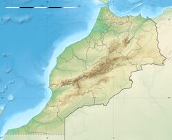
The Azilal Formation, also known as Toundoute Continental Series and Wazzant Formation (Called Informally "Marnes chocolat"), is a geological unit in the Azilal, Béni-Mellal, Ouarzazate, Tinerhir and Errachidia provinces of the High Atlas of Morocco, that cover the Latest Pliensbachian to Middle Aalenian stages of the Jurassic Period. It is a terrestrial deposit which overlies marine dolomites of equivalent age to the Rotzo Formation of Italy, mostly part of the Aganane Formation.[6] Dinosaur remains, such the sauropod Tazoudasaurus and the basal ceratosaur Berberosaurus are known from the unit, along with several undescribed genera.[8] The Units inside the group have been considered individual on the past, being a division of the so-called "Couches rouges", and subdivided by a supposed geological scale.[9] The strata of the group extends towards the Central High Atlas, covering different anticlines, and topographic accidents along the range of the Mountains.[10] Although new studies have suggested that the strata is coeval in age, and should be referred to as a unique unit.[11] The formation is best assigned to an alluvial environment occasionally interrupted by shallow marine incursions (tidal flat setting) and marks a dramatic decrease of the carbonate productivity under increasing terrigenous sedimentation.[12] The Azilal Formation consists mainly of claystones rich in continental plant debris and laminated microbial facies.[13] The toarcian High Atlas is divided in 5 units: the continental layers with paralic deposits belong to the Azilal, along the shoreface layers of the Tagoudite Formation and Tafraout Formation, both connected with the offshore Ait Athmane Formation and the deeper shelf deposits of the Agoudim 1 Formation.[14]
Geology
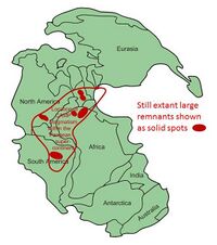
The Central High Atlas of Morocco is part of a double-vergent mountain belt that originated due to Cenozoic shortening and inversion of a rift that developed between the Triassic-Jurassic periods.[1][15] Its geometry is distinctive due to the presence of a several ENE–WSW narrow rift basins, derived from four major tectonic phases: pre-rift, that was linked with the Hercynian Orogeny and the union of Pangea in the Paleozoic; syn-rift, that was developed mostly between the Late Permian-Late Triassic with several NE–SW to ENE–WSW rift-basins, al derived from the almost coeval opening of the Atlantic Ocean and Tethys Sea.[16] This rift-derived basins ended filled with continental siliciclastic sediments, and latter towards the Rhaetian stage of the Triassic affected by emissions of the Central Atlantic magmatic province.[17] It was on the so-called Post-rift phase that the local tectonics had a thermal relaxation and allowed the deposition of the Jurassic-Cretaceous carbonate platforms.[16] The structure of the High Atlas can be defined by two main groups of faults, thrust and oblique-slip faults, that occur from W-E to NE-SW.[15] The presence of tectonic inversion in the Atlas Mountains has shown that are an intracontinental mountain belts that appeared from the uplift of pre-existing rift systems, where here is represented by a major rift system (~2000 km) originated on the Mesozoic, that was later uplifted and inverted in the Cenozoic.[15] The impact and convergence movements of the African-Iberian plates after the Mesozoic end with an inversion of the previous deposited strata, transporting the sediments of that and forming new low angle thrusts. Triassic, Jurassic and Cretaceous strata are confined within basins controlled by the extensional structures of the Mesozoic rift. The Jurassic basins can be grouped into two main provinces located on either side of an emerged Massif Ancien: west, where the basin was open to the Early Atlantic, being related to its passive margin, and east with several epicontinental troughs connected to the Tethys Ocean.[18] Across the Toarcian-Bajocian strata, there was a great deposition of marine shales as marls, calciturbidites and reefal limestones, that were accumulated in the Central High Atlas, while on the west margin around the Massif Ancien terrestrial, specially fluvial sedimentation dominated.[18] The present Red Beds of Azilal indicate various marine transgressions across the Toarcian-Aalenian boundary, after ending its sedimentation on the Bathonian.[19][18] A initial tectonic event on the Triassic-Jurassic boundary led to the formation of the Tigrinine-Taabast pull-apart basin, for example.[20] Following this event a major extensional tectonic activity (derived from the second Pangea rifting) occurred towards the end of the Pliensbachian and beginning of the Toarcian.[20] This second major tectonic event developed towards the E-W to NE-SW, reactivating trending normal faults, what led to the drowning of the Lower Liassic carbonate platform and the predominance of marls during the Middle Liassic to Toarcian.[20]
Rift Vulcanism
Along the High Atlas Triassic-Jurassic boundary, and until the Bathonian stage of the Middle Jurassic (then again in the Lower Cretaceous), there is a record on vulcanism locally on the succession of different local formations, such as the own Azilal Formation and others, but also absent on others such as the underlying Aganane Formation.[21] Mostly of the north-African Rhaetian-Bathonian volcanic events are related to the open of the Atlantic Ocean, with parallel records found on the North American coast and other zones such as Mexico.[21] On some locations, such as Haute Moulouya, it is even possible to delimitate the transitions between the several Volcanic events that happened locally along the post Triassic-Jurassic boundary (Belonging to the Tizi-n-Ghachou Formation).[22] Mostly of the effects of the volcanism occur on the main emerged terrestrial deposits, where some of the nearshore strata was turned down due to tectonics, and hit after by volcanic eruptions of different grades, leading different kinds of volcanic strata, as can be seen in the presence of basaltic intrusions in the younger Bathonian layers of the Beni-Mellal zone.[23]
The origin of the Volcanism is related with the Geography of the zone. On the Hettangian-Sinemurian there was a post-rift carbonate platform developed in the Atlas area that emerged older marine strata. On the Middle Toarcian, subsiding basins appeared which isolated the Mesetas and Precambrian and Paleozoic massifs.[24] Alkaline magmas overflowed the created Central High Atlas basin.[25] This basins were fault-bounded basins, with variations of the sedimentary thicknesses and intra-formational breccias related to major blocks. The Magmatic Province of the Atlas influenced the deposition of the main strata, where the Terrestrial settings of some Formations (Including Azilal) was disposed over a series of cut extensional faults depicting a mosaic of horsts and grabens oriented to the East, North-East and east–west, with the Middle Atlas among the main areas of subsidence. The Central Atlantic Magmatic Province continue to erupt around the Pliensbachian–Toarcian event ~183 Ma ago, overlapping the eruption of the Karoo–Ferrar igneous province. The Central High Atlas recovers two sections of lava flows and dikes of 188-153 M.a and 199-178 M.a respectively, showing there where several coeval events developed locally when the Azilal Formation deposited.[26] This lava flows derived from several coaeval rifting events, with middle-late Toarcian vulcanism present but on smaller extension, as prove the Toundoute Continental Series Member.[27]
Overall Description
Levêque called this unit "Marnes chocolat" in the Azilal region, made up of red-brown marls, silts (microsandstones) and conglomerates with centimetric quartz dragees. The presence of many dwarf lamellibranchs in the "Marnes chocolat" south of Azilal, the fine oblique stratifications, the floating plants and the imprints of raindrops show that this layers are of aquatic origin, perhaps lagoonal, and have undergone temporary emersion. Locations at Adoumaz, Ghnim and Jbel Taguendouft (Béni-Mellal Province) are the ones that provided originally a better view of the layers, sedimentation, lithology and facies evolution.[28] This main layers are composed by a succession of reddish-brown tints with terrigenous dominance: Sandstone, clays with paleosols and sandstone Limestones sometimes dolomitized, with marmorized levels in paleosols towards the northern region of Ghnim and Adoumaz. The lowermost sections show a transition from sandstone limestone and/or sandstone to clay, with a thin level of green marls locally rich in ostracods. This initial layers are followed by a subtidal term, represented by an oolitic limestone, with fine lamellibranch bioclasts and variable percentages of Quartz, that host also small sections of sandstone with calcareous cement and rare oolites, representing this last one is an oblique bedding, of metric dimensions, drawing on the surface mega-ripples of 3 to 5 m in wavelength.[28] The last major section represents a supratidal deposit, as shown by the presence of coarse sandstone gradually changing to red Marls with "fluer" structures and locally to paleosols. This section in Adoumaz has abundance of Paleozoic quartz grains, that are found organized in decametric channeling lenses evoking a predominantly fluvial dynamic.[28]
On the southern edge of the basin towards Guettioua, within the same stratigraphic framework, a thick red sandstone-pelitic formation with changes of conglomerates with quartz dragees and breccias with Liassic limestone elements (locally called " Wazzant Formation") is developed. This sector is called "Wazzant series", and recovers a variation of the sedimentary process formed by a complex sedimentary unit, terrigenously dominated, composed by the abundance of conglomeratic channels with quartz dragees and Paleozoic basement elements, sandstones organized in bars channeled lenticulars and red clays, the whole part of the facies is organized in metric sequences of filling and alluvial channels.[19] In addition, exceptionally, the "Wazzant series" rests in this place directly on massive dolomites, having eroded the marno-limestones of the Domerian. The "Wazzant Series" river system was driven by several minor freshwater currents, likely temporal and related to the rainy seasons. The "Wazzant series" has a notorious proximal character compared to the other sections of the Azilal formation.[29]
The lithology of this unit at Tundoute is divided in 5 units from D to H, (A-C represent the units of the underlying marine dolomite, C representing a transition to a terrestrial environment).[30] The deposits starting with the so-called term A facies, composed of Gypsum and Salt, of Triassic age, supported by the presence of volcanic Basalt Intercalations.[30][31] Above are B-term carbonates alternating at first with Dolomites, Pelites and Limestoness as well as crimes of Marly- Silt with plant debris, which had the regular influence of a marine environment.[30] The third level shows a transition between marine and continental deposits, through carbonate palustrine levels and horizons of Caliche, being continental layers superimposed in stratigraphic continuity on the marine carbonates of the lower Lias (Sinemurian- Hettangian).[30]
Strata
The layers at Azilal evolved along the central high Altas Pliens-Toarc Carbonate Platform, and consist mostly on a succession of detritic rocks with Red Marls, deposited on an alluvial environment occasionally interrupted by shallow marine incursions, a Mudflat setting.[1][19] The unit represents a major sea regression measured in the central High Atlas, specially after the Lower Toarcian, proven by sections such as "Tarhia n’Dadès", where the Pliensbachian Choucht Formation marginal marine layers are overlain by one meter of red silt/bioclastic limestone alternations, that start a local paralic to continental environments, assigned to the Domerian Aganane Formation. Over this unit the limit with the Azilal formation is marked with a karstified subaerial exposure surface, that wears also great abundance of plant material, what overall implicates prograding terrestrial facies and a shrinking of the local carbonate platform width.[32]
The flow of the fluvial-washed sediments take place in a E-NE direction, being moved to the layers of the Tafraout Formation and other coeval marine units, as well are found on fluviatile channels inside the own rocks of this unit. The lithology of the Azilal Formation recovers a Claystone-dominated interval, incised by metric dolomitized beds of Mudstones, Peloid-rich Packstones, Ooid-rich Grainstones, and Polymictic Conglomerates, all rich in Terrestrial plant debris (Mostly Ferns debris), with faunal content very poor and mostly dominated by microbial facies.[1][3] The Jbel El Abbadine zone provides the biggest outcrop of the parts of a Calcareous massif, with strata of the Late Lias.[1] Mostly of this strata is recovered inside the Azilal Formation, with a succession of seashore and inland deposits.[1] Several seismic events located on the Tethian realm where the main genesis of the Tectonic activity locally, with emerged strata from the Paleozoic, that was eroded due to the local conditions.[33] On the Toarcian-Aalenian transgression, the High Atlas domain experienced a long process of extension and rifting, recorded by the presence of marine carbonates and shales. It is related to the formation of the Atlantic Rifting to the west and of the formation of the Tethys Ocean to the north.[34]
The aftermath of the Toarcian Oceanic Anoxic Event is also highly present on the marginal marine strata of the formation, with the so-called Toksine Section, a succession of near shore marine strata disposed along the Toarcian boundary, where its last 40 m belong to the lower part of the Azilal Formation and are composed of dolomitized Mudstones and ooidal Grainstones, that show a slowly recovering a low-depth nearshore marine environment after in the Pliensbachian-Toarcian boundary a dramatic Tethys-wide collapse of the Neritic Carbonate System happened.[35]
| Unit | Lithology | Thickness (metres) | Fossils |
|---|---|---|---|
| 14) | Red, Bluish and Green Pelites, disposed on lenticular bands over yellow Breccia marls, parallel deposited with bodies of Calcite | 10–15 m | Non present |
| 13) | Very finely lit bistrated limestone, with green and purple grains | 0.2-0.3 m | Non present |
| 12) | Pelite and Bluish sandstones | 0.7 m | Non present |
| 11) | Yellowish marno-conglomeratic Sandstone | 0.7 m | Vertebrate remains indet.; Macroflora Indet. |
| 10) | Bluish sandstones of fairly variable composition: fine particles of Angular Quartz, Plagioclases, abundant Chlorite, clastic Andalusite and Iron Oxide; The coarse parts consisting of Quartz and Moscovite, over Cemented Calcite; Overall urface impregnations of Malachite | 2 m | Non present |
| 9) | Yellowish marno-conglomeratic sandstone, with bones and remains of plants, which, when not transformed into Lignite, show traces of preserved structure; this lenticular layer, which does not seem to exceed 80 cm, locally contains regions of sandstone and Calcite Geodes | 0.8 m | Sauropoda indeterminate; Vertebrate remains indet.; Macroflora Indet. |
| 8) | Sandy red pelites | 8–10 m | Non present |
| 7) | Red pelites passing through Leafy sandstone | 2 m | Non present |
| 6) | Sandy red pelites | 2 m | Non present |
| 5) | Coarse red sandstone (pebbles of 1 cm with other pebbles, many less than 2 to 3 cm) | 0.8–4m | Non present |
| 4) | Lithified red Pelite | 2 m | Non present |
| 3) | Red Sandstone composed by grains of 1/2 mm in benches of 10 to 20 cm | 1 m | Non present |
| 2) | Red Pelites: these levels form the horizontal table of the Summit | 4–5 m | Non present |
| 1) | Sandstone with a wine tone, composed by grains that range from 1/4 to 1 mm | 0.2 m | Non present |
Sedimentation on the Tundoute member has some characteristics, such as Sieve-Conglomerate lenticular channels of ~5 m (16 ft) thickness (≤ 5 m (16 ft)) for visible decametres, composed of several materials, such as volcanic products, such as blocks of volcanic rocks such as sands composed of Feldspars, black ferruginous grains coming from the surface volcanic rocks in the dry period, siliceous green fragments from post-eruption processes (veins, microgeods, hummocky concretions), Limestone debris with traces of roots and cracks, where in some parts traces of fine, dark brushy algal filaments are still visible, similar to blue-green algae of the genus Girvanella.[30] Finally, there are intercalations of fine, often laminated sandstone which mark the Inondation facies of the channels during flood periods, being composed solely of Feldspars plagioclase and to a lesser extent of orthoclase s, as well as small ferruginous grains or fine silts of quartz.[30]
| Unit | Lithology | Thickness (metres) | Dinosaur fossils |
|---|---|---|---|
| Alluvium | Holocene conglomerate | ||
| H | Clay-sandstone series | ≥ 100 | |
| G | Clay-sandstone series, with gypsum layer present at the top, just below this a second dinosaur bearing horizon is present with very similar lithology to unit F. | 50 | Tazoudasaurus, Berberosaurus[36] |
| F | Greenish grey clay-marl, detrital gravel to pebble-sized clasts with lignite and bones. | ≤ 5 | Present, indeterminate |
| E | Alternation of red-brown clay, fine sandstone and sandstone coarse conglomerates | 100 | |
| D | Clay, fine sandstone and conglomerate, large volcanic rocks present. | 80 |
Microfacies
Due to the strong Dolomitization affecting the strata of this formation, it is difficult to describe in detail the microfacies types, so it was necessary to work with isolated samples combined with ground observations.[37] Based on this, the following types of microfacies were distinguished:
The first include laminated algal boundstones, with broad areal are characterized by yellow dolomitized Stromatolites.[37] Characteristic of this type of microfacies are cavity channels, which are often arranged parallel to the layering. The presence of peloids is an important facies indicator for the supratidal zone, being transported into the tidal flats by periodic storms and then covered in turn by Microbial mats.[37]
The oosparites/Wackestones along dolomitic grainstones occur rarely, usually only as sparsely massive, gray to yellow layers, which are often obliquely stratified. This layers have diverse but scarce biocomponents, some of which form ooid cores and consist of Foraminifera, Echinoderms, Lamellibranch, Gastropods and Algae. Intraclasts are usually rounded. Peloids occur in a subordinate form.[37]
Biogenic pelmicrites and oomicrites/wackestones are rare facies. In addition to individual Ostracods, Mussel shells, foraminifera and Scytonemataceae Cyanobacteria (Ortonella spp.), Bioturbation is present.[37]
Dolomites, whose components are either completely recognizable or only barely identifiable, depending on the degree of dolomitization.[37]
Sandstone/Conglomerate/Marl: The sandstones of the Azilal Formation are composed of quartz clay, some Feldspar and Glauconite. Pyrite, Malachite, as well as bone and plant remains are found. In the microconglomerate gullies there are also clasts (mainly quartz, quartzite, Granite, Basalt, clay, sandstone) from the Paleozoic and to a lesser extent from the Triassic and Jurassic.[37]
Paleogeography
The Azilal Formation was deposited in the Moroccan Carbonate Platform, at a palaeolatitude between 19°-20°N, around the same latitude as modern Mauritania or Cuba, and developed along a major drowning episode linked with the Toarcian Anoxic event, that led to the eustatic sea–level rise on the Early Toarcian in Europe and Africa.[38]
Towards the west (Afourer and Azilal province maps) as the marine Tagoudite Formation is not represented, the local laguno-marine facies of the Aganane Formation are directly overlain by terrigenous deposits: red clays, conglomerates with paleozoic elements, cargneules and dolomites, that belong to the "Marnes Chocolat" system whose lowermost unit is the Azilal formation, at least in the Azilal Atlas and Demnat. This deposits fill many small basins in tearing in the Atlas of Afourer and Azilal, having the Demnat Accident as the major structural element in this last sector. Towards the south the marly basin facies of the Tagoudite Formation end overlain by the terrigenous layers towards the Middle-Late Toarcian. The Amezraï Basin evolved as a lateral equivalent, composed of intertidal to subtidal carbonate environments, hosting also layers of the Tagoudite Formation, that end first overlain by the Tafraout Formation, and then in the westernmost sectors by the Azilal Formation.[28]
The Azilal Formation co-evolved with several staggered sections from the southern edge of the Tilougguit Syncline in the north to the axis of the Aït Bouguemmez Basin in the south, showed that the depocenter zone corresponded to the disposal area located between the Talmest-Tazolt Ridge to the North and the North-Atlasic accident to the South. At Talmest-Tazoult ridge, the terrigenous series of the Toarcian-Aalenian form a clear progressive unconformity above the carbonates of the Sinemurian-Pliensbachian, building an individualized ridge oriented NE-SW, limiting two local depressions to the South-East (Amezraï and Wahmane). The North Altas accident shows variations of thickness and facies, testifying a weak activity of the latter, in particular during the deposition of the Azilal Formation, with the reliefs created during the previous phase covered by the terrigenous layers of this last one.[28] Two main stages can be distinguished in the paleogeographic evolution of the western border of the High Atlas Basin during the Toarcian-Aalenian: during the Lower Toarcian, this sector presented the same paleogeographic characteristics as those sketched out during the uppermost Pliensbachian, being latter followed by a reduction in the deposition areas and a filling of the Pliensbachian basins by terrigenous material from the Tagoudite Formation.[28] Then, with the Middle Toarcian- Aalenian, the Azilal Formation expanded towards the east as the sedimentation resumed throughout the region, where coeval layers in the Amezraï subsiding basin was filled by carbonates from the internal platform of the Tafraout and Agrd N'Tazolt Formations, being this carbonate platform surrounded to the north, east and south by a coastal area with dominant terrigenous sedimentation of the own Azilal Formation, including Wazzant and Toundoute subunits. This period is marked by the individualization of the Talmest-Tazolt Ridge in the center of the basin and by a relative tectonic calm in the other coeval sectors.[28]
Despite having Latest Pliensbachian layers, the Azilal Formation impacts in the sedimentation (Specially of the Béni-Mellal Province) in the Middle Toarcian-Lower Aalenian, marked by essentially terrigenous sedimentation, distributed in at least 6 sequences, that overlie layers with the ammonite genus Eodactylioceras and Hildoceras bifrons allow a precise localization of this initial progradation of the terrestrial settings around the Bifrons substage of the Toarcian (that can be either considered the uppermost Lower Toarcian of the lower Middle Toarcian). The layers are, at the oldest sections of this initial phase, represented by marly and silty marls and limestones as well as marginal-littoral sandstones testifying to the siltation of this sector by sandy sheets of deltaic origin. At the same time on the Amezraï basin the fauna is composed by brachiopod fauna such as Soaresirhynchia bouchardi, S. babtisrensis and Pseudogibbirhynchia jurensis that corroborate the Bifrons age and the connection between both locations.[28]
Environment
The Azilal Formation represented a variety of settings on the coast of the Toarcian Atlas basins, including continental river-dominated settings, paralic tidal-dominated deposits, and tidal mudflat shorelines.[39] The terrigenous-dominated deposits of the Azilal Formation were deposited in a coastal environment with continental influence. This terrigenous deposition can be seen from north to south as a lateral transition from a coastal facies to a fluvial facies (at Adoumaz) to a foreshore facies (Ghnim "fining up" type sequences) to a beach facies (Jbel Taguendouft "coarsening up" type sequences). The relatively small thicknesses found at the Jbel Taguendouft section would testify to the tectonic activity of the Jbel Abbadine ridge.[28]
The environment of the Azilal Formation becomes notorious after the Bifrons substage (especially measured in Beni-Mellal), with a clear regression that ends with a slowdown of the local sedimentary filling. The paralic deposits of this phase contain clay intervals rich in continental organic matter such as wood debris, but a rare fossil fauna consisting of abundant algae, benthic foraminifera, common oncoids, gastropods, and bivalve bioclasts.[39] As the Lower Toarcian started, over the region, the carbonate platform was abruptly replaced by siliciclastic deposits fed by a greater surrounding hinterland weathering, measured thanks to increased plant debris and the absence of evaporite-rich intervals and semi-arid paleosols, with alternating shoreline-forest depositional contexts.[39] This initial layers are overlied by storm-dominated deposits, with a depauperate fauna and very common occurrence of plant debris, which with the increase in ooid-rich facies suggest deposition on a warm, wet climate belt.[39] Some of these areas, particularly the more coastal ones located in the Azilal region, have an appearance similar to that of modern Sebkhas, for example those of Foun in the modern Persian Gulf. These intervals have increased nutrient levels locally, as evidenced by the high amount of Phosphorus along the entire Atlas Basin.[40] These siliciclastic beds have abundant pebbles of metamorphic and igneous rocks, implying that the material must have been derived from the Paleozoic or Proterozoic, implying a hinterland that is frequently emerged and subject to erosion and the effects of diagenesis. The only ones of this nature in Morocco, that on the Atlas are located to the south in the Anti-Atlas, to the west in the Ancient Massif and the Jebilet, and to the north in the Central Meseta, all places that were subaerially exposed during the Jurassic.[40][41] Specifically, the Anti-Atlas shows processes of tectonic uplift, overburden erosion, which, combined with the concentration of coarse siliciclastic material in the western part of the central High Atlas (absent in the east), suggest that this area was the source of the altered Lower Toarcian sediments, allowing the tracing of the fluvial channels that developed towards the Azilal Formation.[39]
At the same time towards the South-East the sister and connected Tafraout Formation in the Amezraï basin represents a marginal marine environment, with wave ripples, cross-bedding, the Amphipoda ichnofossil Arenicolites isp. and the calcareous algae Cayeuxia sp., all deposited on diagenetic mudstone.[39] Concretely, on Taguendouft, towards the Middle Toarcian the carbonate producers recovered locally, with the ooid grainstone replaced by wackestone to packstone beds, where heterotrophic faunal bioclasts increase, such as cephalopods, brachiopods, echinoderms, and gastropods, with occasional coral patch reefs.[39]
The Azilal formation recovers, as seen on worldwide units an increase of weathering due to the Pl/To and T-OAE events, with increase of the siliciclastic sediment supply and increased dissolved material to the oceans. This occurred along an intensification of tropical storm events (as well Hurricane action) on the T-OAE, destroying the older carbonate platform organisms locally.[39] This allowed to set the Azilal Formation environments, that range from a series of continental settings with river influence, increased during the T-AOE with more amounts of flora being washed, to nearshore deposits, paralic and subtidal, subject of storm and tropical storm events, all set on a warm humid climate.[39]
There is also a local record of a Cold Snap, where the Akenzoud section, that has 182 section meters on the Azilal Formation, and shows that after cold event that affect the local waters, related to the Karoo & the Atlantic Rift volcanism the present Brachiopods, based on their preserved oxygen isotope data show that warm seawater temperatures re-established during the early Late Toarcian.[13]
In the Middle Toarcian the eastern and north-eastern part of High Atlas of Todrha-Dadès, sedimentation carbonate with bioconstructions (patch-reef), develops with a thickening towards the East and a still thinning towards the West in the direction of the reef of Jbel Akenzoud, where the dew marine fossils of the formation are recovered.[33] The Coralline faunas suffered a significant collapse visible in the locality of Ouguerd Zegzaoune, showing that sedimentation at this time took place in a distensive tectonic context.[33] Then, towards the Late Toarcian-Aalenian series correspond to detrital deposits with carbonate intercalations with neritic fauna. The structural analysis shows that the sedimentation during the upper Toarcian was controlled by a tectonic game, always distensive, causing the tilting of blocks along the transverse fault of NW-SE direction, which leads to the creation of available space with openings always towards E and NE.[33]
The Tazouda Duar layers begin to overlie bioclastic limestones, indicating a transgression surface to continental deposits with both fluvial and volcanically influenced alluvial sedimentation.[30] The deposit represents a channel/floodplain type fluvial system, with sand-filled channels abundant in plant roots (mostly located in fine limestone, probably from the channel margins), developed in the near E-W direction of transit. The channel lithology shows notable enrichment of material from the Paleozoic basement and Mesozoic cover. Interbedded with these layers is volcanic material ranging from sand to pebbles, generally constituting more than half of the detrital components.[30] These basaltic layers host fragments that show clear carbonate recrystallization, suggesting that these fragments were still at high temperature during deposition and, therefore, contemporaneous with the sedimentation.[30] Lithic elements or isolated crystals found locally show no evidence of prolonged transport, probably from relatively nearby springs, being these collected and transported by a poorly developed river system during episodic floods.[30] The area is under close marine influences, with intertidal sediments (stromatolites, algal material) often highly developed.[30]
The overall local climate has been warm with alternating wet and dry periods have generated soils with differentiated calcareous profiles (pedogenetic nodules, Caliche), hosting active erosion on sparsely vegetated soils.[30]
The fossil record of the Azilal Formation is very restrictive compared to the Tafraout Formation. Coral patch reefs rarely occur in the middle of the unit with echinodems (Sea urchin spines, Crinoid fragments) lamellibranchs, gastropods, solitary corals and algae.[37] Plant remains are very abundant in places such as the north of Jbel Akenzoud and partly impregnated and/or carbonized by malachite.[37]
"Lithiotid"-Coral reefs
The Azilal Formation lacks proper marine layers, yet has lagoonal and intertidal ones, with the common "lithiotids" (an informal group of large, aberrant bivalves), that are know from the Sinemurian to Toarcian of Italy, Spain , Slovenia, Croatia, Montenegro, Albania and also in Morocco.[42] This "Reefs" had a strong zonation, starting with the bivalves Gervilleioperna and Mytiloperna, restricted to intertidal and shallow-subtidal facies. Lithioperna is limited to lagoonal subtidal facies and even in some low-oxygen environments. Finally Lithiotis and Cochlearites are found in subtidal facies, constructing buildups.[43] The Azilal Formation is connected with this type of deposits at least in Jebel Toksine in the Dades Valley, which was deposited in the Tafraout Formation developing local lagoonal-subtidal ecosystems under both arid and humid conditions.[42] The Jebel Toksine layers represent one of the most complete records of this type of ecosystems in Morocco, recording multiple generations of lithiotid growth over ~1 km of exposure (composed of the genera Gervilleioperna, Mytiloperna, Lithioperna and Cochlearites), as well a diverse associated fauna, including udotacean algae (Cayeuxia); coralline red algae (Solenopora liasica); solitary corals (Archaeosmilia, Zardinophyllidae); phaceloid corals; Periseris (Thamnasterioidea corals); Hispaniastraea (Hispaniastraeidae); Ampakabastraea (Stylophyllidae); serpulid worm tubes; Arbaciidae echinoids; Scurriopsis Limpets; high-spired gastropods; plant root traces; coalified plant debris & wood logs.[42][44] The role of the Azilal Formation was likely similar of the Budoš Limestone, with, based on root accumulation, possible ephemeral Mangrove-like environments in the Tafraout Formation and the Azilal representing the nearby dry inland setting.[45] The study of this section also revealed that the beach to nearshore deposits of the formation were part of a storm-dominated platform.[13] On the related strata there is a wide presence of storm events, as after the Toarcian AE and the rising of the temperatures on the late Toarcian the presence of ubiquitous storm deposits appear correlated to the warming of sea-surface temperatures, pointing to an intensification of tropical cyclones during the T-OAE and other warmer periods on the Toarcian.[46]
Invertebrates
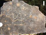
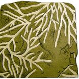
Ichnofossils
| Genus | Species | Location | Material | Type | Made by | Notes | Images |
|---|---|---|---|---|---|---|---|
|
|
Dwelling traces |
Domichnia |
|
Marine, Brackish or Freshwater Unbranched U-shaped burrows having a subvertical orientation, with or without lining and passive fill. Are common on modern coastal environments. |
||
|
|
Tubular Fodinichnia |
Fodinichnia |
|
Burrow-like ichnofossils. Interpreted as the feeding burrow of a sediment-ingesting animal. A more recent study has found that Scoloplos armiger and Heteromastus filiformis, occurring in the German Wadden Sea in the lower parts of tidal flats, make burrows that are homonymous with numerous trace fossils of the ichnogenus.[48] |
||
|
|
Tubular Fodinichnia |
Domichnia and/or fodinichnia. |
|
Dwelling and feeding burrow of a suspension-feeder or deposit-feeder, associated usually with shallow waters |
||
|
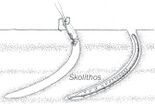
Skolithos[47] |
|
|
Cylindrical to subcylindrical burrows |
Domichnia |
|
Burrow-like ichnofossils made by organisms advancing along the bottom surface. Very narrow, vertical or subvertical, slightly winding unlined shafts filled with mud. Interpreted as dwelling structures of vermiform animals; specifically, the domichnion of a suspension-feeding worm or phoronidans |
|
|
|
Tubular Fodinichnia |
Fodinichnia |
Burrow-like ichnofossils. Large burrow-systems consisting of smooth-walled, essentially cylindrical components. Common sedimentary features are Thalassinoides trace fossils in the fissile marlstone to claystone intervals |
|||
|
|
Dwelling traces |
Domichnia & Fodinichnia |
Burrow-like ichnofossils. It has been related to Echiurans, but also from moving and feeding polychaete worms. |
Brachiopoda
| Genus | Species | Stratigraphic position | Material | Notes | Images |
|---|---|---|---|---|---|
|
Homoeorhynchia[33] |
|
|
Isolated Shells |
A Brackish rhynchonellidae Brachiopod. Relatively abundant on seashore deposits. Homoeorhynchia meridionalis juvenile forms are present. |
|
|
Stroudithyris[33] |
|
|
Isolated Shells |
A Brackish Lissajousithyrididae Brachiopod. Mostly benthonic specimens are known. |
|
|
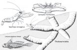
Telothyris[33] |
|
|
Isolated Shells |
A Brackish Lobothyrididae Brachiopod. Relatively abundant on seashore deposits. Includes juvenile forms of Telothyris jauberti, present on benthonic deposited strata. |
Bivalves
| Genus | Species | Stratigraphic position | Material | Notes | Images |
|---|---|---|---|---|---|
|
Mesomiltha[49] |
|
|
Isolated Shells |
A shallow marine/lagoon burrower Lucinida Bivalve. A burrowing mollusc which lived in the low intertidal/shallow subtidal environments |
|
|
Opisoma[49] |
|
|
Isolated Shells |
A shallow marine/lagoon burrower Astartidae Bivalve. Is considered to be a genus that evolved from shallow burrowing ancestors, secondarily becoming an edge-lying semi-fauna adapted to photosymbiosis that grew in shallow subtidal areas.[50] |
Gastropoda
Gastropods have been discovered in several places, but none of the specimens have been studied.[51]
Ammonites
| Genus | Species | Stratigraphic position | Material | Notes | Images |
|---|---|---|---|---|---|
|
Planammatoceras[37] |
|
|
Isolated Shell |
An Ammonite of the family Hammatoceratidae. Indicator of a Middle Aalenian age for the uppermost layers, as well evidence of greater marine influx |
Crustacea
| Genus | Species | Stratigraphic position | Material | Notes | Images |
|---|---|---|---|---|---|
|
|
Isolated Valves |
A Marine/Brackish Polycopidae Ostracodan. Present with large accumulations of specimens on a thin level of green marl |
Vertebrates
Several scales & teeth of unidentified fishes are know from Mizaguène Hill and Acforcid quarry, coming from freshwater layers.[7]
Actinopteri
| Genus | Species | Stratigraphic position | Material | Notes | Images |
|---|---|---|---|---|---|
|
|
|
A Marine/Brackish/Freshwater bony fish of the family Leptolepidae. Recovered on both the Azilal and the Tagoudite Formation, represents a cosmopolitan fish genus, common on the Toarcian Mediterranean realm. Most of the specimens appear to come from lagoonal facies. |
||
|
|
|
A Marine/Brackish/Freshwater bony fish of the family Lepisosteiformes. Local isolated specimens have resemblance with Lepidotes spp. from Brazil and Niger |
Dipnomorpha
| Genus | Species | Stratigraphic position | Material | Notes | Images |
|---|---|---|---|---|---|
|
|
|
A Freshwater lungfish of the family Arganodontidae. Represents the only proper identified vertebrate remain outside dinosaurs from Wazzant, recovered on the margin of a freshwater lacustrine body or an ephemeral pond system. |
Dinosauria Indet
| Genre | Species | Stratigraphic position | Material | Notes | Images |
|---|---|---|---|---|---|
|
Dinosauria[55] |
Indeterminate |
|
Bone fragments |
|
Theropoda
| Genus | Species | Stratigraphic position | Material | Notes | Images |
|---|---|---|---|---|---|
|
B. liassicus |
|
Described originally as a basal representative of the Abelisauroidea, it was recovered as a basal ceratosaur in later studies.[58] It was a medium-sized theropod, measuring 5.1 m (17 ft) long, with a weight of 200 kg (440 lb). |
|||
|
Indeterminate |
Two adults and one recently hatched juvenile. At least the posterior half of the skeleton is present: caudal, sacral, dorsal vertebrae, pelvis and both hind legs |
A coelophysid coelophysoid. According to Mickey Mortimer: "Assigned to Coelophysidae based on the apparent fusion between distal tarsal III and metatarsal III". It has been also proposed as a possible tetanuran.[62] That was dismissed by Benson in 2010.[63] Includes at least three different individuals that have been collected in Wazzant: two adults and a newly hatched juvenile. The former foot material resembles the Cretaceous Australian genus Kakuru, that has been proposed as a basal tyrannoraptoran. Mortimer said that "I really don't see much resemblance to Kakuru in the astragalus" and labeled it as a possible dilophosaurid or coelophysoid.[64] |
|||
| Theropoda[56][36][65][66] |
Indeterminate |
|
Described as a "Large theropod of uncertain affinities"[56] and as an "enigmatic theropod".[65] To quote Allain: "Two theropods have been found on Toundoute. The first theropod hasn't been described but shows a size larger than any of the know theropods of the Triassic-Early Jurassic know by now, indicating that Toarcian theropods had sizes rivaling that of late Jurassic allosaurs".[67] |
Sauropodomorpha
| Genus | Species | Stratigraphic position | Material | Notes | Images |
|---|---|---|---|---|---|
|
Indeterminate |
|
Pubis and other indeterminate remains |
A gravisaurian sauropod. Quoted to resemble Tazoudasaurus |
||
|
Indeterminate |
5 dorsal & caudal vertebrae, fragmentary ribs, chevrons and several large badly determinable debris.[55][60][61] |
A eusauropodan sauropod maybe related with Spinophorosaurus. Was collected on a freshwater lagoonal depositional setting.[55] |
|||
|
Indeterminate |
A possible basal sauropod of uncertain affinities. Remains recovered represent a Juvenile |
||||
|
Indeterminate |
|
One or more vertebrae and other unidentified remains |
A possible Sauropodomorpha of uncertain affinities. P. Lévêque brought these bones back from a hill which he placed in Cretaceous strata, but more recent work has shown that the deposit is in fact in Toarcian layers. |
||
|
T. naimi |
Around 10 different specimens:Partially articulated skeleton and cranial material including complete left mandible with teeth, quadrate, jugal, postorbital, parietal, frontal and exoccipital. Associated remains of a juvenile skeleton. |
A gravisaurian sauropod related to Vulcanodon. The most complete sauropod from the Lower Jurassic Found, with adult, sub adult and juvenile specimens.[56][65][66][36] |
Plantae
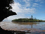
The Major Vegetational distribution on the Toundoute layers was compared with the modern inland of the Isle of Pines.[69] Paleobotany of the zone has shown that the layers at the Toundoute Continental Series there is not any major wood or plant macrofossil, although there is abundant infra-centimeter plant debris dispersed in the sediments.[30] This debris is composed mostly probably Leaflets from ferns and, less frequently, cycad pinnulae. Although fragments of cuticle were common, no palynomorphs were recovered (maybe because sedimentation did not occur during the period of dissemination of the spores and pollens produced by these plants).[31] Palynological analysis did not deliver any palynomorph, but the Plant debris left some Tracheids.[31] On the debris, however, it was possible to isolate many wood debris, that was revealed to had characters such as Homoxylated structure apparently devoid of Parenchymas, with uniform rays, tracheids with uniseriate punctuation of the "abietinean type" and crossed oculipores of "piceoid type", that overall suggest the affinity of this wood within the coniferophytes, towards the abietoid Pinaceae (As seen for example on Protocedroxylon araucarioides) or towards the Taxaceae (maybe related with the Austrotaxus-like Protelicoxylon lepennecii, from the Pliensbachian-Toarcian of southern France, linked with the same ecoregion).[30] By quantity of material, it was seen that the Vegetation was apparently very dominant by ferns, what indicates that may have been concentrated in punctual wetlands, as prove the fact that there isn't any botanical indications of arid climatic phases. Overall, the local flora was apparently dominated by ferns, cycads and conifers. The frequency in the sediments of the fine tuff debris shows the existence of more or less durable water points (spring tuffs) capable of maintaining sufficient humidity in the dry period.[30] A possible correlative flora if found in the same age layers of the Mashabba Formation, North Sinai, Egypt, and is composed by the genera Equisetites (Equisetales), Phlebopteris and Piazopteris branneri (Matoniaceae).[70] Other coeval flora includes the plants recovered on the Budoš Limestone and specially the Rotzo Formation, both on carbonate Platforms on the Mediterranean Tethys, that where deposited in limestones that point to an environment like the one recovered in the sea around the Bahamas, in areas of shallow water bordered by mangroves and "Taxodium swamp"-like settings, with nearby dry inland settings dominated by Cheirolepidaceous conifers.[71][72]
Paleosols, which clearly show the structures of plant roots in ancient soils, are found associated with an intramicritic and brecciated facies with Paleozoic or Triassic quartz dragees, frequent in some regions towards the Middle Atlas such as at Haute Moulouya. In outcrops of the Azilal Fm such as Col de Ghnim traces of roots and plants are abundant and associated with heavily bioturbated layers that resemble the "Mangrove-Lagoonal" layers found in the Rotzo Formation, yet none of the plant specimens have been studied neither the soils have been decently sampled, yet suggest shifting of the coastline and increased non-marine environments.[73]
Fossil Wood
At the top of the formation at the Idemrane geosite, unidentified pieces of wood fossils of variable sizes were recovered (largest over 20 cm in length) showing traces of iron oxides. This woody pieces are considered root fragments.[74]
| Genus | Species | Stratigraphic position | Material | Habit | Notes | Images |
|---|---|---|---|---|---|---|
|
|
|
Arboreal, high canopy, linked with floodplain margins yet high aridity tolerant |
Conifer fossil wood related with Podocarpaceae inside Pinales. Probably built evergreen tropophilous forests in alluvial plains together with Agathoxylon. A genus closely related with Dacrydium and Dacrycarpus.[77] |
See also
- Marne di Monte Serrone, Italy
- Calcare di Sogno, Italy
- Cañadón Asfalto Formation, Argentina
- Los Molles Formation, Argentina
- Mawson Formation, Antarctica
- Kandreho Formation, Madagascar
- Kota Formation, India
- Cattamarra Coal Measures, Australia
References
- ↑ 1.0 1.1 1.2 1.3 1.4 1.5 1.6 Jenny, J. (1985). "Carte Géologique du Maroc au 1: 100.000, feuille Azilal". Notes et Mémoires du Service Géologique du Maroc 339 (2): 1–104. https://searchworks.stanford.edu/view/235894. Retrieved 25 January 2022.
- ↑ Jenny, J. (1988). "Carte géologique du Maroc au 1/100 000: feuille Azilal (Haut Atlas central). Mémoire explicatif.". Notes et mémoires du Service géologique 378 (1): 1–122. https://eurekamag.com/research/020/690/020690584.php. Retrieved 25 January 2022.
- ↑ 3.0 3.1 3.2 3.3 Le Marrec, A.; Jenny, J. (1980). "L'accident de Demnat, comportement synsedimentaire et tectonique d'un decrochement transversal du Haut-Atlas central (Maroc)". Bulletin de la Société Géologique de France 7 (3): 421–427. https://pubs.geoscienceworld.org/sgf/bsgf/article-abstract/S7-XXII/3/421/111140/L-accident-de-Demnat-comportement-synsedimentaire?redirectedFrom=fulltext. Retrieved 25 January 2022.
- ↑ Peleogeographiques, C. E. R. (2002). "Les formations lithostratigraphiques jurassiques du Haut Atlas central (Maroc) : corrélations et reconstitutions paléogéographiques". Documents des laboratoires de géologie Lyon 156 (1): 163. https://www.persee.fr/doc/geoly_0750-6635_2002_act_156_1_3179. Retrieved 25 January 2022.
- ↑ El Bchari, F.; Ibouh, H.; Souhel, A.; Taj-Eddine, K.; Canérot, J.; Bouabdelli, M. (2001). "Cadre stratigraphique et étapes de structuration de la plate-forme liasique d'Aït Bou Guemmez (Haut-Atlas central, Maroc)". Revista de Geociências 16 (3): 163–172. https://www.researchgate.net/publication/249746377. Retrieved 25 January 2022.
- ↑ 6.0 6.1 Souhel, A.; El Hariri, K.; Chafiki, D.; Canerot, J. (1998). "Stratigraphie sequentielle et evolution geodnamique du Lias (Sinemurien terminal-Toarcien moyen) de l'Atlas de Beni-Mellal (Haut Atlas central, Maroc).". Bulletin de la Société Géologique de France 169 (4): 527–536. https://pubs.geoscienceworld.org/sgf/bsgf/article-abstract/169/4/527/88118/Stratigraphie-sequentielle-et-evolution. Retrieved 25 January 2022.
- ↑ 7.0 7.1 7.2 7.3 Jossen, J. A. (1990). "Carte géologique du Maroc au 1/100000, feuille de Zawyat Ahançal". Notes et Mém. Serv. Géol. Maroc 1 (1): 355. https://searchworks.stanford.edu/view/235894. Retrieved 25 April 2022.
- ↑ Haddoumi, H.; Charrière, A.; Mojon, P. O. (2010). "Stratigraphie et sédimentologie des "Couches rouges" continentales du Jurassique-Crétacé du Haut Atlas central (Maroc): implications paléogéographiques et géodynamiques". Geobios 43 (4): 433–451. doi:10.1016/j.geobios.2010.01.001. Bibcode: 2010Geobi..43..433H.
- ↑ Ettaki, M.; Chellaï, E. H. (2005). "Le Toarcien inférieur du Haut-Atlas de Todrha-Dadès (Maroc) : sédimentologie et lithostratigraphie". C. R. Géosciences, Paris 337 (1): 814–823. doi:10.1016/j.crte.2005.04.007. Bibcode: 2005CRGeo.337..814E. https://www.academia.edu/4685032. Retrieved 25 January 2022.
- ↑ Dresnay, R. D. (1971). "Extension et développement des phénomènes récifaux jurassiques dans le domaine atlasique marocain, particulièrement au Lias moyen". Bulletin de la Société Géologique de France 7 (2): 46–56. doi:10.2113/gssgfbull.S7-XIII.1-2.46. https://pubs.geoscienceworld.org/sgf/bsgf/article-abstract/S7-XIII/1-2/46/89139/Extension-et-developpement-des-phenomenes-recifaux. Retrieved 25 January 2022.
- ↑ Ibouh, H. (2004). "Du rift avorté au bassin sur décrochement, contrôles tectonique et sédimentaire pendant le Jurassique (Haut Atlas central, Maroc)". These d'É tat. Université de Marrakech, Maroc 1 (2): 1–224. https://www.researchgate.net/publication/325344151. Retrieved 25 January 2022.
- ↑ Ettaki, M; Ouahhabi, B.; Dommergues, J. L.; Meister, C.; Chellaï, E. H. (2011). "Analyses biostratigraphiques dans le Lias de la bordure sud de la Téthys méditerranéenne: l'exemple de la frange méridionale du Haut-Atlas central (Maroc)". Bulletin de la Société Géologique de France 182 (6): 521–532. doi:10.2113/gssgfbull.182.6.521. https://dialnet.unirioja.es/servlet/articulo?codigo=3812914. Retrieved 25 January 2022.
- ↑ 13.0 13.1 13.2 13.3 Krencker, F. N.; Bodin, S.; Hoffmann, R.; Suan, G.; Mattioli, E.; Kabiri, L.; Immenhauser, A. (2014). "The middle Toarcian cold snap: trigger of mass extinction and carbonate factory demise". Global and Planetary Change 117 (1): 64–78. doi:10.1016/j.gloplacha.2014.03.008. Bibcode: 2014GPC...117...64K. https://www.researchgate.net/publication/261109644. Retrieved 25 January 2022.
- ↑ Stüder, M.; du Dresnay, R. (1980). "Deformations synsedimentaires en compression pendant le Lias superieur et le Dogger, au Tizi n'Irhil (Haut Atlas central de Midelt, Maroc)". Bull. Soc. Géol. Fr. 34 (3): 391–397. doi:10.2113/gssgfbull.S7-XXII.3.391. https://pubs.geoscienceworld.org/sgf/bsgf/article-abstract/S7-XXII/3/391/111135/Deformations-synsedimentaires-en-compression. Retrieved 28 March 2022.
- ↑ 15.0 15.1 15.2 Beauchamp, W. (2004). "Superposed folding resulting from inversion of a synrift accommodation zone, Atlas Mountains, Morocco". AAPG Memoir 82 (82): 635–646. https://www.researchgate.net/publication/262560749. Retrieved 25 January 2022.
- ↑ 16.0 16.1 Manspeizer, W. (1988). Triassic–Jurassic rifting, Continental Breakup and the Origin of the Atlantic Ocean and Passive Margins. Amsterdam: Elsevier. pp. 41–79. https://www.elsevier.com/books/triassic-jurassic-rifting/manspeizer/978-0-444-42903-2. Retrieved 22 August 2022.
- ↑ Font, E.; Youbi, N.; Fernandes, S.; El Hachimi, H.; Kratinova, Z.; Hamim, Y. (2011). "Revisiting the magnetostratigraphy of the Central Atlantic Magmatic Province from Morocco". Earth and Planetary Science Letters 309 (4): 302–317. doi:10.1016/j.epsl.2011.07.007.
- ↑ 18.0 18.1 18.2 Teixell, A.; Arboleya, M. L.; Julivert, M.; Charroud, M. (2003). "Tectonic shortening and topography in the central High Atlas (Morocco)". Tectonics 22 (5): 6–14. doi:10.1029/2002TC001460. Bibcode: 2003Tecto..22.1051T. https://www.researchgate.net/publication/228879499. Retrieved 25 January 2022.
- ↑ 19.0 19.1 19.2 Ibouh, H.; El Bchari, F.; Bouabdelli, M.; Souhel, A.; Youbi, N. (2001). "L'accident tizal-azourki haut atlas central du maroc: déformations synsedimentaires liasiques en extension et conséquences du serrage atlasique". Estudios Geológicos 57 (2): 15–30. doi:10.3989/egeol.01571-2124. https://estudiosgeol.revistas.csic.es/index.php/estudiosgeol/article/view/124/120. Retrieved 25 January 2022.
- ↑ 20.0 20.1 20.2 Duval-Arnould, A.; Schröder, S.; Charton, R.; Joussiaume, R.; Razin, P.; Redfern, J. (2021). "Early post-rift depositional systems of the Central Atlantic: Lower and Middle Jurassic of the Essaouira-Agadir Basin, Morocco". Journal of African Earth Sciences 178 (1): 104–164. doi:10.1016/j.jafrearsci.2021.104164. Bibcode: 2021JAfES.17804164D. https://pure.manchester.ac.uk/ws/files/189441952/1_s2.0_S1464343X21000650_main.pdf.
- ↑ 21.0 21.1 Aït Chayeb, E. H.; Youbi, N.; El-Boukhari, A.; Bouabdelli, M.; Amrhar, M. (1998). "Le volcanisme permien et mésozoïque inférieur du bassin d'Argana (Haut-Atlas occidental, Maroc): un magmatisme intraplaque associé à l'ouverture de l'Atlantique central". Journal of African Earth Sciences 26 (1): 499–519. doi:10.1016/S0899-5362(98)00029-3. Bibcode: 1998JAfES..26..499A.
- ↑ Ouarhache, D.; Charriere, A.; Chalot-Prat, F.; El-Wartiti, M. (2000). "Sedimentation detritique continentale synchrone d'un volcanisme explosif dans le Trias terminal a infra-Lias du domaine atlasique (Haute Moulouya, Maroc)(Late Triassic to infra-Liassic continental detrital sedimentation synchronous with an explosive volcanic event in the Atlas area [Hgh Moulouya, Morocco)"]. Journal of African Earth Sciences 31 (4): 555–570. doi:10.1016/S0899-5362(00)80007-X. Bibcode: 2000JAfES..31..555O. https://www.academia.edu/19415817. Retrieved 25 January 2022.
- ↑ Dubar, G.; Mouterde, R. (1978). "L'Aalenien et le Toarcien terminal du Haut Atlas; esquisse paleogeographique". Bulletin de la Société Géologique de France 7 (2): 169–178. doi:10.2113/gssgfbull.S7-XX.2.169. https://ur.booksc.me/book/63655884/bd4063. Retrieved 25 January 2022.
- ↑ Piqué, A; Charroud, M; Laville, A; Aı̈t Brahim, M; Amrhar, E (2000). "The Tethys southern margin in Morocco and Cenozoic evolution of the Atlas domain.". Mémoire du Museum National d'Histoire Naturelle de Paris 182 (1): 93–106.
- ↑ Brahim, L. A.; Chotin, P.; Hinaj, S.; Abdelouafi, A.; El Adraoui, A.; Nakcha, C.; Bouaza, A. (2002). "Paleostress evolution in the Moroccan African margin from Triassic to Present". Tectonophysics 357 (4): 187–205. doi:10.1016/S0040-1951(02)00368-2. Bibcode: 2002Tectp.357..187A.
- ↑ Youbi, N.; Martins, L. T.; Munhá, J. M.; Ibouh, H.; Madeira, J.; Chayeb, E. A.; El Boukhari, A. (2003). "The late Triassic-early Jurassic volcanism of Morocco and Portugal in the Framework of the Central Atlantic Magmatic Province: an overview". The Central Atlantic Magmatic Province: Insights from Fragments of Pangea. Geophysical Monograph Series. 136. pp. 179–208. doi:10.1029/136GM010. ISBN 0-87590-995-7. Bibcode: 2003GMS...136..179Y. https://www.academia.edu/download/41294927/The_Late_Triassic-Early_Jurassic_Volcani20160117-11933-1ds6ku7.pdf. Retrieved 22 August 2022.[yes|permanent dead link|dead link}}]
- ↑ Cohen, A. S.; Coe, A. L. (2007). "The impact of the Central Atlantic Magmatic Province on climate and on the Sr-and Os-isotope evolution of seawater". Palaeogeography, Palaeoclimatology, Palaeoecology 244 (4): 374–390. doi:10.1016/j.palaeo.2006.06.036. Bibcode: 2007PPP...244..374C.
- ↑ 28.0 28.1 28.2 28.3 28.4 28.5 28.6 28.7 28.8 Souhel, A. (1996). "Le Mésozoïque dans Haut Atlas de Beni-Mellal (Maroc). Stratigraphie, sédimentologie et évolution géodynamique". Strata: Série 2, Mémoires 27 (6): 1–227. https://strata.fr/pdf/strata1996-2.27-hautatlas-benimellal-souhel.pdf. Retrieved 12 May 2022.
- ↑ Laville, E. (1978). "Incidence des jeux successifs d'un accident synsedimentaire sur les structures plicatives du versant nord du Haut Atlas central (Maroc)". Bulletin de la Société Géologique de France 7 (3): 329–337. doi:10.2113/gssgfbull.S7-XX.3.329. https://pubs.geoscienceworld.org/sgf/bsgf/article-abstract/S7-XX/3/329/89705/Incidence-des-jeux-successifs-d-un-accident?redirectedFrom=fulltext. Retrieved 25 January 2022.
- ↑ 30.00 30.01 30.02 30.03 30.04 30.05 30.06 30.07 30.08 30.09 30.10 30.11 30.12 30.13 30.14 Montenat, C.; Monbaron, M.; Allain, R.; Aquesbi, N.; Dejax, J.; Hernandez, J.; Taquet, P. (2005). "Stratigraphie et paléoenvironnement des dépôts volcano-détritiques à dinosauriens du Jurassique inférieur de Toundoute (Province de Ouarzazate, Haut-Atlas–Maroc)". Eclogae Geologicae Helvetiae 98 (2): 261–270. doi:10.1007/s00015-005-1161-x. https://sjg.springeropen.com/track/pdf/10.1007/s00015-005-1161-x.pdf. Retrieved January 25, 2022.
- ↑ 31.0 31.1 31.2 31.3 Allain, Ronan; Aquesbi, Najat; Jean, Dejax; Meyer, Christian; Monbaron, Michel; Montenat, Christian; Richir, Philippe; Rochdy, Mohammed et al. (2004). "A basal sauropod dinosaur from the Early Jurassic of Morocco". Comptes Rendus Palevol 3 (3): 199–208. doi:10.1016/j.crpv.2004.03.001. Bibcode: 2004CRPal...3..199A. http://doc.rero.ch/record/14560/files/PAL_E1771.pdf.
- ↑ Andrieu, S.; Krencker, F. N.; Bodin, S. (2022). "Anatomy of a platform margin during a carbonate factory collapse: implications for the sedimentary record and sequence stratigraphy interpretation of poisoning events". Journal of the Geological Society 179 (5): 15–75. doi:10.1144/jgs2022-005. Bibcode: 2022JGSoc.179....5A. https://jgs.lyellcollection.org/content/early/2022/06/06/jgs2022-005.abstract. Retrieved 25 January 2022.
- ↑ 33.0 33.1 33.2 33.3 33.4 33.5 33.6 Ettaki, M.; Ibouh, H.; Chellaï, E. H. (2007). "Événements tectono-sédimentaires au Lias-Dogger de la frange méridionale du Haut-Atlas central, Maroc". Estudios Geológicos 63 (2): 103–125. https://www.researchgate.net/publication/26580571. Retrieved 2 February 2022.
- ↑ El Harfi, A.; Guiraud, M.; Lang, J. (2006). "Deep-rooted "thick-skinned" model for the High Atlas Mountains (Morocco). Implications for the structural inheritance of the southern Tethys passive margin". Journal of Structural Geology 28 (11): 1958–1976. doi:10.1016/j.jsg.2006.08.011. Bibcode: 2006JSG....28.1958E. https://www.researchgate.net/publication/26580561. Retrieved 25 January 2022.
- ↑ Bodin, S.; Krencker, F. N.; Kothe, T.; Hoffmann, R.; Mattioli, E.; Heimhofer, U.; Kabiri, L. (2016). "Perturbation of the carbon cycle during the late Pliensbachian–early Toarcian: New insight from high-resolution carbon isotope records in Morocco". Journal of African Earth Sciences 116 (2): 89–104. doi:10.1016/j.jafrearsci.2015.12.018. Bibcode: 2016JAfES.116...89B.
- ↑ 36.00 36.01 36.02 36.03 36.04 36.05 36.06 36.07 36.08 36.09 36.10 Taquet, P. (2010). "The dinosaurs of Maghreb: the history of their discovery". Historical Biology 22 (3): 88–99. doi:10.1080/08912961003625657.
- ↑ 37.0 37.1 37.2 37.3 37.4 37.5 37.6 37.7 37.8 37.9 Milhi, Abdellah (1992). Stratigraphie, Fazies und Paläogeographie des Jura am Südrand des zentralen Hohen Atlas (Marokko). Selbstverlag Fachbereich Geowissenschaften, FU Berlin. OCLC 763029903. http://worldcat.org/oclc/763029903.
- ↑ Bassoullet, J. P.; Elmi, S.; Poisson, A.; Cecca, F.; Bellion, Y.; Guiraud, R.; Vrielynck, B. (1993). "Middle Toarcian". Atlas Tethys Paleoenvironmental Maps 7 (1): 63–84.
- ↑ 39.00 39.01 39.02 39.03 39.04 39.05 39.06 39.07 39.08 39.09 39.10 39.11 39.12 Krencker, F. N.; Fantasia, A.; Danisch, J.; Martindale, R.; Kabiri, L.; El Ouali, M.; Bodin, S. (2020). "Two-phased Collapse of the Shallow-water Carbonate Factory during the Late Pliensbachian–Toarcian Driven by Changing Climate and Enhanced Continental Weathering in the Northwestern Gondwana Margin". Earth-Science Reviews 208 (1): 103–254. doi:10.1016/j.earscirev.2020.103254. Bibcode: 2020ESRv..20803254K.
- ↑ 40.0 40.1 Bodin, S.; Mattioli, E.; Frohlich, S.; Marshall, J.D.; Boutib, L.; Lahsini, S.; Redfern, J. (2010). "Toarcian carbon isotope shifts and nutrient changes from the Northern margin of Gondwana (High Atlas, Morocco, Jurassic): palaeoenvironmental implications". Palaeogeogr. Palaeoclimatol. Palaeoecol. 297 (1): 377–390. doi:10.1016/j.palaeo.2010.08.018. Bibcode: 2010PPP...297..377B. https://pure.manchester.ac.uk/ws/files/24618209/PRE-PEER-REVIEW.PDF.
- ↑ Frizon de Lamotte, D.; Zizi, M.; Missenard, Y.; Hafid, M.; Azzouzi, M.E.; Maury, R.C.; Charrière, A.; Taki, Z. et al. (2008). "The Atlas System". Continental Evolution: The Geology of Morocco. Lecture Notes in Earth Sciences. 6. Springer Berlin Heidelberg. pp. 133–202. doi:10.1007/978-3-540-77076-3_4. ISBN 978-3-540-77075-6.
- ↑ 42.0 42.1 42.2 Brame, H. M. R.; Martindale, R. C.; Ettinger, N. P.; Debeljak, I.; Vasseur, R.; Lathuilière, B.; Bodin, S. (2019). "Stratigraphic distribution and paleoecological significance of Early Jurassic (Pliensbachian-Toarcian) lithiotid-coral reefal deposits from the Central High Atlas of Morocco". Palaeogeography, Palaeoclimatology, Palaeoecology 514 (2): 813–837. doi:10.1016/j.palaeo.2018.09.001. Bibcode: 2019PPP...514..813B.
- ↑ Franceschi, M.; Dal Corso, J.; Posenato, R.; Roghi, G.; Masetti, D.; Jenkyns, H.C. (2014). "Early Pliensbachian (Early Jurassic) C-isotope perturbation and the diffusion of the Lithiotis Fauna: Insights from the western Tethys". Palaeogeography, Palaeoclimatology, Palaeoecology 410 (4): 255–263. doi:10.1016/j.palaeo.2014.05.025. Bibcode: 2014PPP...410..255F. https://www.academia.edu/18803196. Retrieved 3 January 2022.
- ↑ Boivin, S.; Vasseur, R.; Lathuilière, B.; Lazăr, I.; Durlet, C.; Martindale, R. C.; Martini, R. (2019). "A little walk between Early Jurassic sponges and corals: A confusing morphological convergence". Geobios 57 (2): 1–24. doi:10.1016/j.geobios.2019.10.001. Bibcode: 2019Geobi..57....1B.
- ↑ Pantić, N.K.; Duuc, S. (1990). "Palaeophytogeography of Jurassic land flores in Tethyan regions and its margins". Geol. An. Balk. Pol. 2 (1): 237–247.
- ↑ Krencker, F. N.; Bodin, S.; Suan, G.; Heimhofer, U.; Kabiri, L.; Immenhauser, A. (2015). "Toarcian extreme warmth led to tropical cyclone intensification". Earth and Planetary Science Letters 425 (1): 120–130. doi:10.1016/j.epsl.2015.06.003. Bibcode: 2015E&PSL.425..120K. https://www.researchgate.net/publication/278022392. Retrieved 25 January 2022.
- ↑ 47.0 47.1 47.2 47.3 47.4 47.5 Rodríguez-Tovar, F. J. (2021). "Ichnology of the Toarcian Oceanic Anoxic Event: An understimated tool to assess palaeoenvironmental interpretations". Earth-Science Reviews 216 (1): 103–119. doi:10.1016/j.earscirev.2021.103579. Bibcode: 2021ESRv..21603579R.
- ↑ Hertweck, G.; Wehrmann, A.; Liebezeit, G. (2007). "Bioturbation structures of polychaetes in modern shallow marine environments and their analogues to Chondrites group traces". Palaeogeography, Palaeoclimatology, Palaeoecology 245 (3–4): 382–389. doi:10.1016/j.palaeo.2006.09.001. Bibcode: 2007PPP...245..382H.
- ↑ 49.0 49.1 Lee, C.W. (1976). "Facies and Faunistic Variation in the Middle Lias (Domerian) of the Central High Atlas Mountains, Morocco". University College of Swansea. https://books.google.com/books?id=3VlOAQAAIAAJ. Retrieved 2 July 2023.
- ↑ Posenato, R. (2013). "Opisoma excavatum Boehm, a Lower Jurassic photosymbiotic alatoform-chambered bivalve". Lethaia 46 (2): 424–437. doi:10.1111/let.12020. https://www.researchgate.net/publication/257390499. Retrieved 3 January 2022.
- ↑ Boudchiche, L.; Sadki, D. (2000). "Mise en évidence de la limite Pliensbachien-Toarcien par les ammonites, les foraminifères et l'interaction tectono-eustatique dans la région de Todrha-Dadès". Revenue de paléobiologie 19: 299–317. https://www.researchgate.net/publication/287513236. Retrieved 8 September 2021.
- ↑ 52.0 52.1 Chafiki, D. (1994). "Dynamique sédimentaire à l'articulation plate forme-bassin: Exemple du Lias de la région de Beni Melal (Haut Atlas central-Maroc)". Thèse de 3ième cycle, Université Cadi Ayyad, Marrakech 1 (1): 189p.
- ↑ 53.0 53.1 Chafiki, D.; ElHariri, K.; Souhel, A.; Lachkar, N.; Sarih, S.; Dommergues, J.L.; Garcia, J.P.; Quiquerez, A. (2007). "Données lithostratigraphiques et biostratigraphiques sur le Lias dans le cadre de deux transects du Haut-Atlas central (Beni Mellal et Midelt-Errachidia, Maroc)". Africa Geoscience Review 14 (1): 15–28. https://www.hal.inserm.fr/SEDS/hal-00198534. Retrieved 8 September 2021.
- ↑ Dubar, G. (1960). "Notes sur la paléogéographie du Lias marocain (domaine atlasique)". Livre à la mémoire du Prof. P. Fallot 2 (1): 529–544.
- ↑ 55.0 55.1 55.2 55.3 55.4 55.5 Termier, H. (1942). "Données nouvelles sur le Jurassique rouge à Dinosauriens du Grand et du Moyen-Atlas (Maroc) [New data on the Jurassic red beds with dinosaurs from the Great and Middle Atlas (Morocco)"]. Bulletin de la Société Géologique de France 12 (6): 199–207. doi:10.2113/gssgfbull.S5-XII.4-6.199. https://pubs.geoscienceworld.org/sgf/bsgf/article-abstract/S5-XII/4-6/199/516777/Donnees-nouvelles-sur-le-Jurassique-rouge-a?redirectedFrom=fulltext. Retrieved 25 January 2022.
- ↑ 56.0 56.1 56.2 56.3 56.4 56.5 56.6 56.7 56.8 Allain, R.; Tykoski, R.; Aquesbi, N.; Jalil, N. E.; Monbaron, M.; Russell, D.; Taquet, P. (2007). "An abelisauroid (Dinosauria: Theropoda) from the Early Jurassic of the High Atlas Mountains, Morocco, and the radiation of ceratosaurs". Journal of Vertebrate Paleontology 27 (3): 610–624. doi:10.1671/0272-4634(2007)27[610:AADTFT2.0.CO;2]. http://doc.rero.ch/record/8145/files/monbaron_adt.pdf.
- ↑ Ibrahim, N.; Sereno, P. C.; Zouhri, S.; Zouhri, S. (2017). "Les dinosaures du Maroc–aperçu historique et travaux récents.". Mémoires de la Societé géologique de France 180 (4): 249–284. https://d3qi0qp55mx5f5.cloudfront.net/paulsereno/i/docs/17-MSGF-Ibrahim_etal-MorocDinos.pdf?mtime=1591805182. Retrieved 21 April 2023.
- ↑ Dal Sasso, C; Maganuco, S; Cau, A. (2018). "The oldest ceratosaurian (Dinosauria: Theropoda), from the Lower Jurassic of Italy, sheds light on the evolution of the three-fingered hand of birds". PeerJ 1 (1): e5976. doi:10.7717/peerj.5976. PMID 30588396.
- ↑ 59.0 59.1 59.2 59.3 Jenny, J.; Jenny-Deshusses, C.; Le Marrec, A.; Taquet, P. (1980). "Découverte d'ossements de Dinosauriens dans le Jurassique inférieur (Toarcien) du Haut Atlas central (Maroc) [Discovery of dinosaur bones in the Lower Jurassic (Toarcian) of the central High Atlas (Morocco)"]. Comptes Rendus de l'Académie des Sciences, Série D 290 (1): 839–842. https://gallica.bnf.fr/ark:/12148/bpt6k5497484p/f247.item.r=Taquet?fbclid=IwAR1TmegyACkDfyC6tFyvmOH1N6i1DYOjo1agM7O7_VXh0wEvPyQuMusGtDw. Retrieved 25 January 2022.
- ↑ 60.0 60.1 60.2 60.3 60.4 Taquet, P. (1985). "Two new Jurassic specimens of coelurosaurs (Dinosauria)". The beginning of birds. Eichstätt, Germany: Freunde des Jura Museums 1 (1): 229–232.
- ↑ 61.0 61.1 61.2 61.3 61.4 Taquet, P. (1986). "Les découvertes récentes de dinosaures au Maroc. In Les dinosaures de la Chine à la France". Colloque international de paléontologie 7 (2): 39–43.
- ↑ Allain, Ronan; Bailleul, Alida (2010). "First Revision of the Theropod from the Toarcian of Wazazant (High Atlas Mountains, Morocco): The oldest Know Tetanureae?". Abstracts du 1er Congrès International sur la Paléontologie des Vertébrés du Nord de l'Afrique 1 (1): 34.
- ↑ Benson, Roger B. J. (2010). "The osteology of Magnosaurus nethercombensis (Dinosauria, Theropoda) from the Bajocian (Middle Jurassic) of the United Kingdom and a re-examination of the oldest records of tetanurans". Journal of Systematic Palaeontology 8 (1): 131–146. doi:10.1080/14772011003603515.
- ↑ Mortimer, M.. "RE:African Kakuru-like material". http://reptilis.net/DML/2002Feb/msg00624.html.
- ↑ 65.0 65.1 65.2 65.3 Allain, R.; Aquesbi, N. (2008). "Anatomy and phylogenetic relationships of Tazoudasaurus naimi (Dinosauria, Sauropoda) from the late Early Jurassic of Morocco". Geodiversitas 30 (2): 345–424. https://sciencepress.mnhn.fr/en/periodiques/geodiversitas/30/2/anatomie-et-relations-phylogenetiques-de-tazoudasaurus-naimi-dinosauria-sauropoda-de-la-fin-du-jurassique-inferieur-du-maroc. Retrieved 25 January 2022.
- ↑ 66.0 66.1 66.2 66.3 66.4 66.5 66.6 Peyer, K.; Allain, R. (2010). "A reconstruction of Tazoudasaurus naimi (Dinosauria, Sauropoda) from the late Early Jurassic of Morocco". Historical Biology 22 (3): 134–141. doi:10.1080/08912960903562317. https://www.researchgate.net/publication/233071644. Retrieved 25 January 2022.
- ↑ 67.0 67.1 Allain, R. (2012). Histoire des dinosaures. Paris: Perrin. p. 112. ISBN 978-2081353053. https://books.google.com/books?id=n-QtMPTyDsoC&dq=Tazoudasaurus&pg=PT40. Retrieved 25 January 2022.
- ↑ Lévêque, P. (1961). "Contribution à l'étude géologique et hydrogéologique de l'Atlas de Demnate (Maroc)". Thèse Sciences.
- ↑ Gandini, Jacques. "Tazouda (Toundoute) - Les fouilles". Le Marroc Avant l´historie. https://www.prehistoire-du-maroc.com/tazouda-toundoute/les-fouilles.html.
- ↑ Ghandour, I. M.; Fürsich, F. T. (2022). "Allogenic and autogenic controls on facies and stratigraphic architecture of the Lower Jurassic Mashabba Formation, Gebel Al-Maghara, North Sinai, Egypt". Proceedings of the Geologists' Association 133 (1): 67–86. doi:10.1016/j.pgeola.2021.12.001. Bibcode: 2022PrGA..133...67G.
- ↑ Pantić, N. K. (1952). "Liassic flora from Budos mountain - Montenegro". Glasnik Prir. Muzeja SRP. Zem 5 (1): 293–308.
- ↑ Neri, M.; Roghi, G.; Ragazzi, E.; Papazzoni, C. A. (2017). "First record of Pliensbachian (Lower Jurassic) amber and associated palynoflora from the Monti Lessini (northern Italy).". Geobios 50 (1): 49–63. doi:10.1016/j.geobios.2016.10.001. Bibcode: 2017Geobi..50...49N.
- ↑ Löwner, R. (2009). "Recherches sedimentologiques et structurales à l'articulation entre Haut et Moyen Atlas et la Haute Moulouya, Maroc". Publications of the Universität Berlin 356 (2): 2–212. https://do.tu-berlin.de/bitstream/11303/2561/3/Dokument_10.pdf. Retrieved 20 August 2022.
- ↑ Louz, E.; Rais, J.; Barka, A. A.; Nadem, S.; Barakat, A. (2022). "Geological heritage of the Taguelft syncline (M'Goun Geopark): Inventory, assessment, and promotion for geotourism development (central high atlas, Morocco)". International Journal of Geoheritage and Parks 10 (2): 218–239. doi:10.1016/j.ijgeop.2022.04.002. Bibcode: 2022IJGP...10..218L.
- ↑ Gazeau, F. (1969). "Sur quelques structures de bois Mésozoïques du Maroc". Notes, Mém. Serv. Géol. Maroc 210 (3): 93–120.
- ↑ Philippe, M.; Bamford, M.; McLoughlin, S.; Alves, L. S. R.; Falcon-Lang, H. J.; Gnaedinger, S.; Zamuner, A. (2004). "Biogeographic analysis of Jurassic–Early Cretaceous wood assemblages from Gondwana". Review of Palaeobotany and Palynology 129 (3): 141–173. doi:10.1016/j.revpalbo.2004.01.005. Bibcode: 2004RPaPa.129..141P.
- ↑ Gazeau, F. (1969). "Etude du Protophyllocladoxylon maurianum Gazeau 1967 du Jurassique du Haut Atlas". Notes et Mémoires du Service Géologique du Maroc 210 (3): 108–113.
 |
