Earth:List of northernmost items


This is a list of various northernmost things on Earth.
Cities and settlements
| Category | Place | Latitude/longitude |
|---|---|---|
| Capital (of an independent state) | Reykjavík, Iceland[1] | Lua error: callParserFunction: function "#coordinates" was not found. |
| Capital (of an autonomous territory) | Nuuk, Greenland[2] | Lua error: callParserFunction: function "#coordinates" was not found. |
| Non-permanent settlement of any size | Camp Barneo[3] | Lua error: callParserFunction: function "#coordinates" was not found. (may vary as it changes every summer) |
| Permanent settlement of any size | Alert, Nunavut (CFS Alert), Canada[4] | Lua error: callParserFunction: function "#coordinates" was not found. |
| Non-active public settlement (ghost town) | Wandel Dal Settlements, Greenland[5] | Lua error: callParserFunction: function "#coordinates" was not found. |
| Active public settlement | Ny-Ålesund, Svalbard, Norway | Lua error: callParserFunction: function "#coordinates" was not found. |
| Village inhabited by native people | Siorapaluk, Greenland[6] | Lua error: callParserFunction: function "#coordinates" was not found. |
| Medieval town | Vágar, Austvågøy, Lofoten, Norway[7] | Lua error: callParserFunction: function "#coordinates" was not found. |
| City > 1,000 people | Longyearbyen, Svalbard, Norway[8] | Lua error: callParserFunction: function "#coordinates" was not found. |
| City > 2,500 people | Khatanga, Russia[9] | Lua error: callParserFunction: function "#coordinates" was not found. |
| City > 4,000 people | Tiksi, Russia | Lua error: callParserFunction: function "#coordinates" was not found. |
| City > 4,500 people | Utqiagvik, Alaska, United States[10] | Lua error: callParserFunction: function "#coordinates" was not found. |
| City > 5,000 people | Hammerfest, Norway[11] | Lua error: callParserFunction: function "#coordinates" was not found. |
| City > 10,000 people | ||
| City > 25,000 people | Tromsø, Norway[11] | Lua error: callParserFunction: function "#coordinates" was not found. |
| City > 50,000 people | Norilsk, Russia[12][13] | Lua error: callParserFunction: function "#coordinates" was not found. |
| City > 100,000 people | ||
| City > 250,000 people | Murmansk, Russia | Lua error: callParserFunction: function "#coordinates" was not found. |
| City > 300,000 people | Arkhangelsk, Russia | Lua error: callParserFunction: function "#coordinates" was not found. |
| City > 350,000 people | Yakutsk, Russia | Lua error: callParserFunction: function "#coordinates" was not found. |
| City > 375,000 people | Surgut, Russia | Lua error: callParserFunction: function "#coordinates" was not found. |
| City > 500,000 people | Helsinki, Finland | Lua error: callParserFunction: function "#coordinates" was not found. |
| City > 1,000,000 people | Saint Petersburg, Russia[14] | Lua error: callParserFunction: function "#coordinates" was not found. |
| City > 2,500,000 people | ||
| City > 5,000,000 people | ||
| City > 10,000,000 people Metropolitan area > 20,000,000 people |
Moscow, Russia[14][15] | Lua error: callParserFunction: function "#coordinates" was not found. |
| City > 25,000,000 people | Tokyo, Japan | Lua error: callParserFunction: function "#coordinates" was not found. |
Geography
| Category | Place | Latitude/longitude |
|---|---|---|
| Lake | Kaffeklubben Sø, Greenland[16] | Lua error: callParserFunction: function "#coordinates" was not found. |
| Pond | Lake North Pole, North Pole (on ice)[17] | Lua error: callParserFunction: function "#coordinates" was not found.[18] |
| Permanent island | Kaffeklubben Island, Greenland[19] | Lua error: callParserFunction: function "#coordinates" was not found. |
| Non-permanent island | Qeqertaq Avannarleq, Greenland | |
| Lake island | Gatter Island, Lake Hazen, Canada | Lua error: callParserFunction: function "#coordinates" was not found. |
| Archipelago | Arctic Archipelago, Canada (northernmost point, Cape Columbia, Ellesmere Island) | Lua error: callParserFunction: function "#coordinates" was not found. |
| Sea | Lincoln Sea, Greenland and Canada | Lua error: callParserFunction: function "#coordinates" was not found. (northernmost point) |
| Bay | Constable Bay, Greenland[20] | Lua error: callParserFunction: function "#coordinates" was not found. |
| Mountain range | Roosevelt Range, Greenland[21] | Lua error: callParserFunction: function "#coordinates" was not found. |
| National park | Northeast Greenland National Park, Greenland | Lua error: callParserFunction: function "#coordinates" was not found. (northernmost point) |
| Continental mainland | Cape Chelyuskin, Taymyr Peninsula, Krasnoyarsk Krai, Russia | Lua error: callParserFunction: function "#coordinates" was not found. |
| Active volcano | Beerenberg, Jan Mayen, Norway[22] | Lua error: callParserFunction: function "#coordinates" was not found. |
| Coral reef | Korallen,[23] Finnmark, Norway | Lua error: callParserFunction: function "#coordinates" was not found. |
| Location with all monthly average temperatures above freezing |
Bø Municipality, Nordland, Norway[24] | Lua error: callParserFunction: function "#coordinates" was not found. |
| Crater lake | Lake Lappajärvi, Lappajärvi,[25] Finland | Lua error: callParserFunction: function "#coordinates" was not found. |
| Beach of southern type[A] | Lua error: callParserFunction: function "#coordinates" was not found. | |
| Active sand dunes | Great Kobuk Sand Dunes, Alaska, United States[27] | Lua error: callParserFunction: function "#coordinates" was not found. |
| Coral atoll | Kure Atoll, Hawaii, United States[28] | Lua error: callParserFunction: function "#coordinates" was not found. |
| Tropical sea | Red Sea[29] | Lua error: callParserFunction: function "#coordinates" was not found. |
Nature
Wild animals
| Animal | Place | Latitude/longitude |
|---|---|---|
| Fresh water fish: arctic char | Arctic Ocean[30] | Approx. 82°N |
| Coral reef | Off the north coast of Norway[31] | Lua error: callParserFunction: function "#coordinates" was not found. |
| Amphibian: Siberian wood frog | Northern Siberia[32] | Approx. 71°N |
| Bat colony (naturally occurring) | Rundhaug, Målselv Municipality (Troms), Norway[33] | Lua error: callParserFunction: function "#coordinates" was not found. |
| Reptile: viviparous lizard | Scandinavia and Russia[34] | Approx. 68°N |
| Snake: European adder | Arctic Circle[35] | Approx. 66°34′N |
| Scorpion: Northern scorpion | Red Deer County, Alberta, Canada[36] | Lua error: callParserFunction: function "#coordinates" was not found. |
| Tortoise: Horsfield tortoise | Southern Kazakhstan[37][38] | Approx. 48°67′N[clarification needed] |
| Non-human primate colony | Shimokita Peninsula, Honshu, Japan[39] | Lua error: callParserFunction: function "#coordinates" was not found. |
| Parrot: Alexandrine parakeet | Area of Jalalabad, Afghanistan[40] | Lua error: callParserFunction: function "#coordinates" was not found. |
| Penguin: Galapagos penguin | Galápagos Islands, Ecuador[41] | Lua error: callParserFunction: function "#coordinates" was not found. |
Plants
These lists only contain naturally occurring plants and trees, excluding individuals planted by humans.
General
| Plant | Place | Latitude/longitude |
|---|---|---|
| Flower | Arctic Poppy on Kaffeklubben Island[42] | Lua error: callParserFunction: function "#coordinates" was not found. |
| Forest | Lukunsky grove of Dahurian larch, south from Khatanga River, Krasnoyarsk Krai, Russia[43] | Lua error: callParserFunction: function "#coordinates" was not found. |
| Temperate rainforest | Prince William Sound, Alaska, United States[44] | Lua error: callParserFunction: function "#coordinates" was not found. |
| Palms (European fan palm Chamaerops humilis) | Nice, Mediterranean coast of southern France[45] | Lua error: callParserFunction: function "#coordinates" was not found. |
| Papyrus swamp | Hula Valley, Israel[46] | Lua error: callParserFunction: function "#coordinates" was not found. |
| Lowland tropical rainforest | Namdapha National Park, India[47] | Lua error: callParserFunction: function "#coordinates" was not found. |
Shrubs
| Plant | Place | Latitude/longitude |
|---|---|---|
| Willow (Arctic willow Salix arctica) | Reaches the northern limits of land in Greenland[48] |
Trees
| Plant | Place | Latitude/longitude |
|---|---|---|
| Larch (Dahurian larch Larix gmelinii) | About 150 kilometres (93 mi) westward of Khatanga River outfall, Taymyr Peninsula, Siberia, Russia.[49] This location is that of the northernmost tree of any kind (this is a creeping form of Dahurian larch) |
Lua error: callParserFunction: function "#coordinates" was not found. |
Education
| Category | Place | Latitude/longitude |
|---|---|---|
| Kindergarten | Kullungen barnehage and Polarflokken barnehage,[50] Longyearbyen, Svalbard, Norway | Lua error: callParserFunction: function "#coordinates" was not found. (coordinates of Longyearbyen) |
| Primary/secondary school | Longyearbyen School,[51] Longyearbyen, Svalbard, Norway | Lua error: callParserFunction: function "#coordinates" was not found. |
| Higher education institute | University Centre in Svalbard,[52] Longyearbyen, Svalbard, Norway | Lua error: callParserFunction: function "#coordinates" was not found. |
| Agricultural school | Tana videregående skole,[53] Tana Municipality, Norway | Lua error: callParserFunction: function "#coordinates" was not found. |
| Montessori school | Tana Montessoriskole,[54] Tana Municipality, Norway | Lua error: callParserFunction: function "#coordinates" was not found. |
| Folk high school | Svalbard Folkehøgskole,[55] Longyearbyen, Svalbard, Norway | Lua error: callParserFunction: function "#coordinates" was not found. |
| International Baccalaureate | Kirkenes,[56] Norway | Lua error: callParserFunction: function "#coordinates" was not found. |
| Music conservatory | Conservatory of Tromsø,[57] Tromsø, Norway | Lua error: callParserFunction: function "#coordinates" was not found. |
| Art school | Karasjok,[58] Norway | Lua error: callParserFunction: function "#coordinates" was not found. |
| University | University of Tromsø,[59][60] Tromsø, Norway | Lua error: callParserFunction: function "#coordinates" was not found. |
| Gardening school | Rå videregående skole,[61] Borkenes, Norway | Lua error: callParserFunction: function "#coordinates" was not found. |
| Catholic school | St. Eystein skole,[62] Bodø, Norway (Primary school)
Monroe Catholic High School,[63] Fairbanks, Alaska, United States (High school) |
Lua error: callParserFunction: function "#coordinates" was not found.
Lua error: callParserFunction: function "#coordinates" was not found. |
| Architecture school | University of Oulu, Oulu, Finland | Lua error: callParserFunction: function "#coordinates" was not found. |
| School for the deaf | Kristinaskolan School for the Deaf,[64] Härnösand, Sweden | Lua error: callParserFunction: function "#coordinates" was not found. |
Science and technology
| Category | Place | Latitude/longitude |
|---|---|---|
| Scientific laboratory | Camp Barneo,[65] Russian arctic laboratory | Floating relatively close to the North Pole |
| Observatory | Arctic Geodetic Earth Observatory, Ny-Ålesund, Svalbard, Norway[66] | Lua error: callParserFunction: function "#coordinates" was not found. |
| Sewage farm | Kings Bay, Ny-Ålesund, Svalbard, Norway[67] | Lua error: callParserFunction: function "#coordinates" was not found. |
| LTE cell tower | Longyearbyen, Svalbard, Norway[68] | Lua error: callParserFunction: function "#coordinates" was not found. |
| Oil platform | Goliat, Arctic Ocean[69] | Lua error: callParserFunction: function "#coordinates" was not found. |
| Wind farm | Tiksi,[70] Yakutia, Russia | Lua error: callParserFunction: function "#coordinates" was not found. |
| LNG plant | Melkøya,[71] Hammerfest, Norway | Lua error: callParserFunction: function "#coordinates" was not found. |
| High voltage power line | Balsfjord-Hammerfest,[72][73] Norway | Lua error: callParserFunction: function "#coordinates" was not found. |
| Planetarium | Northern Light Planetarium,[74] Tromsø, Troms, Norway | Lua error: callParserFunction: function "#coordinates" was not found. |
| Web conferencing | Tag-IT,[75] Tromsø, Norway | Lua error: callParserFunction: function "#coordinates" was not found. |
| Astronomical Observatory | Skibotn Observatory,[76] Storfjord Municipality, Norway | Lua error: callParserFunction: function "#coordinates" was not found. |
| Smeltery | Finnfjord AS,[77] Finnsnes, Norway | Lua error: callParserFunction: function "#coordinates" was not found. |
| Permanent launch facility for sounding rockets & scientific balloons | Andøy Municipality,[78] Norway | Lua error: callParserFunction: function "#coordinates" was not found. |
| Radioactive waste plant | Murmansk,[79] Russia | Lua error: callParserFunction: function "#coordinates" was not found. |
| Solar power station | Grise Fiord, Canada[80] | Lua error: callParserFunction: function "#coordinates" was not found. |
| Car testing center | White Hell,[81] Saariselkä, Inari, Finland | Lua error: callParserFunction: function "#coordinates" was not found. |
| Nuclear Power Plant (mobile) | Akademik Lomonosov, Pevek harbor, Chukotka Autonomous Okrug, Russia[82] | Lua error: callParserFunction: function "#coordinates" was not found. |
| Spaceport | Esrange Space Center,[83] Jukkasjärvi, Kiruna, Sweden | Lua error: callParserFunction: function "#coordinates" was not found. |
| Laser cutting machine | LKAB Mekaniska,[84] Kiruna, Sweden | Lua error: callParserFunction: function "#coordinates" was not found. |
| Biogas plant | Ammattiopisto Lappia,[85] Tervola, Finland | Lua error: callParserFunction: function "#coordinates" was not found. |
| Crusher | Kajaanin Romu,[86] Kajaani, Finland | Lua error: callParserFunction: function "#coordinates" was not found. |
| Psycholinguistics and neurolinguistics laboratory | University Hospital of Trondheim,[87] Trondheim, Norway | Lua error: callParserFunction: function "#coordinates" was not found. |
Historical sites and archaeological findings

| Category | Place | Latitude/longitude |
|---|---|---|
| Confirmed archaeological site of Neolithic Stone Age | Bliss Bay site, Peary Land, Greenland, Denmark[42] | Lua error: callParserFunction: function "#coordinates" was not found. |
| Known shipwreck | Breadalbane, near Beechey Island, Nunavut, Canada[88][89] | Lua error: callParserFunction: function "#coordinates" was not found. |
| Archaeological site of Paleolithic Stone Age | Lua error: callParserFunction: function "#coordinates" was not found. | |
| Fortress | Vardøhus Fortress,[90] Vardø, Norway | Lua error: callParserFunction: function "#coordinates" was not found. |
| Discovered medieval coin | Alta, Norway[91] | Lua error: callParserFunction: function "#coordinates" was not found. |
| Bronze Age archaeological site | Sandvika, Brensholmen,[92] Kvaløya, Tromsø Municipality, Norway | Lua error: callParserFunction: function "#coordinates" was not found. |
| Discovered Byzantine coin | Ljønes,[93] Bodø Municipality, Norway | Lua error: callParserFunction: function "#coordinates" was not found. |
| Runestone (remains near original location) | Frösö Runestone,[94] Frösö, Sweden | Lua error: callParserFunction: function "#coordinates" was not found. |
| Runestone (original site, not there anymore) | Kingittorsuaq Runestone, Kingittorsuaq Island, Greenland | Lua error: callParserFunction: function "#coordinates" was not found. |
| Medieval stone castle | Olavinlinna, Savonlinna, Finland[95] | Lua error: callParserFunction: function "#coordinates" was not found. |
| Cave painting | Kapova Cave,[96] Burzyansky District, Bashkortostan, Russia | Lua error: callParserFunction: function "#coordinates" was not found. |
| Discovered megalithic coffin | Hylligrava, Hyllibråten garden, Indre Østfold Municipality, Norway[97] | Lua error: callParserFunction: function "#coordinates" was not found. |
| Windmills | Village Kimzha, Mezen, Arkhangelsk Region, Russia | Lua error: callParserFunction: function "#coordinates" was not found. |
Recreation
General
| Category | Place | Latitude/longitude |
|---|---|---|
| Circus | Sirkus Svalnardo, Longyearbyen, Svalbard, Norway[98] | Lua error: callParserFunction: function "#coordinates" was not found. |
| Naturist beach | Kjølnes,[99] Berlevåg Municipality, Norway | Lua error: callParserFunction: function "#coordinates" was not found. |
| Escape room | Arctic Escape,[100] Tromsø, Troms, Norway | Lua error: callParserFunction: function "#coordinates" was not found. |
| Water amusement park | Norilsk,[101] Russia | Lua error: callParserFunction: function "#coordinates" was not found. |
| Natural playground | Fabeløya Natural Playground,[102] Hamnvik, Norway | Lua error: callParserFunction: function "#coordinates" was not found. |
| Theme park | Angry Birds Park,[103] Saariselkä, Inari, Finland | Lua error: callParserFunction: function "#coordinates" was not found. |
| Geocaching Mega-event | Midnight Sun Geocaching, Saariselkä, Inari, Finland[104] | Lua error: callParserFunction: function "#coordinates" was not found. |
| Hot air balloon festival | Arctic Balloon Adventure, Gällivare, Sweden[105] | Lua error: callParserFunction: function "#coordinates" was not found. |
| Travelling funfair | Hugos Tivoli,[106] Levanger and Mo i Rana, Norway | Lua error: callParserFunction: function "#coordinates" was not found. |
| Beach resort/spa hotel (opened 1886 or 1888; closed 1918) | Nordanskär Island,[107] Kalix, Sweden | Lua error: callParserFunction: function "#coordinates" was not found. |
| Permanent roller coaster | Alpin Coaster, Namsskogan Familiepark,[108] Trones, Norway | Lua error: callParserFunction: function "#coordinates" was not found. |
| Amusement park | PowerPark,[109] Alahärmä, Kauhava, Finland | Lua error: callParserFunction: function "#coordinates" was not found. |
Culture and music


| Category | Place | Latitude/longitude |
|---|---|---|
| Museum | Ny-Ålesund Town and Mine Museum,[110] Ny-Ålesund, Svalbard, Norway | Lua error: callParserFunction: function "#coordinates" was not found. |
| Piano | Pyramiden, Svalbard, Norway[111] | Lua error: callParserFunction: function "#coordinates" was not found. |
| Chamber music festival | Arctic Chamber Music Festival,[112] Longyearbyen, Svalbard, Norway | Lua error: callParserFunction: function "#coordinates" was not found. |
| Children's choir | Polargospel,[113] Longyearbyen, Svalbard, Norway | Lua error: callParserFunction: function "#coordinates" was not found. |
| Electric Organ | Svalbard Church,[114] Longyearbyen, Svalbard, Norway | Lua error: callParserFunction: function "#coordinates" was not found. |
| Literature festival | Longyearbyen Literature Festival,[115] Longyearbyen, Svalbard, Norway | Lua error: callParserFunction: function "#coordinates" was not found. |
| Men's chorus | Store Norske Mandskor,[116][117] Longyearbyen, Svalbard, Norway | Lua error: callParserFunction: function "#coordinates" was not found. |
| Mixed choir | Longyearbyen blandakor,[116] Longyearbyen, Svalbard, Norway | Lua error: callParserFunction: function "#coordinates" was not found. |
| Oktoberfest | Oktoberfest 78° Nord,[118] Longyearbyen, Svalbard, Norway | Lua error: callParserFunction: function "#coordinates" was not found. |
| Cinema | Kulturhuset,[119] Longyearbyen, Svalbard, Norway | Lua error: callParserFunction: function "#coordinates" was not found. |
| Art gallery | The Gallery and Longyearbyen Arts & Crafts Centre,[120] Longyearbyen, Svalbard, Norway | Lua error: callParserFunction: function "#coordinates" was not found. |
| Blues festival | Dark Season Blues,[121] Longyearbyen, Svalbard, Norway | Lua error: callParserFunction: function "#coordinates" was not found. |
| Rock festival | Spitsbergen Rock festival,[122] Longyearbyen, Svalbard, Norway | Lua error: callParserFunction: function "#coordinates" was not found. |
| Jazz festival | Polarjazz,[123] Longyearbyen, Svalbard, Norway | Lua error: callParserFunction: function "#coordinates" was not found. |
| Photo club | Longyearbyen fotoklubb,[124] Longyearbyen, Svalbard, Norway | Lua error: callParserFunction: function "#coordinates" was not found. |
| Pipe organ | Qaanaaq church,[125] Qaanaaq, Greenland, Denmark | Lua error: callParserFunction: function "#coordinates" was not found. |
| Open-air museum | Upernavik,[126] Greenland, Denmark | Lua error: callParserFunction: function "#coordinates" was not found. |
| Beer Festival | Skarsvåg,[127] Norway | Lua error: callParserFunction: function "#coordinates" was not found. |
| Graffiti | Gjesvær,[128] Norway | Lua error: callParserFunction: function "#coordinates" was not found. |
| Christmas museum | Mehamn,[129] Gamvik Municipality, Norway | Lua error: callParserFunction: function "#coordinates" was not found. |
| Film festival | Nordkapp filmfestival,[130] Honningsvåg, Norway | Lua error: callParserFunction: function "#coordinates" was not found. |
| Film studio | Orto Polare AS, Kjøllefjord,[131] Norway | Lua error: callParserFunction: function "#coordinates" was not found. |
| Dance theatre | Stellaris DansTeater, Hammerfest,[132] Norway | Lua error: callParserFunction: function "#coordinates" was not found. |
| String orchestra | Oppstryk Finnmark, Hammerfest,[133] Norway | Lua error: callParserFunction: function "#coordinates" was not found. |
| Dance festival | DanseFestival Barents,[134] Hammerfest, Norway | Lua error: callParserFunction: function "#coordinates" was not found. |
| Outdoor music festival | Midnattsrocken,[135] Lakselv, Norway | Lua error: callParserFunction: function "#coordinates" was not found. |
| Art festival | Barents Spektakel, Sør-Varanger Municipality,[136] Norway | Lua error: callParserFunction: function "#coordinates" was not found. |
| Professional theatre | Samovarteateret, Kirkenes,[137] Norway | Lua error: callParserFunction: function "#coordinates" was not found. |
| Tango club | Tango Polar, Tromsø,[138] Norway | Lua error: callParserFunction: function "#coordinates" was not found. |
| Regional theatre | Hålogaland Teater, Tromsø,[139] Norway | Lua error: callParserFunction: function "#coordinates" was not found. |
| Heavy Metal Music Festival | Iskald,[140] Alta, Norway | Lua error: callParserFunction: function "#coordinates" was not found. |
| Soul and Blues Festival | Alta Soul & Blues Festival,[141] Alta, Norway | Lua error: callParserFunction: function "#coordinates" was not found. |
| Animation studio | Fabelfjord, Tromsø,[142] Norway | Lua error: callParserFunction: function "#coordinates" was not found. |
| Lindy Hop dance group | Tromsø Lindy Hop, Tromsø,[143] Norway | Lua error: callParserFunction: function "#coordinates" was not found. |
| Stand-up comedy club | Stand Up Nord, Tromsø,[144] Norway | Lua error: callParserFunction: function "#coordinates" was not found. |
| Stunt company | Arctic Action AS, Tromsø,[145] Norway | Lua error: callParserFunction: function "#coordinates" was not found. |
| Symphony orchestra | Norwegian Arctic Philharmonic Orchestra, based in both Tromsø (more northerly) and Bodø,[146] Norway | Lua error: callParserFunction: function "#coordinates" was not found. |
| NAF Blood Bowl Tournament | da Keffo Kup,[147] Setermoen, Bardu Municipality, Norway | Lua error: callParserFunction: function "#coordinates" was not found. |
| Country music Festival | Hålogaland Country Festival, Harstad,[148] Norway | Lua error: callParserFunction: function "#coordinates" was not found. |
| Military band | Military band of Northern Norway, Harstad,[149] Norway | Lua error: callParserFunction: function "#coordinates" was not found. |
| Doll museum | Lofoten Toy Museum, Sakrisøy, Reine,[150] Norway | Lua error: callParserFunction: function "#coordinates" was not found. |
| Folk dance theatre | Rimpparemmi, Rovaniemi,[151] Finland | Lua error: callParserFunction: function "#coordinates" was not found. |
| Design week | Arctic Design, Rovaniemi,[152] Finland | Lua error: callParserFunction: function "#coordinates" was not found. |
| Light festival | Polar Night Light Festival, Rukatunturi, Kuusamo,[153] Finland | Lua error: callParserFunction: function "#coordinates" was not found. |
| Comics Festival | Kemi International Comics Festival, Kemi,[154] Finland | Lua error: callParserFunction: function "#coordinates" was not found. |
| Barbershop choir | Lule Barbershop Singers, Luleå,[155] Sweden | Lua error: callParserFunction: function "#coordinates" was not found. |
| Shakespeare theatre | Fairbanks Shakespeare Theatre, Fairbanks,[156] Alaska, United States | Lua error: callParserFunction: function "#coordinates" was not found. |
| Crime fiction festival | Iceland Noir, Reykjavík,[157] Iceland | Lua error: callParserFunction: function "#coordinates" was not found. |
| Samba dance group | Samba el Gambo, Kokkola,[158] Finland | Lua error: callParserFunction: function "#coordinates" was not found. |
| Opera house | Norrlandsoperan, Umeå,[159] Sweden | Lua error: callParserFunction: function "#coordinates" was not found. |
| Ukulele festival | Tropical Winter Ukulele Fest, Leppävirta,[160] Finland | Lua error: callParserFunction: function "#coordinates" was not found. |
| 4DX cinema | Cinema Park, Surgut City Mall, Surgut,[161] Russia | Lua error: callParserFunction: function "#coordinates" was not found. |
| Sea shanty festival | Baltic Shanty Festival, Mariehamn, Åland,[162] Finland | Lua error: callParserFunction: function "#coordinates" was not found. |
| Amphitheatre | Saint Petersburg, Russia[163] | Lua error: callParserFunction: function "#coordinates" was not found. |
Sport


| Category | Place | Latitude/longitude |
|---|---|---|
| Ocean Rowing expedition | Polar Row led by Fiann Paul[165] | Lua error: callParserFunction: function "#coordinates" was not found. |
| Cycling sport | Arctic Race of Norway, Longyearbyen, Norway[166] | Lua error: callParserFunction: function "#coordinates" was not found. |
| Fell running | Platåfjellet, Svalbard, Norway[167] | Lua error: callParserFunction: function "#coordinates" was not found. |
| Judo club | Longyearbyen, Norway[168] | Lua error: callParserFunction: function "#coordinates" was not found. |
| Marathon running race | Spitsbergen Marathon, Longyearbyen, Norway[169] | Lua error: callParserFunction: function "#coordinates" was not found. |
| Marathon ski race | Svalbard Skimaraton, Longyearbyen, Norway | Lua error: callParserFunction: function "#coordinates" was not found. |
| Swimming pool, at least 20 metres (66 ft) | Longyearbyen, Norway | Lua error: callParserFunction: function "#coordinates" was not found. |
| Gym | Longyearbyen, Norway[170] | Lua error: callParserFunction: function "#coordinates" was not found. |
| Football school | Qaanaaq,[171] Greenland, Denmark | Lua error: callParserFunction: function "#coordinates" was not found. |
| Taekwondo club | Qaanaaq,[172] Greenland, Denmark | Lua error: callParserFunction: function "#coordinates" was not found. |
| American football field | Utqiaġvik, Alaska, United States[173] | Lua error: callParserFunction: function "#coordinates" was not found. |
| High school American football team | Utqiaġvik, Alaska, United States[174][175][176] | Lua error: callParserFunction: function "#coordinates" was not found. |
| Football (soccer) field | Qaanaaq, Greenland[177] | Lua error: callParserFunction: function "#coordinates" was not found. |
| Artificial turf | Honningsvåg gym,[178] Honningsvåg, Norway | Lua error: callParserFunction: function "#coordinates" was not found. |
| Beach volleyball field | Qaanaaq, Greenland[179] | Lua error: callParserFunction: function "#coordinates" was not found. |
| Diving school | Kongsfjord International Scuba School,[180] Kongsfjord, Berlevåg Municipality, Norway | Lua error: callParserFunction: function "#coordinates" was not found. |
| Nine-hole golf course | Ulukhaktok, Northwest Territories, Canada[181] | Lua error: callParserFunction: function "#coordinates" was not found. |
| Skatepark | Alta, Norway[182] | Lua error: callParserFunction: function "#coordinates" was not found. |
| Sled dog marathon | Finnmarksløpet, Alta, Norway[183] | Lua error: callParserFunction: function "#coordinates" was not found. |
| Climbing park | Sarves, Alta, Norway[184] | Lua error: callParserFunction: function "#coordinates" was not found. |
| Outdoor swimming pool | Skittenelv Camping, Krokelvdalen, Tromsø Municipality[185] Norway | Lua error: callParserFunction: function "#coordinates" was not found. |
| Ice hockey club | Kirkenes Puckers, Kirkenes,[186] Norway | Lua error: callParserFunction: function "#coordinates" was not found. |
| Squash centre | Tromsø Golf and Squash park, Tromsø,[187] Norway | Lua error: callParserFunction: function "#coordinates" was not found. |
| CrossFit center | CrossFit Tromsø, Tromsø,[188] Norway | Lua error: callParserFunction: function "#coordinates" was not found. |
| Floorball elite league | Tromsø Floorball Club, Tromsø,[189] Norway | Lua error: callParserFunction: function "#coordinates" was not found. |
| Kung fu club | Hung Kuen, Tromsø,[190] Norway | Lua error: callParserFunction: function "#coordinates" was not found. |
| Football arena | Alfheim Stadium, Tromsø,[184] Norway | Lua error: callParserFunction: function "#coordinates" was not found. |
| Football elite league | Tromsø Idrettslag, Tromsø,[191] Norway | Lua error: callParserFunction: function "#coordinates" was not found. |
| Ice skating rink | Tromsdalen kunstisbane, Tromsdalen, Tromsø,[192] Norway | Lua error: callParserFunction: function "#coordinates" was not found. |
| Aikido club | Aikido Reimeikan, Tromsø, Norway[193] | Lua error: callParserFunction: function "#coordinates" was not found. |
| Curling club | Boet curlingklubb, Tromsø, Norway[194] | Lua error: callParserFunction: function "#coordinates" was not found. |
| Ski resort | Tromsø Municipality, Norway[195]Also self claimed | Lua error: callParserFunction: function "#coordinates" was not found. |
| 18 hole golf course | Tromsø Golfpark at Breivikeidet near Tromsø, Norway[74] | Lua error: callParserFunction: function "#coordinates" was not found. |
| Parachute association | Tromsø Parachute Association, Tromsø, Norway[196] | Lua error: callParserFunction: function "#coordinates" was not found. |
| Ice arena | Taymyr, Dudinka, Russia[197] | Lua error: callParserFunction: function "#coordinates" was not found. (coordinates of Dudinka) |
| Sailing regatta | Severomorsk, Russia[198] | Lua error: callParserFunction: function "#coordinates" was not found. (coordinates of Severomorsk) |
| Drag racing rail | Arctic Raceway AS, Elvenes, Salangen Municipality, Norway[199] | Lua error: callParserFunction: function "#coordinates" was not found. |
| Harness racing track | Harstad Travpark, Harstad, Norway[200] | Lua error: callParserFunction: function "#coordinates" was not found. |
| Disc golf course | Ivalon Frisbeegolfrata, Ivalo, Inari, Finland[201] | Lua error: callParserFunction: function "#coordinates" was not found. |
| Links-styled golf course | Lofoten Links, Gimsøysand,[202] Lofoten, Norway | Lua error: callParserFunction: function "#coordinates" was not found. |
| Surfing competition | Lofoten Masters, Bøstad,[203] Norway | Lua error: callParserFunction: function "#coordinates" was not found. |
| Downhill mountain biking track | Levi, Ylläs, Kolari,[204] Finland | Lua error: callParserFunction: function "#coordinates" was not found. |
| Steeplechase race | Arctic Challenge, Levi, Ylläs, Kolari,[205] Finland | Lua error: callParserFunction: function "#coordinates" was not found. |
| Hot yoga studio | Kuru Yoga, Levi Hotel Spa, Levi, Ylläs, Kolari,[206] Finland | Lua error: callParserFunction: function "#coordinates" was not found. |
| Triathlon school | Levi, Ylläs, Kolari,[207] Finland | Lua error: callParserFunction: function "#coordinates" was not found. |
| Triathlon | Lofoten Triathlon, Svolvær, Norway[208] | Lua error: callParserFunction: function "#coordinates" was not found. |
| Yoga Festival | Arctic Yoga Conference, Bodø, Norway[209] | Lua error: callParserFunction: function "#coordinates" was not found. |
| Race track | Arctic Circle Raceway, Mo i Rana, Norway[210] | Lua error: callParserFunction: function "#coordinates" was not found. |
| Footgolf course | Helgeland Golfklubb, Helgeland, Norway[211] | Lua error: callParserFunction: function "#coordinates" was not found. |
| 27 hole golf course | Luleå Golfklubb, Luleå, Sweden[212] | Lua error: callParserFunction: function "#coordinates" was not found. |
| Ice hockey elite league | Luleå Hockey, Luleå, Sweden[213] | Lua error: callParserFunction: function "#coordinates" was not found. |
| Padel field | Padel 365, Luleå, Sweden[214] | Lua error: callParserFunction: function "#coordinates" was not found. |
| Kendo society | Kendo Society of Tornio, Tornio, Finland[215] | Lua error: callParserFunction: function "#coordinates" was not found. |
| 36 hole golf course | Piteå Golfklubb, Piteå, Sweden[216] | Lua error: callParserFunction: function "#coordinates" was not found. |
| Cable wakeboard line | Oulu Wakepark Oy, Oulu, Finland[217] | Lua error: callParserFunction: function "#coordinates" was not found. |
| Disc golf competition | Naamivaara Open, Oulu, Finland[218] | Lua error: callParserFunction: function "#coordinates" was not found. |
| Gaelic Athletic Association club | Oulu Irish Elks, Oulu, Finland[219] | Lua error: callParserFunction: function "#coordinates" was not found. |
| Lido | Otanmäki Lido, Otanmäki, Kajaani, Finland[220] | Lua error: callParserFunction: function "#coordinates" was not found. |
| Cricket field | Iceland Cricket Ground, Víðistaðatún, Hafnarfjörður, Iceland[221] | Lua error: callParserFunction: function "#coordinates" was not found. |
| Indoor surfing area | Radisson Blu Resort Trysil, Trysil Municipality, Norway[222] | Lua error: callParserFunction: function "#coordinates" was not found. |
| Cricket club | Oulu Cricket Club Oulu, Finland | Lua error: callParserFunction: function "#coordinates" was not found. |
| Ski jumping hill | Grønnåsen hoppbakke, Tromsø, Norway | 69˚69N 018˚96E |
| Ski jumping hill with plastic matting for year round jumping | Grønnåsen hoppbakke, K6, K15 and K45, Tromsø, Norway | 69˚69N 018˚96E |
Religious structures
_10.jpg)


| Category | Place | Latitude/longitude |
|---|---|---|
| Church (Eastern Orthodox Church) (military church) | Church of St. Nicholas the Miracle Worker,[223] Alexandra Land, Franz Josef Land, Arkhangelsk Oblast, Russia | Lua error: callParserFunction: function "#coordinates" was not found. |
| Lutheran confirmation | Longyearbyen,[116] Svalbard, Norway | Lua error: callParserFunction: function "#coordinates" was not found. |
| Church (Lutheran church) (civilian church) | Svalbard church,[224] Longyearbyen, Svalbard, Norway | Lua error: callParserFunction: function "#coordinates" was not found. |
| Haziratu'l-Quds (a.k.a. Baháʼí Faith Centre) | Lua error: callParserFunction: function "#coordinates" was not found. (coordinates of Qaanaaq) | |
| Anglican church | St Peter's Church,[225] Grise Fiord, Nunavut, Canada | Lua error: callParserFunction: function "#coordinates" was not found. (coordinates of Grise Fiord) |
| Eastern Orthodox Church (civilian) | Church of Saint Nicholas,[226] Dikson, Russia | Lua error: callParserFunction: function "#coordinates" was not found. |
| Catholic church | Church of the Sacred Heart of Jesus,[227] Pond Inlet, Nunavut, Canada | Lua error: callParserFunction: function "#coordinates" was not found. |
| Latter-day Saint church | Boxer Chapel,[228] Utqiaġvik, Alaska, United States | Lua error: callParserFunction: function "#coordinates" was not found. |
| Seventh-day Adventist Church | Barrow SDA Church,[229] Utqiaġvik, Alaska, United States | Lua error: callParserFunction: function "#coordinates" was not found. |
| Presbyterian church | Utqiagvik Presbyterian Church in Utqiaġvik,[230] Alaska, United States | Lua error: callParserFunction: function "#coordinates" was not found. |
| Assemblies of God church | Inupiat Assembly of God, Utqiaġvik,[231] Alaska, United States | Lua error: callParserFunction: function "#coordinates" was not found. |
| Baptist church | Calvary Bible Baptist Church,[232] Utqiaġvik, Alaska, United States | Lua error: callParserFunction: function "#coordinates" was not found. |
| Pilgrimage church | Skarsvåg Church,[233] Skarsvåg, Norway | Lua error: callParserFunction: function "#coordinates" was not found. |
| Methodist church | Metodistkirken in Hammerfest,[234] Norway | Lua error: callParserFunction: function "#coordinates" was not found. |
| Kingdom Hall of Jehovah's Witnesses | Rikets sal, Rypklubbveien, Hammerfest, Norway[235] | Lua error: callParserFunction: function "#coordinates" was not found. |
| Clergy house | Måsøy Municipality, Norway[236] | Lua error: callParserFunction: function "#coordinates" was not found. (coordinates of Måsøy) |
| Ecumenic chapel | St. Johannes kapell, Nordkapp Municipality, Norway[237] | Lua error: callParserFunction: function "#coordinates" was not found. (coordinates of Nordkapp) |
| Salvation Army Guesthouse | Frelsesarmeen Vardø korps, Vardø, Norway[238] | Lua error: callParserFunction: function "#coordinates" was not found. |
| Deaf ministry | Tromsø,[239] Norway | Lua error: callParserFunction: function "#coordinates" was not found. |
| Cathedral | Vår Frue Church,[137] Tromsø, Norway | Lua error: callParserFunction: function "#coordinates" was not found. |
| Bible school | Fjellheim Bible School,[240] Tromsø, Norway | Lua error: callParserFunction: function "#coordinates" was not found. |
| Mosque | Alnor Senter, Tromsø, Norway[241][242] |
Lua error: callParserFunction: function "#coordinates" was not found. |
| Mosque Custom Built | Nurd Kamal Mosque, Norilsk, Russia[243] | Lua error: callParserFunction: function "#coordinates" was not found. |
| New Apostolic Church | Murmansk,[244] Russia | Lua error: callParserFunction: function "#coordinates" was not found. |
| Medieval church | Trondenes Church,[245] Norway | Lua error: callParserFunction: function "#coordinates" was not found. |
| Jewish community | Murmansk,[246] Russia | Lua error: callParserFunction: function "#coordinates" was not found. |
| Eckankar temple | Inuvik,[247] Northwest Territories, Canada | Lua error: callParserFunction: function "#coordinates" was not found. (coordinates of Inuvik) |
| Buddhist temple and monastery | Fredens hus, Boden, Sweden[248] | Lua error: callParserFunction: function "#coordinates" was not found. |
| Quaker meeting house | Hidden Hill Friends Center, Fairbanks,[249] Alaska, United States | Lua error: callParserFunction: function "#coordinates" was not found. |
| Synagogue (Reform) | Fairbanks,[250] Alaska, United States | Lua error: callParserFunction: function "#coordinates" was not found. |
| Unitarian Universalist church | Unitarian Universalist Church, Fairbanks,[251] Alaska, United States | Lua error: callParserFunction: function "#coordinates" was not found. |
| Wicca coven, group or organisation | Fairbanks & North Pole Pagan Wives, Fairbanks,[252] Alaska, United States | Lua error: callParserFunction: function "#coordinates" was not found. (coordinates of Fairbanks) |
| Christian Community Church | Kristensamfunnet Trøndelag,[253] Trøndelag, Norway | Lua error: callParserFunction: function "#coordinates" was not found. |
| Gothic cathedral | Nidaros Cathedral,[254] Trondheim, Norway | Lua error: callParserFunction: function "#coordinates" was not found. |
| Orthodox Jewish synagogue | Trondheim,[255] Norway | Lua error: callParserFunction: function "#coordinates" was not found. |
| Pilgrimage route | St. Olavsleden, Selånger-Trondheim[256] | Lua error: callParserFunction: function "#coordinates" was not found. |
| Armenian church | Saint Karapet,[257] Yakutsk, Sakha, Russia | Lua error: callParserFunction: function "#coordinates" was not found. |
| Buddhist datsan | Lotus,[258] Yakutsk, Sakha, Russia | Lua error: callParserFunction: function "#coordinates" was not found. (coordinates of Yakutsk) |
| Buddhist stupa | Siikainen stupa, Siikainen, Finland[259] | Lua error: callParserFunction: function "#coordinates" was not found. |
| Hindu temple | Sri Ganesha Hindu temple,[260] Anchorage, Alaska, United States | Lua error: callParserFunction: function "#coordinates" was not found. |
| Taoist center | Taoism Center for Wellness,[261] Anchorage, Alaska, United States | Lua error: callParserFunction: function "#coordinates" was not found. |
| Mennonite church | Prince of Peace Mennonite Church,[262] Anchorage, Alaska, United States | Lua error: callParserFunction: function "#coordinates" was not found. |
| Sikh Gurudwara | The Sikh Society of Alaska,[263] Anchorage, Alaska, United States | Lua error: callParserFunction: function "#coordinates" was not found. |
| Mormon temple | Anchorage Alaska Temple,[264] Anchorage, Alaska, United States | Lua error: callParserFunction: function "#coordinates" was not found. |
| Hare Krishna temple | Malmi Manor,[265] Malmi, Helsinki, Finland | Lua error: callParserFunction: function "#coordinates" was not found. |
| Metropolitan Community Church | Elävä vesi MCC, Helsinki, Finland[266] | Lua error: callParserFunction: function "#coordinates" was not found. (coordinates of Helsinki) |
| Liberal Catholic Church | Church of Saint Michel and all Angels,[267] Stockholm, Sweden | Lua error: callParserFunction: function "#coordinates" was not found. |
| Coptic Church | St. Mary & St. Paul Coptic Orthodox Church,[268] Stockholm, Sweden | Lua error: callParserFunction: function "#coordinates" was not found. |
| Scientology church | Scientologi-kyrkan,[269] Stockholm, Sweden | Lua error: callParserFunction: function "#coordinates" was not found. |
| Hutterian church | Hutterian Brethren Church,[270] Eaglesham, Alberta, Canada | Lua error: callParserFunction: function "#coordinates" was not found. |
| Ancient Roman temple | Maryport,[271] England, United Kingdom | Lua error: callParserFunction: function "#coordinates" was not found. (coordinates of Maryport) |
| Christian Science church | First Church of Christ, Scientist,[272] Anchorage, Alaska, United States | Lua error: callParserFunction: function "#coordinates" was not found. |
| Jain temple | Jain Samaj,[273] Manchester, United Kingdom | Lua error: callParserFunction: function "#coordinates" was not found. |
| Shinto shrine | Japanese Dutch Shinzen Foundation,[274] Amsterdam, Netherlands | Lua error: callParserFunction: function "#coordinates" was not found. |
| Amish community | Rexford community[275] in Rexford, Montana, United States | Lua error: callParserFunction: function "#coordinates" was not found. (coordinates of Rexford, Montana) |
| Zoroastrian fire temple (defunct) | Archaeological remains of a fire temple[276] in Tbilisi, Georgia | Lua error: callParserFunction: function "#coordinates" was not found. (coordinates of Tbilisi) |
| Zoroastrian fire temple (active) | Fire Temple of Yazd in Yazd, Iran | Lua error: callParserFunction: function "#coordinates" was not found. |
Monasteries, religious orders and institutions
.jpg)
| Category | Place | Latitude/longitude |
|---|---|---|
| Nunnery | Carmelite Nunnery Totus Tuus,[277] Tromsø, Norway | Lua error: callParserFunction: function "#coordinates" was not found. |
| Monastery | Pechenga Monastery,[278] Pechenga, Murmanskaya, Russia | Lua error: callParserFunction: function "#coordinates" was not found. |
| Cistercian monastery | Munkeby Abbey,[279] Levanger, Norway | Lua error: callParserFunction: function "#coordinates" was not found. |
| Ursuline convent | Jyväskylä,[280][281] Finland | Lua error: callParserFunction: function "#coordinates" was not found. |
| Society of Jesus Center | Jesuiterna i Uppsala,[282] Uppsala, Sweden | Lua error: callParserFunction: function "#coordinates" was not found. |
| Opus Dei center | Stockholm,[283] Sweden | Lua error: callParserFunction: function "#coordinates" was not found. |
| Poor Clares monastery | Høysteinane kloster,[284] Larvik Municipality, Norway | Lua error: callParserFunction: function "#coordinates" was not found. |
| Benedictine monastery | Heliga Hjärtas Kloster,[285] Borghamn, Sweden | Lua error: callParserFunction: function "#coordinates" was not found. |
| Augustinian monastery or parish | St Joseph's Parish, Edinburgh, United Kingdom | Lua error: callParserFunction: function "#coordinates" was not found. |
| Carthusian monastery | St. Hugh's Charterhouse,[286] Horsham, England, United Kingdom | Lua error: callParserFunction: function "#coordinates" was not found. |
Transportation


_September_2023.jpg)
| Category | Place | Latitude/longitude |
|---|---|---|
| Unscheduled airport | Alert Airport, Nunavut, Canada[4][287] | Lua error: callParserFunction: function "#coordinates" was not found. |
| Locomotive | Ny-Ålesund, Svalbard, Norway[288] | Lua error: callParserFunction: function "#coordinates" was not found. |
| Asphalt concrete | Longyearbyen,[289] Svalbard, Norway | Lua error: callParserFunction: function "#coordinates" was not found. |
| Bicycle-sharing system | Longyearbyen[290] Svalbard, Norway | Lua error: callParserFunction: function "#coordinates" was not found. |
| Bus station | Longyearbyen,[291] Svalbard, Norway | Lua error: callParserFunction: function "#coordinates" was not found. |
| Car rental | Arctic Autorent AS,[292] Svalbard, Norway | Lua error: callParserFunction: function "#coordinates" was not found. |
| Cargo route | MS Norbjørn,[293] Tromsø – Longyearbyen, Norway | Lua error: callParserFunction: function "#coordinates" was not found. |
| Harbor | Longyearbyen Harbor,[294] Longyearbyen, Svalbard, Norway | Lua error: callParserFunction: function "#coordinates" was not found. |
| Gas station | Circle K, Longyearbyen,[295] Svalbard, Norway | Lua error: callParserFunction: function "#coordinates" was not found. |
| Limousine | Svalbards Limousineservice,[118] Svalbard, Norway | Lua error: callParserFunction: function "#coordinates" was not found. |
| Roundabout | Ingøy, Måsøy Municipality, Norway[296] planned: Longyearbyen,[297] Svalbard, Norway |
Lua error: callParserFunction: function "#coordinates" was not found. Lua error: callParserFunction: function "#coordinates" was not found. |
| Taxi rank | Longyearbyen,[291] Svalbard, Norway | Lua error: callParserFunction: function "#coordinates" was not found. |
| Permanent airport with scheduled flights | Svalbard Longyear Airport, Svalbard, Norway[298] | Lua error: callParserFunction: function "#coordinates" was not found. |
| Helicopter route | Qaanaaq-Siorapaluk[299]
Svalbard has non-public helicopter routes |
Lua error: callParserFunction: function "#coordinates" was not found. |
| Bridge | Grise Fiord, Nunavut, Canada[300] | Lua error: callParserFunction: function "#coordinates" was not found. |
| Road | road to Anabar, Anabar Bay, Yuryung-Khaya, Russia[301] | Lua error: callParserFunction: function "#coordinates" was not found. |
| Trail | Knivskjellodden,[302] Norway | Lua error: callParserFunction: function "#coordinates" was not found. |
| Ice-free year-round port | Skarsvåg, Norway[303][304] | Lua error: callParserFunction: function "#coordinates" was not found. |
| Crosswalk | Mehamn,[305][306] Norway | Lua error: callParserFunction: function "#coordinates" was not found. |
| Electric vehicle charging station | Havøysund, Norway[307][308] Mehamn, Norway |
Lua error: callParserFunction: function "#coordinates" was not found. Lua error: callParserFunction: function "#coordinates" was not found. |
| Road tunnel | Honningsvågtunnelen,[309] Honningsvåg, Norway | Lua error: callParserFunction: function "#coordinates" was not found. |
| Suspension bridge | Kvalsund Bridge,[310] Kvalsund (village), Norway | Lua error: callParserFunction: function "#coordinates" was not found. |
| Railway | Obskaya–Bovanenkovo Line, Russia[311] | Lua error: callParserFunction: function "#coordinates" was not found. |
| Railway station | Karskaya station, Russia[312] | Lua error: callParserFunction: function "#coordinates" was not found. |
| Pedestrian zone | Markedsgata, Alta,[305] Norway | Lua error: callParserFunction: function "#coordinates" was not found. |
| Aviation school | School of Aviation,[313] University of Tromsø, Tromsø, Norway | Lua error: callParserFunction: function "#coordinates" was not found. |
| Traffic light | Tromsø,[305][314] Norway | Lua error: callParserFunction: function "#coordinates" was not found. |
| Main road | E69, North Cape, Norway
Northwestern E105,[315] Murmansk-Kirkenes |
Lua error: callParserFunction: function "#coordinates" was not found. Lua error: callParserFunction: function "#coordinates" was not found. |
| Biodiesel fueling station | Skattøra,[316] Tromsø, Norway | Lua error: callParserFunction: function "#coordinates" was not found. |
| Trolleybus | Murmansk,[317] Russia | Lua error: callParserFunction: function "#coordinates" was not found. |
| Electrified railway | Kirov Railway,[318] Murmansk-Saint Petersburg, Russia | Lua error: Internal error: The interpreter has terminated with signal "24". |
| Motorway | Tornio–Kemi, Finland (road 29/E8)[319] | Lua error: Internal error: The interpreter has terminated with signal "24". |
| Blue Flag marina | Uleninranta,[320] Kemi, Finland | Lua error: Internal error: The interpreter has terminated with signal "24". |
| Motorway interchange | traffic place Notviken,[321] Luleå, Sweden | Lua error: Internal error: The interpreter has terminated with signal "24". |
| Motorway interchange | traffic place Murmansk, Russia | Lua error: Internal error: The interpreter has terminated with signal "24". |
| Moveable bridge | Bergnäsbron, Luleå, Sweden[322][323] | Lua error: Internal error: The interpreter has terminated with signal "24". |
| Year-round ship route | Vaasa-Umeå (large car ferry),[324]
Hurtigruten at Cape Nordkinn (passenger ship) |
Lua error: Internal error: The interpreter has terminated with signal "24".
Lua error: Internal error: The interpreter has terminated with signal "24". |
| Tram | Trondheim,[325] Norway | Lua error: Internal error: The interpreter has terminated with signal "24". |
| Underground railway station | Helsinki Airport railway station, Vantaa, Finland | Lua error: Internal error: The interpreter has terminated with signal "24". |
| Metro station | Mellunmäki metro station, Helsinki, Finland (Helsinki Metro)[326] | Lua error: Internal error: The interpreter has terminated with signal "24". |
| Monorail | Moscow Monorail, Moscow,[327] Russia | Lua error: Internal error: The interpreter has terminated with signal "24". |
Shops and service facilities
General


| Category | Place | Latitude/longitude |
|---|---|---|
| Post office (military) | CFS Alert, (Alert) Nunavut, Canada[328] | Lua error: Internal error: The interpreter has terminated with signal "24". |
| Post office (civilian) | Ny-Ålesund, Svalbard, Norway[329] | Lua error: Internal error: The interpreter has terminated with signal "24". |
| Hotel | Nordpol hotel,[330] Ny-Ålesund, Svalbard, Norway | Lua error: Internal error: The interpreter has terminated with signal "24". |
| Store | Kongsfjordbutikken,[331] Ny-Ålesund, Svalbard, Norway | Lua error: Internal error: The interpreter has terminated with signal "24". |
| Bakery | Rabalder café & bakery,[332][333] Longyearbyen, Svalbard, Norway | Lua error: Internal error: The interpreter has terminated with signal "24". |
| Bookstore | Uroens bokhandel,[334] Longyearbyen, Svalbard, Norway | Lua error: Internal error: The interpreter has terminated with signal "24". |
| Call centre | Svalcom,[335] Longyearbyen, Svalbard, Norway | Lua error: Internal error: The interpreter has terminated with signal "24". |
| Children's clothing store | RaBis Bua,[336] Longyearbyen, Svalbard, Norway | Lua error: Internal error: The interpreter has terminated with signal "24". |
| Commercially available cottage | Basecamp Nordensköld,[337] Longyearbyen, Svalbard, Norway | Lua error: Internal error: The interpreter has terminated with signal "24". |
| Make-up studio | Longyearbyen,[332] Svalbard, Norway | Lua error: Internal error: The interpreter has terminated with signal "24". |
| Massage | Longyearbyen,[332] Svalbard, Norway | Lua error: Internal error: The interpreter has terminated with signal "24". |
| Plumbing company | Assemblin Spitsbergen,[338] Longyearbyen, Svalbard, Norway | Lua error: Internal error: The interpreter has terminated with signal "24". |
| Police station | Longyearbyen,[339] Svalbard, Norway | Lua error: Internal error: The interpreter has terminated with signal "24". |
| Shopping mall | Lompensenteret,[340] Svalbardbutikken, Longyearbyen, Svalbard, Norway | Lua error: Internal error: The interpreter has terminated with signal "24". |
| Soft serve machine | Lompensenteret,[341] Longyearbyen, Svalbard, Norway | Lua error: Internal error: The interpreter has terminated with signal "24". |
| Supermarket | Coop,[332] Svalbardbutikken, Longyearbyen, Svalbard, Norway | Lua error: Internal error: The interpreter has terminated with signal "24". |
| Tourist office | Spitsbergen Travel,[291] Longyearbyen, Svalbard, Norway | Lua error: Internal error: The interpreter has terminated with signal "24". |
| Veterinarian | Longyearbyen,[342] Svalbard, Norway | Lua error: Internal error: The interpreter has terminated with signal "24". |
| Pharmacy | Apotek Spitsbergen,[343] Longyearbyen, Svalbard, Norway | Lua error: Internal error: The interpreter has terminated with signal "24". |
| Fully-serviced hotel Four-star hotel |
Radisson Blu Polar Hotel Spitsbergen, Longyearbyen,[344][345] Longyearbyen, Svalbard, Norway | Lua error: Internal error: The interpreter has terminated with signal "24". |
| Toy store | Ringo,[346] Longyearbyen, Svalbard, Norway | Lua error: Internal error: The interpreter has terminated with signal "24". |
| Library | Longyearbyen Public Library,[347] Longyearbyen, Svalbard, Norway | Lua error: Internal error: The interpreter has terminated with signal "24". |
| Automated teller machine | Longyearbyen, Svalbard, Norway[348] | Lua error: Internal error: The interpreter has terminated with signal "24". |
| Dentist | Longyearbyen Hospital,[349] Longyearbyen, Svalbard, Norway | Lua error: Internal error: The interpreter has terminated with signal "24". |
| Hospital | Longyearbyen Hospital, Longyearbyen, Svalbard, Norway | Lua error: Internal error: The interpreter has terminated with signal "24". |
| Retirement home | Qaanaaq,[350] Greenland, Denmark | Lua error: Internal error: The interpreter has terminated with signal "24". |
| Tanning salon | Dorothys Arctic Hair & Tanning Salon,[351][352] Utqiaġvik, Alaska, United States | Lua error: Internal error: The interpreter has terminated with signal "24". |
| Retailer of snow mobiles and/or all-terrain vehicles | Ingeniør G. Paulsen,[353] Longyearbyen, Norway | Lua error: Internal error: The interpreter has terminated with signal "24". |
| Hardware store | Byggtorget,[354] Honningsvåg, Norway | Lua error: Internal error: The interpreter has terminated with signal "24". |
| Sporting goods retailer | Benihana sports,[355] Honningsvåg, Norway | Lua error: Internal error: The interpreter has terminated with signal "24". |
| Maternity ward | Hammerfest Hospital,[356] Hammerfest, Norway | Lua error: Internal error: The interpreter has terminated with signal "24". |
| Advertising agency | Reklamehuset Nord AS,[357] Hammerfest, Norway | Lua error: Internal error: The interpreter has terminated with signal "24". |
| Motel | Hammerfest Motell,[358] Hammerfest, Norway | Lua error: Internal error: The interpreter has terminated with signal "24". |
| Shopping street | Hammerfest,[359] Norway | Lua error: Internal error: The interpreter has terminated with signal "24". |
| Ice cream van | Vadsø,[360] Norway | Lua error: Internal error: The interpreter has terminated with signal "24". |
| Chiropractic clinic | Hammerfest,[361] Norway | Lua error: Internal error: The interpreter has terminated with signal "24". |
| Record store | Puskas musikk,[362] Alta, Norway | Lua error: Internal error: The interpreter has terminated with signal "24". |
| Plastic surgery clinic | Alta,[363] Norway | Lua error: Internal error: The interpreter has terminated with signal "24". |
| Lighting store | Møbelringen Alta,[364] Alta, Norway | Lua error: Internal error: The interpreter has terminated with signal "24". |
| Ice hotel | Igloo Hotel,[365] Sorrisniva, Alta, Norway | Lua error: Internal error: The interpreter has terminated with signal "24". |
| Auction house | Linden Lück,[366] Tromsø, Norway | Lua error: Internal error: The interpreter has terminated with signal "24". |
| Fertility clinic | University Hospital of North Norway[367] Tromsø, Troms, Norway | Lua error: Internal error: The interpreter has terminated with signal "24". |
| Neurosurgical department | University Hospital of North Norway[368] Tromsø, Troms, Norway | Lua error: Internal error: The interpreter has terminated with signal "24". |
| Psychiatric hospital | BUP Tromsø, Tromsø, Norway[369] | Lua error: Internal error: The interpreter has terminated with signal "24". |
| Antiquarian bookshop | Septentria,[370] Tromsø, Norway | Lua error: Internal error: The interpreter has terminated with signal "24". |
| Skate shop | Badlands Skateshop,[371] Tromsø, Norway | Lua error: Internal error: The interpreter has terminated with signal "24". |
| Zone therapy clinic | Isfoden,[372] Ilulissat, Greenland | Lua error: Internal error: The interpreter has terminated with signal "24". |
| Give-away shop | Free Shop,[373] Murmansk, Russia | Lua error: Internal error: The interpreter has terminated with signal "24". |
| Tropical spa | Holiday Club Saariselkä,[374] Saariselkä, Inari, Finland | Lua error: Internal error: The interpreter has terminated with signal "24". |
| Surf shop | Unstad Arctic Surf,[375] Unstad, Lofoten, Norway | Lua error: Internal error: The interpreter has terminated with signal "24". |
| Bookmobile | Överkalix-Gällivare (road E10),[376] Sweden | Lua error: Internal error: The interpreter has terminated with signal "24". |
| Equine veterinarian | Rovaniemi Equine Clinic,[377] Kemijärvi, Finland | Lua error: Internal error: The interpreter has terminated with signal "24". |
| Castle hotel | Balfour Castle,[378] Shapinsay, Orkney, United Kingdom | Lua error: Internal error: The interpreter has terminated with signal "24". |
Famous brand names
Lua error: Internal error: The interpreter has terminated with signal "24".

| Brand | Place | Latitude/longitude |
|---|---|---|
| Airbnb room letting | Total Solar Eclipse, Longyearbyen, Svalbard, Norway[379] | Lua error: Internal error: The interpreter has terminated with signal "24". |
| Circle K gas station | Longyearbyen, Svalbard, Norway[380] | Lua error: Internal error: The interpreter has terminated with signal "24". |
| Spar | Berlevåg, Norway[381] | Lua error: Internal error: The interpreter has terminated with signal "24". |
| ABB office | Hammerfest, Norway[382] | Lua error: Internal error: The interpreter has terminated with signal "24". |
| Aveda Salon | Morten Dame og herrefrisør, Hammerfest, Norway[383] | Lua error: Internal error: The interpreter has terminated with signal "24". |
| Esso gas station | Varangerbotn, Norway[384] | Lua error: Internal error: The interpreter has terminated with signal "24". |
| H&M | Alta,[385] Norway | Lua error: Internal error: The interpreter has terminated with signal "24". |
| Harley Davidson retailer | Tromsø, Norway[386] | Lua error: Internal error: The interpreter has terminated with signal "24". |
| ECCO | Tromsø, Norway[387] | Lua error: Internal error: The interpreter has terminated with signal "24". |
| The Body Shop | Tromsø, Norway[388] | Lua error: Internal error: The interpreter has terminated with signal "24". |
| 7-Eleven | Tromsø, Norway[389] | Lua error: Internal error: The interpreter has terminated with signal "24". |
| Microsoft development office | Tromsø, Norway[390] | Lua error: Internal error: The interpreter has terminated with signal "24". |
| Yves Rocher | Norilsk, Russia[391] | Lua error: Internal error: The interpreter has terminated with signal "24". |
| Pull & Bear | Murmansk, Russia[392] | Lua error: Internal error: The interpreter has terminated with signal "24". |
| Bershka | Murmansk, Russia[393] | Lua error: Internal error: The interpreter has terminated with signal "24". |
| Stradivarius | Murmansk, Russia[394] | Lua error: Internal error: The interpreter has terminated with signal "24". |
| Zara | Murmansk, Russia[395] | Lua error: Internal error: The interpreter has terminated with signal "24". |
| Lidl | Sodankylä, Finland[396] | Lua error: Internal error: The interpreter has terminated with signal "24". |
| IKEA | Haparanda, Sweden[397] | Lua error: Internal error: The interpreter has terminated with signal "24". |
| Esprit | Kempele, Finland[398] | Lua error: Internal error: The interpreter has terminated with signal "24". |
| GameStop | Fairbanks, Alaska, United States[399] | Lua error: Internal error: The interpreter has terminated with signal "24". |
| Walmart | Fairbanks, Alaska, United States[400] | Lua error: Internal error: The interpreter has terminated with signal "24". |
| Costco | Fairbanks, Alaska, United States[401] | Lua error: Internal error: The interpreter has terminated with signal "24". |
| Shell gas station | Fairbanks, Alaska, United States[402] | Lua error: Internal error: The interpreter has terminated with signal "24". |
| Target | Wasilla, Alaska, United States[403] | Lua error: Internal error: The interpreter has terminated with signal "24". |
| Holiday Inn hotel | Tampere, Finland[404] | Lua error: Internal error: The interpreter has terminated with signal "24". |
| Apple Store | Anchorage 5th Avenue Mall, Anchorage, Alaska, United States[405] | Lua error: Internal error: The interpreter has terminated with signal "24". |
| Massimo Dutti | Helsinki, Finland[406] | Lua error: Internal error: The interpreter has terminated with signal "24". |
| Louis Vuitton | Helsinki, Finland[407] | Lua error: Internal error: The interpreter has terminated with signal "24". |
| Tesco | Lerwick,[408] Mainland, United Kingdom | Lua error: Internal error: The interpreter has terminated with signal "24". |
| Aldi | Macduff, Scotland, United Kingdom[409] | Lua error: Internal error: The interpreter has terminated with signal "24". |
| Marks & Spencer | Elgin, Scotland, United Kingdom[410] | Lua error: Internal error: The interpreter has terminated with signal "24". |
| Kaufland | Flensburg, Germany[411] | Lua error: Internal error: The interpreter has terminated with signal "24". |
| Toys "R" Us | York, United Kingdom[412] | Lua error: Internal error: The interpreter has terminated with signal "24". |
Car brands
| Brand | Place | Latitude/longitude |
|---|---|---|
| Toyota retailer | Svalbard Auto AS,[413] Longyearbyen, Svalbard, Norway | Lua error: Internal error: The interpreter has terminated with signal "24". |
| Honda retailer | Reidar Svendsen AS,[414] Berlevåg, Norway | Lua error: Internal error: The interpreter has terminated with signal "24". |
| Mercedes-Benz and Peugeot retailer | Star Autoco,[415] Hammerfest, Norway | Lua error: Internal error: The interpreter has terminated with signal "24". |
| Citroën retailer | Barents bil AS,[416] Hammerfest, Norway | Lua error: Internal error: The interpreter has terminated with signal "24". |
| Volkswagen retailer | Hammerfest Auto AS,[417] Hammerfest, Norway | Lua error: Internal error: The interpreter has terminated with signal "24". |
| Mitsubishi retailer | AS Normaskin Tana,[418] Tana bru, Norway | Lua error: Internal error: The interpreter has terminated with signal "24". |
| Mazda and Ford retailer | Autosalg AS,[419][420] Vadsø, Norway | Lua error: Internal error: The interpreter has terminated with signal "24". |
| Volvo retailer | Harila AS,[421] Vadsø, Norway | Lua error: Internal error: The interpreter has terminated with signal "24". |
| Audi retailer | Alta Motor,[422] Alta, Norway | Lua error: Internal error: The interpreter has terminated with signal "24". |
| Nissan retailer | Alta Autosenter AS,[423] Alta, Norway | Lua error: Internal error: The interpreter has terminated with signal "24". |
| Porsche retailer | Traasdahl AS,[424] Tromsø, Norway | Lua error: Internal error: The interpreter has terminated with signal "24". |
| Lexus retailer | Lexus Tromsø,[425] Tromsø, Norway | Lua error: Internal error: The interpreter has terminated with signal "24". |
| BMW retailer | Trondsen Bil AS,[426] Tromsø, Norway | Lua error: Internal error: The interpreter has terminated with signal "24". |
| Dacia retailer | Trondsen Bil AS,[427] Tromsø, Norway | Lua error: Internal error: The interpreter has terminated with signal "24". |
| Tesla retailer | Tesla Tromsø,[428] Tromsø, Norway | Lua error: Internal error: The interpreter has terminated with signal "24". |
| Opel retailer | Biltrend Tromsø,[429] Tromsø, Norway | Lua error: Internal error: The interpreter has terminated with signal "24". |
Fast food restaurants
| Brand | Place | Latitude/longitude |
|---|---|---|
| Tim Hortons | Pond Inlet, Nunavut, Canada[430] | Lua error: Internal error: The interpreter has terminated with signal "24". |
| Burger King | Tromsø, Norway[431] | Lua error: Internal error: The interpreter has terminated with signal "24". |
| McDonald's | Tromsø, Norway[432] | [ ⚑ ] 69°38′59″N 18°57′21″E / 69.6498481°N 18.9558126°E |
| Carl's Jr. | Talnakh, Russia[433] | Lua error: Internal error: The interpreter has terminated with signal "24". |
| Cinnabon | Norilsk, Russia[434] | Lua error: Internal error: The interpreter has terminated with signal "24". |
| KFC | Cambridge Bay, Nunavut, Canada[435] | Lua error: Internal error: The interpreter has terminated with signal "24". |
| Pizza Hut | Cambridge Bay, Nunavut, Canada[436] | Lua error: Internal error: The interpreter has terminated with signal "24". |
| Subway | Levi, Finland[437] | Lua error: Internal error: The interpreter has terminated with signal "24". |
| Starbucks | Bodø, Norway[438] | Lua error: Internal error: The interpreter has terminated with signal "24". |
| Taco Bell | Tornio, Finland[439] | Lua error: Internal error: The interpreter has terminated with signal "24". |
| Domino's Pizza | Akureyri, Iceland[440] | Lua error: Internal error: The interpreter has terminated with signal "24". |
| Wendy's | Fairbanks, Alaska, United States[441] | Lua error: Internal error: The interpreter has terminated with signal "24". |
| Dairy Queen | Palmer, Alaska, United States[442] | Lua error: Internal error: The interpreter has terminated with signal "24". |
| Denny's | Anchorage, Alaska, United States[443] | Lua error: Internal error: The interpreter has terminated with signal "24". |
| Baskin Robbins | Anchorage, Alaska, United States[444] | Lua error: Internal error: The interpreter has terminated with signal "24". |
Restaurants

| Category | Place | Latitude/longitude |
|---|---|---|
| Restaurant | Messa,[445] Kings Bay Service, Ny-Ålesund, Svalbard, Norway | Lua error: Internal error: The interpreter has terminated with signal "24". (coordinates of Ny-Ålesund) |
| Bar | Culture House,[446] Pyramiden, Svalbard, Norway | Lua error: Internal error: The interpreter has terminated with signal "24". |
| Gourmet restaurant | Huset,[447] Longyearbyen, Svalbard, Norway | Lua error: Internal error: The interpreter has terminated with signal "24". |
| Kebab restaurant | Røde Isbjørn, Longyearbyen,[448] Svalbard, Norway | Lua error: Internal error: The interpreter has terminated with signal "24". |
| Nightclub | Huset Nattklubb,[440] Longyearbyen, Svalbard, Norway | Lua error: Internal error: The interpreter has terminated with signal "24". |
| Café | Café Huskies,[449] Longyearbyen, Svalbard, Norway | Lua error: Internal error: The interpreter has terminated with signal "24". |
| Pizzeria | Classic Pizza,[450] Longyearbyen, Svalbard, Norway | Lua error: Internal error: The interpreter has terminated with signal "24". (coordinates of Longyearbyen) |
| Russian restaurant | 78th Parallel,[451] Barentsburg, Svalbard, Norway | Lua error: Internal error: The interpreter has terminated with signal "24". (coordinates of Barentsburg) |
| Internet café | Innaarsuit,[452] Greenland, Denmark | Lua error: Internal error: The interpreter has terminated with signal "24". (coordinates of Innaarsuit) |
| Mexican restaurant | Cruz's Mexican Grill, Utqiaġvik, Alaska, United States | Lua error: Internal error: The interpreter has terminated with signal "24". |
| Chinese restaurant | Sam & Lee's Restaurant,[453] Utqiaġvik, Alaska, United States | Lua error: Internal error: The interpreter has terminated with signal "24". |
| Ice bar | Artico Ice Bar AS,[454] Honningsvåg, Norway | Lua error: Internal error: The interpreter has terminated with signal "24". |
| Hospital restaurant | Hammerfest sykehuskantine,[455] Hammerfest, Norway | Lua error: Internal error: The interpreter has terminated with signal "24". |
| Hot dog stand | Ittoqqortoormiit,[456] Greenland, Denmark | Lua error: Internal error: The interpreter has terminated with signal "24". |
| Indian restaurant | Indigo,[457] Vadsø, Norway | Lua error: Internal error: The interpreter has terminated with signal "24". |
| Wok restaurant | Shanghai Wok AS,[458] Tromsø, Norway | Lua error: Internal error: The interpreter has terminated with signal "24". |
| Tea house | Tante Ingers tehus,[459] Tromsø, NorwayLua error: Internal error: The interpreter has terminated with signal "24". | Lua error: Internal error: The interpreter has terminated with signal "24". |
| Falafel buffet | Hildr Gastro Bar,[460] Tromsø, Norway | Lua error: Internal error: The interpreter has terminated with signal "24". |
| Vegetarian restaurant | Sivertsen Kafé,[461] Tromsø, NorwayLua error: Internal error: The interpreter has terminated with signal "24". | Lua error: Internal error: The interpreter has terminated with signal "24". |
| Irish pub | O'Learys, Tromsø Airport, Norway[462] | Lua error: Internal error: The interpreter has terminated with signal "24". |
| Truck stop | Coldfoot, Alaska,[198] United States | Lua error: Internal error: The interpreter has terminated with signal "24". (coordinates of Coldfoot, Alaska) |
| Michelin starred restaurant | Tapio,[463] Ruka, Finland | Lua error: Internal error: The interpreter has terminated with signal "24". |
| Ethiopian restaurant | Wedeb's Restaurant,[460] Tromsø, Norway | Lua error: Internal error: The interpreter has terminated with signal "24". |
Factories
| Category | Place | Latitude/longitude |
|---|---|---|
| Sawmill | Logosol,[464] Trollholmen, Nordkapp Municipality, Norway | Lua error: Internal error: The interpreter has terminated with signal "24". |
| Feed company | Polarfeed AS,[465] Øksfjord, Norway | Lua error: Internal error: The interpreter has terminated with signal "24". |
| Concrete factory | Jaro AS,[466] Alta, Norway | Lua error: Internal error: The interpreter has terminated with signal "24". |
| Glass factory | Blåst Glasshytta,[467] Tromsø, Troms, Norway | Lua error: Internal error: The interpreter has terminated with signal "24". |
| Glazing factory | Nicopan AS,[468] Vangsvik, Norway | Lua error: Internal error: The interpreter has terminated with signal "24". |
| Producer of beeswax candles | Lødingen Arbeidssenter,[469] Lødingen Municipality, Norway | Lua error: Internal error: The interpreter has terminated with signal "24". |
| Cement factory | Norcem AS,[470] Kjøpsvik, Norway | Lua error: Internal error: The interpreter has terminated with signal "24". |
| Ironworks (historical) | Kengis Bruk,[471] Pajala, Sweden | Lua error: Internal error: The interpreter has terminated with signal "24". |
| Cable factory | Nexans Norway AS,[472] Rognan, Norway | Lua error: Internal error: The interpreter has terminated with signal "24". |
| Tannery | Kero Försäljning AB,[473] Pajala, Sweden | Lua error: Internal error: The interpreter has terminated with signal "24". |
| Violin maker | Salten Violinmageres Selskap,[474] Salten, Norway | Lua error: Internal error: The interpreter has terminated with signal "24". |
| Fertilizer company | Yara Norge Glomfjord Fabrikker,[475] Glomfjord, Norway | Lua error: Internal error: The interpreter has terminated with signal "24". |
| Sticker factory | Pelloplast Oy,[476] Pello, Finland | Lua error: Internal error: The interpreter has terminated with signal "24". |
| Plastic sheet factory | Lapin Muovi Oy,[477] Rovaniemi, Finland | Lua error: Internal error: The interpreter has terminated with signal "24". |
| Sledge factory | BRP Finland Oy,[478] Rovaniemi, Finland | Lua error: Internal error: The interpreter has terminated with signal "24". |
| Ceramics factory | Pentik,[479] Posio, Finland | Lua error: Internal error: The interpreter has terminated with signal "24". |
| Steel producer | Outokumpu Tornio Works,[480] Tornio, Finland | Lua error: Internal error: The interpreter has terminated with signal "24". |
| Paper mill | Veitsiluoto,[481] Kemi, Finland | Lua error: Internal error: The interpreter has terminated with signal "24". |
| Cell phone producer | Bittium Oyj,[482] Oulu, Finland | Lua error: Internal error: The interpreter has terminated with signal "24". |
| Manufacturer of travel trailers | Polar,[483] Dorotea, Sweden | Lua error: Internal error: The interpreter has terminated with signal "24". |
| Brick factory | Ylivieskan Tiili Oy,[484] Ylivieska, Finland | Lua error: Internal error: The interpreter has terminated with signal "24". |
| Tractor factory | Valtra Oy Ab,[485] Suolahti, Äänekoski, Finland | Lua error: Internal error: The interpreter has terminated with signal "24". |
| Tire producer | Nokian Tyres,[486] Nokia, Finland | Lua error: Internal error: The interpreter has terminated with signal "24". |
| Car factory | Valmet Automotive Oy,[487] Uusikaupunki, Finland | Lua error: Internal error: The interpreter has terminated with signal "24". |
| Producer of down feather products | Joutsen Finland Oy,[488] Riihimäki, Finland | Lua error: Internal error: The interpreter has terminated with signal "24". |
| Clock factory | Suunto Oy,[489] Vantaa, Finland | Lua error: Internal error: The interpreter has terminated with signal "24". |
Food and drinks
| Category | Place | Latitude/longitude |
|---|---|---|
| Brewery | Svalbard Bryggeri,[490] Longyearbyen, Svalbard, Norway | Lua error: Internal error: The interpreter has terminated with signal "24". (coordinates of Longyearbyen) |
| Chocolate factory | Kafé Fruene,[491] Longyearbyen, Svalbard, Norway | Lua error: Internal error: The interpreter has terminated with signal "24". (coordinates of Longyearbyen) |
| Bottled water factory | Svalbarði,[492] Longyearbyen, Svalbard, Norway | Lua error: Internal error: The interpreter has terminated with signal "24". (coordinates of Longyearbyen) |
| Fish factory | Royal Greenland's Fish Factory,[493] Nutaarmiut, Greenland, Denmark | Lua error: Internal error: The interpreter has terminated with signal "24". |
| Dairy | TINE,[494] Tana Municipality, Norway | Lua error: Internal error: The interpreter has terminated with signal "24". |
| Winery | North Cape Wine,[495] Lakselv, Norway | Lua error: Internal error: The interpreter has terminated with signal "24". |
| Cheese producer | Vildenvang,[496] Nordreisa Municipality, Norway | Lua error: Internal error: The interpreter has terminated with signal "24". |
| Syrup producer | Reisa AS,[497] Sørkjosen, Norway | Lua error: Internal error: The interpreter has terminated with signal "24". |
| Distillery | AuroraSpirit AS,[498] Lyngseidet, Norway | Lua error: Internal error: The interpreter has terminated with signal "24". |
| Producer of cola drinks | Mack Brewery,[499] Balsfjord Municipality, Norway | Lua error: Internal error: The interpreter has terminated with signal "24". |
| Salt producer | Arctic Salt,[500] Saltstraumen, Bodø, Norway | Lua error: Internal error: The interpreter has terminated with signal "24". |
| Whiskey distillery | Myken Destilleri,[501] Myken, Helgeland, Norway | Lua error: Internal error: The interpreter has terminated with signal "24". |
| Coffee roastery | Svalbard Brenneri,[502] Longyearbyen, Svalbard, Norway | Lua error: Internal error: The interpreter has terminated with signal "24". |
| Gin producer | Sangen Oy,[503] Oulu, Finland | Lua error: Internal error: The interpreter has terminated with signal "24". |
| Malt whisky destillery | Box Destillery,[504] Bjärtrå, Sweden | Lua error: Internal error: The interpreter has terminated with signal "24". |
| Sugar refinery | Sucros Oy,[505] Säkylä, Finland | Lua error: Internal error: The interpreter has terminated with signal "24". |
| Mustard factory | LissEllas senap,[506] Garpenberg, Sweden | Lua error: Internal error: The interpreter has terminated with signal "24". |
| Sake brewery | Nye Gressholmen Kro,[507] Gressholmen Kro, Oslo, Norway | Lua error: Internal error: The interpreter has terminated with signal "24". |
Farming
| Category | Place | Latitude/longitude |
|---|---|---|
| Greenhouse | Ny-Ålesund,[508] Svalbard, Norway | Lua error: Internal error: The interpreter has terminated with signal "24". |
| Producer of herbs | Polar Gardens,[509] Longyearbyen, Svalbard, Norway | Lua error: Internal error: The interpreter has terminated with signal "24". |
| Fish farm | Grieg Seafood Finnmark,[510] Nordkapp Municipality, Norway | Lua error: Internal error: The interpreter has terminated with signal "24". |
| Poultry farm | Lebesby Municipality,[511] Norway | Lua error: Internal error: The interpreter has terminated with signal "24". |
| Beekeeper | Rolvsøy,[512] Måsøy Municipality, Norway | Lua error: Internal error: The interpreter has terminated with signal "24". |
| Farm (sheep, poultry, cattle) |
Gammelhjem,[513] Sørøya Gjestehus, Sørøya, Norway | Lua error: Internal error: The interpreter has terminated with signal "24". |
| Dairy farm | Bækkarfjord,[514] Finnmark, Norway | Lua error: Internal error: The interpreter has terminated with signal "24". |
| Producer of reindeer meat | Finnmark Rein,[515] Tana Municipality, Norway | Lua error: Internal error: The interpreter has terminated with signal "24". |
| Alpaca farm | Lakselv,[516] Norway | Lua error: Internal error: The interpreter has terminated with signal "24". |
| Riding camp | Saarela gård,[517] Lakselv, Norway | Lua error: Internal error: The interpreter has terminated with signal "24". |
| Potato cultivation area | Finnmark,[518] Norway | Lua error: Internal error: The interpreter has terminated with signal "24". |
| Cereal cultivation area | Alta Municipality,[519] Norway | Lua error: Internal error: The interpreter has terminated with signal "24". |
| Milking machine | Eiby,[520] Alta Municipality, Norway | Lua error: Internal error: The interpreter has terminated with signal "24". |
| Community-supported farm | Sør-Varanger Municipality,[521] Norway | Lua error: Internal error: The interpreter has terminated with signal "24". |
| Strawberry field | Tromsø Municipality,[522] Norway | Lua error: Internal error: The interpreter has terminated with signal "24". |
| Rose garden | Kvaløya,[523] Tromsø Municipality, Norway | Lua error: Internal error: The interpreter has terminated with signal "24". |
| Apple garden | moen,[524] Målselv Municipality, Norway | Lua error: Internal error: The interpreter has terminated with signal "24". |
| Fur farm | Kåfjorddal,[525] Norway | Lua error: Internal error: The interpreter has terminated with signal "24". |
| Wild sheep farmer | Brenngam Garden, Brenngammen, Svanvik, Sør-Varanger Municipality,[526] Norway | Lua error: Internal error: The interpreter has terminated with signal "24". |
| Ostrich farm | Murmansk,[527] Russia | Lua error: Internal error: The interpreter has terminated with signal "24". |
| Pig farm | Prigorodnyi, Murmansk,[528] Russia | Lua error: Internal error: The interpreter has terminated with signal "24". |
| Sea buckthorn plantation | Kittilä,[529] Finland | Lua error: Internal error: The interpreter has terminated with signal "24". |
| Asparagus field | Pello,[530] Finland | Lua error: Internal error: The interpreter has terminated with signal "24". |
| Hop plantation | Ylitornio,[531] Finland | Lua error: Internal error: The interpreter has terminated with signal "24". |
| Mustard plantation | Kukkola, Tornio, Finland[532] | Lua error: Internal error: The interpreter has terminated with signal "24". |
| Plantation of vegetable oil plants | Kukkola, Tornio, Finland[532] | Lua error: Internal error: The interpreter has terminated with signal "24". |
| Vineyard | Ranua-Northern Lights,[533] Ranua, Finland | Lua error: Internal error: The interpreter has terminated with signal "24". |
| Barley cultivation area | Area of Oulu,[534] Finland | Lua error: Internal error: The interpreter has terminated with signal "24". |
| Wheat cultivation area | Northern Ostrobothnia,[535] Finland | Lua error: Internal error: The interpreter has terminated with signal "24". |
| Banana plantation | Agricultural University of Iceland,[536] Hveragerði, Iceland | Lua error: Internal error: The interpreter has terminated with signal "24". |
| Apple, pear cultivation area | near Dawson City,Canada[537][538][539] | Lua error: Internal error: The interpreter has terminated with signal "24". |
| Fruit garden (rhubarb, raspberry, blackcurrant, redcurrant, bilberry, plum, cranberry, chokeberry) |
near Dawson City, Canada[537][538][539] | Lua error: Internal error: The interpreter has terminated with signal "24". |
| Celeriac field | Frosta Municipality,[540] Norway | Lua error: Internal error: The interpreter has terminated with signal "24". |
| Sugar beet plantation | Pedersöre,[541] Finland | Lua error: Internal error: The interpreter has terminated with signal "24". |
| Cornfield | Kaikontarha,[542] Vehmersalmi, Kuopio, Finland | Lua error: Internal error: The interpreter has terminated with signal "24". |
| Flax cultivation area | Hälsingland,[543] Sweden | Lua error: Internal error: The interpreter has terminated with signal "24". |
| Permaculture farm | Ridgedale Permaculture,[544] Västra Ämtervik, Sweden | Lua error: Internal error: The interpreter has terminated with signal "24". |
| Oyster farm | Kachemak Bay,[545] Alaska, United States | Lua error: Internal error: The interpreter has terminated with signal "24". |
| Soy plantation | Uppland,[546] Sweden | Lua error: Internal error: The interpreter has terminated with signal "24". |
| Chickpea plantation | Northern Alberta,[547] Canada | approximately 58°N |
| Truffle plantation | Bräntings farmyard,[548] Gotland, Sweden | Lua error: Internal error: The interpreter has terminated with signal "24". |
| Lavender field | Lavendelbo,[549] Hjallerup, Denmark | Lua error: Internal error: The interpreter has terminated with signal "24". |
| Apricot plantation | Ural State Agricultural University,[550] Yekaterinburg, Russia | Lua error: Internal error: The interpreter has terminated with signal "24". |
| Chili farm | Overstekvarn Gotland,[551] Visby, Gotland, Sweden | Lua error: Internal error: The interpreter has terminated with signal "24". |
| Tea plantation | Roskilde,[552] Denmark | Lua error: Internal error: The interpreter has terminated with signal "24". |
| Olive grove | Anglesey, Wales, United Kingdom[553] | Lua error: Internal error: The interpreter has terminated with signal "24". |
| Sweet potato cultivation area | northernmost China[554] | Lua error: Internal error: The interpreter has terminated with signal "24". |
| Grapefruit garden | Chelsea Physic Garden,[555] London, United Kingdom | Lua error: Internal error: The interpreter has terminated with signal "24". |
| Sorghum cultivation area | northernmost France[556] | Lua error: Internal error: The interpreter has terminated with signal "24". |
| Cherry, Peach cultivation | North Okanagan, Okanagan valley, British Columbia, Canada[557][558] | Lua error: Internal error: The interpreter has terminated with signal "24". |
| Rice field | Near highway 11 (Abbotsford), Fraser Valley, Canada[559][560] | Lua error: Internal error: The interpreter has terminated with signal "24". |
| Lemon garden | North Saanich, Vancouver Island, Canada[561][562] | Lua error: Internal error: The interpreter has terminated with signal "24". |
| Cotton plantation | Southern Kazakhstan[563] | approximately 43–44°N |
| Coffee field | Morro Bay, California, United States[564] | Lua error: Internal error: The interpreter has terminated with signal "24". |
| Sugarcane field | Rapides Parish, Louisiana, United States[565] | Lua error: Internal error: The interpreter has terminated with signal "24". |
| Cassava growing area | Southern China[566] | approximately 25°N |
| Cocoa plantation | Northern Cibao Valley, Dominican Republic[567] | Lua error: Internal error: The interpreter has terminated with signal "24". |
| Commercial mango growing area | area around Valencia, Valencian Community, Spain[568] | north of 39°N |
Gardens, zoos and aquaria

| Category | Place | Latitude/longitude |
|---|---|---|
| Greenhouse | Ny-Ålesund,[508] Svalbard, Norway | Lua error: Internal error: The interpreter has terminated with signal "24". |
| Green wall | shopping centre Amfi Veita,[569] Tromsø, Troms, Norway | Lua error: Internal error: The interpreter has terminated with signal "24". |
| Aquarium | Polaria,[570] Tromsø, Troms, Norway | Lua error: Internal error: The interpreter has terminated with signal "24". |
| Botanical garden | Tromsø Botaniske Hage,[571] Tromsø, Troms, Norway[59] | Lua error: Internal error: The interpreter has terminated with signal "24". |
| Zoo | Bardu Municipality, Troms, Norway | Lua error: Internal error: The interpreter has terminated with signal "24". |
| Wildlife park | Polar Park,[572] Bardu Municipality, Norway | Lua error: Internal error: The interpreter has terminated with signal "24". |
| Allotment garden | Rovaniemi,[573] Finland | Lua error: Internal error: The interpreter has terminated with signal "24". |
| Renaissance garden | Lurøygården,[574] Lurøy Municipality, Norway | Lua error: Internal error: The interpreter has terminated with signal "24". |
| Arboretum | Arboretum Norr,[575] Umeå, Sweden | Lua error: Internal error: The interpreter has terminated with signal "24". |
| Plant nursery for fruit trees | Plant nursery of Blomqvist,[576] Pedersöre, Finland | Lua error: Internal error: The interpreter has terminated with signal "24". |
| Botanical butterfly garden | Perhos-Botania,[577] Joensuu, Finland | Lua error: Internal error: The interpreter has terminated with signal "24". |
| Fruit research institute | Leikanger, Sogndal Municipality, Norway[578] | Lua error: Internal error: The interpreter has terminated with signal "24". |
| Japanese garden | Helsinki, Finland[579] | Lua error: Internal error: The interpreter has terminated with signal "24". |
| Tropical island | Flor & Fjære, Stavanger, Norway[580] | Lua error: Internal error: The interpreter has terminated with signal "24". |
| Dolphinarium | Lua error: Internal error: The interpreter has terminated with signal "24". (coordinates of Kolmården Wildlife Park) | |
| Islamic garden | Aga Khan Garden,[581] University of Alberta, Edmonton, Alberta, Canada | Lua error: Internal error: The interpreter has terminated with signal "24". |
International organizations
| Organization | Place | Latitude/longitude |
|---|---|---|
| Rotary Club | Longyearbyen,[582] Svalbard, Norway | Lua error: Internal error: The interpreter has terminated with signal "24". |
| Lions Club | Utqiaġvik,[583] Alaska, United States | Lua error: Internal error: The interpreter has terminated with signal "24". |
| Red Cross office | Mehamn,[584] Norway | Lua error: Internal error: The interpreter has terminated with signal "24". |
| 4-H | Nordkapp Municipality,[585] Norway | Lua error: Internal error: The interpreter has terminated with signal "24". |
| Ten Sing group | Alta Municipality,[586] Norway | Lua error: Internal error: The interpreter has terminated with signal "24". |
| Youth With A Mission center | YWAM Borgen,[587] Oteren, Norway | Lua error: Internal error: The interpreter has terminated with signal "24". |
| SOS Children's Village | Murmansk,[588] Russia | Lua error: Internal error: The interpreter has terminated with signal "24". |
| Jamboree | Bodø Municipality,[589] Norway | Lua error: Internal error: The interpreter has terminated with signal "24". |
| Girl Guides of Canada District | Inuvik, Northwest Territories, Canada | 68°21′39"N 133°43′47"W |
| Girl Scout Council | Fairbanks,[590] Alaska, United States | Lua error: Internal error: The interpreter has terminated with signal "24". |
| Alcoholics Anonymous | Fairbanks,[591] Alaska, United States | Lua error: Internal error: The interpreter has terminated with signal "24". |
| Greenpeace office | Helsinki,[592] Finland | Lua error: Internal error: The interpreter has terminated with signal "24". |
Buildings and landmarks

| Type of Building | Place | Latitude/longitude |
|---|---|---|
| Statue | statue of St. Nicholas,[593] Nagurskoye, Alexandra Land, Franz Josef Land, Arkhangelsk Oblast, Russia | Lua error: Internal error: The interpreter has terminated with signal "24". |
| Bust | bust of Roald Amundsen,[445] Ny-Ålesund, Svalbard, Norway | Lua error: Internal error: The interpreter has terminated with signal "24". |
| Timber building | geological research station,[594] Ny-Ålesund, Svalbard, Norway | Lua error: Internal error: The interpreter has terminated with signal "24". (coordinates of Ny-Ålesund) |
| Lighthouse | Isfjord Lighthouse,[595] Svalbard, Norway | Lua error: Internal error: The interpreter has terminated with signal "24". |
| Totem pole | Utqiaġvik, Alaska,[198] United States | Lua error: Internal error: The interpreter has terminated with signal "24". (coordinates of Utqiaġvik, Alaska) |
| Mainland lighthouse | Slettnes Lighthouse,[596] Gamvik Municipality, Norway | Lua error: Internal error: The interpreter has terminated with signal "24". |
| Passive house | Sjunde huset,[597] Kiruna, Sweden | Lua error: Internal error: The interpreter has terminated with signal "24". |
| Mansion | Kengis bruksherrgård,[598] Pajala, Sweden | Lua error: Internal error: The interpreter has terminated with signal "24". |
| Earthship | Skattungbyn, Orsa Municipality, Sweden[599] | Lua error: Internal error: The interpreter has terminated with signal "24". |
| Skyscraper | Lakhta Center,[600] St. Petersburg, Russia (at least 150 m)
Atlas (skyscraper) (fi),[601] Helsinki, Finland (at least 100 m) |
Lua error: Internal error: The interpreter has terminated with signal "24".
Lua error: Internal error: The interpreter has terminated with signal "24". |
| Medieval monument of Islamic architecture | Bolgar Complex, Bolgar, Russia[602] | Lua error: Internal error: The interpreter has terminated with signal "24". |
Other
Lua error: Internal error: The interpreter has terminated with signal "24".
| Category | Place | Latitude/longitude |
|---|---|---|
| Webcam | North Pole Environmental Observatory,[603][604] drifting on the Arctic Ocean's pack ice | Lua error: Internal error: The interpreter has terminated with signal "24". (August,Lua error: Internal error: The interpreter has terminated with signal "24". position varies) |
| Discovered dinosaur fossil | Hadrasaurid fossil,[605] Axel Heiberg Island, Nunavut, Canada | Lua error: Internal error: The interpreter has terminated with signal "24". |
| Sauna | Radisson Blu Polar Hotel,[606] Longyearbyen, Svalbard, Norway | Lua error: Internal error: The interpreter has terminated with signal "24". |
| Wine cellar | Radisson Blu Polar Hotel,[607] Longyearbyen, Svalbard, Norway | Lua error: Internal error: The interpreter has terminated with signal "24". |
| Alternative newspaper | Icepeople, Longyearbyen, Svalbard, Norway[608] | Lua error: Internal error: The interpreter has terminated with signal "24". |
| Bank robbery | Sparebank 1 Nord-Norge, Longyearbyen, Svalbard, Norway[609] | Lua error: Internal error: The interpreter has terminated with signal "24". |
| Food festival | SmakSvalbard,[610] Longyearbyen, Svalbard, Norway | Lua error: Internal error: The interpreter has terminated with signal "24". |
| Former cemetery | Longyearbyen,[611] Svalbard, Norway | Lua error: Internal error: The interpreter has terminated with signal "24". |
| Mine | Gruve 7,[612] Longyearbyen, Svalbard, Norway | Lua error: Internal error: The interpreter has terminated with signal "24". |
| Newspaper | Svalbardposten,[613] Longyearbyen, Svalbard, Norway | Lua error: Internal error: The interpreter has terminated with signal "24". |
| Radio station | Svalbard Radio,[614] Longyearbyen, Svalbard, Norway | Lua error: Internal error: The interpreter has terminated with signal "24". |
| Secular coming-of-age ceremony | Longyearbyen,[615] Svalbard, Norway | Lua error: Internal error: The interpreter has terminated with signal "24". |
| Sundial | Longyearbyen,[616] Svalbard, Norway | Lua error: Internal error: The interpreter has terminated with signal "24". |
| Pride parade | Longyearbyen Pride,[617] Longyearbyen, Svalbard, Norway[618] | Lua error: Internal error: The interpreter has terminated with signal "24". (coordinates of Longyearbyen) |
| Diplomatic mission | Swiss Consulate[619] in Longyearbyen on Svalbard, Norway | Lua error: Internal error: The interpreter has terminated with signal "24". |
| Cemetery | Siorapaluk,[620] Greenland, Denmark | Lua error: Internal error: The interpreter has terminated with signal "24". |
| U.S. military base | Pituffik Space Base,[621] North Star Bay, Greenland | Lua error: Internal error: The interpreter has terminated with signal "24". |
| UNESCO world heritage site (natural) | Natural System of Wrangel Island Reserve,[622] Chukotka, Russia | Lua error: Internal error: The interpreter has terminated with signal "24". |
| Fishing village | Skarsvåg,[623] Norway | Lua error: Internal error: The interpreter has terminated with signal "24". |
| Telephone booth | Honningsvåg,[624] Norway | Lua error: Internal error: The interpreter has terminated with signal "24". |
| Orphanage | Uummannaq Children's Home,[625] Uummannaq, Greenland, Denmark | Lua error: Internal error: The interpreter has terminated with signal "24". |
| UNESCO world heritage site (cultural) | Struve Geodetic Arc,[622] Hammerfest Municipality, Norway | Lua error: Internal error: The interpreter has terminated with signal "24". |
| Refugee shelter | Hammerfest, Norway[626] | Lua error: Internal error: The interpreter has terminated with signal "24". (coordinates of Hammerfest) |
| Fish festival | Sørvær, Hasvik Municipality, Norway[627] | Lua error: Internal error: The interpreter has terminated with signal "24". |
| Bird festival | Gullfest, Varanger Peninsula, Norway[628] | Lua error: Internal error: The interpreter has terminated with signal "24". |
| Prison | Vadsø prison, Norway[629] | Lua error: Internal error: The interpreter has terminated with signal "24". |
| Recording studio | Vadsø, Norway[630] | Lua error: Internal error: The interpreter has terminated with signal "24". |
| Military garrison | Porsanger Municipality, Norway[631] | Lua error: Internal error: The interpreter has terminated with signal "24". |
| Former prison | Gorlag Penal Center (closed 1954), Norilsk, Krasnoyarsk Krai, Russia | Lua error: Internal error: The interpreter has terminated with signal "24". |
| Television station and studio | NRK Tromsø, Tromsø, Norway | Lua error: Internal error: The interpreter has terminated with signal "24". |
| Google Earth 3D imagery | Kvaløysetta, South Kvaløya, Tromsø Municipality, Norway[632] | Lua error: Internal error: The interpreter has terminated with signal "24". |
| Cat show | Ishavskatten,[633] Tromsø, Norway | Lua error: Internal error: The interpreter has terminated with signal "24". |
| Packaging center | Tromspotet AS,[634] Silsand, Norway | Lua error: Internal error: The interpreter has terminated with signal "24". |
| Crematory | Kiruna,[635] Sweden | Lua error: Internal error: The interpreter has terminated with signal "24". |
| Church bell | Bodø Cathedral,[636] Bodø, Norway | Lua error: Internal error: The interpreter has terminated with signal "24". |
| Daily newspaper | Lapin Kansa,[637] Rovaniemi, Finland | Lua error: Internal error: The interpreter has terminated with signal "24". |
| Dinosaur exhibition | University of Alaska Museum,[638] Fairbanks, Alaska, United States | Lua error: Internal error: The interpreter has terminated with signal "24". |
| Unesco Geopark | Rokua,[639] Vaala, Finland | Lua error: Internal error: The interpreter has terminated with signal "24". |
| Skyspace | Ytterjärna Hotel,[640] Järna, Sweden | Lua error: Internal error: The interpreter has terminated with signal "24". |
| NOAA Weather Radio Station | KZZ53,[641]
Utqiagvik, North Slope Borough, Alaska, United States |
Lua error: Internal error: The interpreter has terminated with signal "24". |
See also
- List of southernmost items
- Extreme points of Earth
- Extreme points of the Arctic
- List of countries by northernmost point
Notes
- ^ That is, recreational beach with an extensive stretch of fine sand of gradual slope, where beach swimming, sunbathing, and surfing are regularly practiced.[642][643] The remote Norwegian resort town of Grense Jakobselv, on the Barents Sea at the Norwegian-Russian border Lua error: Internal error: The interpreter has terminated with signal "24"., also has an extensive sand beach of gradual slope (the Lungomare), but the air and water are cold even in summer, and traditional southern-beach activities are much less common.[644]
References
- ↑ "The world's northernmost capital city Reykjavík". Iceland on the web. https://www.icelandontheweb.com/articles-on-iceland/iceland-regions/reykjavik.
- ↑ Folkard, Claire (2003). Guinness World Records 2003. Bantam Books. p. 128. ISBN 9780553586367. https://books.google.com/books?id=2ZSHm9rYq38C&q=nuuk. ""The most northerly capital of a dependency is Nuuk""
- ↑ Nilsen, Thomas (2021-03-18). "Russia's North Pole Barneo camp cancelled for the third year in a row" (in en-GB). https://www.thebarentsobserver.com/arctic/russias-north-pole-barneo-camp-cancelled-for-the-third-year-in-a-row/117165.
- ↑ 4.0 4.1 Reynolds, Lindor (August 31, 2000). "Life is cold and hard and desolate at Alert, Nunavut". Guelph Mercury. https://pqasb.pqarchiver.com/thestar/access/445998211.html?dids=445998211:445998211&FMT=ABS&FMTS=ABS:FT&type=current&date=Aug+31%2C+2000&author=Reynolds%2C+Lindor&pub=Daily+Mercury&desc=Life+is+cold+and+hard+and+desolate+at+Alert%2C+Nunavut&pqatl=google. ("Twice a year, the military resupply Alert, the world's northernmost settlement.")
- ↑ Bjarne Grønnow, Jens Fog Jensen: The Northernmost Ruins of the Globe. Eigil Knuth’s Archaeological Investigations in Peary Land and Adjacent Areas of High Arctic Greenland (= Man & Society. Vol. 29). Museum Tusculanums Forlag, Københavns Universitet, Copenhagen 2003, Lua error: Internal error: The interpreter has terminated with signal "24". pp. 56-119
- ↑ "Världens nordligaste by dokumenterad – P4 Norrbotten – Sveriges Radio". Sveriges Radio (sverigesradio.se). 24 January 2012. http://sverigesradio.se/sida/artikel.aspx?programid=98&artikel=4926013.
- ↑ "An Introduction to the Lofoten Islands". bivrost.com. http://www.bivrost.com/an-introduction-to-the-lofoten-islands/.
- ↑ Rosenthal, Elisabeth (March 3, 2008). "A Speck of Sunlight Is a Town's Yearly Alarm Clock". The New York Times. https://www.nytimes.com/2008/03/03/world/europe/03sun.html. ("this remote Arctic settlement — which bills itself as the northernmost town in the world ... The 2,000 inhabitants of Longyearbyen...")
- ↑ Russian Federal State Statistics Service (21 May 2004). "Численность населения России, субъектов Российской Федерации в составе федеральных округов, районов, городских поселений, сельских населённых пунктов – районных центров и сельских населённых пунктов с населением 3 тысячи и более человек" (in Russian) (XLS). Всероссийская перепись населения 2002 года [All-Russia Population Census of 2002]. http://www.perepis2002.ru/ct/doc/1_TOM_01_04.xls.
- ↑ "2020 Census Data - Cities and Census Designated Places" (Web). State of Alaska, Department of Labor and Workforce Development. https://live.laborstats.alaska.gov/cen/2020-census-data.html.
- ↑ 11.0 11.1 "Folkemengde og befolkningsendringar – årleg, per 1. januar – Tabellar – SSB". ssb.no. https://ssb.no/befolkning/statistikker/folkemengde/aar-per-1-januar/2016-02-19?fane=tabell&sort=nummer&tabell=256001.
- ↑ Januszczak, Waldemar (January 20, 2008). "Darker than it looks". The Times (London). http://entertainment.timesonline.co.uk/tol/arts_and_entertainment/visual_arts/article3200272.ece. ("Norilsk, in Siberia, is the northernmost city on the planet, and one of only two cities, the other being Yakutsk, in the permafrost zone inside the Arctic Circle.")
- ↑ Jorma Mänty, & Norman Pressman. Cities designed for winter p.295 (1988) (Lua error: Internal error: The interpreter has terminated with signal "24".) ("Norilsk, the northernmost city in the world of over 100000 population")
- ↑ 14.0 14.1 "5. Численность населения России, федеральных округов, субъектов Российской Федерации, районов, городских населенных пунктов, сельских населенных пунктов – районных центров и сельских населенных пунктов с населением 3 тысячи человек и более". Perepis-2010.ru. http://www.gks.ru/free_doc/new_site/perepis2010/croc/Documents/Vol1/pub-01-05.pdf.
- ↑ "rosstat.gov.ru". https://rosstat.gov.ru/storage/mediabank/VRP_s_1998.xlsx.
- ↑ "Kaffeklubben Sø, world's most northern lake, comes back to life". 31 July 2016. https://www.pri.org/stories/2012-10-05/kaffeklubben-s-worlds-most-northern-lake-comes-back-life.
- ↑ "Ice Melt at the North Pole Forms a Lake – French Tribune". frenchtribune.com. http://frenchtribune.com/teneur/1319281-ice-melt-north-pole-forms-lake.
- ↑ "WebCams and Melt Ponds". psc.apl.washington.edu. http://psc.apl.washington.edu/northpole/WebCams.html.
- ↑ "Land Farthest North Is Kaffeklubben Island". The New York Times. June 15, 1969. http://select.nytimes.com/gst/abstract.html?res=F10F12F7395E1A7B93C7A8178DD85F4D8685F9. ("Cartographers in north Greenland have found that Kaffeklubben Island is farther north than any previously known point of land.")
- ↑ "Constable Bugt". https://mapcarta.com/19193876.
- ↑ 2002 American Alpine Journal, p.286
- ↑ Lopes, Rosaly. The Volcano Adventure Guide p.14 (Cambridge University Press 2005) (Lua error: Internal error: The interpreter has terminated with signal "24".)
- ↑ "Ikke-kommersielle bestander". imr.no. https://www.imr.no/filarkiv/havets_ressurser_og_miljo_2009/2.6.1_bunndyr.pdf/nb-no.
- ↑ "1991–2020 averages (normal mean temperature)". yr.no. https://www.yr.no/en/statistics/table/5-86740/Norway/Nordland/B%C3%B8/B%C3%B8%20Vester%C3%A5len?q=last-13-months.
- ↑ "Maailman pohjoisin kraaterijärvi, Lappajärvi". marianmaailmat.blogspot.fi. http://marianmaailmat.blogspot.fi/2016/01/maailman-pohjoisin-kraaterijarvi.html.
- ↑ "– Skremmende mye søppel". alda.no. http://rbnett.alda.no/bestillpluss?3&artRefId=14665839&aviskode=ROM&targetUrl=http%253A%252F%252Fwww.rbnett.no%252F%253Fservice%253DpaywallRedirect%2526articleUrl%253Dhttp%253A%252F%252Fwww.rbnett.no%252Fpluss%252Farticle14665839.ece.
- ↑ Voiland, Adam (2020-12-02). "An Unexpected Expanse of Sand in Alaska" (in en). https://earthobservatory.nasa.gov/images/147600/an-unexpected-expanse-of-sand-in-alaska.
- ↑ Harrison, Craig S. Seabirds of Hawaii: Natural History and Conservation p.18 (Cornell University Press 1990) (Lua error: Internal error: The interpreter has terminated with signal "24".)
- ↑ "Coral Reef Symposium". sgmeet.com. https://www.sgmeet.com/icrs2016/viewabstract.asp?AbstractID=28664.
- ↑ "Anadromy and smoltification in the world's northernmost fresh water fish species". uit.no. https://uit.no/prosjekter/prosjekt?p_document_id=386022.
- ↑ "Distribution of coral reefs". imr.no. http://www.imr.no/coral/distribution_map.php.
- ↑ "Amphibians 101". nps.gov. https://www.nps.gov/gaar/learn/nature/wood-frog-page-5.htm.
- ↑ "Flaggermus I Nord-Norge". tmu.uit.no. http://www.tmu.uit.no/ommuseet/enheter/zoo/karlf/flaggermus.html.
- ↑ "Viviparous lizard videos, photos and facts – Zootoca vivipara". ARKive. http://www.arkive.org/viviparous-lizard/lacerta-vivipara/info.html.
- ↑ "Venomous and Sublime: The Viper Tells Its Tale". December 10, 2002. https://www.nytimes.com/2002/12/10/science/venomous-and-sublime-the-viper-tells-its-tale.html.
- ↑ "Johnson, D.L. 2004. The Northern Scorpion, Paruroctonus boreus". 2015. https://people.uleth.ca/~dan.johnson/scorpions/northern_scorpion_dj.pdf.
- ↑ "Not found – Tortoise Club". http://www.tortoiseclub.org/...Tortoise/Hibernation_in_Mediterranean_Tortoises.
- ↑ "Image – wildtortoise.weebly.com". http://wildtortoise.weebly.com/uploads/8/6/4/2/8642931/7957692_orig.jpg?334.
- ↑ Gron, Kurt (April 26, 2007). "Japanese macaque Macaca fuscata". University of Wisconsin. http://pin.primate.wisc.edu/factsheets/entry/japanese_macaque.
- ↑ Parrots: A Guide to Parrots of the World. Bloomsbury. 2010. ISBN 9781408135754. https://books.google.com/books?id=kqYmmbZXlOkC&q=most+northerly+parrot&pg=PA20. Retrieved 2017-07-06.
- ↑ "Galapagos Penguin". penguinworld.com. http://www.penguinworld.com/types/galapagos.html.
- ↑ 42.0 42.1 "The last flower at the top of the world—and the perilous journey to reach it". nationalgeographic.com. https://www.nationalgeographic.com/environment/article/northernmost-plant-moss-arctic-poppy?loggedin=true&rnd=1715183731184.
- ↑ "Taimyrsky Biosphere Reserve". taimyrsky.ru. http://www.taimyrsky.ru/index.htm.
- ↑ "Prince William Sound". discoveryvoyages.com. http://www.discoveryvoyages.com/ship-sound/prince-william-sound/.
- ↑ "22/01/2003 – Hyères-les-(ex)-Palmiers ?". portcrosparcnational.fr. http://www.portcrosparcnational.fr/actualites/parcnational/archives.asp?id=60.
- ↑ Bryant, Sue (2008). Israel. London: New Holland Publishers Ltd.. p. 62. ISBN 978-1-84773-094-7. https://books.google.com/books?id=rjOAwPqLiaAC&q=world%27s+northernmost+papyrus&pg=PA9. Retrieved 2017-05-11.
- ↑ Purkayastha, Jubilee (2016-08-16). Bioprospecting of Indigenous Bioresources of North-East India. Springer. ISBN 9789811006203. https://books.google.com/books?id=dgLdDAAAQBAJ&q=northernmost+tropical+rainforest+arunachal&pg=PA86. Retrieved 2017-06-02.
- ↑ "Salicaceae of the Canadian Arctic Archipelago". mun.ca. https://www.mun.ca/biology/delta/arcticf/sal/www/wlsaar.htm.
- ↑ Поспелова Е. Б., Поспелов И. Н. (October 30, 2010). "Larix gmelinii (Rupr.) Rupr. — Лиственница Гмелина". http://www.byrranga.ru/pinaceae/larix_gmelinii/index.htm.
- ↑ "Everything is northernmost here (Svalbard fieldwork, June 2013)". 22 August 2013. https://arcticanthropology.org/2013/08/22/everything-is-northernmost-here-svalbard-fieldwork-june-2013/.
- ↑ Fouché, Gwladys (2007-08-29). "Learning in the freezer". The Guardian. https://www.theguardian.com/education/2007/aug/29/schools.uk1.
- ↑ UNIS website
- ↑ "Velkommen til verdens nordligste landbruksskole – Tana videregående skole". tana.vgs.no. http://www.tana.vgs.no/nyheter/velkommen-til-verdens-nordligste-landbruksskole.504859.aspx.
- ↑ "Barnehager og skoler". montessorinorge.no. https://www.montessorinorge.no/barnehager-og-skoler/.
- ↑ https://svalbardfolkehogskole.no/ website
- ↑ "Verdens nordligste IB-skole – iEuropa". ieuropa.no. 23 April 2014. http://ieuropa.no/2014/04/verdens-nordligste-ib-skole/.
- ↑ "Håkon & Pat – 150 år! – Event in Tromsø". wherevent.com. 4 April 2017. http://www.wherevent.com/detail/Konsen-Musikkonservatoriet-i-Hakon-Pat-150-ar.
- ↑ "Karasjok Businesses". ikarasjok.no. http://ikarasjok.no/en/businesses/category/alle-bedrifter-3/6.
- ↑ 59.0 59.1 "Norwegian outpost mix of books, booze". Reading Eagle. March 9, 1999. https://news.google.com/newspapers?id=k4c1AAAAIBAJ&pg=6138,4792915. (regarding Tromsø, "this small Norwegian city has the most northerly university in the world, the most northerly cathedral and the most northerly botanical gardens.")
- ↑ "Welcome to the University of Tromsø!". uit.no. http://uit.no/informasjon/english.
- ↑ "Planter: Seminar om hagebruk i nord – regjeringen.no". regjeringen.no. 6 October 2016. https://www.regjeringen.no/no/aktuelt/planter-seminar-om-hagebruk-i-nord/id477262/?selectLanguage=/se/id4/.
- ↑ "Catholic schools in the Nordic countries". katolsk.no. http://www.katolsk.no/organisasjon/norge/skoler/index/norden.
- ↑ Shropshire, Mike (2012). Sarah Palin and the Wasilla Warriors: The True Story of the Improbable 1982. New York: St. Martin's. p. 207. ISBN 978-0-312-60424-0. https://archive.org/details/sarahpalinwasill0000shro. Retrieved 2017-11-19. "northernmost catholic high school."
- ↑ "World Deaf Directory – Deaf Schools". deafconnect.com. http://www.deafconnect.com/deaf/school.html.
- ↑ "Working in the world's most northerly science lab – ITV News". itv.com. 10 April 2013. http://www.itv.com/news/2013-04-10/is-melting-polar-ice-causing-extreme-weather-in-britain/.
- ↑ "Sustainability – Rockwool Group – Arctic Geodetic Earth Observatory". rockwool.com. http://www.rockwool.com/sustainable+buildings/rockwool+showcases/u/2011.case/2845/arctic-geodetic-earth-observatory?lang=us.
- ↑ "Verdens nordligste kloakkrenseanlegg – 23.09.2015 – VANytt.no". vanytt.no. http://www.vanytt.no/artikkel/8061/verdens-nordligste-kloakkrenseanlegg.html.
- ↑ "Telenor opsætter verdens nordligste LTE-mobilmast". mobilsiden.dk. July 2011. http://www.mobilsiden.dk/nyheder/telenor-opsaetter-verdens-nordligste-lte-mobilmast,lid.16111/.
- ↑ Zampano, Giada. "Oil starts pumping from world's northernmost rig – MarketWatch". Marketwatch (marketwatch.com). http://www.marketwatch.com/story/oil-starts-pumping-from-worlds-northernmost-rig-2016-03-13.
- ↑ "ВЭС в посёлке Тикси". https://energybase.ru/power-plant/wind-power-plant-tiksi.
- ↑ "Her fakles det mest på norsk sokkel". sysla.no. https://sysla.no/offshore/fakles-det-mest-pa-norsk-sokkel/.
- ↑ "Geomagnetically induced currents in Norway: the northernmost high-voltage power grid in the world – Journal of Space Weather and Space Climate". swsc-journal.org. doi:10.1051/swsc/2014007. http://www.swsc-journal.org/articles/swsc/full_html/2014/01/swsc130041/swsc130041.html.
- ↑ "Vil sikre strøm til Finnmark – NRK Troms – Lokale nyheter, TV og radio". nrk.no. 25 January 2013. https://www.nrk.no/troms/vil-sikre-strom-til-finnmark-1.10886444.
- ↑ 74.0 74.1 Mulvaney, Kieran (2001). At the Ends of the Earth: A History of the Polar Regions. Washington, DC: Island Press. p. 207. ISBN 1-55963-908-3. https://archive.org/details/atendsofearthhis00mulv. Retrieved 2016-05-19. "northernmost planetarium."
- ↑ "Vican – TAG-IT 2014". vican.no. http://www.vican.no/mobile_kurs/68.
- ↑ "Skibotn Observatory – Norwegian Center for Space Weather". site.uit.no. https://site.uit.no/spaceweather/2014/07/15/skibotn-observatory/.
- ↑ "Jo, framtidens Norge trenger industriungdommen!". industrienergi.no. https://www.industrienergi.no/2017/10/19/jo-framtidens-norge-trenger-industriungdommen/.
- ↑ "Andøy – Store norske leksikon". snl.no. https://snl.no/And%C3%B8y.
- ↑ "World's northernmost radioactive waste plant opens – The Independent Barents Observer". thebarentsobserver.com. http://www.thebarentsobserver.com/en/ecology/2015/11/radioactive-waste-plant-opens-saida-bay.
- ↑ "https://www.fronius.com/en-us/usa/solar-energy/installers-partners/info-center/references/10-kwp-pv-system-in-the-northernmost-community-in-canada-grise-fiord".
- ↑ "Flat Out At White Hell, The Northernmost Car Testing Center In The World". jalopnik.com. 17 March 2015. http://jalopnik.com/flat-out-at-white-hell-the-northernmost-car-testing-ce-1690321231.
- ↑ "Russia launches 'floating Chernobyl' plant across Arctic". 24 August 2019. https://www.9news.com.au/world/news-akademik-lomonosov-russia-launches-floating-chernobyl-plant-across-arctic/6dfd63e3-c9b2-4220-ac88-c645d06a5937.
- ↑ "Rymdbasen siktar högt". http://kontigopress.se/wp-content/uploads/2010/11/Esrange.pdf.
- ↑ "Läge för Guinness rekordbok? – Aktuell Produktion". aktuellproduktion.se. http://www.aktuellproduktion.se/2012/07/lage-for-guinness-rekordbok/.
- ↑ "Suomen pohjoisin biokaasureaktori hyrisee Tervolassa – Maaseudun Tulevaisuus". maaseuduntulevaisuus.fi. http://www.maaseuduntulevaisuus.fi/suomalainen-maaseutu/suomen-pohjoisin-biokaasureaktori-hyrisee-tervolassa-1.39661.
- ↑ "Kajaanin Romu toimii koko maassa". http://www.eko-kymppi.fi/uploads/files/kajaanin_romu.pdf.
- ↑ "Language Acquisition and Language Processing Lab". ntnu.edu. https://www.ntnu.edu/langdevlab.
- ↑ "Wreck of the HMS Breadalbane National Historic Site of Canada". Parks Canada. http://www.historicplaces.ca/en/rep-reg/place-lieu.aspx?id=15149&pid=0.
- ↑ "Archives & Special Collections". Ryerson.ca. http://www.ryerson.ca/archives/sc/av/index.html.
- ↑ Sortland, Arnulf. "Reiselivsbasen: Tourist Information Vardø – Finnmark County Millennium Capital". rlb.no. http://rlb.no/tourist/kommune/2002/info/.
- ↑ "Norway man finds medieval coin from London". theforeigner.no. http://theforeigner.no/pages/news/norway-man-finds-medieval-coin-from-london/.
- ↑ "Veiutbygging førte til unikt arkeologifunn -itromso.no". itromso.no. 30 July 2013. http://www.itromso.no/nyheter/article8009381.ece.
- ↑ "Nordligste funn av bysantinsk mynt – NRK Nordland – Lokale nyheter, TV og radio – Professor: – Verdens nordligste funn av bysantinsk mynt". nrk.no. 14 October 2014. https://www.nrk.no/nordland/_-nordligste-funn-av-bysantinsk-mynt-1.11986066.
- ↑ "Runstenen – Världens nordligaste, Översikt, Platser/Byggnader, Östersund". www2.visitostersund.se. http://www2.visitostersund.se/sv/se-gora/a89888/runstenen-varldens-nordligaste/detaljer.
- ↑ "Getting Around by motoring". finland.com. http://www.finland.com/gettingaround.do?page=motoring.
- ↑ Whitaker, Alex. "Prehistoric Cave art". ancient-wisdom.com. http://www.ancient-wisdom.com/caveart.htm.
- ↑ "Fornminner I Norge". arild-hauge.com. http://www.arild-hauge.com/fornminner.htm.
- ↑ TV 2 AS (9 October 2015). "Dette er semifinalistene i Norske Talenter 2015 – Disse 54 talentene skal kjempe om seier". tv2.no. http://www.tv2.no/a/7471392/Circus.
- ↑ "Fyrvertinne på verdens nest nordligste fyrstasjon". fyr.no. http://www.fyr.no/nytt/nyheter/997-fyrvertinne-pa-verdens-nest-nordligste-fyrstasjon.
- ↑ "Arctic Escape – Verdens nordligste escape room, Oversikt, Opplevelsessenter, Severdigheter, Tromsø". booking.visittromso.no. https://booking.visittromso.no/no/se-gjore/a1141995/arctic-escape-%E2%80%93-verdens-nordligste-escape-room/showdetails?filter=c%3D30501.
- ↑ "Самый северный аквапарк в мире появился в Норильске – РАППА". raapa.ru. http://www.raapa.ru/news/norilsk-aquapark.
- ↑ "Fabeløya naturlekepark". strr.no. http://www.strr.no/prosjekter/imella-en-opplevelsesrute-i-soer-troms/fabeloeya-naturlekepark/.
- ↑ "Maailman pohjoisin Angry Birds puisto on Saariselällä". lappilainen.fi. 4 October 2016. http://lappilainen.fi/2016/10/04/maailman-pohjoisin-angry-birds-puisto-on-saariselalla/.
- ↑ "Geokätköilijät kokoontuvat kesäkuussa Kiilopäälle – Suomen Latu". suomenlatu.fi. https://www.suomenlatu.fi/uutiset/ulkoile/2017/geokatkoilijat-kokoontuvat-kesakuussa-kiilopaalle.html.
- ↑ "Världens nordligaste ballongevent – Gällivare kommun". gallivare.se. http://www.gallivare.se/Naringslivet/Nyheter/Nyheter/Varldens-nordligaste-ballongevent/.
- ↑ "Hugos Tivoli". hugostivoli.no. http://hugostivoli.no/.
- ↑ "Nordanskär – världens nordligaste badort". kulturmiljonorrbotten.com. 2017-06-02. https://kulturmiljonorrbotten.com/2017/06/02/nordanskar-varldens-nordligaste-badort/.
- ↑ "Alpinracer – Namsskogan Familiepark – Opplev Trøndelag". trondelag.com. http://www.trondelag.com/aktiviteter/Alpinracer_-_Namsskogan_Familiepark/705552/.
- ↑ "Powerpark ja Vaasanlaivat houkuttelevat yhdessä lapsiperheitä – Yle Uutiset – yle.fi". yle.fi. 28 March 2013. http://yle.fi/uutiset/powerpark_ja_vaasanlaivat_houkuttelevat_yhdessa_lapsiperheita/6557913.
- ↑ "Ny Ålesund By- og Gruvemuseum – Museumsnett". museumsnett.no. 2016-06-07. http://www.museumsnett.no/ny-alesund-by-og-gruvemuseum/.
- ↑ "The Northernmost Piano In The World". regtien.info. http://www.regtien.info/pages/NorthernMostGrandPiano.html.
- ↑ "Verdens nordligste kammermusikkfestival – Nordnorsk Opera og Symfoniorkester". noso.no. http://www.noso.no/nyheter/verdens-nordligste-kammermusikkfestival.
- ↑ "Klimarop fra Arktis". vl.no. 22 November 2009. http://www.vl.no/klimarop-fra-arktis-1.66135.
- ↑ "Fyller kirka med stor lyd". svalbardpost.no. 19 March 2016. https://svalbardposten.no/fyller-kirka-med-stor-lyd/19.6987.
- ↑ "Høstens festivaler!". visitsvalbard.com. http://www.visitsvalbard.com/?News=248&id=1631666203&framed=1&template=_printer.
- ↑ 116.0 116.1 116.2 "Langt borte, men likevel nært – Kirkens Nødhjelp". kirkensnodhjelp.no. https://www.kirkensnodhjelp.no/om-oss/kirkens-nodhjelps-blogg/2016/langt-borte-men-likevel-nart/.
- ↑ "Store Norske Mandskor – Home – Facebook". facebook.com. https://www.facebook.com/Store-Norske-Mandskor-1432730346998627/.
- ↑ 118.0 118.1 "Världens nordligaste – Lundagard.se". lundagard.se. http://lundagard.se/tag/varldens-nordligaste/.
- ↑ "På besøk hos verdens nordligste kino". kinomagasinet.no. http://www.kinomagasinet.no/artikkel/4661/paa-besoek-hos-verdens-nordligste-kino.
- ↑ "The lightest Places to Visit on the Summer Solstice – Stylist Magazine". stylist.co.uk. 2013-06-20. http://www.stylist.co.uk/travel/the-lightest-places-to-visit-on-the-summer-solstice.
- ↑ "Dark Season Blues". svalbardblues.com. http://www.svalbardblues.com/.
- ↑ "icepeople.net – High and hardcore". icepeople.net. http://www.icepeople.net/icepeople061609/spitsbergenrock.
- ↑ All About Jazz (19 March 2008). "The World's Northernmost Jazz Festival: Polarjazz 2008 in Longyearbyen, Norway". allaboutjazz.com. http://www.allaboutjazz.com/the-worlds-northernmost-jazz-festival-polarjazz-2008-in-longyearbyen-norway-by-mark-sabbatini.php.
- ↑ "Longyearbyen fotoklubb – verdens nordligste fotoklubb". foto78.no. http://foto78.no/.
- ↑ "Åpnet Pipe Organs of Greenland". randallharlow.com. http://randallharlow.com/qaanaaq.html.
- ↑ "Jobs i Upernavik – Greenland jobbank". greenlandjobbank.com. http://greenlandjobbank.com/byer-bygder/qaasuitsup-kommunia/upernavik/.
- ↑ "Åpnet Verdens nordligste bryggefestival". radionordkapp.no. http://www.radionordkapp.no/nyheter/629/apnet-verdens-nordligste-bryggefestival/.
- ↑ ""The Northernmost" – Pt.3 – Klark Kent". klarkkent.de. http://www.klarkkent.de/2012/01/02/the-northernmost-pt-3/.
- ↑ "Her apner snart verdens nordligste julemuseum enorm samling skal stilles ut". ifinnmark.no. 2017-03-10. https://www.ifinnmark.no/gamvik/julehuset-i-mehamn/brodrene-tetlie/her-apner-snart-verdens-nordligste-julemuseum-enorm-samling-skal-stilles-ut/s/5-81-455050.
- ↑ "Velkommen Til Europas Nordligste Mulighet – Nordkapp filmfestival". nordkappfilmfestival.no. http://www.nordkappfilmfestival.no/article1223584.ece.
- ↑ "Film". hermetikken.no. http://www.hermetikken.no/om-surstoff/film.
- ↑ "Danse- og Teatersentrum – Stellaris DansTeater". danseogteatersentrum.no. http://www.danseogteatersentrum.no/medlemmer/?id=1318m.
- ↑ "Miriam Helms Ålien & Oppstryk Finnmark – begivenhet – Hammerfest". no.eventbu.com. https://no.eventbu.com/hammerfest/miriam-helms-alien-oppstryk-finnmark/2072409.
- ↑ "Andersson Dance Pressmeddelande Name of the next song gästspelar i Köpenhamn, Hammerfest och återkommer till Stockholm". epostservice.se. http://www.epostservice.se/aspnet/v3/page/read.ashx?issueid=166534.
- ↑ "Midnattsrocken". midnattsrocken.no. https://www.midnattsrocken.no/.
- ↑ "Spektakulært Spektakel – Fineart.no". fineart.no. https://www.fineart.no/doc/spetakelfestivalen.
- ↑ 137.0 137.1 "Verdens nordligste". nordnorge.com. http://www.nordnorge.com/no/nord-norge/?News=13.
- ↑ "Tango Polar". tangopolar.info. http://www.tangopolar.info/inett/.
- ↑ "Verdens nordligste regionteater runder 40 -Altaposten.no". altaposten.no. 2011-02-20. http://www.altaposten.no/lokalt/nyheter/article432005.ece.
- ↑ "Iskald-metalfest 2017". facebook.com. https://www.facebook.com/events/359804281045355/.
- ↑ "Alta Soul & Bluesfestival – 8. – 10. juni 2017". altasoulogblues.no. http://www.altasoulogblues.no/.
- ↑ "Utekino: Familiedag – Tromsø International Film Festival". tiff.no. 2015-12-09. http://tiff.no/program/2016/arrangement/utekino-familiedag.
- ↑ "Lindy Hop – driv". driv.no. 2015-04-15. http://driv.no/borgere/utovende-borgere/lindy-hop.
- ↑ "Backstageprat med Trine Lise Olsen". podcast.badeog.no. http://podcast.badeog.no/backstageprat.
- ↑ "Arctic Action – Filmverftet". filmverftet.com. http://www.filmverftet.com/partnerbedrifter/arctic-action/.
- ↑ "Hjem – Tromsymf.no – Tromsø Symfoniorkester". tromsymf.no. http://www.tromsymf.no/.
- ↑ "Keffo Kup". teamanarchy.no. http://www.anarchy.bloodbowlleague.com/default.asp?p=cp&cpid=27/.
- ↑ "Årets countryfestival". lokalavisa.no. http://www.lokalavisa.no/artikkel.php?aid=38530.
- ↑ "Våre Veteraners Festkonsert". Wherevent. http://www.wherevent.com/detail/Forsvarets-musikkorps-Nord-Vare-Veteraners-Festkonsert.
- ↑ "Dagmar's Museum of Dolls and Toys, Sakrisøy, Reine i Lofoten". lofoten-info.no. http://www.lofoten-info.no/dolls.htm.
- ↑ "www.adkioski.com/tyonaytteet/rimpparemmi/". adkioski.com. http://www.adkioski.com/tyonaytteet/rimpparemmi/.
- ↑ "Arctic Design Week 2017 – Word's northernmost design week". arcticdesignweek.fi. http://arcticdesignweek.fi/.
- ↑ "Tapahtumakalenteri – ruka.fi". ruka.fi. http://www.ruka.fi/tapahtumat.
- ↑ "Maailman pohjoisimmat festivaalit". http://www.sonjasiltala.net/Kymen_Sanomat_170811.pdf.
- ↑ Lundberg, Tomas. "Lule Barbershop Singers". http://www.lulebarbershop.se/.
- ↑ "Fairbanks Shakespeare Theatre". https://www.facebook.com/pg/FairbanksShakespeare/about/.
- ↑ "11 unmissable authors at Iceland Noir". crimefictionlover.com. 16 October 2016. http://www.crimefictionlover.com/2016/10/11-unmissable-authors-at-iceland-noir/.
- ↑ "Kokkolan Matkailu Oy : Faktatietoa Kokkolasta – Tiesitkö tämän Kokkolasta?". kokkola.fi. http://www.kokkola.fi/visitkokkola/fi_FI/tiesitko_nama_asiat_kokkolasta/.
- ↑ "Biografi". konserthuset.se. http://www.konserthuset.se/Default.aspx?PageId=7&CategoryId=68&ItemId=1816&Sida=Artister&Kategori=&Person=Cape+Town+Opera+Chorus.
- ↑ "Ukulelejuhla otti vauhtia lounaskonsertissa – Savon Sanomat". savonsanomat.fi. 22 January 2016. http://www.savonsanomat.fi/savo/Ukulelejuhla-otti-vauhtia-lounaskonsertissa/723954.
- ↑ "4dx Theaters". 4dx Theaters. http://www.cj4dx.com/theaters/theaters.asp.
- ↑ "Världens nordligaste festival för... – Nordens Institut på Åland (NIPÅ) – Facebook". facebook.com. https://www.facebook.com/nipaaland/photos/pb.106119792784625.-2207520000.1467994814./1132657833464144/?type=3&theater.
- ↑ "Самый северный в мире амфитеатр строится в Санкт-Петербурге. Блоги. Онлайн-гид по Санкт-Петербургу.". saintpetersburg.zagranitsa.com. http://saintpetersburg.zagranitsa.com/blog/2321/samyi-severnyi-v-mire-amfiteatr-stroitsia-v-sanktp.
- ↑ Specia, Megan (2017-08-28). "Stranded on Norwegian Island, Rowers End Their Arctic Mission" (in en-US). The New York Times. ISSN 0362-4331. https://www.nytimes.com/2017/08/28/world/arctic-polar-row-norway-rowers.html.
- ↑ "Northernmost latitude reached by a rowing vessel on the Arctic Ocean Open Waters at the edge of the Arctic ice pack" (in en-GB). Guinness World Records. http://guinnessworldrecords.com/world-records/524085-northernmost-latitude-reached-by-a-rowing-vessel-on-the-arctic-ocean-open-waters.
- ↑ "Verdens nordligste sykkelritt enda nærmere Nordpolen – NRK Troms – Lokale nyheter, TV og radio". nrk.no. 17 March 2016. https://www.nrk.no/troms/verdens-nordligste-sykkelritt-enda-naermere-nordpolen-1.12858491.
- ↑ "Sporty geofysikkgjeng som akkuratt har fullført verdens nordligste motbakkeløp". PictaStar. https://www.pictastar.com/view/1326703602982705691.
- ↑ "Svalbard Turn – Gradering i verdens nordligste judoklubb". svalbardturn.no. http://svalbardturn.no/index.php?id=252.
- ↑ "Spitsbergen Marathon". spitsbergenmarathon.no. http://spitsbergenmarathon.no/.
- ↑ "Världens nordligaste sim,gymnastikhall o Leninstaty på Svalbard". natgeo.fi. http://natgeo.fi/varldens-nordligaste-simgymnastikhall-o-leninstaty-pa-svalbard.
- ↑ "Verdens nordligste fodboldskole – KNR". knr.gl. http://knr.gl/en/node/162699.
- ↑ "Taekwondo-politikeren fra det yderste nord har lavet uro i Rigsfællesskabet – politiken.dk". politiken.dk. 25 December 2016. http://politiken.dk/udland/art5760844/Taekwondo-politikeren-fra-det-yderste-nord-har-lavet-uro-i-Rigsf%C3%A6llesskabet.
- ↑ "The world's northernmost football field, Cathy Parker Field in Barrow, Alaska, home of the Barrow Whalers high school team". adamlyon.com. http://www.adamlyon.com/gallery/v/Vacations/alaska_2011/arctic_circle/wIMG_7940.jpg.html.
- ↑ "Thunder on the Tundra" Lew Friedman
- ↑ "Barrow Football". nsbsd.org. http://www.nsbsd.org/schools/bhs/athletics/barrow-highschool-football.
- ↑ "The Real Frozen Tundra". ESPN. https://www.espn.com/espn/eticket/story?page=tundra&redirected=true.
- ↑ "NorthernLights in Qaanaaq football stadium". Dan Normann. 24 December 2017. https://www.flickr.com/photos/dannormann/25479796748/in/photostream/.
- ↑ "Nordkapp tur". dk-autocam.dk. http://www.dk-autocam.dk/H-Ferievej/Nordkapp.htm.
- ↑ "Se verdens nordligste beachvolley-bane" (in Danish). Sermitsiaq. 24 July 2015. https://sermitsiaq.ag/se-verdens-nordligste-beachvolley-bane.
- ↑ "Kongsfjord International Scuba School". dive-and-sea-the-arctic-ocean.com. http://www.dive-and-sea-the-arctic-ocean.com/.
- ↑ "A True Golfing Adventure Under The Midnight Sun – Arcticgolfing.ca". arcticgolfing.ca. http://www.arcticgolfing.ca/contact_us/index.shtml.
- ↑ "Vil bygge verdens nordligste skatepark – NRK Finnmark – Lokale nyheter, TV og radio". nrk.no. 20 July 2016. https://www.nrk.no/finnmark/vil-bygge-verdens-nordligste-skatepark-1.13052232.
- ↑ "Finnmarksløpet – Store norske leksikon". Store Norske Leksikon (snl.no). https://snl.no/Finnmarksl%C3%B8pet.
- ↑ 184.0 184.1 "Klatrepark med ziplines". altaski.no. http://www.altaski.no/index.php/197-klatrepark-med-ziplines.
- ↑ "Skittenelv Camping Vigdis Svelarud". bedriftsoket.no. http://bedriftsoket.no/firma/troms/tromso/krokelvdalen/skittenelv-camping-vigdis-svelarud.
- ↑ Sør-Varanger Avis A/S. "Siste nytt – Sør-Varanger Avis – Sprek ishockeyklubb holder spaken tross utfordringer". sva.no. http://sva.no/index.php?tag=KIRKENES.
- ↑ "Tromsø Golf- og Squash klubb". tgsp.no. http://www.tgsp.no/.
- ↑ "CrossFit Tromsø – unbroken.no". unbroken.no. http://www.unbroken.no/crossfit-tromso/.
- ↑ "nordligaste elitlag". innebandy.se. http://www.innebandy.se/Arkiverade-nyheter/Nyhetsarkiv/September-2006/Varldens-nordligaste-elitlag/Världens.
- ↑ "Tromsø Hung Kuen". tromso.hungkuen.no. http://tromso.hungkuen.no/index.html.
- ↑ "Förre Bajen-keeperns succé i "världens nordligaste elitklubb": "Går runt och svär över vädret"". fotbolldirekt.se. 31 October 2014. http://www.fotbolldirekt.se/2014/10/31/forre-bajen-keeperns-succe-i-varldens-nordligaste-elitklubb-gar-runt-och-svar-over-vadret/.
- ↑ "Tromsdalen kunstisbane er åpen – Tromsø kommune". tromso.kommune.no. http://www.tromso.kommune.no/tromsdalen-kunstisbane-er-aapen.5930137-110070.html.
- ↑ Haglund, Line Stensland (9 December 2016). "iFinnmark – Slåss for aikido-drømmen". Ifinnmark (ifinnmark.no). https://www.ifinnmark.no/hammerfest/sport/reportasje/slass-for-aikido-drommen/s/5-81-388814.
- ↑ "boetck.no: Boet curlingklubb – Verdens nordligste curlingklubb spiller curling i Tromsø Ishall". http://boetck.no/.
- ↑ "Tromsø – Norwegian Ski Resort – Info & Snow – J2Ski". j2ski.com. http://www.j2ski.com/ski_resorts/Norway/Tromso.html.
- ↑ "tromsofallskjermklubb.no/". j2ski.com. https://www.tromsofallskjermklubb.no/.
- ↑ "Dudinka – "Taymyr", the northernmost ice arena in the world, is open – Норильский никель". nornik.ru. http://www.nornik.ru/en/newsroom/news-and-press-releases/news/dudinka-taymyr-the-northernmost-ice-arena-in-the-world-is-open.
- ↑ 198.0 198.1 198.2 "Welcome to nginx! – The Northernmost". archive.uphere.ca. http://archive.uphere.ca/node/36.
- ↑ "Nordlys – Her kommer verdens nordligste dragracebane". nordlys.no. 17 January 2016. http://www.nordlys.no/bardu/kulturdepartementet/salangen/her-kommer-verdens-nordligste-dragracebane/s/5-34-349856.
- ↑ "Travhistorie og fest i Harstad / Nyheter 2012 / Nyhetsarkiv / Trav24.no – Trav24 sover aldri". trav24.no. http://www.trav24.no/Nyhetsarkiv/Travhistorie-og-fest-i-Harstad.
- ↑ "Ivalon Frisbeegolfrata – Professional Disc Golf Association". pdga.com. 13 February 2014. http://www.pdga.com/course-directory/course/ivalon-frisbeegolfrata.
- ↑ "Lofoten Links – Verdens råeste golfbane!". lofotenlinks.no. http://lofotenlinks.no/.
- ↑ "Svensk vann världens nordligaste surftävling – Sport – SVT.se". svt.se. 27 September 2015. http://www.svt.se/sport/artikel/latte-vann-lofoten-masters/.
- ↑ "Levi – House Of Lapland". lapland.fi. http://www.lapland.fi/travel/levi.
- ↑ "Suot on tehty ylitettäväksi ja kivet kannettavaksi!". https://blogbook.fi/fitnessfromthenorth/suot-on-tehty-ylitettavaksi-ja-kivet-kannettavaksi/.
- ↑ "Levi Hotel Spa • Maailman pohjoisin hotjooga-studio Levi Hotel Spahan". levihotelspa.fi. http://www.levihotelspa.fi/maailman-pohjoisin-hotjooga-studio-levi-hotel-spahan/.
- ↑ "Kylmää Kyytiä – Levin Triathlonkoulu – Yhteisöunelmille". yhteisounelmille.fi. http://www.yhteisounelmille.fi/blog/kylmaa-kyytia---levin-triathlonkoulu.
- ↑ "The Arctic Triple – Lofoten Triathlon". thearctictriple.no. http://www.thearctictriple.no/lofoten-triathlon/.
- ↑ "Verdens nordligste yogafestival". yogaportalen.no. http://yogaportalen.no/nyheter/verdens-nordligste-yogafestival.
- ↑ "Arctic Circle Raceway, midnattssol, Hurtigruten". vonbraun.com. http://vonbraun.com/index.php?page=event&id=13.
- ↑ "Lagde banen på en helg – nå er verdens nordligste fotballgolfbane åpnet i Mosjøen". helg.no. 13 June 2017. https://www.helg.no/sport/mosjoen/golf/lagde-banen-pa-en-helg-na-er-verdens-nordligste-fotballgolfbane-apnet-i-mosjoen/s/5-24-201292.
- ↑ "Världens nordligaste 27-håls golfbana. – P4 Norrbotten – Sveriges Radio". Sveriges Radio (sverigesradio.se). 25 August 2002. http://sverigesradio.se/sida/artikel.aspx?programid=98&artikel=108433.
- ↑ "Föreningen – Luleå Hockey". luleahockey.se. http://www.luleahockey.se/foreningen.
- ↑ "hem". padel365.se. http://padel365.se/.
- ↑ "Maailman pohjoisinta kendoa Torniossa". yle.fi. 25 September 2009. http://yle.fi/uutiset/3-5888372.
- ↑ "Världens nordligaste 36-hålsklubb?". xs2010xrt.golf.se. http://xs2010xrt.golf.se/extra/news/?module_instance=1&id=33912#content.
- ↑ "Oulu Wakepark". ouluwakepark.fi. http://www.ouluwakepark.fi/.
- ↑ "Kisoja kesällä 2016 – Oulun Frisbeeseura ry". oulunfrisbeeseura.net. http://www.oulunfrisbeeseura.net/?p=3509.
- ↑ "World's most northerly Gaelic football game fixed for near Arctic Circle". 2 October 2013. https://www.the42.ie/gaa-europe-oulu-helsinki-1111196-Oct2013/.
- ↑ "Kirjaudu – Maailman pohjoisin maauimala vetää lähikuntien uimareita" (in fi). suh.fi. http://www.suh.fi/tiedotus/uutiset/meilta_ja_muualta/maailman_pohjoisin_maauimala_vetaa_lahikuntien_uimareita.1415.news.
- ↑ "World's Northernmost Cricket Ground to Open in Iceland" (in en). 2019-05-16. https://www.icelandreview.com/news/worlds-northernmost-cricket-ground-to-open-in-iceland/.
- ↑ "Nye luksusleiligheter på Radisson Blu i Trysil – Horecanytt". horecanytt.no. 29 October 2009. http://horecanytt.no/nye-luksusleiligheter-p%C3%A5-radisson-blu-i-trysil.
- ↑ "Interfax-Religion". interfax-religion.com. http://www.interfax-religion.com/?act=news&div=5201.
- ↑ "Svalbard Kirke". svalbardkirke.no. http://www.svalbardkirke.no/v2/.
- ↑ "Anglicans Online – The online centre of the Anglican / Episcopal world". anglicansonline.org. http://anglicansonline.org/.
- ↑ "В Красноярском крае освятили самый северный в мире православный храм / Новости общества Красноярска и Красноярского края". newslab.ru. http://newslab.ru/news/616953.
- ↑ "GCatholic.org". gcatholic.org. http://www.gcatholic.org/index.htm.
- ↑ "Find a Meetinghouse Near You - Mormon.org". mormon.org. https://www.mormon.org/meetinghouse?address=Utqia%C4%A1vik.
- ↑ "Adventist Directory – Church Locator". adventistdirectory.org. http://www.adventistdirectory.org/FindByType.aspx?EntityType=C.
- ↑ Pike, George (2013-10-06). "The Universal Christ". http://www.valleypresbyterian.net/uploads/2/2/1/5/22155374/october_6_the_universal_christ_with_george_h._pike.pdf.
- ↑ "Assemblies of God Church Directory". ag.org. http://ag.org/top/church_directory/.
- ↑ "Calvary Bible Baptist Church of Barrow, Alaska". cbbcbarrow.org. http://www.cbbcbarrow.org/events.html.
- ↑ "Nordkapp kirkelige fellesråd søker kirkeverge i 100% fast stilling". linkedin.com. https://no.linkedin.com/jobs/view/nordkapp-kirkelige-fellesr%C3%A5d-s%C3%B8ker-kirkeverge-i-100%25-fast-stilling%2C-oppstart-i-stillingen-etter-avtale.-den-norske-kirke%2C-nordkapp-menighet-at-den-norske-kirke%2C-nordkapp-menighet-492585223.
- ↑ United Methodist Communications. "Northernmost United Methodist congregation thrives – The United Methodist Church". umc.org. http://www.umc.org/news-and-media/northernmost-united-methodist-congregation-thrives.
- ↑ "Find a Meeting". jw.org. http://www.jw.org/apps/E_PBrTFnNsR?l=e56e4cfcd9c68af6385ef1614e9189ad.
- ↑ "Østenstad/Møller Landstad og Landstadmonumentet". sandefjord.folkebibl.no. https://www.sandefjord.folkebibl.no/sandefjord/tema/kulturminner/kulturminnervar1981.html.
- ↑ Ham, Anthony; Butler, Stuart (2015). Norway. Melbourne: Lonely Planet. p. 352. ISBN 9781742202075. https://books.google.com/books?id=FHP02WnoZdsC&q=northernmost+tourist+office+in+the+world&pg=PA352. Retrieved 2016-05-15.
- ↑ "The Salvation Army International – How to contact us". salvationarmy.org. http://www.salvationarmy.org/ihq/contactus.
- ↑ "Velkommen til Døves menighet Tromsø". dovekirken.no. http://www.dovekirken.no/tromso/.
- ↑ "Besøk av verdens nordligste bibelskole". sygna.vgs.no. http://www.sygna.vgs.no/besok-av-verdens-nordligste-bibelskole.
- ↑ "Travelogue of An Armchair Traveller: World's Northern Most Mosque". armchairtravelogue.blogspot.com. http://armchairtravelogue.blogspot.com/2010/02/worlds-northern-most-mosque.html.
- ↑ "Alnor facts Tromsø – Alnor Senter Webpage". alnor.no. http://www.alnor.no/en_facts_tromso.htm.
- ↑ "Всевышний да услышит. Картинки из мечети". gazetazp.ru. http://gazetazp.ru/2003/27/12/.
- ↑ "NAC around the world: New Apostolic Church International (NAC)". nak.org. http://www.nak.org/nac-around-the-world/.
- ↑ Guides, I. (2015). Insight Guides: Norway. APA. ISBN 9781780058733. https://books.google.com/books?id=qORECQAAQBAJ&pg=PT435. Retrieved 2017-04-10.
- ↑ "Synagogues at extreme latitudes". safon.org. http://safon.org/en/index.php/Synagogues_at_extreme_latitudes.
- ↑ "Eckankar around the World". eckankar.org. http://www.eckankar.org/ekcenters.html.
- ↑ "Världens nordligaste tempel finns i Boden – Sesam". sesam.nu. http://www.sesam.nu/artikel/118721.
- ↑ "Friends Meetings – Chena Ridge Friends Meeting (Fairbanks)". Friends General Conference (Alaska Friends Conference). http://www.quakercloud.org/cloud/alaska-friends-conference/pages/chena-ridge-friends-meeting-fairbanks.
- ↑ "Fairbanks' Jewish community welcomes visitors to the northernmost synagogue in the world". global-travel-info.com. http://global-travel-info.com/fairbanks-synagogue/.
- ↑ "Find a Unitarian Universalist Congregation - UUA.org". uua.org. http://www.uua.org/directory/congregations.
- ↑ "Index: Covens & Groups – All Ages". witchvox.com. http://www.witchvox.com/xgroups.html.
- ↑ "The Christian Community – Movement for Religious Renewal – Regions". christengemeinschaft.org. http://www.christengemeinschaft.org/en/01_regions.html.
- ↑ "www.ntnu.edu/lifeandhousing/about-trondheim/nidarosdomen". ntnu.edu. http://www.ntnu.edu/lifeandhousing/about-trondheim/nidarosdomen.
- ↑ "En:Synagogues at extreme latitudes - Alnakka.net". alnakka.net. http://alnakka.net/w/index.php?title=En:Synagogues_at_extreme_latitudes.
- ↑ "Nordic Pilgrim – Wandelen in Zweden en Noorwegen". nordicpilgrim.com. http://www.nordicpilgrim.com/en/.
- ↑ "World's Northernmost Armenian Church Opens in Yakutsk - Asbarez.com". asbarez.com. 8 September 2014. http://asbarez.com/126723/worlds-northernmost-armenian-church-opens-in-yakutsk/.
- ↑ "Самый северный в мире Буддийский Дацан (Якутия)". vk.com. https://vk.com/northdatsan.
- ↑ "The Siikainen Stupa: The Northernmost Stupa in the World – Buddhistdoor". buddhistdoor.net. http://www.buddhistdoor.net/features/the-siikainen-stupa-the-northernmost-stupa-in-the-world.
- ↑ "Chris Thompson: A visit to the northernmost Hindu temple in the world – Alaska Dispatch News". adn.com. http://www.adn.com/article/20150515/chris-thompson-visit-northernmost-hindu-temple-world.
- ↑ "Daoist Organizations in North America". http://www.daoistcenter.org/organizations.pdf.
- ↑ "Find a Church – Mennonite Church USA". mennoniteusa.org. http://mennoniteusa.org/find-a-church/.
- ↑ "Gurudwaras of World". worldgurudwaras.com. https://www.worldgurudwaras.com/users/login?return=L2luZGV4LnBocD9vcHRpb249Y29tX210cmVlJmFtcDt0YXNrPWFkZGxpc3RpbmcmYW1wO2xpbmtfaWQ9MCZhbXA7SXRlbWlkPTEzOQ%3D%3D.
- ↑ "Anchorage Alaska LDS (Mormon) Temple". ldschurchtemples.com. https://churchofjesuschristtemples.org/anchorage-alaska-temple/.
- ↑ "List of Temples – Directory". iskcon.org. http://centres.iskcon.org/centre/iskcon-finland-malmi-manor.
- ↑ "Find a Church – Metropolitan Community Churches". mccchurch.org. http://mccchurch.org/overview/ourchurches/find-a-church/.
- ↑ "Presence in the world". theliberalcatholicchurch.org. http://theliberalcatholicchurch.org/.
- ↑ "World Map of Coptic Orthodox Churches | Coptic Orthodox Directory". Nihov's Worldwide Coptic Directory. http://directory.nihov.org/map.php?grayscale.
- ↑ "Find Your Nearest Scientology Organization". scientology.org. http://www.scientology.org/churches/locator.html.
- ↑ "Hutterite Directory – Hutterites". hutterites.org. http://www.hutterites.org/directory/.
- ↑ "Antinous the Gay God: World's Northnmost Roman Temple Identified Near Hadrian's Wall". antinousgaygod.blogspot.fi. 28 July 2013. http://antinousgaygod.blogspot.fi/2013/07/worlds-northernmost-roman-temple.html.
- ↑ "Find us – Christian Science". christianscience.com. http://www.christianscience.com/find-us.
- ↑ "Digamber Jain Temples Outside India". jaintemple.in. http://www.jaintemple.in/temples/international.
- ↑ "List of shrines outside Japan". greenshinto.com. 18 July 2011. http://www.greenshinto.com/wp/2011/07/18/list-of-shrines-outside-japan/.
- ↑ Donnermeyer, Joseph F.; Luthy, David (2013). "Amish Settlements across America: 2013". Journal of Amish and Plain Anabaptist Studies 1 (2): 107–129. doi:10.18061/1811/57700.
- ↑ "The Northernmost Zoroastrian Fire-Temple in the World – Sasanika". Sasanika. sasanika.org. http://sasanika.org/esasanika/the-northernmost-zoroastrian-fire-temple-in-the-world/.
- ↑ "The Pechenga Monastery, the World's Northernmost Monastery, Being Rebuilt". russkiymir.ru. http://www.russkiymir.ru/en/news/137583/.
- ↑ "World's northernmost monastery under construction – Barentsobserver". barentsobserver.com. http://barentsobserver.com/en/society/worlds-northernmost-monastery-under-construction.
- ↑ "Munkeby Mariakloster". munkeby.net. http://www.munkeby.net/why.html.
- ↑ "Ursulines Worldwide". ursulines.co.uk. http://www.ursulines.co.uk/ursulines-worldwide.htm.
- ↑ "Ursuliinisisaret (SJK)". uskonnot.fi. http://www.uskonnot.fi/yhteisot/view.php?orgId=917.
- ↑ "Jesuit provinces worldwide – Provinces and assistancies". sjweb.info. http://www.sjweb.info/resources/locatio.cfm.
- ↑ "Opus Dei -Finding God in daily life". opusdei.org. http://opusdei.org.
- ↑ "Poor Clare Sisters – Monasteries". poorclare.org. http://poorclare.org/blog/?page_id=2.
- ↑ "Confoederatio Benedictina Ordinis Sancti Benedicti". osbatlas.com. http://www.osbatlas.com/default.asp?id=352.
- ↑ "Carthusian Monasteries around the world". vocatiochartreux.org. August 4, 2011. http://www.vocatiochartreux.org/Carthusian%20Monasteries%20around%20the%20world.html.
- ↑ Canada Flight Supplement. Effective 0901Z 5 December 2019 to 0901Z 30 January 2020.
- ↑ "Verdens nordligste lokomotiv". sysselmannen.no. http://www.sysselmannen.no/Svalbards-miljovernfond/Nyheter/Verdens-nordligste-lokomotiv/.
- ↑ "Verdens nordligste asfalteringsoppdrag". klikk.no. 13 August 2014. http://www.klikk.no/tungt/anleggsmagasinet/article921862.ece.
- ↑ "Bicycle Hire". visitsvalbard. http://www.visitsvalbard.com/en/Frontpage/?News=254&artlang=en.
- ↑ 291.0 291.1 291.2 "Dog Team, Longyearbyen, Svalbard — Google Sightseeing". googlesightseeing.com. 31 July 2007. http://googlesightseeing.com/2007/07/dog-team-longyearbyen-svalbard/comment-page-1/.
- ↑ "Arctic Autorent AS – Verdens nordligste bilutleie". autorent.no. http://autorent.no/.
- ↑ "Tromsø – Longyearbyen: MS Norbjørn – NIVA – Norsk institutt for vannforskning". niva.no. http://www.niva.no/en/miljoedata-paa-nett/ferrybox-og-satellittdata/ms-norbjoern-tromsoe-longyearbyen.
- ↑ "Latest News – Welcome to Port of Longyearbyen – the heart of the high arctic". portlongyear.no. http://www.portlongyear.no/?id=1907521460.
- ↑ "Byn växer – men ingen vill stanna – Sydsvenskan". sydsvenskan.se. 28 September 2009. http://www.sydsvenskan.se/2009-09-28/byn-vaxer--men-ingen-vill-stanna.
- ↑ Lauritzen, Roger (6 August 2016). "Ingøy har mange lengst nord rekorder" (in no). https://www.motor.no/artikler/2016/august/norges-nordligste-rundkjoring/.
- ↑ "Vil ha verdens nordligste rundkjøring : Bygg.no – Byggeindustrien". bygg.no. 11 January 2017. http://www.bygg.no/article/1299800.
- ↑ Svalbard Images Longyearbyen Airport
- ↑ "Qaanaaq". dk.vintage.nanoq.gl. http://dk.vintage.nanoq.gl/Emner/Om%20Groenland/Trafikforhold/Trafikstruktur_2006/By_for_by/Qaanaaq.aspx.
- ↑ "Google Maps". https://www.google.ca/maps/@76.4190625,-82.9048263,3a,75y,146.36h,64.56t/data=!3m6!1e1!3m4!1sZewqBdRlfgXOly5HpM_l5w!2e0!7i13312!8i6656?hl=en.
- ↑ "The world's northernmost road ends". dangerousroads.org. http://www.dangerousroads.org/rankings23/5884-the-world-s-northernmost-road-ends.html.
- ↑ "Book Finnmark – Knivskjellodden, Oversikt, Naturattraksjon, Honningsvåg". www2.bookfinnmark.com. http://www2.bookfinnmark.com/no/se-gjore/a763538/knivskjellodden/showdetails?refcur=%20%20%20.
- ↑ VORES HOTELLER I HONNINGSVÅG (the reference shows ice-free and a fishing port, but not that it is northernmost, but it is further north than Sisimiut which is claimed to be northernmost)
- ↑ "Backpacker". Backpacker. Gear Guide (Active Interest Media, Inc.): 60. March 2009. ISSN 0277-867X. https://books.google.com/books?id=bGl2Wt1GG5IC&pg=PA60. Retrieved 2017-04-10.
- ↑ 305.0 305.1 305.2 "Vegkart". vegvesen.no. https://www.vegvesen.no/vegkart.
- ↑ Search item in Vegkart: Gangfelt, check them in Streetview
- ↑ "Ladestasjoner.no | ladekart og informasjon for elbilisten | ladestasjoner.no". https://www.ladestasjoner.no/.
- ↑ "Suomen ja kenties maailman pohjoisin sähköautojen latauspiste: Nuorgam". moottori.fi. 28 April 2017. http://www.moottori.fi/ajoneuvot/jutut/suomen-pohjoisin-sahkoautojen-latauspiste-nuorgam/.
- ↑ "Femtende etappe, Leirbotnvatnet-Nordkapp, 195 km og 6 dager med Geir". natureadventuresport.com. http://www.natureadventuresport.com/norwaysouthtonorth/thirdpart/etappefemten.htm.
- ↑ "www.flyttnordover.no/kvalsund.4749164-152832.html". flyttnordover.no. http://www.flyttnordover.no/kvalsund.4749164-152832.html.
- ↑ "Gazprom extends Arctic railway". 2011-11-04. http://barentsobserver.com/en/russia/gazprom-extends-arctic-railway.
- ↑ "Most northerly railway station" (in en). https://www.guinnessworldrecords.com/world-records/454171-most-northerly-railway-station.
- ↑ "Luftfartsfag – bachelor – UiT". uit.no. https://uit.no/utdanning/program?p_document_id=275406.
- ↑ Search item in Vegkart: Signalhode Antall lamper = 3, check them in Streetview
- ↑ "Открылся самый северный в мире хайвей – Barentsobserver". barentsobserver.com. http://barentsobserver.com/ru/biznes/2013/10/otkrylsya-samyy-severnyy-v-mire-hayvey-08-10.
- ↑ Henriksen, Lise Lotte (8 May 2015). "Bussen som går på miljøvennlig sprit -itromso.no". itromso.no. http://www.itromso.no/nyheter/article10939107.ece.
- ↑ "Soviet-Era Arktika Hotel Reflects Murmansk's Turbulent History". themoscowtimes.com. 29 September 2014. https://themoscowtimes.com/articles/soviet-era-arktika-hotel-reflects-murmansks-turbulent-history-39883.
- ↑ look in Google streetview at Lua error: Internal error: The interpreter has terminated with signal "24".
- ↑ Raunio, Helena (12 October 2006). "Haaparanta–Tornion kaksoiskaupunki valmistuu" (in fi). Talentum Oyj. http://www.tekniikkatalous.fi/tyo/article44825.ece.
- ↑ "Sök – Pidä Saaristo Siistinä ry". pidasaaristosiistina.fi. http://pidasaaristosiistina.fi/sok?486_n=10&486_o=8&5471_o=25&searchterms=sk%E4rg%E5rden.
- ↑ "Sverigeplats.se – Trafikplats Notviken". sverigeplats.se. http://www.sverigeplats.se/norrbottens-lan/lulea/trafikplats-notviken.html.
- ↑ Bergnäsbron (the reference shows it's moveable and its latitude, but not that it is northernmost, but it is further north than Arkhangelsk which is claimed to be northernmost)
- ↑ "Самый северный разводной мост в мире. – Фото-видео мостов, интересные факты.". bridges.dirty.ru. https://bridges.dirty.ru/samyi-severnyi-razvodnoi-most-v-mire-1019836/.
- ↑ "Ajo-ohjeet – RG Line". rgline.com. http://www.rgline.com/indexquepage_ideq157.html.
- ↑ "Last stop on the world's northernmost tram – 70–130". 70-130.com. http://www.70-130.com/travelogues/europe/last-stop-worlds-northernmost-tram/.
- ↑ "Mellunkylän alueellinen kehittämissuunnitelma" (in fi). City of Helsinki. 15 February 2010. http://www.esikaupunki.hel.fi/pdf/ITA%20raportti%20150210%20small%203.pdf.
- ↑ "Transit Monorails of the World". monorails.org. http://www.monorails.org/tMspages/Where.html.
- ↑ Allemang, Writer John (21 May 2015). "How to survive on the edge: Life at Canadian Forces Station Alert – The Globe and Mail". The Globe and Mail (theglobeandmail.com). https://www.theglobeandmail.com/news/national/how-to-survive-at-the-very-edge-of-nowhere-life-at-canadian-forces-station-alert/article24486577/.
- ↑ Gray, William (March 14, 2001). "Svalbard: To the back of beyond". Telegraph (London). https://www.telegraph.co.uk/travel/717122/Svalbard-To-the-back-of-beyond.html. "Nearby, at the polar research community of Ny-Alesund... cruise ship passengers scuttling ashore to mail cards from the world's most northerly post office."
- ↑ [titleTej-Marhaba-hotel/29983/8 "Nya Ålesund med världens nordligaste Hotell, Nordpol hotel"]. azote.se. http://www.azote.se/image/Nya-%EF%BF%BDlesund-med-v%EF%BF%BDrldens-nordligaste-Hotell-Nordpol-hotel-/[title]Tej-Marhaba-hotel/29983/8.
- ↑ "Jorman maailma – Ny-Ålesundissa lähes kaikki on maailman pohjoisinta". jormanmaailma.fi. http://www.jormanmaailma.fi/index.php?juttuId=jutut/huippuvuoret/nyalesund.htm&menuId=huippuvuoret.
- ↑ 332.0 332.1 332.2 332.3 "Part 7: Discovering Longyearbyen – the world's northernmost town #KeHujungDunia – AzuanZahdi.com". azuanzahdi.com. 26 April 2015. http://www.azuanzahdi.com/index.php/2015/04/26/part-7-discovering-longyearbyen-the-worlds-northernmost-town-svalbard-kehujungdunia/.
- ↑ "Dining – Spitsbergen Travel – Food and Drink". spitsbergentravel.com. http://www.spitsbergentravel.com/Start/Food/.
- ↑ "Uroens nordligste bokhandel – Den norske Forfatterforening (DnF)". forfatterforeningen.no. 29 October 2014. http://www.forfatterforeningen.no/artikkel/uroens-nordligste-bokhandel#.WN6x79K1u70.
- ↑ "Svalbard får verdens nordligste callsenter – NRK Troms – Lokale nyheter, TV og radio". nrk.no. 10 May 2016. http://www.nrk.no/troms/svalbard-far-verdens-nordligste-callsenter-1.12938957.
- ↑ "RaBis Bua". visitsvalbard.com. http://www.visitsvalbard.com/no/Butikker/?News=63&artlang=en.
- ↑ "I Isbjørnens Rike – Snøscootertur – Arktis Opplevelse – Svalbard". basecampexplorer.com. http://www.basecampexplorer.com/no/svalbard/opplevelser/snoscooterturer/i-isbjornens-rike/.
- ↑ "Verdens nordligste rørleggerbedrift – Rørfag – fagbladet for rørleggere". Rørfag – fagbladet for rørleggere. rorfag.no. September 28, 2016. http://www.rorfag.no/aktuelt/assemblin-verdens-nordligste-rorleggerbedrift/.
- ↑ "Erfarna poliser krävs bland isbjörnar och kryssningsfartyg – Polistidningen". polistidningen.se. 26 June 2013. http://polistidningen.se/2013/06/erfarna-poliser-kravs-bland-isbjornar-och-kryssningsfartyg/.
- ↑ "Lompensenteret". amfi.no. http://www.amfi.no/kjopesentre/lompensenteret/.
- ↑ "Arrival to Longyearbyen". aladdin.st. http://aladdin.st/polar2015/svalbard.html.
- ↑ Svalbardposten AS (9 August 2013). "Veterinær på plass". svalbardposten.no. http://svalbardposten.no/nyheter/veterinar-pa-plass/19.3682.
- ↑ "Apotek Spitsbergen". visitsvalbard.com. http://www.visitsvalbard.com/en/Shopping/?News=14.
- ↑ "Radisson Blu Polar Hotel Spitsbergen – Spitsbergen Travel". spitsbergentravel.com. http://www.spitsbergentravel.com/start/accommodation/radisson-blu-polar-hotel-spitsbergen/.
- ↑ Radisson Blu Polar Hotel, Spitsbergen
- ↑ "Lek og glede i 30 år – Ringo". norskebransjemagasinet.no. http://www.norskebransjemagasinet.no/nyheter/Artikkel/lek-og-glede-i-30-ar_Ringo.
- ↑ "What are the most northern public libraries in Scandinavia? [sic]- Kysy.fi". kysy.fi. http://www.kysy.fi/en/kysymys/what-are-most-northern-public-libraries-scandinavia.
- ↑ Wessel, Ben (August 26, 2008). "Svalbard, Norway". The Wall Street Journal. https://www.wsj.com/articles/SB121971230799971357?mod=Off+the+Beaten+Track. "Longyearbyen is the world's northernmost town and boasts many other superlatives, such as the world's northernmost ATM..."
- ↑ "Tannleger i Svalbard". tannlegerinorge.no. http://www.tannlegerinorge.no/tannleger.asp?CMD=Fylke&Fylke=24.
- ↑ "Qaasuitsup Kommunia – Qaanaaq". qaasuitsup.odeum.com. http://qaasuitsup.odeum.com/dk/by-_og_bygdeplaner/qaanaaq/qaanaaq.htm.
- ↑ "Alaska: The Chilly Charms of Point Barrow". NY Times. May 12, 1996. https://www.nytimes.com/1996/05/12/magazine/alaska-the-chilly-charms-of-point-barrow.html. Retrieved 2016-12-31.
- ↑ "Dorothys Arctic Hair & Tanning Salon – Tanning – Barrow, AK – Phone Number – Yelp". yelp.com. https://www.yelp.com/biz/dorothys-arctic-hair-and-tanning-salon-barrow.
- ↑ "Salg AV Snøscootere". spitsbergentravel.no. http://www.spitsbergentravel.no/start/utstyr/Salg-av-snoscootere/.
- ↑ "TRENDER I TRE". http://www2.sodra.com/Documents/Interi%C3%B6r/Norge/Tidningar/TrenderiTre/Trender%20i%20Tre%20nr%203%202011%20norsk.pdf.
- ↑ "iFinnmark – Verdens nordligste brettbutikk – også på nett". ifinnmark.no. 4 April 2015. http://www.ifinnmark.no/nyheter/nordkapp/verdens-nordligste-brettbutikk-ogsa-pa-nett/s/5-81-34937.
- ↑ "iFinnmark – Her er de verdensledende på parasitten reinbrems hos barn". ifinnmark.no. 4 June 2016. http://www.ifinnmark.no/hammerfest/nyheter/helse/her-er-de-verdensledende-pa-parasitten-reinbrems-hos-barn/s/5-81-274468.
- ↑ "Daglig leder 2.0 søkes til verdens nordligste reklamebyrå – Reklamehuset Nord". karrierestart.no. http://karrierestart.no/ledig-stilling/678075.
- ↑ "Hammerfest Motell – Verdens nordligste motell". hammerfestmotell.no. http://hammerfestmotell.no/.
- ↑ "iFinnmark – Disse damene driver verdens nordligste internasjonale handlegate". ifinnmark.no. 21 November 2016. https://www.ifinnmark.no/hammerfest/nyheter/pluss/disse-damene-driver-verdens-nordligste-internasjonale-handlegate/s/5-81-376540.
- ↑ "isbilen.no/". isbilen.no. http://isbilen.no/.
- ↑ "Kiropraktorsenteret Hammerfest". kiropraktorgruppen.no. http://kiropraktorgruppen.no/kiropraktorsenteret-hammerfest.
- ↑ "recordstores.love – all record stores on one map". recordshops.org. http://www.recordshops.org/.
- ↑ "Plastic Surgery Worldwide". whatclinic.com. http://www.whatclinic.com/cosmetic-plastic-surgery/Worldwide.
- ↑ "Sorrisniva Igloo Hotel – Alta, Norway- Atlas Obscura". atlasobscura.com. http://www.atlasobscura.com/places/sorrisniva-igloo-hotel.
- ↑ "Nordlys – Dette skal under hammeren". nordlys.no. 31 May 2013. http://www.nordlys.no/nyheter/dette-skal-under-hammeren/s/1-79-6684979.
- ↑ "Archive 2012 – Gynekologisk sengepost Tromsø – Universitetssykehuset Nord-Norge". www.archive-no-2012.com. http://www.archive-no-2012.com/no/u/2012-07-15_123457_123/Gynekologisk-sengepost-Troms%25C3%25B8-Universitetssykehuset-Nord-Norge/.
- ↑ Ingebrigtsen, T; Romner, B; Solberg, T; Nygaard, ØP (2003). "Neurosurgery at the University Hospital of North Norway: the history of the northernmost neurosurgical department in the world". Neurosurgery 53 (3): 731–40; discussion 740–2. doi:10.1227/01.neu.0000080063.52488.1b. PMID 12943589.
- ↑ "BUP Tromsø · Hansine Hansens veg 92, 9019 Tromsø, Norway". https://www.google.ca/maps/place/BUP+Troms%C3%B8/@69.670283,18.9529575,17z/data=!3m1!4b1!4m5!3m4!1s0x45c4c470497a4d63:0x2734a3871c5f77b0!8m2!3d69.6860206!4d18.9788954.
- ↑ "Verdens nordligste antikvariat – politiken.dk". politiken.dk. 18 August 2006. http://politiken.dk/kultur/boger/art4849124/Verdens-nordligste-antikvariat.
- ↑ "Badlands Skateshop". tiff.no. http://tiff.no/en/badlands-skateshop.
- ↑ "er mp4 – ElaEgypt". www.elaegypt.com. http://www.elaegypt.com/er.
- ↑ "В Мурманске открылся самый северный в мире экологичный фришоп – Recycle". recyclemag.ru. http://recyclemag.ru/news/v-murmanske-otkryilsya-samyiy-severnyiy-v-mire-ekologichnyiy-frishop.
- ↑ "Saariselän kylpylä ja hoidot – Holiday Club – Pohjoisin kylpylä". holidayclubresorts.com. http://www.holidayclubresorts.com/fi/kohteet/saariselka/kylpyla-ja-hoidot/.
- ↑ "This is the World's Northernmost Surf Shop – The Inertia". theinertia.com. 8 November 2015. http://www.theinertia.com/surf/this-is-the-worlds-northernmost-surf-shop/.
- ↑ "Snart öppnar världens nordligaste vägkrogsbibliotek – Transportarbetaren". transport.se. https://www.transport.se/Transportarbetaren/Start/Nyheter1/Snart-oppnar-varldens-nordligaste-vagkrogsbibliotek/.
- ↑ "Heidi Kellokoski-Kiiskinen: Maailman pohjoisin hevosklinikka". osaajia.fi. 2017-06-19. http://osaajia.fi/maailman-pohjoisin-hevosklinikka/.
- ↑ Adams, Stephen (2008-09-12). "For sale: Most northerly castle hotel in the world, £2.7m". telegraph.co.uk. https://www.telegraph.co.uk/news/uknews/scotland/2824804/For-sale-Most-northerly-castle-hotel-in-the-world-2.7m.html.
- ↑ "Total Solar Eclipse – Cottage – Longyearbyen". https://www.airbnb.co.uk/rooms/4058392?s=Q8acPfU0.
- ↑ "Finn din stasjon". circlek.no. https://www.circlek.no/station-search.
- ↑ "Key figures – Annual Report 2015 – SPAR International". spar-international.com. http://www.spar-international.com/aboutus/key-figures/.
- ↑ "Verdens nordligste ABB-kontor på TV". www.abb-conversations.com. https://www.abb-conversations.com/no/2013/07/verdens-nordligste-abb-kontor-pa-tv/.
- ↑ "Lokalhandelsdager hammerfest by Finnmark Dagblad AS – issuu – ONSDAG 25. MAI 2016". issuu.com. 25 May 2016. https://issuu.com/finnmarkdagblad/docs/lokalhandelsdager_hammerfest.
- ↑ "Finn en stasjon nær deg uansett hvor du befinner deg" (in no). esso.no. https://www.esso.no/nb-no/find-station.
- ↑ "Myymälät – H&M FI – Store Locator". hm.com. http://www.hm.com/fi/store-locator#store=NO0850.
- ↑ "Harley-Davidson i Tromsø hedres med utmerkelse". tromsomotor.no. http://tromsomotor.no/aktuelt/31-harley-davidson-i-tromso-hedres-med-utmerkelse.
- ↑ "ECCO.com – Find a store". global.ecco.com. http://global.ecco.com/en/service/find-a-store.
- ↑ "Stores near – Global Site". thebodyshop.com. http://www.thebodyshop.com/services/storelocator-search.aspx.
- ↑ "Butikker". 7-Eleven Norway. https://7-eleven.no/butikker.
- ↑ "Software Engineer". finn.no. https://www.finn.no/job/fulltime/ad.html?finnkode=97543384.
- ↑ "Storelocator, Yves Rocher". storelocator.yves-rocher.com. http://storelocator.yves-rocher.com/en/.
- ↑ "PULL&BEAR Sweden – Store finder". pullandbear.com. https://www.pullandbear.com/se/stores-c29041.html.
- ↑ "Bershka - clothing store, Murmansk, prospekt Lenina, 32 — Yandex.Maps". yandex.com. https://yandex.com/maps/org/bershka/1456556506.
- ↑ "Stradivarius United Kingdom – Store search". stradivarius.com. https://www.stradivarius.com/gb/store-locator.html.
- ↑ Zara.com. "Butiker – ZARA Sverige – Sökverktyg för att hitta butiker". zara.com. http://www.zara.com/se/sv/butiker-c11108.html.
- ↑ "Lidl avasi asiakkailleen kahvipisteen Sodankylän myymälään". lidl.fi. http://www.lidl.fi/fi/3851.htm.
- ↑ "Booming IKEA town – Barentsobserver". barentsobserver.com. http://barentsobserver.com/en/news/booming-ikea-town.
- ↑ Esprit Global Image GmbH. "Esprit :: Esprit Store Finder I Stores near you". esprit.com. http://www.esprit.com/storefinder.
- ↑ "Fairbanks Center - GameStop". GameStop. https://www.gamestop.com/store/us/ak/fairbanks/3219/fairbanks-center-gamestop.
- ↑ "Fairbanks, Alaska – Aeracode". aeracode.org. https://www.aeracode.org/2016/12/6/fairbanks-alaska/.
- ↑ "Fairbanks Warehouse". Costco. https://www.costco.com/warehouse-locations/fairbanks-ak-1342.html.
- ↑ "Finn Shell-Stasjon" (in no). shell.no. https://www.shell.no/privatkunder-og-bilister/shell-station-locator.html.
- ↑ "Wasilla" (in en). target.com. https://www.target.com/sl/wasilla/2339.
- ↑ "Maailman pohjoisin Holiday Inn avautuu Tampereelle – Tradeka". tradeka.fi. https://www.tradeka.fi/uutiset/maailman-pohjoisin-holiday-innr-avautuu-tampereelle.
- ↑ "Apple Anchorage 5th Avenue Mall". apple.com. https://www.apple.com/retail/anchorage5thavenuemall/.
- ↑ "Store search". massimodutti.com. https://www.massimodutti.com/fi/store-locator.html.
- ↑ "Locate a Store". louisvuitton.com. https://eu.louisvuitton.com/eng-e1/stores.
- ↑ "Find Your Nearest Tesco Supermarket". https://www.tesco.com/store-locator/?q=60.1545%2C-1.1494&qp=Lerwick%2C%20Shetland%2C%20Scotland%2C%20United%20Kingdom&l=en.
- ↑ "Aldi Duff Street, MacDuff". Aldi GB. https://stores.aldi.co.uk/scotland/macduff/duff-street.
- ↑ "Elgin Simply Food". marksandspencer.com. https://www.marksandspencer.com/stores/elgin-sf-6994.
- ↑ "Kaufland- Filiale Flensburg". https://filiale.kaufland.de/service/filiale/flensburg-foerde-park-5083.html.
- ↑ "Find a Toys 'R' Us Near You". Toys "R" Us UK. https://www.toysrus.co.uk/storefinder.html.
- ↑ "Toyota Magasinet høst 2012". yumpu.com. https://www.yumpu.com/no/document/view/35924161/toyota-magasinet-hast-2012/23.
- ↑ "Finn en Honda-forhandler nær deg – Honda NO". honda.no. http://www.honda.no/cars/dealer-search.html.
- ↑ "Finn Bil i Nordkapp – Kvalita.no". kvalita.no. http://kvalita.no/Bransje/Bil_Nordkapp.
- ↑ "Finn din Citroën-forhandler med interaktivt kart – Citroën Norge". citroen.no. http://www.citroen.no/citroen-og-deg/finn-en-citroen-forhandler.html.
- ↑ "Volkswagen Norges forhandlere". volkswagen.no. https://www.volkswagen.no/app/volkswagens-forhandlere/vw-no/no/Volkswagens%20forhandlere/alta/70.63579/23.676374/8/+/+/+/+.
- ↑ "Finn nærmeste forhandler – Mitsubishi Motors Norge". mitsubishi-motors.no. http://www.mitsubishi-motors.no/finn-forhandler/.
- ↑ "Forhandlere". mazda.no. https://www.mazda.no/forms-v2/finn-en-forhandler-dealerlocator/#/search/location/.
- ↑ "GUX Dealer Locator – Ford NO". ford.no. http://www.ford.no/SBE/AdvancedDealerLocator#/search/.
- ↑ "Finn en Volvo-forhandler". Volvo Cars. https://www.volvocars.com/no/dealers/forhandler.
- ↑ "Alta Motor". altamotor.no. http://www.altamotor.no/.
- ↑ "Finn en forhandler nær deg – Nissan". nissan.no. https://www.nissan.no/finn-forhandler.html.
- ↑ "Porsche : Verdens nordligste – BilNorge.no". bilnorge.no. 26 April 2011. http://www.bilnorge.no/artikkel.php?aid=37639.
- ↑ "Om oss – Volvo Harila (Harila AS)". volvoharila.no. http://volvoharila.no/om-oss/.
- ↑ "Finn forhandler". bmw.no. http://www.bmw.no/no/fastlane/dealer-locator.html#/NO/no/BMW_BMWM.
- ↑ "Dacia". trondsen.no. http://www.trondsen.no/nye-biler/63.
- ↑ "Finn forhandler". Tesla.com. https://www.tesla.com/no_NO/findus?v=2&bounds=70.11640184964064%2C21.742435746093758%2C69.22239880261486%2C16.468998246093758&zoom=9&search=store%2C&filters=store%2Cservice%2Csupercharger%2Cdestination%20charger%2Cbodyshop&location=tromso.
- ↑ "Opel forhandler: søk etter en autorisert Opel forhandler – Opel Norge". opel.no. https://www.opel.no/tools/opel-finn-forhandler.html.
- ↑ "Northern Pond Inlet". Tim Hortons. https://www.timhortons.ca/store-locator/store/restaurant_70237.
- ↑ "Northernmost Burger King in the world". 2011-06-11. http://virtualglobetrotting.com/map/northernmost-burger-king-in-the-world/view/?service=0.
- ↑ "I dag åpner verdens nordligste McDonald's-restaurant i Tromsø" (in no). McDonald's Norway. 2024-03-14. https://www.mcdonalds.com/no/nb-no/om-oss/presserom/artikler/I-dag-apner-verdens-nordligste-McDs-restaurant-i-Troms.html.
- ↑ "НОРИЛЬСК". Carl's Jr Russia. http://carlsjr.ru/adresa/norilsk/.
- ↑ "Адреса и доставка". Cinnabon Russia. https://cinnabonrussia.com/locations/.
- ↑ "Find a KFC". KFC Canada. https://www.kfc.ca/find-a-kfc.
- ↑ "Locator: Cambridge Bay (Ikaliuktutiak)". NorthMart. https://www.northmart.ca/our-stores/locator.
- ↑ "Subway® Kittilä Levi". https://restaurants.subway.com/fi/suomi/kittila/keskuskuja-3.
- ↑ "Starbucks åpner sin første kaffebar nord for polarsirkelen" (in no). Jordanes. 2024-06-25. https://www.jordanes.no/news/starbucks-apner-sin-forste-kaffebar-nord-for-polarsirkelen.
- ↑ "Ravintolat". Taco Bell Finland. https://tacobell.fi/ravintolat/.
- ↑ 440.0 440.1 "Where is ... the world's most northerly nightclub? – Travel – The Guardian". theguardian.com. https://www.theguardian.com/travel/2007/dec/02/escape.clubs.
- ↑ "Wendy's Around the World". wendys.com. https://www.wendys.com/en-us/about-wendys/restaurants-around-the-world.
- ↑ "About DQ – History, Community & Information about Dairy Queen". dairyqueen.com. http://www.dairyqueen.com/ca-en/Company/About-Us/?localechange=1#changelocale.
- ↑ "3950 Debarr Road Anchorage, AK 99508". Denny's. https://locations.dennys.com/AK/ANCHORAGE/249002.
- ↑ "content/baskinrobbins/en/aboutus/international". baskinrobbins.com. https://order.baskinrobbins.com/store-selection.
- ↑ "Pyramiden: Culture House". spitsbergen-svalbard.com. https://www.spitsbergen-svalbard.com/photos-panoramas-videos-and-webcams/spitsbergen-panoramas/pyramiden/culture-house.html.
- ↑ "5 finurligheder fra Svalbard – Illvid.dk". illvid.dk. http://illvid.dk/naturen/5-finurligheder-fra-svalbard.
- ↑ "World's most northerly kebab shop opened – Telegraph". telegraph.co.uk. https://www.telegraph.co.uk/news/worldnews/1583815/Worlds-most-northerly-kebab-shop-opened.html.
- ↑ "Café Huskies" (in en). https://www.facebook.com/people/Caf%C3%A9-Huskies/100077975601173/.
- ↑ "Världens nordligaste kebabställe – Lundagard.se". lundagard.se. http://lundagard.se/2012/10/04/varldens-nordligaste-kebabstalle/.
- ↑ "Russian Restaurants in Denmark, Sweden, Norway". restoran.us. http://restoran.us/norswedden/norswedden.htm.
- ↑ Christensen, Neil Blair (2003). Inuit in cyberspace : embedding offline, identities online. Copenhagen: Museum Tusculanum Pr.. p. 62. ISBN 87-7289-723-6. https://books.google.com/books?id=9LfHN8xLILsC&q=northernmost+internet+cafe+world&pg=PA62. Retrieved 2016-05-10.
- ↑ "Is this the world's northernmost Chinese restaurant?". cryopolitics.com. 13 March 2017. https://cryopolitics.com/2017/03/13/is-this-the-worlds-northernmost-chinese-restaurant/.
- ↑ "Nordkapp & Hammerfest". cruisepass.no. http://www.cruisepass.no/nordkapp--hammerfest.html.
- ↑ Iversen, Hanne R. (20 January 2000). "Nytraktet kaffe ved verdens nordligste sykehuskantine – Tidsskrift for den Norske Legeforening". Tidsskrift for den Norske Legeforening (tidsskriftet.no). http://tidsskriftet.no/article/92615/. Retrieved 2017-04-10.
- ↑ "Verdens nordligste pølsebod". sermitsiaq.ag. 9 August 2017. http://sermitsiaq.ag/verdens-nordligste-poelsebod.
- ↑ Ham, A.; Roddis, M.; Lundgren, K. (2008). Norway. Lonely Planet. p. 358. ISBN 9781741045796. https://books.google.com/books?id=FHP02WnoZdsC&pg=PA358. Retrieved 2017-04-10.
- ↑ "9008 – 1885.no – Nummeropplysning på SMS, telefon og nett.". 1885.no. http://1885.no/sok/troms/troms%C3%B8/troms%C3%B8-by/9008.
- ↑ "Lær å ta gode feriebilder mens du blir guidet – Reiseliv – VG". Vg (vg.no). August 2012. http://www.vg.no/forbruker/reise/reiseliv/laer-aa-ta-gode-feriebilder-mens-du-blir-guidet/a/10067196/.
- ↑ 460.0 460.1 "Google Maps". May 2017. https://www.google.com/maps/place/Wedeb's+Restaurant/@69.6536412,18.9624766,18.29z/data=!4m6!3m5!1s0x45c4c576b3fd36e9:0x141f9a3d2c45e8b!8m2!3d69.6541854!4d18.963841!16s%2Fg%2F11m_zpqkfd?entry=ttu&g_ep=EgoyMDI1MDQwOS4wIKXMDSoASAFQAw%3D%3D.
- ↑ "Northern Noshing". vegnews.com. http://vegnews.com/articles/page.do?pageId=330&catId=8.
- ↑ "Tromsø Airport – O'Learys Norway". https://olearys.no/tromso-airport-langnes/.
- ↑ "New MICHELIN stars shine on Finnish restaurants". goodnewsfinland.com. 2024-06-07. https://www.goodnewsfinland.com/en/articles/breaking-news/2024/michelin-stars-finland/.
- ↑ "16 Fra en Solosavsentusia – Verdens nordligste Logosol minisagbruk". yumpu.com. https://www.yumpu.com/sv/document/view/19750619/nysagat-2001-280-mb-id-548-klicka-har-for-att-oppna-logosol/17.
- ↑ "Verdens nordligste fôrselskap sertifisert – IntraFish". Intrafish | Siste Nyheter Fra Fiskeri- og Oppdrettsnæringen (intrafish.no). 19 October 2011. http://www.intrafish.no/nyheter/656933/verdens-nordligste-forselskap-sertifisert.
- ↑ "Verdens nordligste betongelement fabrikk – Kronstadposten". kronstadposten.no. 4 April 2015. http://kronstadposten.no/verdens-nordligste-betongelement-fabrikk/.
- ↑ Administrator (23 March 2016). "Blåst – The world's northernmost glass blowers – Amalie Hotel Tromso". Amalie Hotel Tromso (amalie-hotell.no). http://amalie-hotell.no/en/attractions/blast-the-worlds-northernmost-glass-blowers/.
- ↑ "Om Senja – Norsk – Visit Senja". visitsenja.no. https://www.visitsenja.no/om-senja-norsk.
- ↑ "Lødingen Arbeidssenter – La oss gjøre det – Bivokslys". laoss.no. http://www.laoss.no/.
- ↑ "Norcem Kjøpsvik – Norcem AS i Norge". norcem.no. http://www.norcem.no/no/Kjopsvik.
- ↑ "Start – Heart of Lapland – Kengis Bruk – världens nordligaste järnbruk". heartoflapland.com. http://www.heartoflapland.com/se-gora/7881-2/.
- ↑ "Hjørnesteinsbedrift på Rognan fyller 40 – Nexans". nexans.no. http://www.nexans.no/eservice/Norway-no_NO/navigatepub_142640_-31947/Hjornesteinsbedrift_pa_Rognan_fyller_40.html.
- ↑ "Tannery today". kero.se. http://kero.se/en/experience/categories/24--the-tannery.
- ↑ "Verdens nordligste fiolinmaker-klubb til Arkiv i Nordland". hadsel.vgs.no. http://www.hadsel.vgs.no/artikkel.aspx?Aid=5674&Back=1.
- ↑ "Gjødselproduksjon i Norge – viktig for norsk landbruk – Yara". yara.no. http://www.yara.no/gjodsel/Tools-and-Services/gjodselaktuelt/gjodselaktuelt-2013-1/Gjodselproduksjon-i-Norge-viktig-for-norsk-landbruk.aspx.
- ↑ "Yritys – Pelloplast Oy – Maailman pohjoisin tarratehdas". pelloplast.fi. http://www.pelloplast.fi/fi/.
- ↑ "Muovikalvotuotteita sairaaloihin, rakentamiseen, teollisuuteen ja kauppaan". lapinmuovi.fi. http://www.lapinmuovi.fi/.
- ↑ "Pentik Mäki". matkailu.posio.fi. http://matkailu.posio.fi/en/Places-to-visit/Places-to-visit/Pentik-maki-Culture-Center#.VzuDPt5f3q4.
- ↑ "Jaloteräs henkii Inarijärven tunnelmaa". tekniikkatalous.fi. 21 December 2007. http://www.tekniikkatalous.fi/arkisto/2007-12-21/Jaloter%C3%A4s-henkii-Inarij%C3%A4rven-tunnelmaa-3262702.html.
- ↑ "Stora Enso – A progressive supplier of notebooks for a digitised world". printingandreading.storaenso.com. http://printingandreading.storaenso.com/news-and-events-site/news-site/Pages/A-progressive-supplier-of-notebooks-for-a-digitised-world.aspx.
- ↑ "Suomessa tehdään 1 000 euron puhelinta – "Emme kerro missä" – Taloussanomat – Ilta-Sanomat". digitoday.fi. http://www.digitoday.fi/bisnes/2016/02/23/suomessa-tehdaan-1-000-euron-puhelinta--emme-kerro-missa/20162125/66.
- ↑ "Tony Ekström – Ny VD för Polar – Polar – Njut mer.". polarvagnen.com. http://www.polarvagnen.com/nyheter/tony-ekstrom-ny-vd-for-polar/.
- ↑ "Tiileri tuntee tiilet". rakentaja.fi. http://www.rakentaja.fi/artikkelit/334/tiileri_tuntee_tiilet.htm.
- ↑ "Tervetuloa Valtran traktoritehtaalle". https://opetusmateriaalit.wikispaces.com/file/view/Tervetuloa_tehtaalle_2014.pdf.
- ↑ "Nokian Renkaat ja Valtra ajoivat uuden huiman traktorien maailman nopeusennätyksen – 130.165 km/h! / Nokian Raskaat Renkaat". nokianraskaatrenkaat.fi. http://www.nokianraskaatrenkaat.fi/uutiset/artikkeli/nokian-renkaat-ja-valtra-ajoivat-uuden-huiman-traktorien-maailman-nopeusennatyks/.
- ↑ "Culture: Uusikaupunki – Town of the Peace in perpetuity". publiscan.fi. http://www.publiscan.fi/re26e-7.htm.
- ↑ "Joutsen Finland Oy – Y-tunnus: 0114317-7 – Yritystiedot, taloustiedot, päättäjät & hallituksen jäsenet". finder.fi. https://www.finder.fi/Tekstiilej%C3%A4/Joutsen+Finland+Oy/Riihim%C3%A4ki/yhteystiedot/164780.
- ↑ "Greetings from Luxury Finland: Maailman pohjoisin kellotehdas". greetingsfromluxuryfinland.blogspot.fi. 9 October 2013. http://greetingsfromluxuryfinland.blogspot.fi/2013/10/maailman-pohjoisin-kellotehdas.html.
- ↑ "Will Longyearbyen get the northernmost brewery in the world?". spitsbergen-svalbard.com. 18 March 2014. http://www.spitsbergen-svalbard.com/2014/03/18/will-longyearbyen-get-northernmost-brewery-world.html.
- ↑ "Verdens nordligste sjokolademakeri – NRK Troms – Lokale nyheter, TV og radio". nrk.no. 23 August 2014. https://www.nrk.no/troms/verdens-nordligste-sjokolademakeri-1.11894685.
- ↑ "The Finest of WSaters". svalbardi.com. https://svalbardi.com/pages/the-water.
- ↑ "HiMolde-studenter hadde "helsprø" sommerjobb". panorama.himolde.no. http://panorama.himolde.no/2017/10/10/himolde-studenter-hadde-helspro-sommerjobb/.
- ↑ "Politikerbesøk på Tanas største bedrift". sagat.no. 23 June 2017. http://www.sagat.no/index.php?page=vis_nyhet&NyhetID=8266.
- ↑ Ham, Anthony; Roddis, Miles; Lundgren, Kari (2008). Norway. Lonely Planet. p. 947. ISBN 9781741045796. https://books.google.com/books?id=FHP02WnoZdsC&q=world%27s+northernmost&pg=PA352. Retrieved 2017-02-20.
- ↑ "Tønsbergs Blad – Ruth er verdens nordligste ostemaker". tb.no. 13 November 2011. http://www.tb.no/nyheter/nyheter/ruth-er-verdens-nordligste-ostemaker/s/2-2.516-1.6596204.
- ↑ "Reisa AS — Rundt Neste Sving – Verdens nordligste sirupsfabrikk". rundtnestesving.no. http://rundtnestesving.no/reisa/.
- ↑ Skog, Kjetil Martesønn (10 March 2015). "Får verdens nordligste destilleri -Framtid i Nord". framtidinord.no. http://www.framtidinord.no/nyheter/article10735066.ece.
- ↑ "Mack – the World's Northernmost Brewery – ThorNews". thornews.com. 26 October 2012. https://thornews.com/2012/10/26/mack-the-worlds-northernmost-brewery/.
- ↑ "Arctic Salt – Spesialgrossisten AS". spesialgrossisten.no. http://www.spesialgrossisten.no/leverandor/arctic-salt/.
- ↑ "Verdens nordligste whiskydistilleri ligger på Myken i Helgeland – De lager verdens nordligste whisky". dn.no. 22 October 2015. http://www.dn.no/smak/2015/10/22/2119/Mat-og-drikke/de-lager-verdens-nordligste-whisky.
- ↑ Rossi, Maria Philippa (20 June 2023). "Arktisk stillhet og magisk kaffe" (in nb). Norsk kaffeinformasjon. https://kaffe.no/arktisk-stillhet-og-nybrent-kaffe/.
- ↑ "Maailman pohjoisin gini tulee Suomesta – Sangen – The Sound of Superior Taste". sangen.fi. 2016-02-26. http://www.sangen.fi/maailman-pohjoisin-gini-tulee-suomesta/.
- ↑ "Whiskyfestivalen – en smakresa". 2014-06-29. http://www.allehanda.se/angermanland/kramfors/whiskyfestivalen-en-smakresa.
- ↑ "Päätös sokeritehtaan jatkosta toi makean hymyn naamalle – Kotimaa – Turun Sanomat". Turun Sanomat. 2008-02-08. https://www.ts.fi/uutiset/1074259447.
- ↑ "Nyhetsbrev – Matcompaniet – for gastronomisk velbefinnende". matcompaniet.no. http://www.matcompaniet.no/nyhetsbrev.php.
- ↑ "Japanese Sake Tasting by the Sea". evensi.com. https://www.evensi.com/japanese-sake-tasting-by-the-sea-nye-gressholmen-kro/219942266.
- ↑ 508.0 508.1 "The most northerly greenhouse in the world at Ny Alesund. Spitsbergen. Norway.: Spitsbergen: Arctic & Antarctic photographs, pictures & images from Bryan & Cherry Alexander Photography.". arcticphoto.co.uk. http://www.arcticphoto.co.uk/supergal/sz/sz60/sz6003-14.htm.
- ↑ "Verdens nordligste matfestival". oikos.no. http://www.oikos.no/aktuelt/verdens-nordligste-matfestival.
- ↑ "Grieg Seafood Finnmark – Grieg Seafood Finnmark – Regions – Engelsk". griegseafood.ca. http://www.griegseafood.ca/english.aspx?pageId=19.
- ↑ "Frykter slutten for norske egg i butikkene – NRK Finnmark – Lokale nyheter, TV og radio". nrk.no. 2016-05-06. https://www.nrk.no/finnmark/frykter-slutten-for-norske-egg-i-butikkene-1.12934110.
- ↑ "Pressemelding: Arktiske delikatesser på Grüne Woche". arktiskedelikatesser.no. http://www.arktiskedelikatesser.no/index.php?option=com_content&view=article&id=2&catid=7&Itemid=110&Itemid=110.
- ↑ "Bjørns reisetips: I seng på skolen". abcnyheter.no. 2017-05-20. https://www.abcnyheter.no/reise/2017/05/20/195303598/i-seng-pa-skolen.
- ↑ "Lise er verdens nordligste melkebonde". bondelaget.no. http://www.bondelaget.no/nyheter/lise-er-verdens-nordligste-melkebonde-article83936-5083.html.
- ↑ Larsen, Hanne (2017-08-30). "– Hvis trenden fortsetter vil vi til slutt ikke kjenne forskjellen på ku og rein". altaposten.no. http://www.altaposten.no/nyheter/2017/08/30/%E2%80%93-Hvis-trenden-fortsetter-vil-vi-til-slutt-ikke-kjenne-forskjellen-p%C3%A5-ku-og-rein-15227597.ece.
- ↑ "Verdens nordligste alpakkaoppdrett:– De trives like godt som i Andesfjellene – NRK Finnmark – Lokale nyheter, TV og radio". nrk.no. 2017-04-02. https://www.nrk.no/finnmark/verdens-nordligste-alpakkaoppdrett__-de-trives-like-godt-som-i-andesfjellene-1.13450444.
- ↑ "English – Riding at Saarela Gård". saarela.weebly.com. http://saarela.weebly.com/english.html.
- ↑ "Potetdyrking i Finnmark? – Finnmark Venstre". venstre.no. 2008-08-19. https://www.venstre.no/artikkel/2008/08/19/potetdyrking-i-finnmark/.
- ↑ "Alfa Travel – Norge Rundt -> Finnmark". alfatravel.no. http://www.alfatravel.no/150615finnmark.php.
- ↑ "Eiby Samdrift DA". delaval.no. http://www.delaval.no/Meet-our-customers1/Eiby-Samdrift-DA/.
- ↑ "Har du en grønnsaksbonde i magen?". Sør-Varanger Avis. http://sva.no/nyheter/har-du-en-gronnsaksbonde-i-magen/19.6263.
- ↑ "Hotell Tromsø – Bestill hotell i Tromsø her – Thon Hotels". thonhotels.no. http://www.thonhotels.no/hoteller/land/norge/tromso/.
- ↑ "Verdens nordligste rosegartneri – NRK Troms – Lokale nyheter, TV og radio". nrk.no. 2006-03-22. https://www.nrk.no/troms/verdens-nordligste-rosegartneri-1.374145.
- ↑ "epler-i-snoeen-har-sin-egen-sang". folkebladet.no. 2023-10-08. https://www.folkebladet.no/nyheter/i/76O983/epler-i-snoeen-har-sin-egen-sang.
- ↑ "NRK TV – Distriktsnyheter Nordnytt – 04.03.2016". tv.nrk.no. 4 March 2016. https://tv.nrk.no/serie/distriktsnyheter-nordnytt/DKTR99030416/04-03-2016#t=4m10s.
- ↑ "Brenngam Gård". facebook.com. https://www.facebook.com/Brenngam-Gård-220724478366756/?hc_ref=ARTDxeHh8vyjO8BCdvNuvvuA6Sqptq7FCRSTmJvJq2SxjxNwDoyA9Q9xSYKicT36Mx0&fref=nf.
- ↑ "An Arctic Ostrich Farm – Barentsobserver". barentsobserver.com. http://barentsobserver.com/en/society/arctic-ostrich-farm.
- ↑ "TOPIGS boars in world's northernmost pig farm in Russia". wattagnet.com. 22 December 2010. http://www.wattagnet.com/articles/7820-topigs-boars-in-world-s-northernmost-pig-farm-in-russia.
- ↑ "Sea buckthorn is cultivated in private and commercial gardens – from wild to cultivated plant". seabuckthornoil.com. http://www.seabuckthornoil.com/en/info/from-wild-to-cultivated-plant.
- ↑ "Maailman pohjoisin parsa kasvaa Lapissa – kylmä talvi ja valoisa kesä tekevät siitä ainutlaatuisen makean – Yle Uutiset – yle.fi". yle.fi. 22 June 2015. http://yle.fi/uutiset/maailman_pohjoisin_parsa_kasvaa_lapissa__kylma_talvi_ja_valoisa_kesa_tekevat_siita_ainutlaatuisen_makean/8087987.
- ↑ "Maailman pohjoisin humala pääsi olueen". olutposti.fi. 2017-10-10. https://olutposti.fi/maailman-pohjoisin-humala-paasi-olueen/.
- ↑ 532.0 532.1 "The businesses capitalising on 24-hour sunlight". BBC News. 26 July 2017. https://www.bbc.com/news/business-40629992.
- ↑ "Suomen viinitilat – Ranua-Revontuli – Ranua-Northern Lights – Satamegaa.fi". satamegaa.fi. http://www.satamegaa.fi/suomen-viinitilat-ranua-revontuli-ranua-northern-lights/.
- ↑ "Percentage of land dedicated to barley cultivation". http://1.bp.blogspot.com/-I18le-H5U9Q/T_jryUz9K2I/AAAAAAAAASo/nAUQ09bZCs8/s1600/barley_area.png.
- ↑ "WHEAT in the World – CGIAR Research Program on WHEAT". wheat.org. http://wheat.org/wheat-in-the-world/.
- ↑ "Top Ten Northernmost Items on Google Maps — Google Sightseeing". googlesightseeing.com. 2012-04-26. http://googlesightseeing.com/2012/04/top-ten-northernmost-items-on-google-maps/.
- ↑ 537.0 537.1 "Growing in the north - Food in CanadaFood in Canada". August 2016. https://www.foodincanada.com/features/growing-in-the-north/.
- ↑ 538.0 538.1 Kawaja, Cheryl (2016-07-29). "A subarctic orchard? Why not, says pioneering Yukon fruit grower". CBC News. https://www.cbc.ca/news/canada/north/dawson-farmer-apples-grapes-lenart-1.3699735.
- ↑ 539.0 539.1 "North of 60 Fruit!". 26 September 2018. https://firstweeat.ca/2018/09/26/north-of-60-fruit/#:~:text=Apples%2C%20pears%20and%20grapes%20can,most%20northerly%20nursery%20in%20Canada..
- ↑ "Archive 2012 – Bama – Sellerirot fra Frosta – verdens nordligste og norsk i verdensklasse". archive-no-2012.com. http://archive-no-2012.com/no/b/2012-07-21_174355_91/Bama-Sellerirot-fra-Frosta-verdens-nordligste-og-norsk-i-verdensklasse/.
- ↑ "Världens nordligaste betodlare". http://www.sjt.fi/wp-content/uploads/2015/01/01-36-Juurikas-2-09.pdf.
- ↑ "Kaikontarhassa Vehmersalmella tuotetaan maailman pohjoisinta Ameriikan herkkua". sss.multiedition.fi. http://sss.multiedition.fi/multiMagazine/web/2010/07-2010/6.php.
- ↑ "Flax-producing regions". http://etc.usf.edu/maps/pages/4700/4731/4731.gif.
- ↑ "Welcome to the northernmost Permaculture farm on the planet". Ridgedale Permaculture. http://www.ridgedalepermaculture.com/.
- ↑ "Alaska Oysters – Oysterater". Oysterater (oysterater.com). https://www.oysterater.com/region/alaska/.
- ↑ "Odling av alternativa proteingrödor i Sverige" (in sv). http://www.ksla.se/wp-content/uploads/2013/02/Fredrik-Fogelberg.pdf.
- ↑ "Grow your chickpea marketing plan". 26 November 2007. https://www.topcropmanager.com/other-crops/grow-your-chickpea-marketing-plan-1093.
- ↑ "tryffel – Bräntings Gård". brantings.se. http://brantings.se/sv/tryffel/.
- ↑ "Lavendelbo – Lavendelfarm". visitbroenderslev.dk. http://www.visitbroenderslev.dk/nordjylland/naturomraader/lavendelfarmen-lavendelbo.
- ↑ "Путь.РФ – Самый северный в мире сорт абрикосов выведут в Екатеринбурге". xn—o1agc1b.xn—p1ai. http://xn--o1agc1b.xn--p1ai/news/291/.
- ↑ "Overstekvarn Gotland". overstekvarn.se. https://overstekvarn.se/.
- ↑ "Verdens nordligste te-have ligger ved Roskilde – politiken.dk". politiken.dk. 15 June 2006. http://politiken.dk/indland/ECE149122/verdens-nordligste-te-have-ligger-ved-roskilde/.
- ↑ "First Welsh olive grove planted on Anglesey". 30 April 2007. http://www.walesonline.co.uk/news/wales-news/tm_headline=first-welsh-olive-grove-is-planted-on-anglesey&method=full&objectid=18987846&siteid=50082-name_page.html.
- ↑ "Sweet Potato Ecogeographic Gaps". http://gisweb.ciat.cgiar.org/GapAnalysis/wp-content/files/crop_maps/sweetpotato_ecogeographic_gaps.gif.
- ↑ "Grapefruit Essential Oil". starchild.co.uk. http://www.starchild.co.uk/products/6564_3382_grapefruit-essential-oil.aspx.
- ↑ "Sorghum Ecogeographic Gaps". http://gisweb.ciat.cgiar.org/GapAnalysis/wp-content/files/crop_maps/sorghum_ecogeographic_gaps.gif.
- ↑ "August expected to be a great window of opportunity for Canadian cherry growers". 25 May 2021. https://www.freshplaza.com/article/9324072/august-expected-to-be-a-great-window-of-opportunity-for-canadian-cherry-growers/.
- ↑ "Fresh peaches finally ready in the Okanagan". https://infotel.ca/newsitem/fresh-peaches-finally-ready-in-the-okanagan/it44514.
- ↑ "Abbotsford Rice Paddies Thriving". 29 June 2019. https://tourismabbotsford.ca/abbotsford-rice-paddies-thriving/.
- ↑ "The 2014 Sake Rice Crop in Abbotsford, BC | the Way of Words". 7 May 2014. https://www.thewayofwords.com/various-topics/the-2014-sake-rice-crop-in-abbotsford-bc.php.
- ↑ "Citrus fruits discussed at next Comox Valley Horticultural Society meeting". 9 June 2019. https://www.comoxvalleyrecord.com/community/citrus-fruits-discussed-at-next-comox-valley-horticultural-society-meeting/.
- ↑ "Milder winters mean lemons and olives can grow on Vancouver Island". 9 May 2013. https://www.ctvnews.ca/vancouver/article/milder-winters-mean-lemons-and-olives-can-grow-on-vancouver-island/.
- ↑ "Condition and Development Prospects – Cotton Branch in Kazakhstan". https://www.icac.org/meetings/plenary/67_ouagadougou/documents/country_reports/e_kazakhstan.pdf.
- ↑ "Santa Monica Farmers' Market Report: Yes, You Can Grow Your Own Coffee Beans – Los Angeles Magazine". lamag.com. 6 November 2014. http://www.lamag.com/digestblog/santa-monica-farmers-market-report-yes-can-grow-coffee-beans/.
- ↑ "Sugarcane Trivia – Interesting Sugar Cane & Sugar-Related Facts". amscl.org. http://www.amscl.org/trivia.
- ↑ "Cassava Distribution". http://gisweb.ciat.cgiar.org/metadata/gifs/CassavaDistribution.gif.
- ↑ "Red Santo Domingo – Bensdorp – About the Origin". bensdorp.com. http://www.bensdorp.com/red-santo-domingo.
- ↑ "Mangos de Valencia - Madurats a l'arbre". http://mangosdevalencia.com/quienes-somos.
- ↑ "PLANTEVEGG i KJØPESENTER". Greenfortune. http://www.greenfortune.no/portfolio-items/exclusive-urban-living/.
- ↑ "The Northernmost Aquarium Looks As Though It Has Fallen Over". atlasobscura.kinja.com. http://atlasobscura.kinja.com/the-northernmost-aquarium-looks-as-though-it-has-fallen-1565743382.
- ↑ "Tromsø botaniske hage". uit.no. http://uit.no/botanisk/.
- ↑ "The World's Northernmost Wildlife Park – Norway Today". norwaytoday.info. 30 April 2016. http://norwaytoday.info/travel/worlds-northernmost-wildlife-park/.
- ↑ "Napapiirin ryhmäpuutarha". rovaniemi.fi. http://www.rovaniemi.fi/fi/Palvelut/Asuminen/Asuinymparisto/Ryhmapuutarha.
- ↑ "Velkommen Til Lurøygården". Lurøygården.no. http://lurøygården.no/.
- ↑ "Arboretum Norr". arboretum-norr.se. http://www.arboretum-norr.se/.
- ↑ "Puutarhaelämyksiä – Jakobstad". jakobstad.fi. https://www.jakobstad.fi/dmsdocument/531.
- ↑ "Botania – Kasvitieteellinen puutarha – Trooppinen perhospuutarha – Matkailukohde Joensuussa – Vierailukohde Pohjois-Karjalassa". botania.fi. http://www.botania.fi/.
- ↑ Robins, Philip; Mead, William Richard (2002). Suits and Uniforms: Turkish Foreign Policy Since the Cold War. London: C. Hurst & Co.. p. 51. ISBN 1-85065-675-4. https://books.google.com/books?id=PpkzVugTFZwC&q=world%27s+northernmost+farm+-wind&pg=PA51. Retrieved 2017-04-26.
- ↑ "JAPANILAISTYYLINEN PUUTARHA" (in fi). http://www.roihuvuori.fi/hanami/japanilaistyylinen-puutarha/.
- ↑ "The Most Northern Tropical Island". http://guidecompaniet.no/en/activity/the-most-northern-tropical-island/.
- ↑ "UofA Botanic Garden > Gardens & Collections > Aga Khan Garden, Alberta". https://botanicgarden.ualberta.ca/Gardens-Collections/Aga-Khan-Garden-Alberta.
- ↑ "The Rotarian". The Rotarian (Rotary International): 30. December 2006. ISSN 0035-838X. https://books.google.com/books?id=FjMEAAAAMBAJ&pg=PA30. Retrieved 2017-04-10.
- ↑ "Find a Club". directory.lionsclubs.org. https://directory.lionsclubs.org/?language=EN.
- ↑ "Lokalforeninger og distrikter". redcross.int. http://www.redcross.int/%5D%5Bhttps://www.rodekors.no/om-rode-kors/lokalforeninger-og-distrikter/.
- ↑ "4H der du bor". 3t61of1t6u3x3af7ir2y91ib.wpengine.netdna-cdn.com. http://3t61of1t6u3x3af7ir2y91ib.wpengine.netdna-cdn.com/wp-content/uploads/2016/02/4-H-Map.pdf%5D%5Bhttp://www.4h.no/Finnmark/4H-Der-du-bor.aspx.
- ↑ "Finn din gruppe". kfuk-kfum.no. http://kfuk-kfum.no/ditt-kfuk-kfum/finn-din-gruppe?t=200.
- ↑ "About YWAM Borgen". uioborgen.no. http://uioborgen.no/about-ywam-borgen/.
- ↑ "Where We Help – SOS Children's Villages International". sos-childrensvillages.org. http://www.sos-childrensvillages.org/where-we-help/.
- ↑ Norbury, David (11 April 2017). "Cheshire Scouts fundraise themselves to the land of the midnight sun". http://www.chesterchronicle.co.uk/news/chester-cheshire-news/cheshire-scouts-fundraise-themselves-land-12877080.
- ↑ "thefabweb.com/52775/10-most-unique-water-parks-all-around-the-world/". thefabweb.com. http://thefabweb.com/52775/10-most-unique-water-parks-all-around-the-world/.
- ↑ "Welcome to Alcoholics Anonymous". aa.org. http://www.aa.org/.
- ↑ "Google Maps". google.nl. https://www.google.nl/maps/@49.7410162,16.3301382,3z/data=!4m2!6m1!1szhHYRgbqujds.kcyf53_ZnOcw?hl=en.
- ↑ "Franz Joseph Land : strange islands lost in the Barents sea". ultima0thule.blogspot.fi. 20 June 2012. http://ultima0thule.blogspot.fi/2012/06/franz-joseph-land-strange-islands-lost.html.
- ↑ "Timber building prospers even in Arctic climate". gtf-info.com. http://www.gtf-info.com/news/timber-building-arctic-climate/.
- ↑ Rowlett, Russ. "Lighthouses of Error: invalid page designation when using {{cite rowlett}}". The Lighthouse Directory. University of North Carolina at Chapel Hill. http://www.ibiblio.org/lighthouse/svb.htm.
- ↑ "Travelogue of An Armchair Traveller: World's Northernmost Mainland Lighthouse". armchairtravelogue.blogspot.fi. http://armchairtravelogue.blogspot.fi/2011/03/worlds-northernmost-mainland-lighthouse.html.
- ↑ "Världens nordligaste passivhus nominerat till Årets Bygge – Ny Teknik". nyteknik.se. 20 January 2015. http://www.nyteknik.se/bygg/varldens-nordligaste-passivhus-nominerat-till-arets-bygge-6395875.
- ↑ "Världens nordligaste myntprägling? – Historiebloggen – SvD". blog.svd.se. http://blog.svd.se/historia/2013/02/01/varldens-nordligaste-myntpragling/.
- ↑ "Världens nordligaste Jordskepp ligger i Skattungbyn, Dalarna". varumarketdalarna.se. http://www.varumarketdalarna.se/dokument/Varldens%2520nordligaste%2520jordskepp%2520ligger%2520i%2520Skattungbyn.docx+&cd=1&hl=en&ct=clnk&gl=fi.
- ↑ "Lakhta Center Officially Commissioned". https://lakhta.center/en/article/?id=1321.
- ↑ "Atlas, Helsinki". https://skyscraperpage.com/cities/?buildingID=151366.
- ↑ "Bolgar". kazansummit.com. https://kazansummit.com/helpful-information/bolgar/.
- ↑ "North Pole 90N – North Pole Environmental Observatory". psc.apl.washington.edu. http://psc.apl.washington.edu/northpole/index.html.
- ↑ "NOAA Arctic Theme page". arctic.noaa.gov. http://www.arctic.noaa.gov/gallery_np.html.
- ↑ "The World's Northern-most Dinosaur – Home – Quirks & Quarks with Bob McDonald – CBC Radio". cbc.ca. http://www.cbc.ca/radio/quirks/quirks-quarks-for-april-5-2014-1.2842945/the-world-s-northern-most-dinosaur-1.2842954.
- ↑ MEOM. "Case: Basecamp Explorer – Mainostoimisto MEOM – Jyväskylä". meom.fi. https://www.meom.fi/asiakastarina/basecamp-explorer/.
- ↑ "Verdens nordligste vinkælder". mitfyn.dk. 23 December 2006. http://www.mitfyn.dk/article/736687.
- ↑ "icepeople – The world's northernmost alternative newspaper". icepeople.net. http://icepeople.net/.
- ↑ "BREAKING: Man arrested after armed robbery at bank; believed to be first bank robbery in Longyearbyen's history | icepeople". http://icepeople.net/2018/12/21/breaking-man-arrested-after-armed-robbery-at-bank-believed-to-be-first-bank-robbery-in-longyearbyens-history/.
- ↑ "SmakSvalbard: verdens nordligste matfestival". spitsbergentravel.no. http://www.spitsbergentravel.no/start/reisetilbud/smaksvalbard/.
- ↑ "12 Facts You Never Knew About Longyearbyen: The World's Northernmost City -". johnnyjet.com. 5 April 2012. http://www.johnnyjet.com/12-facts-you-never-knew-about-longyearbyen-the-worlds-northernmost-city/.
- ↑ "The world's northernmost mines". mining.com. 11 January 2016. http://www.mining.com/the-worlds-northernmost-mines/.
- ↑ "Rekordår for verdens nordligste lokalavis: 3,4 millioner sidevisninger for Svalbardposten i fjor – Medier24.no". medier24.com. http://www.medier24.com/nyheter/rekordar-for-verdens-nordligste-lokalavis-34-millioner-sidevisninger-for-svalbardposten-i-fjor/.
- ↑ "Svalbard Radio – Store norske leksikon". snl.no. https://snl.no/Svalbard_Radio.
- ↑ Human-Etisk Forbund (25 April 2014). "Verdens nordligste humanistiske konfirmasjon". Fri Tanke - Nettavis for Livssyn og Livssynspolitikk (fritanke.no). http://fritanke.no/nyheter/verdens-nordligste-humanistiske-konfirmasjon/19.9401.
- ↑ "Soluret i Longyearbyen". sun.nessy-edv.at. http://sun.nessy-edv.at/IndexN.htm.
- ↑ "Longyearbyen Pride" (in en). https://www.facebook.com/longyearbyenpride/.
- ↑ "Longyearbyen's first Pride parade is happening soon. Is LGBT even an 'issue' for locals and outsiders in this unique place? | icepeople". http://icepeople.net/2019/07/25/longyearbyens-first-pride-parade-is-happening-soon-is-lgbt-even-an-issue-for-locals-and-outsiders-in-this-unique-place/.
- ↑ "Switzerland opens honorary consulate on Svalbard". polarjournal.ch. https://polarjournal.ch/en/2021/12/08/switzerland-opens-honorary-consulate-on-svalbard/.
- ↑ "Cemetery At Siorapaluk In Northwest Greenland Stock Photo – Getty Images". Getty Images (gettyimages.fi). http://www.gettyimages.fi/detail/photo/cemetery-at-siorapaluk-in-northwest-high-res-stock-photography/519969578.
- ↑ "Aircraft Photos and Aircraft Pictures – Aviation Image Library – Thule Air Base". airteamimages.com. http://www.airteamimages.com/-___223317.html.
- ↑ 622.0 622.1 UNESCO World Heritage Centre. "UNESCO World Heritage Centre – World Heritage List". whc.unesco.org. https://whc.unesco.org/en/list.
- ↑ "Nordkapp Caravan & Camping – Accommodation in Skarsvåg/North Cape – the northernmost fishing village in the world". nordkappcaravancamp.no. http://www.nordkappcaravancamp.no/.
- ↑ "Honningsvåg". www.mylder.no. http://www.mylder.no/?offset=45150&kategori=7&limit=50.
- ↑ "Inside the Cocoon - EurasiaNet.org". eurasianet.org. http://www.eurasianet.org/voices/centralasia?page=133.
- ↑ "A glimpse into the world's northernmost refugee shelter – The Boston Globe". bostonglobe.com. https://www.bostonglobe.com/news/world/2016/02/17/glimpse-into-world-northernmost-refugee-shelter/uhFFVvyuPExJi57gXjAnrK/story.html.
- ↑ "Hasvik – Store norske leksikon". snl.no. https://snl.no/Hasvik.
- ↑ "Gullfest 2013 – the worlds northernmost bird festival". biotope.no. http://www.biotope.no/2013/03/gullfest-2013-worlds-northernmost-bird.html.
- ↑ "Tror ny plan styrker drømmen om fengsel". altaposten.no. http://www.altaposten.no/lokalt/nyheter/article569100.ece.
- ↑ "Rana Blad – Ny klezmerplate til høsten". ranablad.no. 14 March 2006. http://www.ranablad.no/kultur/ny-klezmerplate-til-hosten/s/1-93-1999369.
- ↑ "Garnisonen i Porsanger feirer sitt 70-års jubileum. – NRK Finnmark – Lokale nyheter, TV og radio". nrk.no. 15 August 2015. https://www.nrk.no/finnmark/garnisonen-i-porsanger-feirer-sitt-70-ars-jubileum.-1.12499359.
- ↑ "Take a tour in Google Earth". https://www.google.com/earth/about/gallery/.
- ↑ "Velkommen til verdens nordligste katteutstilling i midnattsolens rike!". http://www.nrr.no/innbydelser/2011/ISHjuni2011.pdf.
- ↑ "Norsk Landbruk – Coops gourmetmerke på småpotet fra Nord-Norge". norsklandbruk.no. 4 December 2009. http://www.norsklandbruk.no/article/coops-gourmetmerke-pa-smapotet-fra-nord-norge/.
- ↑ Nilsson, Ellika (5 December 2013). "Världens nordligaste krematorium – SVT Nyheter". SVT Nyheter (svt.se). http://www.svt.se/nyheter/lokalt/norrbotten/varldens-nordligaste-krematorium.
- ↑ "Verdens nordligste klokkespill innvies i dag". nrk.no. December 2012. https://www.nrk.no/nordland/verdens-nordligste-klokkespill-1.8983165.
- ↑ "Lapin Kansa (@lapinkansa) on Twitter". twitter.com. https://twitter.com/lapinkansa.
- ↑ "DinoDatabase.com :: Where to see Dinosaurs – United States". dinodatabase.com. http://www.dinodatabase.com/dinowhre.asp.
- ↑ "Rokua Geopark – Rokua – Maailman pohjoisin UNESCO:n Geopark". rokuageopark.fi. http://www.rokuageopark.fi/.
- ↑ "» Kontakt". https://www.ytterjarnahotell.se/kontakt/.
- ↑ "KZZ53". https://www.weather.gov/nwr/sites?site=KZZ53.
- ↑ "Farstadstranden and Nordneset Coastal path (1 M.A.S.)". Innovation Norway. https://www.visitnorway.com/places-to-go/fjord-norway/northwest/listings-northwest/farstadstranden-and-nordneset-coastal-path-(1-m-a-s-)/7580/.
- ↑ "Farstadstranda Surf Forecast and Surf Reports (South and West Norway)". https://www.surf-forecast.com/breaks/Farstadstranda.
- ↑ "Grense Jakobselv". https://www.visitkirkenes.no/around/grense-jakobselv.
Lua error: Internal error: The interpreter has terminated with signal "24".
Lua error: Internal error: The interpreter has terminated with signal "24".

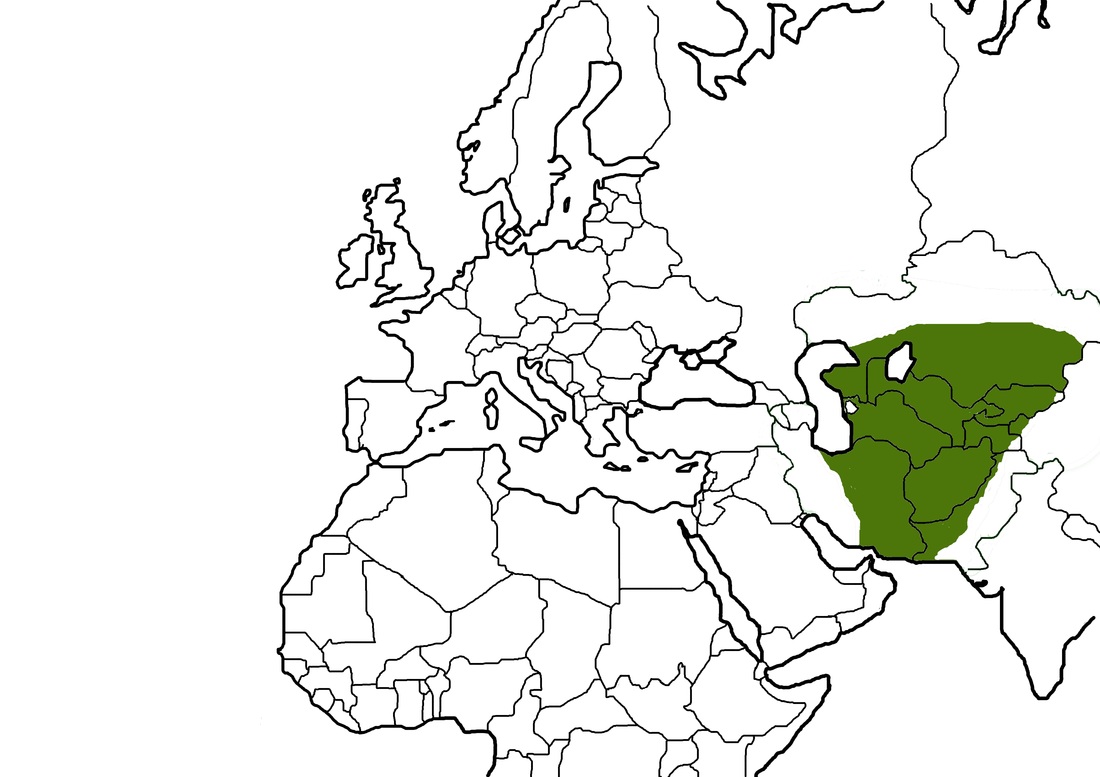